Safety Score: 2,7 of 5.0 based on data from 9 authorites. Meaning we advice caution when travelling to United States.
Travel warnings are updated daily. Source: Travel Warning United States. Last Update: 2024-04-28 08:22:10
Discover Oakcrest
Oakcrest in Charleston County (South Carolina) is a town in United States about 457 mi (or 735 km) south of Washington DC, the country's capital city.
Current time in Oakcrest is now 07:03 PM (Sunday). The local timezone is named America / New York with an UTC offset of -4 hours. We know of 8 airports near Oakcrest, of which 4 are larger airports. The closest airport in United States is Robert F Swinnie Airport in a distance of 56 mi (or 90 km), North-East. Besides the airports, there are other travel options available (check left side).
Also, if you like playing golf, there are a few options in driving distance. We discovered 10 points of interest in the vicinity of this place. Looking for a place to stay? we compiled a list of available hotels close to the map centre further down the page.
When in this area, you might want to pay a visit to some of the following locations: Charleston, Moncks Corner, Walterboro, Beaufort and Saint George. To further explore this place, just scroll down and browse the available info.
Local weather forecast
Todays Local Weather Conditions & Forecast: 23°C / 73 °F
| Morning Temperature | 18°C / 64 °F |
| Evening Temperature | 21°C / 69 °F |
| Night Temperature | 18°C / 65 °F |
| Chance of rainfall | 0% |
| Air Humidity | 57% |
| Air Pressure | 1026 hPa |
| Wind Speed | Gentle Breeze with 7 km/h (4 mph) from North-West |
| Cloud Conditions | Broken clouds, covering 71% of sky |
| General Conditions | Broken clouds |
Sunday, 28th of April 2024
24°C (75 °F)
19°C (66 °F)
Sky is clear, gentle breeze, clear sky.
Monday, 29th of April 2024
25°C (77 °F)
20°C (69 °F)
Light rain, moderate breeze, scattered clouds.
Tuesday, 30th of April 2024
28°C (82 °F)
21°C (69 °F)
Light rain, gentle breeze, clear sky.
Hotels and Places to Stay
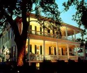
The Governor's House Inn
La Quinta Inn and Suites Charleston Riverview
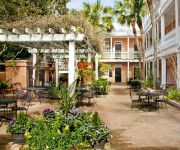
ELLIOTT HOUSE INN
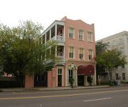
MEETING STREET INN
Holiday Inn Express CHARLESTON DWTN - MEDICAL AREA
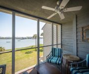
Mariners Cay 27 2 Bedroom Holiday Home By My Ocean Rentals
Mariners Cay 2 Bedroom Holiday Home By My Ocean Rentals
Mariners Cay 15 2 Bedroom Holiday Home By My Ocean Rentals
Mariners Cay 13 2 Bedroom Holiday Home By My Ocean Rentals
Marsh Winds 2A 3 Bedroom Holiday Home By My Ocean Rentals
Videos from this area
These are videos related to the place based on their proximity to this place.
HolidayFestival of Lights Magic in the Making
Let the spirit of the season embrace you as James Island County Park comes alive with illumination at Charleston's most beloved nighttime event - the Holiday Festival of Lights! Beginning November...
In The Foxhole! - Episode 38 - Part 2
Recommend watching in HD or at least full screen. Season's greetings from the foxhole everyone! Hope everyone had a very Merry Christmas/whatever Holiday you celebrate! We've got a colorful...
1238 West Capers Rd
Welcome to the Low-Country! This All-Brick, one-story James Island home has been meticulously maintained and is located within 5 minutes of Down Town Charleston!........This charming home features ...
CHARLESTON FOOD PHOTOGRAPHY | Holger Obenaus Photography
HOLGEROBENAUS.COM | Holger Obenaus is the Number #1 Photographer for several fine restaurants in Charleston, SC. A good food photographer has to be a food lover in the first place.
Easiest Roast Chicken~~ SpatchCock~~Delicious in 1 Hour!
A Very simple way to make a very delicious roast chicken. You can use this method on the grill too for BBQ Chicken. Skin like bacon.
Videos provided by Youtube are under the copyright of their owners.
Attractions and noteworthy things
Distances are based on the centre of the city/town and sightseeing location. This list contains brief abstracts about monuments, holiday activities, national parcs, museums, organisations and more from the area as well as interesting facts about the region itself. Where available, you'll find the corresponding homepage. Otherwise the related wikipedia article.
James Island (South Carolina)
James Island is one of South Carolina's most urban Sea Islands. The island is separated from peninsular downtown Charleston by the Ashley River, from the mainland by Wappoo Creek and the Wappoo Cut, and from Johns Island by the Stono River. It lies inshore of Morris Island and Folly Beach. Fort Sumter is located on an island just off the eastern tip of James Island and is the site of the first battle of the Civil War.
James Island, South Carolina
James Island is a town in Charleston County, South Carolina, United States. It is located in the central and southern parts of James Island. As defined by the U.S. Office of Management and Budget, and used by the U.S. Census Bureau for statistical purposes only, James Island is included within the Charleston-North Charleston-Summerville metropolitan area and the Charleston-North Charleston Urbanized Area.
Battle of James Island
The Battle of Secessionville (or the First Battle of James Island) on June 16, 1862, was the defeat of the only Union attempt to capture Charleston, South Carolina, by land during the American Civil War.
Battle of Grimball's Landing
The Battle of Grimball's Landing took place in James Island, South Carolina, on July 16, 1863, during the American Civil War. It was a part of the campaign known as Operations Against the Defenses of Charleston.
Riverland Terrace
Riverland Terrace, developed in the 1940s, is James Island (South Carolina)'s oldest neighborhood. The Terrace is located just 10 minutes west of downtown Charleston, South Carolina along Wappoo Creek and the inland waterway. The neighborhood boasts a public boat landing, Charleston Municipal Golf Course, a playground, five restaurants and numerous antique shops. Leading into the neighborhood is the historic Avenue of Oaks, consisting of 73 live oak trees believed to be over 100 years old.
Charleston Executive Airport
Charleston Executive Airport is a public use airport located in Charleston in Charleston County, South Carolina, United States. It is approximately six nautical miles (11 km) southwest of the central business district of the city. It is owned by the Charleston County Aviation Authority. The airport serves the general aviation community, with no scheduled commercial airline service.
Folly boat
The Folly Boat is a boat that was washed ashore near Folly Beach in Charleston, South Carolina during Hurricane Hugo. After nobody claimed the boat, passers-by began painting messages and pictures on the boat. It has become an unofficial symbol of Folly Beach.
Charles Town expedition
The Charles Town expedition (September 1706) was a combined French and Spanish attempt under Captain Jacques Fefebvre to capture the capital of the English Province of Carolina, Charles Town, during Queen Anne's War (as the North American theater of the War of the Spanish Succession is sometimes known). Organized and funded primarily by the French and launched from Havana, Cuba, the expedition reached Charles Town in early September 1706 after stopping at St.


