Safety Score: 2,7 of 5.0 based on data from 9 authorites. Meaning we advice caution when travelling to United States.
Travel warnings are updated daily. Source: Travel Warning United States. Last Update: 2024-05-11 07:34:58
Touring Ashley Villas
The district Ashley Villas of Cohen Hill in Charleston County (South Carolina) is a subburb located in United States about 450 mi south of Washington DC, the country's capital place.
Need some hints on where to stay? We compiled a list of available hotels close to the map centre further down the page.
Being here already, you might want to pay a visit to some of the following locations: Charleston, Moncks Corner, Walterboro, Saint George and Beaufort. To further explore this place, just scroll down and browse the available info.
Local weather forecast
Todays Local Weather Conditions & Forecast: 25°C / 76 °F
| Morning Temperature | 13°C / 56 °F |
| Evening Temperature | 23°C / 74 °F |
| Night Temperature | 17°C / 63 °F |
| Chance of rainfall | 0% |
| Air Humidity | 30% |
| Air Pressure | 1011 hPa |
| Wind Speed | Gentle Breeze with 8 km/h (5 mph) from South |
| Cloud Conditions | Clear sky, covering 0% of sky |
| General Conditions | Sky is clear |
Sunday, 12th of May 2024
27°C (81 °F)
19°C (66 °F)
Scattered clouds, gentle breeze.
Monday, 13th of May 2024
28°C (82 °F)
20°C (68 °F)
Overcast clouds, gentle breeze.
Tuesday, 14th of May 2024
21°C (70 °F)
20°C (68 °F)
Moderate rain, gentle breeze, overcast clouds.
Hotels and Places to Stay
Aloft Charleston Airport & Convention Center
North Charleston Marriott
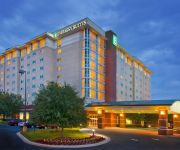
Embassy Suites North Charleston - Airport-Hotel - Convention
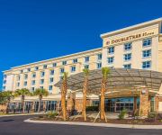
DoubleTree by Hilton North Charleston - Convention Center
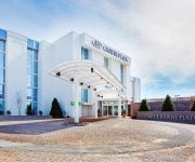
Crowne Plaza CHARLESTON AIRPORT - CONV CTR
Hilton Garden Inn Charleston Airport
Courtyard North Charleston Airport/Coliseum
Fairfield Inn & Suites Charleston Airport/Convention Center
Hampton Inn - Suites Charleston Airport SC
Holiday Inn Express & Suites CHARLESTON ARPT-CONV CTR AREA
Videos from this area
These are videos related to the place based on their proximity to this place.
ThyssenKrupp Hydraulic Elevators at the Holiday Inn North Charleston
Riding the very nice elevators at the Holiday Inn on International Blvd. in North Charleston, SC, featuring ThyssenKrupp's nudge mode!
Otis Hydraulic Elevators at the Hilton Garden Inn North Charleston
Riding the elevators at the Hilton Garden Inn on International Blvd. in North Charleston, SC.
North Charleston and American LaFrance Fire Museum - Ask Bob
http://CharlestonProperty.net -- I often get asked, by clients, what are cool things to do when they visit or move to Charleston. We recently toured the North Charleston and American LaFrance...
Dover Scenic Traction Elevators at the Embassy Suites North Charleston
Riding the elevators at the Convention Center Embassy Suites in North Charleston, SC.
230 Muirfield Parkway, Charleston, SC
This is a great renovated home in Shadowmoss Plantation!!!!! Come see it today to view all of the features and amenities in one of West Ashley's premier coun...
2335 Tall Sail Dr Apt H Charleston SC
http://www.exite-listings.com/10572 Enjoy riverfront living in this unique condominium neighborhood that boasts a private boat ramp and deep water marina on the Ashley River You can sit...
The MGB Running on Gasoline
It lives! It lives! Even drove it up and down the driveway after this short video. Still lots to do - like figure out why the fuel pump isn't working - but she is on her way. Will be driving...
Takeoff from: CHS Charleston International Airport
Takeoff from CHS Charleston International Airport on JetBlue flight1274 to JFK International Airport in NYC on April 22, 2013 at 12:00pm. Despegando del aeropuerto Internacional Charleston...
Landing in Charleston, SC - CHS - 2011 - Southwest
Landing at Charleston AFB International Airport (CHS) on May 10 around 12:30EST from Chicago's Midway.
The MGB
It started! Of course, just running on starter fluid at the moment. Very short, and very boring, but nice to see the car come to life.
Videos provided by Youtube are under the copyright of their owners.
Attractions and noteworthy things
Distances are based on the centre of the city/town and sightseeing location. This list contains brief abstracts about monuments, holiday activities, national parcs, museums, organisations and more from the area as well as interesting facts about the region itself. Where available, you'll find the corresponding homepage. Otherwise the related wikipedia article.
Charleston International Airport
Charleston International Airport is a joint civil-military airport located in the city of North Charleston, Charleston County, South Carolina, USA. The airport serves the needs of the entire South Carolina Lowcountry. The airport has two runways and is operated under a joint-use agreement with Joint Base Charleston. It is South Carolina's busiest airport. In 2012, the airport served 2,593,063 passengers in its busiest year ever. The airport is approximately 13 miles north of downtown Charleston.
Academic Magnet High School
Academic Magnet High School (AMHS) is a high school (grades 9-12) in North Charleston, South Carolina, USA. The school requires students to join through an admissions process based on middle school grades, test scores, teacher recommendations, and a written essay.
Charleston Field
Charleston Field is a United States military facility located in North Charleston, South Carolina. The facility is under the jurisdiction of the United States Air Force 628th Air Base Wing, Air Mobility Command (AMC) It is part of Joint Base Charleston, which combined the Air Force Base with Naval Support Activity Charleston.
North Charleston Coliseum
The North Charleston Coliseum is a 14,000-seat multi-purpose arena in North Charleston, South Carolina. It is part of the North Charleston Convention Center Complex, which also includes a Performing Arts Center, and is owned by the City of North Charleston and managed by SMG. The Coliseum was built in 1993 (the Performing Arts Center and Convention Center opened in 1999), and is located on the access road to the Charleston International Airport.
1886 Charleston earthquake
The Charleston Earthquake of 1886 was a powerful intraplate earthquake that hit Charleston, South Carolina and the East Coast of the US. After the 1811 and 1812 earthquakes in New Madrid, Missouri, it is one of the most powerful and damaging quakes to hit the southeastern United States. The shaking occurred at 9:50 p.m. on August 31, 1886 and lasted just under a minute.
Audubon Swamp Garden
Audubon Swamp Garden is a 60-acre cypress and tupelo swamp on the grounds of Magnolia Plantation near Charleston, South Carolina. At one time, the swamp served as a reservoir for the plantation's rice cultivation. Today, the swamp garden includes native flora but also non-native, exotic plantings and is home to herons, ibis, turtles, otters, alligators, and other wildlife.
Citadel Mall
Citadel Mall is a regional 1,138,527 square feet shopping mall located in Charleston, South Carolina, USA. It opened in 1981 and is located just off the I-526 exit, the mall features more than 100 stores, including six anchor stores: Belk, Dick's Sporting Goods, Dillard's, JCPenney, Sears and Target. It is owned and managed by CBL & Associates Properties.
WSPO
WSPO is an American radio station serving the Charleston, South Carolina, area with a tourist information format. This station is under ownership of Apex Broadcasting.
Magnolia Plantation and Gardens (Charleston, South Carolina)
Magnolia Plantation and Gardens (70 acres, 28 hectares) is a historic house with gardens located on the Ashley River at 3550 Ashley River Road, Charleston County, South Carolina. It is one of the oldest plantations in the South, and listed on the National Register of Historic Places. Magnolia Plantation is located near Charleston and directly across the Ashley River from North Charleston. The house and gardens are open daily; an admission fee is charged.
Hanahan High School
Hanahan High School is a public high school located in Hanahan, South Carolina, USA. It serves grades 9 through 12 and is a part of the Berkeley County School District. The principal is Richard Raycroft. The mascot is the hawk. Hanahan High School was opened in Fall 1958 with 282 students, but demand quickly exceeded its capacity. An additional eight-room portion was begun on June 20, 1960 along the northern side of the original building.
West Ashley
West Ashley is one of the six distinct areas of the city proper of Charleston, South Carolina, with an estimated 2010 population of 57,403. Its name is derived from the fact that the land is west of the Ashley River. A few skirmishes took place there in the American Revolution and some military activity took place here during the Civil War.
Charleston, South Carolina (Amtrak station)
The Charleston Amtrak station is a train station located in North Charleston, South Carolina, United States served by Amtrak, the national railroad passenger system. The North Charleston station was originally built by the Atlantic Coast Line Railroad in 1956, after a fire destroyed Charleston Union Station in 1947.
Charles Towne Square
Charles Towne Square was an indoor shopping mall located in North Charleston, South Carolina opened in 1976 by developer Melvin Simon & Associates. It was most noted for its large "town square" style clock and children's train ride during Christmas time. The mall's tenants included original anchors Montgomery Ward, JCPenney and Edward's, a local department store which would later be sold to Kuhn's-Big K and renamed "Big K-Edwards.
West Ashley High School
West Ashley High School was created in 2000, when Charleston County School District merged Middleton High School (South Carolina) and St. Andrew's High schools. The school is a part of St. Andrew's Constituent District #10. The school is located in the heart of the West Ashley area in Charleston, South Carolina. With approximately 2,200 students, it is among the largest high schools in the state.
Ashley Plaza Mall
Ashley Plaza Mall (now known as Ashley Landing), built in 1970, was the first indoor shopping mall built in the West Ashley area of Charleston, South Carolina. The center is located at 1401 Sam Rittenberg Boulevard (S.C. Highway 7) at the fork of Old Towne Road (S.C. Highway 171). It was built as a joint venture of shopping center developers the LeFrak Organization of New York City and The Cordish Company of Baltimore, Maryland under the name Ashley Plaza Mall Associates.
National Register of Historic Places listings in Charleston County, South Carolina
This is a list of the National Register of Historic Places listings in Charleston County, South Carolina. This is intended to be a complete list of the properties and districts on the National Register of Historic Places in Charleston County, South Carolina, United States. The locations of National Register properties and districts for which the latitude and longitude coordinates are included below, may be seen in a Google map.
Trident Technical College
Trident Technical College (TTC) is a two-year college based in the City of North Charleston, Charleston and Dorchester counties in South Carolina. It is part of the South Carolina Technical College System. Enrollment for each semester is approximately 18,000 students working their way toward college transfer associate degrees and technical associate degrees, diplomas and certificates.
W257BQ
W257BQ is an American radio station serving the Charleston, South Carolina, area with a Mainstream urban format simulcast on the HD-2 channel of WMXZ. This station is under ownership of Apex Broadcasting.
General William C. Westmoreland Bridge
The General William C. Westmoreland Bridge connects the city of North Charleston with the West Ashley area of Charleston in South Carolina. Composed of twin spans, it carries two lanes of Interstate 526 in each direction across the Ashley River and the surrounding marshes. It is often referred to as simply the "Westmoreland Bridge". The highway was named for General William C. Westmoreland, a South Carolina native and graduate of West Point.
National Register of Historic Places listings in North Charleston, South Carolina
Current listings[edit] Name on the Register Image Date listed Location
Boeing Charleston Factory
The Boeing Charleston Factory located in North Charleston, South Carolina is the East Coast manufacturing, assembly and delivery site for Boeing commercial aircraft. The site is located adjacent to the Charleston Air Force Base / Charleston International Airport. Workers will have a 1,200,000 sq ft building to use for aircraft assembly. A separate 11,550-square-foot facility is being built where workers will paint airplane logos onto aircraft tail-fins.
North Charleston Air Force Station
North Charleston Air Force Station is a closed United States Air Force General Surveillance Radar station. It is located 4.0 miles northwest of Charleston, South Carolina. It was closed in 1980.
Bees Landing Park
Bees Ferry Landing Park is a public park in Charleston, South Carolina. Seventeen of the twenty-five acres are high ground surrounded by wetlands. The city had envisioned creating a park in West Ashley since the mid-1990s and had budgeted $2 million to acquire the property. The developer of the surrounding community, known as Grande Oaks, donated the property to the city for a park, and the city hired a consultant to develop plans.
West Ashley Park
West Ashley Park is the largest municipal park in Charleston, South Carolina. The city originally bought a 99.8-acre parcel, including a lake created from an old phosphate mine, in 1985. In 1997, a neighboring property owner, Ross Development Corp. , offered to deed the city six adjoining parcels in exchange for the city's constructing a road from the Glen McConnell Parkway to the park.
Joint Base Charleston
Joint Base Charleston is a United States military facility located in North Charleston, South Carolina. The facility is under the jurisdiction of the United States Air Force 628th Air Base Wing, Air Mobility Command (AMC) The facility is an amalgamation of the United States Air Force Charleston Air Force Base and the United States Navy Naval Support Activity Charleston, which were merged on 1 October 2010.


