Safety Score: 2,7 of 5.0 based on data from 9 authorites. Meaning we advice caution when travelling to United States.
Travel warnings are updated daily. Source: Travel Warning United States. Last Update: 2024-04-27 08:23:39
Delve into Pleasant Valley Mobile Home Park
Pleasant Valley Mobile Home Park in Ventura County (California) is located in United States about 2,342 mi (or 3,768 km) west of Washington DC, the country's capital town.
Current time in Pleasant Valley Mobile Home Park is now 04:23 PM (Saturday). The local timezone is named America / Los Angeles with an UTC offset of -7 hours. We know of 12 airports close to Pleasant Valley Mobile Home Park, of which 5 are larger airports. The closest airport in United States is Santa Barbara Municipal Airport in a distance of 42 mi (or 68 km), North-West. Besides the airports, there are other travel options available (check left side).
Also, if you like playing golf, there are some options within driving distance. If you need a hotel, we compiled a list of available hotels close to the map centre further down the page.
While being here, you might want to pay a visit to some of the following locations: Ventura, Santa Barbara, Los Angeles, Bakersfield and Santa Ana. To further explore this place, just scroll down and browse the available info.
Local weather forecast
Todays Local Weather Conditions & Forecast: 15°C / 58 °F
| Morning Temperature | 13°C / 56 °F |
| Evening Temperature | 16°C / 60 °F |
| Night Temperature | 16°C / 61 °F |
| Chance of rainfall | 0% |
| Air Humidity | 68% |
| Air Pressure | 1016 hPa |
| Wind Speed | Fresh Breeze with 17 km/h (10 mph) from East |
| Cloud Conditions | Clear sky, covering 0% of sky |
| General Conditions | Sky is clear |
Saturday, 27th of April 2024
15°C (59 °F)
16°C (60 °F)
Sky is clear, light breeze, clear sky.
Sunday, 28th of April 2024
15°C (59 °F)
17°C (63 °F)
Scattered clouds, gentle breeze.
Monday, 29th of April 2024
16°C (60 °F)
16°C (60 °F)
Sky is clear, gentle breeze, clear sky.
Hotels and Places to Stay
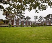
Embassy Suites by Hilton Mandalay Beach Hotel - Resort
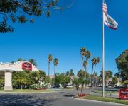
Hilton Garden Inn Oxnard-Camarillo
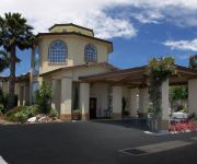
Holiday Inn Express PORT HUENEME
Residence Inn Oxnard River Ridge
BW OXNARD INN
Courtyard Oxnard Ventura
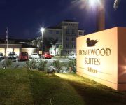
Homewood Suites by Hilton Oxnard-Camarillo CA
Hampton Inn Channel Islands Harbor
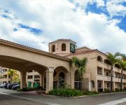
Quality Inn & Suites Camarillo
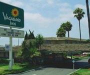
VAGABOND INN OXNARD
Videos from this area
These are videos related to the place based on their proximity to this place.
Oceanview Pavillion Port Hueneme California
Oceanview Pavilion http://oceanviewinfo.com Video Courtesy Prince Productions filmed a beautiful wedding there in 2011. http://www.princeweddings.net.
Auto Glass Repair Port Hueneme (805) 203-0454 Auto Glass Repair www.autoglassondemand.com
Mobile Auto Glass Repair Port Hueneme, CA (805) 203-0454 auto glass port hueneme car window repair port hueneme, windshield replacement port hueneme. auto glass cost, auto glass repair quote,.
PORT HUENEME OXNARD MEMORIAL DAY WEEKEND 2014
Memorial Day weekend with family and friends in the Ventura County. Make sure video playback is on HD! Thanks.
Kayak Fishing Hueneme Beach For Calico Bass
Walk to Port Hueneme Beach for a quick trip on the water, fishing for Calico Bass. A few Rockfish were caught and released. All fish were caught using Warbait weedless head, root beer twin...
Port Hueneme Beach Sunset - January 13th 2013
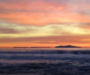
Time lapse video of a sunset at Port Hueneme Beach Pier, California. The sun sets between Anacapa Island and Santa Cruz Island. Shot on the Sony Nex-VG 10 camera.
Garage Door Repair Port Hueneme 1 (800) 801-3903 Garage Door Spring Repair Services
Garage Door Repair Port Hueneme - Any Type Of Garage Door Repair, Plus Garage Door Spring Repair Services (800) 801-3903 Garage Door Repair - The Garage Door Guys will repair your garage ...
Sunset on Port Hueneme Beach Time Lapse
Here is a sunset time lapse with some clouds, and Anacapa Island. We are lucky enough to get great sunsets here in Ventura County. This particular day was cold and windy. I shoot it on a...
Port Hueneme Beach Sunrise - Jan 16th 2013
Time lapse video of the sunrise over the Santa Monica Mountains and the Edison power plant in Oxnard. Video shot at Port Hueneme Beach Pier, Ventura County California using the Sony Nex VG10.
Videos provided by Youtube are under the copyright of their owners.
Attractions and noteworthy things
Distances are based on the centre of the city/town and sightseeing location. This list contains brief abstracts about monuments, holiday activities, national parcs, museums, organisations and more from the area as well as interesting facts about the region itself. Where available, you'll find the corresponding homepage. Otherwise the related wikipedia article.
Port Hueneme, California
Port Hueneme is a small beach city in Ventura County, California surrounded by the city of Oxnard, Naval Base Ventura County, and the Pacific Ocean. The name derives from the Spanish spelling of the Chumash wene me, meaning "Resting Place". The area was discovered by Juan Rodríguez Cabrillo in the mid 16th century. The settlement's name was officially changed to Port Hueneme in 1939 and was incorporated March 24, 1948.
Oxnard, California
Oxnard is a city in the United States, located along the Coast of Southern California. It is the 19th most populous city in California and the most populous in Ventura County. The city lies approximately 35 miles west of the Los Angeles city limits, and is part of the larger Greater Los Angeles area. The population of Oxnard is 203,585 as of the 2012 Financial Report. Founded in 1903, it is the most populous city in the Oxnard-Thousand Oaks-Ventura metropolitan area.
Arosa Star
The SS Arosa Star was a cruise ship which was built in the United States in 1930 and grounded on the California coast in 1970. Originally called the Borinquen (7,114 grt, 429 ft long), the ship was built in 1930 at the Bethlehem Shipbuilding Corporation of Quincy, Massachusetts, and launched near the end of September. She began her working career on runs between Puerto Rico and New York until 1949. During World War II she was drafted as a military transport.
Oxnard College
Oxnard College is a California-state funded community college located in Oxnard, California. It was established in 1975. It serves the Oxnard Plain cities of Oxnard, Camarillo, and the town of Port Hueneme. The college offers two year degrees including the new California transfer curriculum, as well as career and technical education programs to the local community. The Dental hygienist program consistently ranks in the top of the 5 U.S. programs.
Point Hueneme Light
Point Hueneme Lighthouse is a lighthouse on the southeast entrance to the Santa Barbara Channel, in Ventura County, California
Santa Clara High School (Oxnard, California)
Santa Clara High School, or SCHS as it is commonly referred to, is a private, Catholic four-year high school serving grades 9-12 in Oxnard, California. It is located in the Roman Catholic Archdiocese of Los Angeles. Opening in September 1901. The school is the oldest high school in Ventura County.
Murder of Larry King
The murder of Larry King refers to the February 12, 2008, shooting death of Lawrence "Larry" Fobes King (January 13, 1993 – February 13, 2008), a 15-year-old gay student at E.O. Green Junior High School in Oxnard, California, United States. He was shot twice by a fellow student, 14-year-old Brandon McInerney, and kept on life support until he died two days later.
Rancho El Rio de Santa Clara o la Colonia
Rancho El Rio de Santa Clara o la Colonia was a 44,883-acre Mexican land grant in present day Ventura County, California given in 1837 by Governor Juan B. Alvarado to Valentine Cota et al. The grant extended from the Santa Clara River south to the present day Point Mugu Naval Air Station, and the boundary of Rancho Guadalasca, and east from the Pacific Ocean to the present day 101 Freeway, and the boundary of Rancho Santa Clara del Norte. The grant encompassed present day Colonia and Oxnard.


