Safety Score: 2,7 of 5.0 based on data from 9 authorites. Meaning we advice caution when travelling to United States.
Travel warnings are updated daily. Source: Travel Warning United States. Last Update: 2024-04-28 08:22:10
Explore Mission Dolores
The district Mission Dolores of San Francisco in San Francisco County (California) is located in United States about 2,436 mi west of Washington DC, the country's capital.
If you need a place to sleep, we compiled a list of available hotels close to the map centre further down the page.
Depending on your travel schedule, you might want to pay a visit to some of the following locations: Oakland, San Rafael, Redwood City, Martinez and Napa. To further explore this place, just scroll down and browse the available info.
Local weather forecast
Todays Local Weather Conditions & Forecast: 17°C / 62 °F
| Morning Temperature | 10°C / 50 °F |
| Evening Temperature | 14°C / 57 °F |
| Night Temperature | 11°C / 52 °F |
| Chance of rainfall | 0% |
| Air Humidity | 48% |
| Air Pressure | 1018 hPa |
| Wind Speed | Fresh Breeze with 14 km/h (9 mph) from East |
| Cloud Conditions | Clear sky, covering 0% of sky |
| General Conditions | Sky is clear |
Tuesday, 30th of April 2024
16°C (60 °F)
11°C (51 °F)
Sky is clear, moderate breeze, clear sky.
Wednesday, 1st of May 2024
20°C (67 °F)
13°C (56 °F)
Sky is clear, moderate breeze, clear sky.
Thursday, 2nd of May 2024
20°C (67 °F)
13°C (55 °F)
Sky is clear, gentle breeze, clear sky.
Hotels and Places to Stay
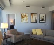
Aboda at 100 Van Ness
EMBASSY HOTEL
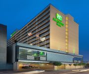
Holiday Inn SAN FRANCISCO-CIVIC CENTER
SAN FRANCISCO
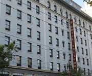
Whitcomb
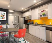
OAKWOOD AT AVA 55 NINTH
Beck's Motor Lodge
San Francisco Inn
CIVIC CENTER MOTOR INN
Ram's Hotel
Videos from this area
These are videos related to the place based on their proximity to this place.
Car ride over the Golden Gate Bridge; Car Trip 2011
Car ride over the Golden Gate Bridge; San Francisco, California.
Mission Workshop Arkiv® Field Packs
The Mission Workshop Arkiv® Field Packs allow for the secure and simple attachment of weatherproof accessories to the exterior of the backpack. The patented Arkiv® modular system gives the...
The Western Circle deel 1: Intro + San Francisco
Een camperreis door het zuidwesten van de Verenigde Staten, deel 1.
2007 San Francisco Frameline31 Trip
http://www.calpernia.com/diary Calpernia and Andrea's trip to the 2007 Frameline31 San Francisco International GLBT Film Festival was amazing! Here's some cellphone cam of the Dykes on Bikes...
SwingNation #25: You're so pretty!
Matthew Morrison of "Glee" Swings, Rik reports his trip to Camp Jitterbug and is there a nice way to tell your friends they suck? SwingNation episode #25 starts now!
Golden City Stories: Dan Doherty (rough edit)
Dan Doherty, a member of Clarion Alley Mural Project, talks about the challenges facing San Francisco's creative community and shares his perspective on the ...
Why Travel to San Francisco
Follow Muns, Jacky, Daeho and Karen as they take you on a quick tour around San Francisco! Check out V. Sattui in Napa, The Golden Gate Bridge and other locations to get a feel of what it...
City of White Gold (San Francisco in the Gilded Age)
The discovery of silver in 1859 propelled San Francisco from a mining boomtown into a world-class metropolis of epic visionaries and entrepreneurs. (Go to www.cityofwhitegold.com for more informati...
Videos provided by Youtube are under the copyright of their owners.
Attractions and noteworthy things
Distances are based on the centre of the city/town and sightseeing location. This list contains brief abstracts about monuments, holiday activities, national parcs, museums, organisations and more from the area as well as interesting facts about the region itself. Where available, you'll find the corresponding homepage. Otherwise the related wikipedia article.
Dolores Park
Dolores Park (originally known as Mission Park) is a city park in San Francisco, California. It is located two blocks south of Mission Dolores at the western edge of the Mission District. South of the park is a hillside area known as "Dolores Heights," while The Castro neighborhood is located a short distance to the west. Dolores Park is bounded by 18th Street on the north, 20th Street on the south, Dolores Street on the east and Church Street on the west.
Church Street Station (San Francisco)
Church Street Station is a Muni Metro station at the intersection of Market Street, Church Street and 14th Street in San Francisco, California. The J Church, which enters and exits the Market Street tunnel in a portal near the station, has an aboveground stop on Church and Market Streets. The N Judah also exits the tunnel before reaching the station and stops one block away at Church and Duboce Avenue.
Mission High School (San Francisco, California)
Mission High School is a public high school in the San Francisco Unified School District (SFUSD) San Francisco, California. Serving grades 9-12, Mission is the oldest high school on its original site in San Francisco; it has been on 18th Street, between Dolores and Church, since 1896. The original campus burned in 1922, and the replacement was completed in two stages, the west wing in 1925 and the main building was dedicated by San Francisco mayor James Rolph on June 12, 1927.
Eureka Valley, San Francisco
Eureka Valley is a neighborhood in San Francisco, primarily a quiet residential neighborhood but boasts one of the most visited sub-neighborhoods - The Castro.
16th Street Mission (BART station)
16th Street Mission Station is a Bay Area Rapid Transit station in the Mission District of San Francisco, California. It is used by the Richmond–Millbrae line, the Pittsburg/Bay Point – SFO line, the Fremont – Daly City line, and the Dublin/Pleasanton – Daly City line. It is an underground station with an island platform located below the intersection of Mission Street and 16th Street.
New College of California
New College of California was founded in the San Francisco Bay Area in 1971 by former Gonzaga University President, Father John Leary. After 37 years, it ceased operations in early 2008. New College's main campus was housed in several buildings in the Mission District in San Francisco.
The Deaf Club
The Deaf Club was a notable music venue located on Valencia Street in San Francisco which remained open for an 18 month period. Its main attraction was punk music. The name comes from the fact the building it was in originally began as a deaf people's clubhouse in the 1930s.
Intersection for the Arts
Intersection for the Arts, established in 1965, is the oldest alternative non-profit art space in San Francisco, California. Intersection's reading series is the longest continuous reading series outside of an academic institution in the state of California. Intersection produces and presents new and experimental work in the fields of literature, theater, music, and the visual arts. Intersection's artists regularly provide classes and workshops to the local community.
Nightingale House
The Nightingale House is a Queen Anne Style, Stick and Eastlake styles Victorian era home built in 1882 at 201 Buchanan Street in San Francisco, California. The structure was designated as a San Francisco landmark in October 1972. Notably the last resident of this home was San Francisco Arts Commissioner and San Francisco artist Jo Hanson who died March 13, 2007.
Different Fur
Different Fur (formerly Different Fur Trading Company, currently Different Fur Studios) is a recording studio located in the Mission District of San Francisco, California, at 3470 19th Street. Since 1968, Different Fur has recorded music from a wide range of artists, including major Grammy and Oscar-winning musicians as well as many important independent musicians.
Southern Exposure (art space)
Hartford Street Zen Center
The Hartford Street Zen Center, temple name Issan-ji (literally 'One Mountain Temple'), is a Soto Zen practice-center located in the Castro district of San Francisco.
The LAB
The LAB, located in San Francisco's historic Redstone Building, is a not-for-profit arts organization and performance space founded in 1984. The Lab "supports interdisciplinary artists in the development and exhibition of new visual, media, literary, and performing art, with a focus on emerging and established experimental artists whose work crosses material, cultural and presentational boundaries and encourages new artistic and social dialogue between artists and audiences.
826 Valencia
826 Valencia is a non-profit organization dedicated to helping children and young adults develop writing skills and to helping teachers inspire their students to write. It was the basis for the 826 National organization, which has centers around the country with the same goal.
Tartine
Tartine is a bakery in San Francisco, California, located in the Mission District, at 600 Guerrero Street (at 18th Street). Writing in the New York Times, food columnist Mark Bittman called it his favorite bakery in the U.S. In 2008 its owners, Elisabeth Prueitt and Chad Robertson, won James Beard Foundation Awards as the best pastry chefs in America, after previously being nominated for this award in 2006 and 2007.
Duboce and Church
Duboce and Church is a station on the San Francisco Municipal Railway light rail network's J Church and N Judah lines and 22 Fillmore bus line. It is the first stop for the routes outside of the Market Street Subway, which these lines leave earlier and through a separate portal from other services. The stop is located in the Duboce Triangle neighborhood.
Church and 14th Street
Church and 14th Street is a station on the San Francisco Municipal Railway light rail network's J Church line. It is located in the Duboce Triangle neighborhood. The F Market & Wharves streetcar line intersects with the Metro system at this stop.
Church and 16th Street
Church and 16th Street is a station on the San Francisco Municipal Railway light rail network's J Church line. It is located in the Castro neighborhood.
Church and 18th Street
Church and 18th Street is a station on the San Francisco Municipal Railway light rail network's J Church line. It is located in the Castro neighborhood.
20th Street (Muni)
20th Street is a station on the San Francisco Municipal Railway light rail network's J Church line. It is located in the Mission District neighborhood. The stop is located as the route leaves its normal trajectory along public streets and cuts through Dolores Park.
Liberty (Muni)
Liberty is a station on the San Francisco Municipal Railway light rail network's J Church line. It is located in the Mission District neighborhood.
21st Street (Muni)
21st Street is a station on the San Francisco Municipal Railway light rail network's J Church line. It is located in the Mission District neighborhood.
Borderlands Books
Borderlands Books is a San Francisco independent bookstore specializing exclusively in science fiction, fantasy and horror.
Noisebridge
Noisebridge is an award winning anarchistic educational hackerspace in San Francisco, inspired by hackerspaces in Europe, like the Metalab in Vienna and c-base in Berlin. It is a registered non-profit California corporation, with IRS 501(c)(3) charitable status. According to the Noisebridge website's Vision page, "Noisebridge is a space for sharing, creation, collaboration, research, development, mentoring, and of course, learning.
Adventures of the Mind
Adventures of the Mind is an achievement mentoring summit for talented 15-18 year olds. Educators from across the nation nominate students whom they believe, with guidance and nurture, can maximize their potential and make important contributions to society. Honored guests share their life stories that can serve as a roadmap to the students on their own personal paths to success.


