Safety Score: 2,7 of 5.0 based on data from 9 authorites. Meaning we advice caution when travelling to United States.
Travel warnings are updated daily. Source: Travel Warning United States. Last Update: 2024-04-28 08:22:10
Explore Dogpatch
The district Dogpatch of San Francisco in San Francisco County (California) is located in United States about 2,434 mi west of Washington DC, the country's capital.
If you need a place to sleep, we compiled a list of available hotels close to the map centre further down the page.
Depending on your travel schedule, you might want to pay a visit to some of the following locations: Oakland, San Rafael, Redwood City, Martinez and Napa. To further explore this place, just scroll down and browse the available info.
Local weather forecast
Todays Local Weather Conditions & Forecast: 16°C / 61 °F
| Morning Temperature | 11°C / 52 °F |
| Evening Temperature | 13°C / 56 °F |
| Night Temperature | 11°C / 52 °F |
| Chance of rainfall | 0% |
| Air Humidity | 62% |
| Air Pressure | 1020 hPa |
| Wind Speed | Fresh Breeze with 15 km/h (9 mph) from East |
| Cloud Conditions | Clear sky, covering 0% of sky |
| General Conditions | Sky is clear |
Monday, 29th of April 2024
17°C (62 °F)
11°C (52 °F)
Sky is clear, fresh breeze, clear sky.
Tuesday, 30th of April 2024
16°C (60 °F)
11°C (51 °F)
Sky is clear, moderate breeze, clear sky.
Wednesday, 1st of May 2024
20°C (67 °F)
13°C (56 °F)
Sky is clear, moderate breeze, clear sky.
Hotels and Places to Stay
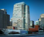
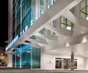
The St. Regis San Francisco
W San Francisco
InterContinental Hotels SAN FRANCISCO
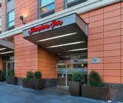
Hampton Inn San Francisco Downtown-Convention Center
OAKWOOD AT EDGEWATER
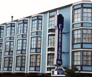
CARRIAGE INN
BEST WESTERN PLUS AMERICANIA
Sumner House SF
ABODA at 340 Fremont
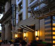
POWELL HOTEL
Videos from this area
These are videos related to the place based on their proximity to this place.
Sunrise from China Basin/AT&T Park in San Francisco
Watch the sunrise from China Basin/AT&T Park w/ the Bay Bridge! Sorry for the video quality, was playing with a new app. I promise I'll reshoot from here. Time lapsed with iPhone 6. Got...
4th St Draw Bridge Mission Bay San Francisco
http://goo.gl/maps/6ksws http://sfhotlist.com/ The 4th Street Draw Bridge - at the crossroads of the SF Giants Baseball Stadium, Mission Creek Park, the Mission Bay condos & neighborhood,...
Bike SF: 4th St through Mission Bay
Bike Commute from 7th St and Townsend St to Dogpatch, via Townsend St, 4th St, 16th St, Illinois St, & 20th St.
Saiga Conservation Alliance · Elena Bykova and Olga Espiova · Expo 2014
Mother-daughter conservation team Elena Bykova and Olga Espiova talk about their work saving the endangered saiga antelope. Recorded at the Wildlife Conservation Network Expo at Mission Bay...
Ewaso Lions · Shivani Bhalla · Expo 2014
Shivani Bhalla started Ewaso Lions seven years ago to save lion in Kenya's northern lands. She works closely with Samburu Warriors—young men from the area—to create a culture of conservation...
Nancy & Stephen Grand Family House Slab Concrete Pour March 12, 2015
Nibbi Brothers Construction poured the ground floor concrete of the Nancy and Stephen Grand Family House at Mission Bay on March 12, 2015. The new Family House will open in Spring, 2016. Learn.
Cheetah Conservation Botswana · Rebecca Klein · Expo 2014
Speaker Rebecca Klein gives an overview of Cheetah Conservation Botswana, the non-governmental organization (NGO) she started to help protect the threatened cheetahs in one of their last ...
Videos provided by Youtube are under the copyright of their owners.
Attractions and noteworthy things
Distances are based on the centre of the city/town and sightseeing location. This list contains brief abstracts about monuments, holiday activities, national parcs, museums, organisations and more from the area as well as interesting facts about the region itself. Where available, you'll find the corresponding homepage. Otherwise the related wikipedia article.
Union Iron Works
Union Iron Works, located in San Francisco, California, on the southeast waterfront, was a central business within the large industrial zone of Potrero Point, for four decades at the end of the nineteenth and beginning of the twentieth centuries.
Anchor Brewing Company
Anchor Brewing Company is an American alcoholic beverage producer, operating a brewery and distillery on Potrero Hill in San Francisco, California. The brewery was founded in 1896 and was purchased by Frederick Louis Maytag III, in 1965, saving it from closure. It moved to its current location in 1979. It is one of the last remaining breweries to produce California common beer, also known as Steam Beer, a trademark owned by the company.
M5 Industries
M5 Industries (M5i) is a special effects company located in San Francisco, California that once produced special effects props for commercials and film, stop motion animation, and animatronic puppets, such as those seen in James and the Giant Peach and The Nightmare Before Christmas. They also extend into prototype development and various display projects.
Mission Bay, San Francisco
Mission Bay is a 303-acre neighborhood in San Francisco, California.
KEST
KEST is a radio station in San Francisco, California. Most of the station's programming is non-English, such as Indian, Chinese, and other Asian languages. KEST does English-language programming during the week, usually from 6:00 a.m. to 11:00 a.m. , which consists of New Age Talk. KEST is owned by Multicultural Radio which owns several stations across the country. KEST broadcasts around the San Francisco Bay Area; its signal is 1000 watts.
Potrero Point
Potrero Point San Francisco is the location of the earliest and most important industrial facilities in the Western United States on the eastern extension of San Francisco's Potrero Hill, a natural land mass extending into San Francisco Bay south of Mission Bay. Potrero Point, the point of Potrero Hill, was systematically blasted and cut, its serpentine cliffs removed.
Potrero Hill, San Francisco
Potrero Hill is a residential neighborhood in San Francisco, California. It is known for its views of the San Francisco Bay and city skyline, its close proximity to many destination spots, its sunny weather, and for having two freeways and a Caltrain station. Initially a working-class neighborhood until gentrification in the 1990s, it is now an upper-middle-class family-oriented neighborhood.
Dogpatch, San Francisco
Dogpatch is a neighborhood in San Francisco, California, roughly half industrial and half residential. It was initially a gritty working-class neighborhood, but has experienced rapid transformation since the 1990s. Now it boasts similar demographics to its neighboring Potrero Hill - an upper middle-class working professional neighborhood. Dogpatch was originally part of Potrero Nuevo and its history is closely tied to Potrero Hill.
Bottom of the Hill
Bottom of the Hill is a concert venue located in San Francisco, California, in the Potrero Hill district. As a venue, it is one of the most active in the city, usually holding shows seven nights a week. It has won the Readers' Poll Best Of The Bay award for Rock venue several times including the last 10 years in a row (as of 2012). It has been a live music venue since September 1991.
Cyclone Warehouse
Cyclone Warehouse is an underground venue in the Butcher Town area of San Francisco, California, between Potrero Hill and Hunter's Point. Though many art and event venues have been ephemeral, the Cyclone has lasted, and is known for hosting eclectic and extreme underground events, and serves as headquarters to a loose collective of artists and artisans. The space adjoins a series of other warehouse spaces—a mix of artists studios and small business workshops.
Wattis Institute for Contemporary Arts
The Wattis Institute for Contemporary Arts is a contemporary art center in San Francisco, California, United States and part of the California College of the Arts. It was established in 1998 and serves as a forum for the presentation and discussion of international contemporary art and curatorial practise. It is regarded as one of the leading institutions for the presentation of contemporary art in the United States.
22nd Street (Caltrain station)
22nd. Street Station is a small commuter rail station on 22nd Street beneath the I-280 freeway in San Francisco, California. Like all other Caltrain stations except San Francisco 4th & King and San Jose Diridon, the station is unstaffed; tickets may be bought from ticket machines. In Southern Pacific days the station was called 23rd St, but its location hasn't changed.
Building 101 (San Francisco)
Building 101 is a building located at San Francisco's Dogpatch neighborhood, designed by Frederick H. Meyer. The building was built after Bethlehem took control of the acreage once owned by Union Iron Works. This building is now abandoned and nearby BAE Systems run the docks that was once owned by Bethlehem Shipbuilding Corporation, which ran it as an administration building.
Pier 70, San Francisco
Pier 70 in San Francisco, California, is a historic pier in San Francisco's Potrero Point neighborhood. The pier still has its historic buildings, which housed Bethlehem Shipbuilding Corporation's administrative offices and Union Iron Works, and is currently occupied by BAE Systems Ship Repair, which once housed the SS Oceanic (also known as the SS Independence) and Sims Group, a metal operator, and the Port of San Francisco currently has plans for redevelopment.
California Culinary Academy
The California Culinary Academy (CCA) is a private, for profit school, affiliate of Le Cordon Bleu, and is located in San Francisco, California. Founded in 1977, the academy has trained more than 15,000 people for restaurant careers through its 30-week baking and pastry chef program and 16-month culinary arts degree program. It was purchased by Career Education Corporation in 1999.
Mission Rock Station
The Mission Rock Street Station is an island platform light rail station of the San Francisco Municipal Railway's Muni Metro system located in the median of Third Street at Mission Rock Street in Mission Bay, San Francisco, California.
UCSF Mission Bay Station
The UCSF Mission Bay Station also known as the Gene Friend Way station is a light rail station of the San Francisco Municipal Railway's Muni Metro system located in the median of Third Street at South Street in Mission Bay, San Francisco, California. This station serves the hub of biotech in this district of the city.
Mariposa Station
The Mariposa Station is a light rail station of the San Francisco Municipal Railway's Muni Metro system located in the median of Third Street at Mariposa Street in Mission Bay, San Francisco, California.
20th Street Station
The 20th Street Station is a light rail station of the San Francisco Municipal Railway's Muni Metro system located in the median of Third Street at 20th Street in Mission Bay, San Francisco, California.
23rd Street (SF Muni station)
The 23rd Street Station is a light rail station of the San Francisco Municipal Railway's Muni Metro system located in the median of Third Street at 23rd Street in Bayview, San Francisco, California.
Marin Street Station
The Marin Street Station is a light rail station of the San Francisco Municipal Railway's Muni Metro system located in the median of Third Street at Marin Street in Bayview, San Francisco, California.
Potrero Generating Station
The Potrero Generating Station was a natural gas and diesel burning electricity generating station owned by Mirant and located on a 23-acre site in Potrero Point, San Francisco, California. The plant's primary power source was a 206 MW, natural gas burning steam turbine providing baseload power and referred to as "Unit 3". In addition, three 52 MW peaking power diesel generators provided additional power during times of highest consumption.
GeoVector
GeoVector Corporation (originally named Criticom Corporation) began conducting research into augmented reality in early 1990s. The company, co-founded by John Ellenby who also founded laptop pioneer GRiD Systems Corporation, devised a method to use sensors in a device to associate relevant digital information with places on earth.
Irish Hill (San Francisco)
Irish Hill was a neighborhood in San Francisco near the intersection of 22nd Street and Illinois Avenue. It consisted of a population of about 800 people living in boarding houses, mostly working class Irish and their families, who worked in the nearby industrial area known as the Dogpatch. Irish Hill was the site of a major fire in 1887 and over the next few decades the area declined, and the hill itself was mostly excavated away, flattened and dumped into San Francisco Bay by the year 1918.
Lefty O'Doul Bridge
The Lefty O'Doul Bridge (also known as the Third Street Bridge or China Basin Bridge) is a drawbridge which connects the China Basin and Mission Bay neighborhoods of San Francisco, carrying Third Street across McCovey Cove. It opened in 1933, and was renamed in 1969 in honor of the famous baseball player Lefty O'Doul. The bridge carries five lanes of traffic.


