Safety Score: 2,7 of 5.0 based on data from 9 authorites. Meaning we advice caution when travelling to United States.
Travel warnings are updated daily. Source: Travel Warning United States. Last Update: 2024-04-28 08:22:10
Touring Produce and Water Front
The district Produce and Water Front of in Alameda County (California) is a subburb located in United States about 2,427 mi west of Washington DC, the country's capital place.
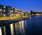
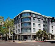
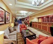
Need some hints on where to stay? We compiled a list of available hotels close to the map centre further down the page.
Being here already, you might want to pay a visit to some of the following locations: Oakland, San Francisco, Martinez, Redwood City and San Rafael. To further explore this place, just scroll down and browse the available info.
Local weather forecast
Todays Local Weather Conditions & Forecast: 18°C / 64 °F
| Morning Temperature | 11°C / 52 °F |
| Evening Temperature | 14°C / 58 °F |
| Night Temperature | 12°C / 53 °F |
| Chance of rainfall | 0% |
| Air Humidity | 57% |
| Air Pressure | 1020 hPa |
| Wind Speed | Moderate breeze with 12 km/h (8 mph) from East |
| Cloud Conditions | Clear sky, covering 0% of sky |
| General Conditions | Sky is clear |
Monday, 29th of April 2024
18°C (64 °F)
11°C (53 °F)
Sky is clear, moderate breeze, clear sky.
Tuesday, 30th of April 2024
17°C (62 °F)
11°C (52 °F)
Sky is clear, gentle breeze, clear sky.
Wednesday, 1st of May 2024
22°C (72 °F)
14°C (57 °F)
Sky is clear, moderate breeze, clear sky.
Hotels and Places to Stay
Oakland Marriott City Center
EXECUTIVE INN AND SUITES EMBARCADERO
BEST WESTERN PLUS BAYSIDE HTL
Courtyard Oakland Downtown
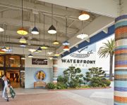
Waterfront Hotel
HAWTHORN SUITES BY WYNDHAM OAK
Homewood Suites by Hilton - Oakland Waterfront
THE WASHINGTON INN
M B Motor Inn
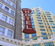
Sutter Hotel
Videos from this area
These are videos related to the place based on their proximity to this place.
The Athletics before the Oakland A's
A clip from a documentary on the Team before the Oakland A's, the Philadelphia Athletics. Can't wait for this season to start.
PBR Oakland Sights and Sounds
Power problems at the Oracle Arena yesterday hit hard today. Lots of trouble shooting. But all is well and I got to walk inside and shoot a bit of the sights and sounds. It's not often I...
Amtrak California Trains at Jack London Square in Oakland (Street Running)
In Oakland near Jack London Square heavy rail tracks run in the middle of a quite busy commercial street (Embarcadero) over a stretch of four blocks. Amtrak (and also some freight trains) use...
Amtrak Heritage 822 in Jack London Square, Oakland, CA 2/20/13
The week of February 17th-23rd, my mom and I took a vacation to California on Amtrak's California Zephyr, and we had two nights and a day in the San Francisco area. Being a railfan, I knew...
Invisalign Oakland - Attention Oakland Invisalign Providers
Invisalign Oakland - Oakland Invisalign Providers "NO ONE NEEDS TO KNOW YOU'RE STRAIGHTENING YOUR TEETH." Attention: Oakland Dentists and Orthodontists who Offer Invisalign! Are you ...
Let's help uplift and inspire Oakland.
http://www.odalc.org/donate - "One thing about Oakland, there is a lot of good people... but there are still things that we need to work on. Let's not vandalize our community, let's help uplift...
Oakland Digital : Digital Literacy. Opportunity. Tech Inclusion.
http://www.odalc.org/donate - Oakland Digital Arts & Literacy Center's work is bridging the digital literacy and opportunity divide. DIGITAL LITERACY: “Oakland Digital's is extremely...
Union Pacific 844, Oakland, California
UP 844 does some street running in Oakland on 4/22/09 during its 2009 Western Heritage Tour. Gotta love the sound of a steam engine, even moving slow!
Amtrak Train 23 Northbound Jack London Square Oakland California
Amtrak Train 23 heads northwest on 1st Street / Embarcadero West through Jack London Square in Oakland, California.
[HD] UP 1989 Rio Grande-KMNOA, Jack London Oakland CA 3/15/15
[HD] Union Pacific 1989, the Rio Grande heritage unit, was the DPU on the KMNOA (intermodal train, Marion AR to Oakland CA) seen at Jack London Square, Oakland, California on March 15, 2015....
Videos provided by Youtube are under the copyright of their owners.
Attractions and noteworthy things
Distances are based on the centre of the city/town and sightseeing location. This list contains brief abstracts about monuments, holiday activities, national parcs, museums, organisations and more from the area as well as interesting facts about the region itself. Where available, you'll find the corresponding homepage. Otherwise the related wikipedia article.
University of California
The University of California (UC) is a public university system in the U.S. state of California. Under the California Master Plan for Higher Education, the University of California is a part of the state's three-tier public higher education system, which also includes the California State University system and the California Community Colleges system.
Jack London Square
Jack London Square is a popular entertainment and business destination on the waterfront of Oakland, California. Named after the author Jack London and owned by the Port of Oakland, it is the home of stores, restaurants, hotels, an Amtrak station, a San Francisco Bay Ferry ferry dock, the historic Heinold’s First and Last Chance Saloon, the (re-located) cabin Jack London lived in the Klondike, and a movie theater. A farmer's market is hosted among the retail shops on Sunday mornings.
Frank Youell Field
Frank Youell Field was a football stadium that stood in Oakland, California. It was the home of the Oakland Raiders from 1962 to 1965. The stadium, which was essentially a temporary home while Oakland-Alameda County Coliseum was being built, sat 22,000 and cost $400,000 to build. The facility was named for Francis J. Youell (1883-1967), an Oakland undertaker owner of the Chapel of the Oaks, Oakland City Councilman, and sports booster.
Lincoln University (California)
Lincoln University is a private, nonprofit, nonsectarian university based in Oakland, California. The university is located near the 12th Street BART station in downtown Oakland. It enrolls about 400 students in undergraduate and graduate level programs in business administration, as well an English language program, certificate programs, and associate degrees. A large percentage of the student body is international students pursuing degrees in business administration.
Laney College
Laney College is a community college located in Oakland, California, next to the Lake Merritt BART station and the Kaiser Convention Center. Laney is the largest of the four colleges of the Peralta Community College District which serves northern Alameda County. Laney College originally opened in 1953 as Oakland City College, at the former University High School campus (which operated from 1923 to 1948).
Roman Catholic Diocese of Oakland
The Roman Catholic Diocese of Oakland is an ecclesiastical territory or diocese of the Roman Catholic Church in Northern California. The diocese comprises Alameda and Contra Costa Counties in the San Francisco Bay Area. The Cathedral of Christ the Light serves as the bishop's seat, replacing the Cathedral of Saint Francis de Sales which was demolished after the Loma Prieta earthquake of 1989.
Chinatown, Oakland
The Chinatown neighborhood in Oakland, California, is a pan-Asian neighborhood which reflects Oakland's diverse Asian American community. It is frequently referred to as "Oakland Chinatown" in order to distinguish it from nearby San Francisco's Chinatown. It lies at an elevation of 39 feet (12 m). Chinese were the first Asians to arrive in Oakland in the 1850s, followed by Japanese in the 1890s, Koreans in the 1900s, and Filipinos in the 1930s-1940s.
Oakland Unified School District
Oakland Unified School District is a public education school district which operates about 100 elementary schools (K-5), middle schools (6-8), and high schools (9-12) in Oakland, California.
12th Street Oakland City Center (BART station)
12th Street Oakland City Center is an underground Bay Area Rapid Transit station located at 12th Street and Broadway next to the Oakland City Center in Downtown Oakland. It used to be a northbound transfer station along the BART system, until that role was moved to 19th Street Oakland station on September 13, 2010. It is the fifth busiest BART station overall, and the busiest outside San Francisco.
Lake Merritt (BART station)
The Lake Merritt Bay Area Rapid Transit station is located in Downtown Oakland on Oak Street near Lake Merritt, Chinatown, Laney College and the Oakland Museum. This station consists of an underground island platform. Service at this station began on September 11, 1972. BART's operations control center is located on the station's west side.
Kaiser Convention Center
The Kaiser Convention Center is a historic, publicly owned multi-purpose arena in Oakland, California. The facility includes a 5,492-seat arena, a large theater, and a large ballroom. The building is #27 on the list of Oakland Historic Landmarks.
Oakland City Center
Oakland City Center is an office and shopping and hotel complex in Downtown Oakland, California. The complex is the product of a redevelopment project begun in the late 1950s. It covers twelve city blocks between Broadway on the east, Martin Luther King Jr. Way. on the west, 14th Street on the north side of the complex and the Oakland Convention Center and Marriott Hotel extend south to 10th Street. An hourly parking garage is located beneath the complex's shopping mall.
Old Oakland
Old Oakland, formally known as the Old Oakland Historic District, is a historic district in downtown Oakland, California. The area is located on the northwest side of Broadway, between the City Center complex and the Jack London Square district, and across Broadway from Chinatown. The Old Oakland district was the "original" downtown Oakland during the 1860s after Central Pacific Railroad constructed a terminus on 7th Street.
Posey and Webster Street tubes
The Posey tube and the Webster Street tube are two parallel underwater tunnels connecting the cities of Oakland and Alameda, California, running beneath the Alameda–Oakland Estuary. Currently, the Posey tube carries Oakland-bound traffic under the Estuary, while the Webster tube carries traffic bound for Alameda. The Posey tube is the second-oldest underwater vehicular tunnel in the US, preceded only by the Holland Tunnel.
Jack London District, Oakland, California
The Jack London District also called the Loft District is a neighborhood of Oakland, California that occupies the region south of the Nimitz Freeway (Interstate 880) along The Embarcadero between Adeline and Lake Merritt Channel. It includes and surrounds the Jack London Square shopping and tourist area, as well as the Warehouse District north of the Oakland Amtrak Station. The area has a long history of industrial and warehouse land use.
Peralta Community College District
The Peralta Community College District is the community college district serving northern Alameda County, California. The district operates four community colleges: Berkeley City College, Laney College and Merritt College in Oakland, and College of Alameda. From 1968 to 1988, non-contiguous Plumas County was part of the district, and Feather River College was operated by the district. Plumas County and Feather River College are now the Feather River Community College District.
Oakland – Jack London Square (Amtrak station)
Oakland is an Amtrak station at 245 Second Street in downtown Oakland, California. The station is served by the Capitol Corridor, Coast Starlight, and San Joaquins trains. Through Thruway buses, this station serves San Francisco. Of the 73 California stations served by Amtrak, Oakland was the eleventh-busiest in FY2010, boarding or detraining an average of about 950 passengers daily.
Oakland Public Library
The Oakland Public Library is the public library in Oakland, California. Opened in 1878, the Oakland Public Library currently serves the city of Oakland, along with some neighboring smaller cities including Emeryville and Piedmont. The Oakland Public Library has the largest collection of any public library in the East Bay, featuring approximately 1.5 million items.
Clorox Building
The Clorox Building is a 24-storey, 100.6 m skyscraper in the City Center complex of downtown Oakland, California. The building was completed in 1976, and designed by Cesar Pelli when he worked with Gruen Associates now based in Los Angeles. The Oakland-based Clorox Company is headquartered in the building.
Downtown Oakland
Downtown Oakland is the central business district of Oakland, California; roughly bounded by 6th Street or the Oakland Estuary on the southwest, Interstate 980 on the northwest, Grand Avenue on the northeast, and Lake Merritt on the east.
Yoshi's (jazz club)
Yoshi's is the preeminent jazz club of the San Francisco Bay Area. Started as a Japanese restaurant in Berkeley by Yoshi Akiba, a World War II war orphan, (who came to the United States to study dance, art, and dance therapy), and her friends Kaz Kajimura and Hiroyuki Hori, the club soon moved to a larger space on Claremont Avenue in Oakland, California and began to feature live jazz music. It eventually gained a reputation as one of the most significant jazz venues on the West Coast.
Civic Center, Oakland, California
Oakland's Civic Center neighborhood is a residential and public building district on the east side of Oakland's Central Business District. Its borders are roughly Downtown and Harrison Street to the west, the East Lake Neighborhood and Lakeshore Avenue to the east, the Lakeside Apartments District and 14th Street to the North, and Chinatown and 11th Street to the South.
PolicyLink
PolicyLink is a national research and action institute dedicated to advancing economic and social equity. They focus on policies affecting low-income communities and communities of color.
Oakland Charter High School
Oakland Charter High School is a charter school in Oakland, California serving high school students. It was established in 2007. The school mascot is the matador. It is part of the Amethod Public Schools system and the Oakland Unified School District. In 2010-2011 the school had 93 students. The California Department of Education recognized the school as a Title I Academic Achievement Award School.
555 City Center
555 City Center is a 20-storey, 85 m skyscraper in the City Center complex of downtown Oakland, California. The building was completed in 2002, and designed by Korth Sunseri Hagey Architects of San Francisco for the Shorenstein Company.






!['[HD] UP 1989 Rio Grande-KMNOA, Jack London Oakland CA 3/15/15' preview picture of video '[HD] UP 1989 Rio Grande-KMNOA, Jack London Oakland CA 3/15/15'](https://img.youtube.com/vi/dpR6X2Tn3IY/mqdefault.jpg)