Safety Score: 2,7 of 5.0 based on data from 9 authorites. Meaning we advice caution when travelling to United States.
Travel warnings are updated daily. Source: Travel Warning United States. Last Update: 2024-04-30 08:30:35
Discover Westbrae
Westbrae in Alameda County (California) is a town in United States about 2,426 mi (or 3,904 km) west of Washington DC, the country's capital city.
Current time in Westbrae is now 06:06 AM (Tuesday). The local timezone is named America / Los Angeles with an UTC offset of -7 hours. We know of 8 airports near Westbrae, of which 4 are larger airports. The closest airport in United States is Metropolitan Oakland International Airport in a distance of 12 mi (or 19 km), South. Besides the airports, there are other travel options available (check left side).
Also, if you like playing golf, there are a few options in driving distance. We discovered 10 points of interest in the vicinity of this place. Looking for a place to stay? we compiled a list of available hotels close to the map centre further down the page.
When in this area, you might want to pay a visit to some of the following locations: Oakland, San Francisco, Martinez, San Rafael and Redwood City. To further explore this place, just scroll down and browse the available info.
Local weather forecast
Todays Local Weather Conditions & Forecast: 17°C / 63 °F
| Morning Temperature | 9°C / 49 °F |
| Evening Temperature | 17°C / 62 °F |
| Night Temperature | 13°C / 55 °F |
| Chance of rainfall | 0% |
| Air Humidity | 34% |
| Air Pressure | 1016 hPa |
| Wind Speed | Gentle Breeze with 7 km/h (5 mph) from North-East |
| Cloud Conditions | Few clouds, covering 16% of sky |
| General Conditions | Few clouds |
Tuesday, 30th of April 2024
22°C (72 °F)
14°C (58 °F)
Sky is clear, moderate breeze, clear sky.
Wednesday, 1st of May 2024
22°C (72 °F)
14°C (58 °F)
Sky is clear, gentle breeze, clear sky.
Thursday, 2nd of May 2024
17°C (62 °F)
12°C (53 °F)
Few clouds, gentle breeze.
Hotels and Places to Stay
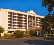
Four Points by Sheraton San Francisco Bay Bridge
DoubleTree by Hilton Berkeley Marina
Courtyard Oakland Emeryville
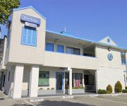
TRAVELODGE BERKELEY
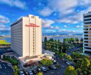
Hilton Garden Inn San Francisco-Oakland Bay Bridge
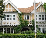
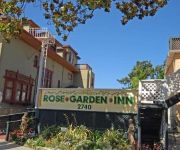
Rose Garden Inn
Rose Garden Inn
Graduate Berkeley
HOTEL SHATTUCK PLAZA
Holiday Inn Express & Suites BERKELEY
Videos from this area
These are videos related to the place based on their proximity to this place.
Berkeley's backyard tiny house adds income & affordable housing
Karen Chapple is a city planning professor so she knows all about the benefits of backyard cottages as urban infill and for adding density to sprawling neighborhoods, but when she took out...
MOD: Simcity BOC Build Outside City [ProcsKalone]
What do you think of the new higher production value? Download the MOD here: http://community.simtropolis.com/files/file/28723-boc-build-outside-citybox/ Follow IdeoREX on Twitter: https://twitte...
Berkeley's 4th Street Neighborhood
Fourth Street is one my favorite shopping streets in Berkeley. When it's time for a break, we often drive down to the 4th Street Shopping District for a bagel at Manhattan Bagel (the BEST bagels...
Berkeley Lab CAG Meeting, November 17, 2014
The Berkeley Lab Community Advisory Group (CAG) was formed in 2010 to provide input into the Lab's physical plans and development projects. The CAG has many interests related to the Lab's...
Oakland Berkeley CPR Courses: How to use an AED on an Adult
http://www.berkeleycprclasses.com teaches AHA certification classes on how to use an AED (automated external defibrillator) on an adult.
Poetry at the Albany Library - Robert Sward and Alan Soldofsky
Tuesday Oct. 14, 2014 7-9 pm Poetry at the Albany Library + Open Mic Robert Sward and Alan Soldofsky met at Iowa Writer's Workshop in 1967, where Sward was Soldofsky's first poetry teacher....
Safeway on Solano - Albany CA LA20120418.wmv
Animation flying around the proposed Safeway development on Solano Ave. in Albany California. First presented to the public the evening of April 18, 2012 at a community meeting.
IBM People for Smarter Cities & TakePart present ‘In the city with: Tom Bates’
Learn more smart ideas at http://bit.ly/18ultdk - Tom Bates is a mayor on a mission – as the leader of one of the most sustainable cities in America he's enacting a four-part plan to help...
Albany Haunt 2014: Fear on the Farm
Albany Haunt Productions In-corpse-erated Presents, Fear on the Farm. Like us on Facebook!!! http://goo.gl/Ip62y3.
Videos provided by Youtube are under the copyright of their owners.
Attractions and noteworthy things
Distances are based on the centre of the city/town and sightseeing location. This list contains brief abstracts about monuments, holiday activities, national parcs, museums, organisations and more from the area as well as interesting facts about the region itself. Where available, you'll find the corresponding homepage. Otherwise the related wikipedia article.
924 Gilman Street
924 Gilman Street is an all-ages, non-profit, collectively organized music club usually referred to by its fans simply as "Gilman". It is located in the West Berkeley area of Berkeley, California about a mile and a half west of the North Berkeley BART station and a quarter-mile west of San Pablo Avenue, at the corner of 8th and Gilman Streets.
North Berkeley (BART station)
North Berkeley is an underground Bay Area Rapid Transit station located on Sacramento Street in Berkeley, California. The station is bounded by Virginia, Sacramento, Delaware, and Acton Streets to the north, east, south, and west, respectively.
Solano Avenue
Solano Avenue in Berkeley and Albany, California is a two mile (3.2 km) long east-west street. Solano Avenue is one of the larger shopping districts in the Berkeley area. Businesses along Solano Avenue cover a wide range, including grocery stores, coffee shops, drugstores, bookstores, antique dealers, apparel outlets, ethnic restaurants and a movie theater.
Ohlone Park
Ohlone Park is a public park in the city of Berkeley, California, United States, situated on a strip of land along the north side of Hearst Avenue between Martin Luther King Jr. Way and Sacramento Street. Directly underground is the subway used by the Bay Area Rapid Transit system's Richmond-Fremont and Richmond-Daly City lines. It is part of the Ohlone Greenway.
Westbrae, Berkeley, California
Westbrae is a neighborhood in the northern part of Berkeley, California in the East Bay section of the San Francisco Bay Area. Westbrae is "centered" on the intersection of Santa Fe Avenue and Gilman Street, although the main extent is east, south and west of this intersection, with the Albany city limit only a short distance north. It lies at an elevation of 79 feet (24 m). The neighborhood is mainly residential, with a small commercial section along Gilman from Santa Fe to Tevlin Street.
West Berkeley, Berkeley, California
West Berkeley is generally the area of Berkeley, California, that lies west of San Pablo Avenue, abutting San Francisco Bay. It includes the area that was once the unincorporated town of Ocean View, as well as the filled-in areas along the shoreline west of I-80, mainly including the Berkeley Marina. It lies at an elevation of 23 feet (7 m).
UC Village
UC Village, also called University Village or University Village Albany, is a housing community for students who are married or have dependents. It is owned and administered by the University of California, Berkeley. It is located within the city limits of Albany about two miles away from the main Berkeley campus, at an elevation of 26 feet (8 m). It was previously known as Albany Village. It is also commonly referred to as The Village.
Saint Mary's College High School
Saint Mary's College High School came into being as part of Saint Mary's College of California, founded in 1863 by the Catholic Church, and put under the auspices of the Institute of the Brothers of the Christian Schools in 1868. Saint Mary's is a coeducational Catholic school located in Albany, California, although its postal address is in Berkeley, California. Currently, 600 students are enrolled.
Martin Luther King Middle School (Berkeley)
Martin Luther King Middle School (commonly MLK or King) is a public middle school in Berkeley, California serving grades 6-8. King is one of three middle schools in the Berkeley Unified School District, which includes Willard Middle School, and Longfellow Middle School. Its address is 1781 Rose Street.
Edible Schoolyard
The Edible Schoolyard (ESY) is a 1-acre garden at the Martin Luther King Jr. Middle School in Berkeley, California. The Edible Schoolyard was established by chef and activist Alice Waters through the Chez Panisse Foundation.
Occupy the Farm
Occupy the Farm was an occupation of the Gill Tract in Albany, California, in protest of planned commercial development of public land and in support of preserving the land for the creation of an open center for urban agroecology and food sovereignty. Since at least 1997, coalitions of local residents, NGOs, and University of California (UC) students and faculty have brought forth proposals to the UC administration for the creation of a center for sustainable urban agriculture.
Ashkenaz (music venue)
The Ashkenaz is a live music and dance venue located in Berkeley, California in the United States. It is a non-profit organization. It focuses on world music. In 2011 it was voted the best place to dance by readers of East Bay Express.







!['MOD: Simcity BOC Build Outside City [ProcsKalone]' preview picture of video 'MOD: Simcity BOC Build Outside City [ProcsKalone]'](https://img.youtube.com/vi/8NBmg_NScNY/mqdefault.jpg)


