Safety Score: 2,7 of 5.0 based on data from 9 authorites. Meaning we advice caution when travelling to United States.
Travel warnings are updated daily. Source: Travel Warning United States. Last Update: 2024-04-30 08:30:35
Discover Montclair
Montclair in Alameda County (California) is a town in United States about 2,423 mi (or 3,899 km) west of Washington DC, the country's capital city.
Current time in Montclair is now 04:19 AM (Tuesday). The local timezone is named America / Los Angeles with an UTC offset of -7 hours. We know of 8 airports near Montclair, of which 4 are larger airports. The closest airport in United States is Metropolitan Oakland International Airport in a distance of 8 mi (or 12 km), South. Besides the airports, there are other travel options available (check left side).
Also, if you like playing golf, there are a few options in driving distance. We discovered 10 points of interest in the vicinity of this place. Looking for a place to stay? we compiled a list of available hotels close to the map centre further down the page.
When in this area, you might want to pay a visit to some of the following locations: Oakland, Martinez, San Francisco, Redwood City and San Rafael. To further explore this place, just scroll down and browse the available info.
Local weather forecast
Todays Local Weather Conditions & Forecast: 17°C / 63 °F
| Morning Temperature | 9°C / 48 °F |
| Evening Temperature | 16°C / 60 °F |
| Night Temperature | 11°C / 52 °F |
| Chance of rainfall | 0% |
| Air Humidity | 34% |
| Air Pressure | 1016 hPa |
| Wind Speed | Gentle Breeze with 8 km/h (5 mph) from East |
| Cloud Conditions | Few clouds, covering 12% of sky |
| General Conditions | Few clouds |
Tuesday, 30th of April 2024
22°C (71 °F)
13°C (55 °F)
Sky is clear, moderate breeze, clear sky.
Wednesday, 1st of May 2024
23°C (73 °F)
13°C (55 °F)
Sky is clear, gentle breeze, clear sky.
Thursday, 2nd of May 2024
17°C (62 °F)
11°C (51 °F)
Few clouds, gentle breeze.
Hotels and Places to Stay
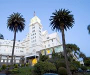
Claremont Club and Spa A Fairmont Hotel
EXECUTIVE INN AND SUITES EMBARCADERO
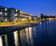
Homewood Suites by Hilton - Oakland Waterfront
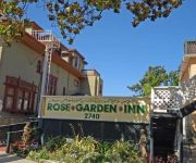
Rose Garden Inn
Rose Garden Inn
BEST WESTERN PLUS BAYSIDE HTL
Graduate Berkeley
Highlander Motel
International Casa
The Empyrean Towers
Videos from this area
These are videos related to the place based on their proximity to this place.
Grizzly Peak Road Drive
The section of Grizzly Peak Road over Oakland, south of the 24. Beautiful view overlooking the entire bay on a clear sunny day.
Bebop Drone View of The Labyrinth at Robert Sibley Volcanic Regional Preserve - SpydrDrone
View of the labyrinth in this San Francisco Bay Area Park.
Refinishing hardwood floors Piedmont Alameda Oakland
Refinishing hardwood floors by National floors. We also provide sales of hardwood flooring and hardwood flooring installation. Our hardwood flooring prices a...
Montclair Village District Oakland CA
Real estate and neighborhood information about Oakland Montclair District Village.
Plumber in Piedmont CA 510-292-4364 Sewer & Drain
Visit: http://preferredplumbinganddrain.com Plumber in Piedmont CA 510-292-4364 Sewer & Drain Piedmont CA Preferred Plumbing We are the plumbing, sewer, drain repair and replacement ...
Welcome To Flavor Country
If you don't watch this video and tell everyone you know to watch it, I'm going to sneek into your house at night and blow cigarette smoke in your face. You don't want that.
Piedmont, California Real Estate and Community
http://www.tarmanhomes.com/ Kent Tarman is an expert Realtor©, serving the cities of Piedmont, Berkeley, Oakland, Rockridge, Beverly Hills, Bel Air, West Hollywood, California and the surroundin...
Best Personal Injury Attorney Piedmont | (800) 474-8413 | Attorney Piedmont, CA
Please Call Now: (800)474-8413 | Call Now: (800)474-8413 Attention: Lease This video for only $19.95 per month. Every City is available in your county!! I wi...
Wonderful Piedmont Brown Shingle
For more details click here: http://www.visualtour.com/showvt.asp?t=2838847 2065 Oakland Avenue Piedmont, CA 94611 $1850000, 4 bed, 3.5 bath, 2809 SF, ...
Oakland Moving Services Movers
Oakland Moving Services: Movers, one of the best in the area, providing comprehensive moving services. We facilitate moving both in and around the city and b...
Videos provided by Youtube are under the copyright of their owners.
Attractions and noteworthy things
Distances are based on the centre of the city/town and sightseeing location. This list contains brief abstracts about monuments, holiday activities, national parcs, museums, organisations and more from the area as well as interesting facts about the region itself. Where available, you'll find the corresponding homepage. Otherwise the related wikipedia article.
Canyon, California
Canyon (formerly, Sequoya) is an unincorporated community in Contra Costa County, California situated between Oakland and Moraga in the San Francisco Bay Area. The community is named for its location in the upper canyon of San Leandro Creek along the eastern slope of the Berkeley Hills. It lies at an elevation of 1142 feet (348 m). The community is mainly traversed by Pinehurst Road and Canyon Road.
Leimert Bridge
Leimert Bridge is located in the Oakmore neighborhood of Oakland, California. It spans 357 feet and is 117 feet high above Sausal Creek. It is a cement and steel arch bridge. When it was built in 1926, it was the largest single span bridge on the West Coast. The bridge was designed by George Posey who also designed the Posey Tube tunnel between Oakland and Alameda. Realtor Walter H. Leimert built the bridge in order to develop the Oakmore Heights area.
Montclair, Oakland, California
Montclair (also known as the Montclair District or Montclair Village) is an affluent hillside/canyon neighborhood of Oakland, California. Montclair is located in the Oakland Hills east of Piedmont in a canyon formed by the Hayward Fault. Although there is no formal definition of the neighborhood, the general boundaries are Highway 24 to the north, the city of Piedmont border to the west of Highway 13, Skyline Boulevard to the east, and Joaquin Miller Road to the south.
Oakmore, Oakland, California
Oakmore is a neighborhood in Oakland, California that is off Leimert Street and above Dimond Park. This neighborhood was built in the 1920s and 1930s for people who worked in San Francisco and took the Key Route to work. The Key System was a primary user of the Leimert Bridge, which connects Oakmore to Park Boulevard.
Piedmont Pines, Oakland, California
Piedmont Pines is a residential district in Oakland, California. It is generally bounded by Highway 13 (the Warren Freeway) to the west, Shepherd Canyon Rd. to the north, Skyline Dr. to the east, and Joaquin Miller Park to the south. Two Oakland public schools are included in the area, Montera Middle School and Joaquin Miller Elementary School. There is no business section in Piedmont Pines.
Huckleberry Botanic Regional Preserve
Huckleberry Botanic Regional Preserve is a 241 acres regional park and nature reserve in the eastern San Francisco Bay Area, in Alameda and Contra Costa Counties, Northern California. It is a park within the East Bay Regional Parks District system. The Preserve is named after the California Huckleberry (Vaccinium ovatum) which grows abundantly within its habitat.
Oakland Hills, Oakland, California
Oakland Hills is an informal term used to indicate the city neighborhoods lying within the eastern portion of Oakland, California.
Alden, California
Alden (also, North Temescal) is a former settlement in Alameda County, California. It was located 2 miles north of Oakland. A post office opened in North Temescal in 1877, the name was changed to Alden in 1899, and the post office closed in 1908. The name commemorated S.E. Alden, farmer and landowner. Coordinates for the post office are listed at USGS website.


