Safety Score: 2,7 of 5.0 based on data from 9 authorites. Meaning we advice caution when travelling to United States.
Travel warnings are updated daily. Source: Travel Warning United States. Last Update: 2024-04-30 08:30:35
Delve into Canyon
Canyon in Alameda County (California) is a city located in United States about 2,421 mi (or 3,896 km) west of Washington DC, the country's capital town.
Current time in Canyon is now 05:29 AM (Tuesday). The local timezone is named America / Los Angeles with an UTC offset of -7 hours. We know of 8 airports closer to Canyon, of which 4 are larger airports. The closest airport in United States is Metropolitan Oakland International Airport in a distance of 8 mi (or 13 km), South. Besides the airports, there are other travel options available (check left side).
Also, if you like playing golf, there are some options within driving distance. We saw 10 points of interest near this location. In need of a room? We compiled a list of available hotels close to the map centre further down the page.
Since you are here already, you might want to pay a visit to some of the following locations: Oakland, Martinez, San Francisco, Redwood City and San Rafael. To further explore this place, just scroll down and browse the available info.
Local weather forecast
Todays Local Weather Conditions & Forecast: 18°C / 65 °F
| Morning Temperature | 8°C / 47 °F |
| Evening Temperature | 16°C / 60 °F |
| Night Temperature | 10°C / 51 °F |
| Chance of rainfall | 0% |
| Air Humidity | 30% |
| Air Pressure | 1016 hPa |
| Wind Speed | Gentle Breeze with 7 km/h (4 mph) from North-East |
| Cloud Conditions | Few clouds, covering 14% of sky |
| General Conditions | Few clouds |
Tuesday, 30th of April 2024
23°C (73 °F)
12°C (54 °F)
Sky is clear, gentle breeze, clear sky.
Wednesday, 1st of May 2024
25°C (77 °F)
12°C (54 °F)
Sky is clear, gentle breeze, clear sky.
Thursday, 2nd of May 2024
18°C (65 °F)
10°C (49 °F)
Sky is clear, gentle breeze, few clouds.
Hotels and Places to Stay
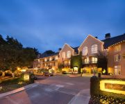
Lafayette Park Hotel and Spa
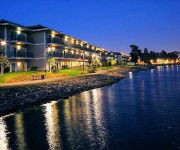
Claremont Club and Spa A Fairmont Hotel
EXECUTIVE INN AND SUITES EMBARCADERO
BEST WESTERN PLUS BAYSIDE HTL
THE CORAL REEF INN AND SUITES
Highlander Motel
International Casa
Bay Breeze Inn
CROWN LODGE MOTEL OAKLAND
Continental Lodge
Videos from this area
These are videos related to the place based on their proximity to this place.
Karate Bunkai in Moraga pt 1
Karate Bunkai with Kenzo Tokuyama at the Moraga Karate & Fitness Center.
Driving down Canyon Rd, Moraga, CA in a stock 2002 Corolla
Driving my stock automatic 2002 Corolla down Canyon Rd, Moraga, CA on June 2009. It's a fun road, almost lost it twice. Had fun with a 240SX in front. Unfortunately, audio cuts out after like...
Moraga Paintless Dent Repair - Dent Erasers LLC
Paintless Dent Repair Moraga - http://moragapaintlessdentrepair.com/ - 510-773-9900 Moraga Paintless Dent Repair should be your first option when removing dings and dents from your vehicle.Dent...
All About Lamorinda
'About Lamorinda' Lamorinda is located in the central part of Contra Costa County. The central part of the county is a valley traversed by Interstate 680 and Highway 24. The towns east of...
E90 M3 Back roads mountain quick fun run
Watch it in 720p. After meeting with a group of BMWCCA members at a Moraga starbucks parking lot, a few of us decided to take a quick short run.
Michelle's Christmas Greeting 2012
Holiday greeting from Michelle Schubnel of CoachAndGrowRich.com and GroupCoachingSuccess.com. Do you put up a Christmas tree? Share a picture or video!
SAY NO to Gore-Tex as Rain Protection in Summer?
You've heard it before. Don't believe the hype! I have three expensive Gore-Tex Jackets and a couple of "normal" affordable rain jackets. The Gore-Tex Jackets are several hundred dollars more...
Grading for Concrete Patio Using Bobcat Mt-52 - All Access 510-701-4400
Grading for Concrete Patio Using Bobcat Mt-52 - All Access 510-701-4400 - Using our Mt 52 to do a little grading for #concrete #patio Share this video: ...
San Francisco-Oakland Day to Night Time-Lapse
This is a UHD 4K day to night time lapse of the San Francisco Bay Area looking east to west from the Oakland Hills. Available as stock video footage here: http://bit.ly/1kJisW2 © Steven Poe.
Videos provided by Youtube are under the copyright of their owners.
Attractions and noteworthy things
Distances are based on the centre of the city/town and sightseeing location. This list contains brief abstracts about monuments, holiday activities, national parcs, museums, organisations and more from the area as well as interesting facts about the region itself. Where available, you'll find the corresponding homepage. Otherwise the related wikipedia article.
Miramonte High School
Miramonte High School is a public high school located in Orinda, California. It is part of the Acalanes Union High School District, which has a college preparatory program, with 15 Advanced Placement courses offered. Over 98% of its graduates go on to college. 320 students graduated in 2005, with 75% attending a four-year college. 35% are attending out-of-state colleges.
Canyon, California
Canyon (formerly, Sequoya) is an unincorporated community in Contra Costa County, California situated between Oakland and Moraga in the San Francisco Bay Area. The community is named for its location in the upper canyon of San Leandro Creek along the eastern slope of the Berkeley Hills. It lies at an elevation of 1142 feet (348 m). The community is mainly traversed by Pinehurst Road and Canyon Road.
Chabot Space and Science Center
Chabot Space and Science Center, located in Oakland, California, is a hands-on center featuring interactive exhibits, a digital planetarium, a large screen theater, hands-on activities and three powerful telescopes. The Center is the continuation and expansion of a public observatory that has served San Francisco Bay Area schools and citizens with astronomy and science education programs since 1883.
Piedmont Pines, Oakland, California
Piedmont Pines is a residential district in Oakland, California. It is generally bounded by Highway 13 (the Warren Freeway) to the west, Shepherd Canyon Rd. to the north, Skyline Dr. to the east, and Joaquin Miller Park to the south. Two Oakland public schools are included in the area, Montera Middle School and Joaquin Miller Elementary School. There is no business section in Piedmont Pines.
Joaquin Miller Park
Joaquin Miller Park is a large open space park in the Oakland Hills owned and operated by the city of Oakland, California. It was named after early California writer and poet Joaquin Miller, who lived here in his house "The Hights", now preserved as the Joaquin Miller House.
Huckleberry Botanic Regional Preserve
Huckleberry Botanic Regional Preserve is a 241 acres regional park and nature reserve in the eastern San Francisco Bay Area, in Alameda and Contra Costa Counties, Northern California. It is a park within the East Bay Regional Parks District system. The Preserve is named after the California Huckleberry (Vaccinium ovatum) which grows abundantly within its habitat.
Roberts Regional Recreation Area
Roberts Regional Recreation Area is a regional park located in Oakland, CA that is part of the East Bay Regional Parks system.
Valle Vista, Contra Costa County, California
Valle Vista is a small unincorporated community in Contra Costa County, California, United States. It lies along Canyon Road between Moraga and Canyon. It is also on the Oakland, Antioch and Eastern Railroad 4.5 miles south-southeast of Orinda, at an elevation of 577 feet (176 m). The ZIP Code is 94517. The community is inside area code 510.


