Safety Score: 2,7 of 5.0 based on data from 9 authorites. Meaning we advice caution when travelling to United States.
Travel warnings are updated daily. Source: Travel Warning United States. Last Update: 2024-04-28 08:22:10
Discover Fort Winfield Scott
Fort Winfield Scott in San Francisco County (California) is a town in United States about 2,437 mi (or 3,922 km) west of Washington DC, the country's capital city.
Current time in Fort Winfield Scott is now 12:42 AM (Monday). The local timezone is named America / Los Angeles with an UTC offset of -7 hours. We know of 8 airports near Fort Winfield Scott, of which 4 are larger airports. The closest airport in United States is San Francisco International Airport in a distance of 14 mi (or 22 km), South-East. Besides the airports, there are other travel options available (check left side).
Also, if you like playing golf, there are a few options in driving distance. We discovered 10 points of interest in the vicinity of this place. Looking for a place to stay? we compiled a list of available hotels close to the map centre further down the page.
When in this area, you might want to pay a visit to some of the following locations: San Francisco, San Rafael, Oakland, Redwood City and Martinez. To further explore this place, just scroll down and browse the available info.
Local weather forecast
Todays Local Weather Conditions & Forecast: 17°C / 62 °F
| Morning Temperature | 10°C / 50 °F |
| Evening Temperature | 14°C / 57 °F |
| Night Temperature | 11°C / 52 °F |
| Chance of rainfall | 0% |
| Air Humidity | 52% |
| Air Pressure | 1017 hPa |
| Wind Speed | Fresh Breeze with 14 km/h (9 mph) from East |
| Cloud Conditions | Clear sky, covering 2% of sky |
| General Conditions | Sky is clear |
Monday, 29th of April 2024
15°C (60 °F)
11°C (51 °F)
Sky is clear, fresh breeze, clear sky.
Tuesday, 30th of April 2024
18°C (65 °F)
13°C (56 °F)
Sky is clear, moderate breeze, clear sky.
Wednesday, 1st of May 2024
17°C (63 °F)
13°C (55 °F)
Sky is clear, gentle breeze, clear sky.
Hotels and Places to Stay
Hotel Drisco
Hotel Del Sol
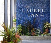
Laurel Inn
Monte Cristo Inn
Coventry Motor Inn
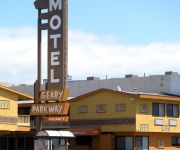
GEARY PARKWAY MOTEL
Chelsea Inn
Cow Hollow Inn
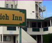
GREENWICH INN
Surf Motel
Videos from this area
These are videos related to the place based on their proximity to this place.
Cops Catch Me Stealth Camping Off To San Francisco Fort Mason Golden Gate Park
In this episode of me living in my van I get woken up in the middle of the night by the police as I selected a bad Stealth Camping location. I was really tired and just wanted to crash. So,...
Bicycle Across America_01
Beginning the cross country trip at the Golden Gate Bridge, San Francisco.
on the cliffs near Golden Gate Bridge, Presidio Heights, San Francisco
on the cliffs, overlooking the Pacific Ocean and Golden Gate, in Presidio Heights, San Francisco, near the Golden Gate Bridge.
Velocity Clip Bike Promo Giveaway Day 1 - San Francisco Presidio
iPhone 5 bike mount promo day at San Francisco Presidio - Swen Duerigen getting in peoples faces to see what people think of the Velocity Clip. We wanted to get out and really see what people...
Golden Gate Bridge
California travel expert Veronica Hill of http://www.CaliforniaTravelExpert.com tours the Golden Gate Bridge, one of the top San Francisco attractions, in this episode of "California Travel...
Golden Gate Bridge South Vista Point Presidio San Francisco California
View of the Golden Gate Bridge from South Vista Point in the Presidio of San Francisco.
Memorial Day Parade 2014 San Francisco National Cemetery Presidio San Francisco California
2014 Memorial Day Parade from the Main Post Parade Ground to the San Francisco National Cemetery in the Presidio of San Francisco, California. Led by the U.S. Army Color Guard and 191st Army ...
San Francisco Fire Department @ Lincoln Boulevard Presidio San Francisco California
San Francisco Fire Department on Lincoln Boulevard in the Presidio of San Francisco.
From SF Muni 28: A totally empty US 101, due to Golden Gate Bridge closure
A short trip on San Francisco Muni bus 28 on a rarely-seen totally empty US 101 (southbound). On the weekend of January 10-11, 2015 the Golden Gate Bridge was closed for the installation of...
Videos provided by Youtube are under the copyright of their owners.
Attractions and noteworthy things
Distances are based on the centre of the city/town and sightseeing location. This list contains brief abstracts about monuments, holiday activities, national parcs, museums, organisations and more from the area as well as interesting facts about the region itself. Where available, you'll find the corresponding homepage. Otherwise the related wikipedia article.
Golden Gate
The Golden Gate is the North American strait that connects San Francisco Bay to the Pacific Ocean. Since 1937, it has been spanned by the Golden Gate Bridge. Technically, the 'gate' is defined by the headlands of the San Francisco Peninsula and the Marin Peninsula, while the 'strait' is the water that flows in between.
Baker Beach
Baker Beach is a public beach on the peninsula of San Francisco, California, U.S.. The beach lies on the shore of the Pacific Ocean to the northwest of the city. It is roughly a half mile (800 m) long, beginning just south of Golden Gate Point (where the Golden Gate Bridge connects with the peninsula), extending southward toward the Seacliff peninsula, the Palace of the Legion of Honor and the Sutro Baths. The northern section of Baker Beach is "frequented by clothing-optional sunbathers".
Crissy Field
Crissy Field is a former U.S. Army airfield, now a part of the Golden Gate National Recreation Area in San Francisco, California, United States. Historically a part of the Presidio of San Francisco, Crissy Field was closed as an airfield and eventually the National Park Service took control over it. While maintained by the Army, Crissy Field was heavily affected by the military's dumping of hazardous materials.
San Francisco National Cemetery
San Francisco National Cemetery is a U.S. National Cemetery, located in the Presidio of San Francisco, California. Because of the name and location, it is frequently confused with Golden Gate National Cemetery, a few miles south of the city. About 1937, San Francisco residents voted to no longer build cemeteries within the city proper and, as a result, the site for a new national cemetery was selected south of the city limits.
Mountain Lake Park
Mountain Lake Park is a San Francisco park in the Richmond District neighborhood, located north of the intersection of Lake and Funston. It was designed by engineer William Hammond Hall in the late 19th century, circa 1875. Hall also designed Golden Gate Park and was significantly influenced by Frederick Law Olmsted. Mountain Lake is a small body of water east of State Route 1 (Park Presidio Boulevard). On the south side of the lake is a playground and tennis court.
Fort Point Light, San Francisco
Fort Point Light was a lighthouse on Fort Point, directly beneath the south anchorage of the Golden Gate Bridge in San Francisco, California. It was added to the National Register of Historic Places in 1970, reference #70000146.
The Walt Disney Family Museum
The Walt Disney Family Museum is an American museum that features the life and legacy of Walt Disney. The museum is located in The Presidio of San Francisco, part of the Golden Gate National Recreation Area in San Francisco. The museum retrofitted and expanded three existing historic buildings on the Presidio’s Main Post. The principal building, at 104 Montgomery Street, faces the Parade Ground, and opened on October 1, 2009.
West Coast Memorial to the Missing of World War II
The West Coast Memorial to the Missing of World War II is a monument dedicated to missing soldiers, sailors, marines, coast guardsmen, and airmen of World War II. It is a curved wall of California granite set in a grove of Monterey pine and cypress and overlooking the Pacific Ocean. It bears the name, rank, organization and State of each of the 413 members of the Armed Forces who lost their lives or were buried at sea in the Pacific coastal waters.
Public Health Service Hospital
The Public Health Service Hospital is a defunct hospital located in the Presidio of San Francisco which was established in 1895. The two non-historic wings were demolished in 2009. The historic 1932 building was rehabilitated for housing and opened in 2010 as the Presidio Landmark apartments. Between 1982 and 1988, this was also the location of the San Francisco branch of the Defense Language Institute.
MacArthur Tunnel
The MacArthur Tunnel, formally known as the General Douglas MacArthur Tunnel, is a highway tunnel located on the grounds of The Presidio of San Francisco (which is now part of the Golden Gate National Recreation Area) in San Francisco, California. It carries California State Route 1 under a large hill at the Presidio Golf Course, and connects Park Presidio Boulevard to US 101 on the Golden Gate Bridge Freeway (better known as Doyle Drive).
Coyote Gulch (California)
Coyote Gulch is a stream in San Francisco, California. It is one of the last remaining free flowing, unculverted creeks in San Francisco. It runs from the foothills of the Presidio to the Pacific Ocean.
Lobos Creek
Lobos Creek is a stream in Presidio of San Francisco in San Francisco, California.


