Safety Score: 2,7 of 5.0 based on data from 9 authorites. Meaning we advice caution when travelling to United States.
Travel warnings are updated daily. Source: Travel Warning United States. Last Update: 2024-04-28 08:22:10
Delve into Fort McDowell
Fort McDowell in San Francisco County (California) is located in United States about 2,433 mi (or 3,916 km) west of Washington DC, the country's capital town.
Current time in Fort McDowell is now 12:48 AM (Monday). The local timezone is named America / Los Angeles with an UTC offset of -7 hours. We know of 8 airports close to Fort McDowell, of which 4 are larger airports. The closest airport in United States is Metropolitan Oakland International Airport in a distance of 15 mi (or 24 km), South-East. Besides the airports, there are other travel options available (check left side).
Also, if you like playing golf, there are some options within driving distance. We encountered 10 points of interest near this location. If you need a hotel, we compiled a list of available hotels close to the map centre further down the page.
While being here, you might want to pay a visit to some of the following locations: San Francisco, San Rafael, Oakland, Martinez and Redwood City. To further explore this place, just scroll down and browse the available info.
Local weather forecast
Todays Local Weather Conditions & Forecast: 17°C / 62 °F
| Morning Temperature | 10°C / 50 °F |
| Evening Temperature | 14°C / 57 °F |
| Night Temperature | 11°C / 52 °F |
| Chance of rainfall | 0% |
| Air Humidity | 52% |
| Air Pressure | 1017 hPa |
| Wind Speed | Fresh Breeze with 14 km/h (9 mph) from East |
| Cloud Conditions | Clear sky, covering 2% of sky |
| General Conditions | Sky is clear |
Monday, 29th of April 2024
15°C (60 °F)
11°C (51 °F)
Sky is clear, fresh breeze, clear sky.
Tuesday, 30th of April 2024
18°C (65 °F)
13°C (56 °F)
Sky is clear, moderate breeze, clear sky.
Wednesday, 1st of May 2024
17°C (63 °F)
13°C (55 °F)
Sky is clear, gentle breeze, clear sky.
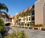
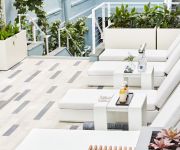
Hotels and Places to Stay
Fairmont Heritage Place Ghirardelli Square
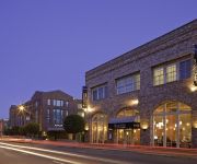
San Francisco Marriott Fisherman's Wharf
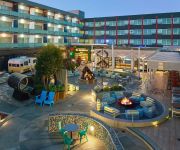
Hyatt Centric Fishermans Wharf
Argonaut Hotel
Hotel Zephyr San Francisco
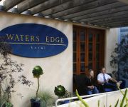
WATERS EDGE HOTEL TIBURON
Sheraton Fisherman's Wharf Hotel
Holiday Inn SAN FRANCISCO-FISHERMANS WHARF
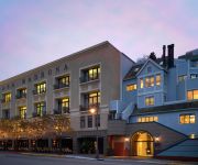
CASA MADRONA
CASA MADRONA
Videos from this area
These are videos related to the place based on their proximity to this place.
Alcatraz | Como escapo Frank Morris y sus secuaces
En este video les presentare primero unas imágenes de la isla y de la cárcel. Luego sobre como escapo el convicto Frank Morri y sus secuaces de la prisión de Alcatraz Disfrútenlo! ;)
Tour Alcatraz Island in San Francisco | WhereTraveler
In our Alcatraz Tour video you get an exclusive sneak peek into Alcatraz, with tips on getting the most out of every minute on the renowned island Stand at the edge of Fisherman's Wharf and...
Alcatraz Gardens - Wisconsin Garden Video Blog 101.avi
The word Garden doesn't come to mind when you think of Jail, Prison, and Incarceration. But just off San Francisco Bay lies a little island known as Alcatraz. Originally an Army fortress...
Death Valley Pleasant Canyon/ South Park 4x4 Jeep Trip with Velocity Clip
This video was shot entirely using a Droid and an iPhone with the Velocity Clip. For more info visit: http://www.velocityclip.com/ A scenic, high elevation trail. Many mines and structures...
Belvedere Island to Tiburon Ferry Ride 3
http://www.TibTV.com http://www.cyc.org Views of Belvedere Island and approaching Corinthian Yacht Club in downtown Tiburon aboard the Blue & Gold 8:15am ferry from San Francisco.
Angel Island Trip
this is a trip from Tiburon to Angel Island to tour the United States Immigration Station.
Paving Stone Installation - Tiburon/Belvedere, CA (800)748-2
Federal Paving Systems was established in 2005 and we are committed to serve you and make sure that when the project is completed we are not just going to have a happy customer, but somebody...
Limo Services in Tiburon, Marin County | Call Us Now (415) 484-5752
e'll provide the trip of your life with the limo of your Dreams. http://www.mylimousineservice.com/ Our luxury fleet offers the latest in body styles and each one of our vehicles is kept to...
100-boat flotilla honors sailors
Full story and slide show: http://www.marinij.com/marinnews/ci_20453695/100-boats-honor-five-sailors-solemn-memorial-flotilla MORE THAN 100 boats formed a solemn flotilla in Belvedere Cove...
Bruckmann 36' Blue Star Mark II $309,000 (US)
Own this immaculate 2005 Bruckmann Blue Star Mark II offered to the market by City Yachts in San Francisco, CA. www.citysf.com Designed by world famous naval architect Mark Ellis her down-easter...
Videos provided by Youtube are under the copyright of their owners.
Attractions and noteworthy things
Distances are based on the centre of the city/town and sightseeing location. This list contains brief abstracts about monuments, holiday activities, national parcs, museums, organisations and more from the area as well as interesting facts about the region itself. Where available, you'll find the corresponding homepage. Otherwise the related wikipedia article.
Angel Island (California)
Angel Island is an island in San Francisco Bay that offers expansive views of the San Francisco skyline, the Marin County Headlands and Mount Tamalpais. The entire island is included within Angel Island State Park, and is administered by California State Parks. The island, a California Historical Landmark, has been used for a variety of purposes, including military forts, a U.S. Public Health Service Quarantine Station and a U.S. Bureau of Immigration inspection and detention facility.
Point Blunt Light
Point Blunt Light is a lighthouse on Angel Island in San Francisco Bay, California.
Southhampton Shoal Light
Southampton Shoal is a former lighthouse site in California, United States. A platform sits at the southwest edge of Southampton Shoals, northeast of Angel Island in the San Francisco Bay. The platform is all that remains of the original structure and supports an automated bell which chimes every ten seconds and red light mounted on a pole, which flashes on for three seconds and is then dark for 3 seconds in each six second cycle (Iso R 6s).
Raccoon Strait
The Raccoon Strait is a waterway of the San Francisco Bay between Angel Island and the Tiburon Peninsula, mainland Marin County, California.
United States Immigration Station, Angel Island
Angel Island Immigration Station was an immigrant processing facility on Angel Island, in the San Francisco Bay. It opened in 1910 and is listed on the National Register of Historic Places. It is now the site of a museum. The museum and grounds were renovated and reopened to the public in February 2009.
Ayala Cove Ferry Terminal
Ayala Cove is a ferry terminal on Angel Island in Marin County, California in the San Francisco Bay Area. There is regularly scheduled passenger ferry service to Tiburon, and Fisherman's Wharf in San Francisco and season service to the Berkeley Marina in the East Bay. Service is provided by the Angel Island - Tiburon Ferry and takes 10 minutes between the Tiburon Ferry Terminal and Ayala Cove. The East Bay Ferry provides connections to Pier 41, Oakland Ferry Terminal, and Alameda Ferry Terminal.
Power House (Alcatraz)
The Power House is a power house on the northwest coast of Alcatraz Island, off the coast of San Francisco, USA. It was constructed in 1939 for $186,000 as part of a $1.1 million modernization scheme which also included the water tower, New Industries Building, officers quarters and remodeling of the D-block. The white powerhouse smokestack and lighthouse were said to give an "appearance of a ship's mast on either side of the island". "A Warning. Keep Off.
Social Hall (Alcatraz)
The Social Hall, also known as the Officer's Club, was a social club located on the northwestern side of the island of Alcatraz, off the coast of San Francisco, USA. Located in close proximity to the Power House, water tower and Former Military Chapel (Bachelor Quarters), it formerly housed the post exchange.


