Safety Score: 2,7 of 5.0 based on data from 9 authorites. Meaning we advice caution when travelling to United States.
Travel warnings are updated daily. Source: Travel Warning United States. Last Update: 2024-04-28 08:22:10
Delve into South Berkeley
The district South Berkeley of in Alameda County (California) is a district located in United States about 2,426 mi west of Washington DC, the country's capital town.
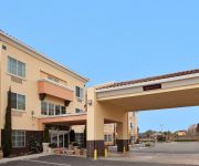
In need of a room? We compiled a list of available hotels close to the map centre further down the page.
Since you are here already, you might want to pay a visit to some of the following locations: Oakland, San Francisco, Martinez, San Rafael and Redwood City. To further explore this place, just scroll down and browse the available info.
Local weather forecast
Todays Local Weather Conditions & Forecast: 18°C / 65 °F
| Morning Temperature | 10°C / 50 °F |
| Evening Temperature | 15°C / 59 °F |
| Night Temperature | 12°C / 53 °F |
| Chance of rainfall | 0% |
| Air Humidity | 40% |
| Air Pressure | 1017 hPa |
| Wind Speed | Moderate breeze with 12 km/h (7 mph) from East |
| Cloud Conditions | Clear sky, covering 1% of sky |
| General Conditions | Sky is clear |
Tuesday, 30th of April 2024
17°C (63 °F)
11°C (52 °F)
Sky is clear, gentle breeze, clear sky.
Wednesday, 1st of May 2024
23°C (73 °F)
14°C (57 °F)
Sky is clear, moderate breeze, clear sky.
Thursday, 2nd of May 2024
23°C (73 °F)
14°C (57 °F)
Sky is clear, gentle breeze, clear sky.
Hotels and Places to Stay
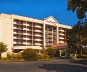
Four Points by Sheraton San Francisco Bay Bridge
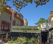
Rose Garden Inn
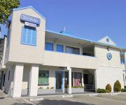
TRAVELODGE BERKELEY
Courtyard Oakland Emeryville
Graduate Berkeley
Rose Garden Inn
Holiday Inn Express & Suites BERKELEY
HOTEL SHATTUCK PLAZA
Bay Bridge Inn
Nights Inn Motel
Videos from this area
These are videos related to the place based on their proximity to this place.
UC Martial Arts Club | Berkeley
http://www.ucmap.org The University of California Martial Arts Program is dedicated to providing outstanding martial arts instruction to the UC Berkeley campus and surrounding community. The...
LSI Berkeley
Language Studies International English language school in Berkeley, California, USA. If you'd like to find out more about LSI Berkeley / San Francisco click here for our school page http://www.lsi....
Wesley House | Berkeley CA Apartments | EDR Trust
http://www.WesleyHouseBerkeley.com Berkeley CA Apartments for Rent | Wesley House Education Realty Trust - America's Leader in Collegiate Housing Wesley House Apartments 2398 Bancroft Way...
Amtrak's Capitol Corridor, Coast Starlight, California Zephyr and San Joaquins in Emeryville, CA
Amtrak's Capitol Corridor, northbound and southbound Coast Starlights, the eastbound California Zephyr and a San Joaquin train make stops in Emeryville, CA on the last day of my vacation.
[HD] A Day of Railfanning at Emeryville (9/07/13) - A New SD70ACe, AMTK 66, AMTK 510, and More!
I finally headed to Emeryville again to railfan for my friend Guillermo's (SP2479Videos) birthday! Although freight action was somewhat slow, I still caught the KOAMN-07 with a brand new SD70ACe...
Emeryville Planning Commission- Mar 26, 2015 - Full Meeting
AGENDA-http://www.emeryville.org/ArchiveCenter/ViewFile/Item/2212.
Emeryville Planning Commission - Oct 30, 2014 - Full Meeting
Planning Commission Meeting Agenda October 30, 2014 I. CONVENE AND ROLL CALL II.PUBLIC COMMENT III. ACTION RECAP - Special Meeting of October 2, 2014 IV. DIRECTORS REPORT A. Planning Commission...
DJI Phantom Vision Plus - Emeryville, CA
Here's a short video of my new DJI Phantom Vision + flying over Aquatic Park & the Emeryville Marina.
Amtrak's Coast Starlight, Emeryville, CA, 2/21/13
The week of February 17th-23rd, my mom and I took a vacation to California on Amtrak's California Zephyr, and we had two nights and a day in the San Francisco area. On the morning we headed...
Videos provided by Youtube are under the copyright of their owners.
Attractions and noteworthy things
Distances are based on the centre of the city/town and sightseeing location. This list contains brief abstracts about monuments, holiday activities, national parcs, museums, organisations and more from the area as well as interesting facts about the region itself. Where available, you'll find the corresponding homepage. Otherwise the related wikipedia article.
Ashby (BART station)
Ashby Station is a BART station, located beneath and parallel to Adeline Street, extending from Woolsey Street to Ashby Avenue in the southern part of Berkeley, California. It consists of an underground island platform. The station was originally planned to be elevated but the City of Berkeley paid the extra cost to have it built underground.
Golden Gate, Oakland, California
The Golden Gate neighborhood of Oakland, California is located in the northwest corner of the city, east of Emeryville and south of Berkeley. It includes the Golden Gate Shopping District, the stretch of San Pablo Avenue between 53rd Street on the south, and the Oakland-Berkeley border at 67th Street to the north. The neighborhood includes the area from a few blocks west of San Pablo Avenue (the Emeryville border) to Adeline Street on the east.
Berkeley High School (Berkeley, California)
Berkeley High School is the only public high school in Berkeley, California. It is located one long block west of Shattuck Avenue and three short blocks south of University Avenue in Downtown Berkeley, and is recognized as a Berkeley landmark. The school mascot is the Yellowjacket.
Barrington Hall (Berkeley, California)
Barrington Hall was a student housing cooperative in the University Students' Cooperative Association (USCA) system in Berkeley, California, from 1935 to 1990. It is currently privately operated student housing.
California Green Archives
The California Green Archives and special collections was formally established in 2000. Its goal is to identify, collect, preserve, and make available records of the Green movement and Green party to green activists, scholars, writers, historians, and journalists, and for posterity. The collection began in 1991 when volunteer archivist Hank Chapot accepted the task of collecting pertinent information from party activities.
Idora Park
This article deals with Idora Park of Oakland, California. For another park of the same name, see Idora Park, Youngstown. Idora Park was a 17.5-acre Victorian era trolley park in north Oakland, California constructed in 1904 on the site of an informal park setting called Ayala Park on the north banks of Temescal Creek. Idora Park was leased by the Ingersoll Pleasure and Amusement Park Company that ran several eastern pleasure parks.
Wat Mongkolratanaram
For the Thai temple in Tampa, see Wat Mongkolratanaram, Tampa {{#invoke:Coordinates|coord}}{{#coordinates:37|51|22.69|N|122|16|14.46|W|region:US |primary |name= }} 50x40pxThis article needs additional citations for verification. Please help improve this article by adding citations to reliable sources. Unsourced material may be challenged and removed. Wat Mongkolratanaram is a small Thai Buddhist temple located in Berkeley, California.
Temescal, Oakland, California
Temescal is one of the oldest neighborhoods in Oakland, California, located in North Oakland, and centered around Telegraph Avenue. The neighborhood derives its name from Temescal Creek, one of the most significant watercourses found in Oakland. The neighborhood's boundaries have changed substantially over time and have often been considered differently by different groups of people.
Lorin District, Berkeley, California
The Lorin district (also known as the Lorin Streetcar District) is a neighborhood located in the southern part of Berkeley, California, bounded by Ashby Avenue, Adeline Street, Martin Luther King Jr. Way, Sacramento Street, and 62nd Street. It was formerly the unincorporated town or settlement of Lorin, the last stop before Berkeley along the Berkeley Branch line of the Central Pacific.
Oaks Park (stadium)
Oaks Park, formally known as the Oakland Baseball Park, and at times nicknamed Emeryville Park, was a baseball stadium in Emeryville, California. It was primarily used for baseball, and was the home field of the Oakland Oaks Pacific Coast League baseball team. It opened in 1913 and held 7,000 people. The Oaks played there until 1955. The ballpark was located within the city limits of Emeryville, between Oakland and Berkeley.
Berkeley Zen Center
Berkeley Zen Center (BZC), temple name Shogakuji, is a Sōtō Zen Buddhist practice center located in Berkeley, California led by Sojun Mel Weitsman. An informal affiliate to the San Francisco Zen Center (SFZC), BZC was originally founded in 1967 by Weitsman and Shunryu Suzuki as a satellite group for the SFZC. Despite founding the center, Weitsman was not installed as abbot there until 1985, one year after receiving Dharma transmission from Hoitsu Suzuki.
South Berkeley, Berkeley, California
South Berkeley is a neighborhood in the city of Berkeley, California. It extends roughly from Dwight Way to the city’s border with Oakland, between Telegraph Avenue in the east and either Sacramento Street or San Pablo Avenue in the west. It lies at an elevation of 102 feet (31 m).
Escuela Bilingüe Internacional
Escuela Bilingüe Internacional, founded in 2006, is a private dual language Spanish-English school serving students ages 3 through eighth grade in Oakland, California.
North Oakland, Oakland, California
North Oakland is an area in Oakland, California, bordered by West Oakland, downtown Oakland, Oakland Hills and the adjacent cities of Berkeley, Emeryville and Piedmont. Annexed to Oakland in 1897, it is known as the birthplace of the Black Panther Party and is the childhood home of both Dr. Huey P. Newton and Bobby Seale. Some areas of North Oakland have seen major gentrification.
Oakland Ashram
The Siddha Yoga Ashram in Oakland (or "Oakland Ashram") is a Siddha Yoga retreat site in Oakland, California, on the east side of San Francisco Bay. It was the second ashram established by the Indian meditation master Swami Muktananda, the first being Sri Gurudev Ashram, now Gurudev Siddha Peeth, in Ganeshpuri, India.
IMusicast
iMusicast was a music venue in Oakland, California. Established in August 1999, It was among the first venues of any sort to offer exclusive live streaming video performances of headlining music acts on the internet. The business formally ceased operation on October 29, 2005. The building at Telegraph & 55th now has the space converted for office use and it is occupied by a bakery and a design firm.
Children's Hospital Oakland
Children's Hospital Oakland, full name Children’s Hospital & Research Center Oakland, is a children's hospital in Oakland, California. It is the only independent children’s hospital in the northern part of the state and is designated a Level I pediatric trauma center.
Bushrod Park, Oakland, California
The Bushrod Park neighborhood in North Oakland, Oakland, California is an area surrounding its namesake park, and bounded by Martin Luther King, Jr. Way to the west, Claremont Avenue to the east, Highway 24 to the south, and the Berkeley border to the north. It borders the neighborhoods of Sante Fe to the west, Fairview Park to the east, and Temescal and Shafter to the south and southeast, respectively.
Longfellow, Oakland, California
Longfellow is a neighborhood of North Oakland, California. It is bounded by Temescal Creek to the north, State Route 24 to the east, Interstate 580 to the south, and Adeline Street to the west.
Harold E. Jones Child Study Center
The Harold E. Jones Child Study Center is a research and educational institution for young children at the University of California, Berkeley. It is one of the oldest continuously running centers for the study of children in the country. The Jones Child Study Center has a special relationship with the Institute of Human Development as a site for research, training and outreach to the community, parents, and teachers.
Emery Secondary School
Emery Secondary School is a high school in Emeryville, California, USA for 7th through 12th grades. It is part of the Emery Unified School District. The school has an enrollment of around 350 students. Emery Secondary School was formerly Emery High School but, after the closure of Emery Middle School, it became a secondary school with the addition of the 7th and 8th grades. The school will close in 2012 and be replaced by a new K-12 school.
Peralta Elementary School, Oakland, California
Peralta Elementary School is a designated arts anchor school in the Oakland Unified School District. It was established over 100 years ago as a one-room schoolhouse, and today has over 250 students in 12 classrooms (K–5th). The school has a tradition of family involvement and activism that stretches back to the 19th century. In 2006, Peralta was one of six schools in California where African-American students scored an API that exceeded 800 on the state STAR test.
Bay Area Technology School
The Bay Area Technology School (BayTech) is a public charter school located in Oakland, California. BayTech is a college prep middle and high school which serves 6th through 12th grade students from the East Bay Region. BayTech was established in 2004 by Willow Education Foundation.
La Peña Cultural Center
La Peña Cultural Center or La Peña for short, is a Chilean-American culture center in the United States. It was founded in 1975 by two Chilean expatriates on Shattuck Avenue in the Ashby neighborhood of Berkeley, California in response to the 1973 golpe de estado.
Willard Middle School
Willard Middle School is a public middle school in Berkeley, California, United States, a city east of San Francisco, California and north of Oakland, California. Willard is one of the three middle schools in the Berkeley Unified School District, which includes Martin Luther King Middle School, and Longfellow Middle School.







!['[HD] A Day of Railfanning at Emeryville (9/07/13) - A New SD70ACe, AMTK 66, AMTK 510, and More!' preview picture of video '[HD] A Day of Railfanning at Emeryville (9/07/13) - A New SD70ACe, AMTK 66, AMTK 510, and More!'](https://img.youtube.com/vi/-tUMOwDwZ-I/mqdefault.jpg)


