Safety Score: 2,7 of 5.0 based on data from 9 authorites. Meaning we advice caution when travelling to United States.
Travel warnings are updated daily. Source: Travel Warning United States. Last Update: 2024-04-28 08:22:10
Discover Central Berkeley
The district Central Berkeley of in Alameda County (California) is a subburb in United States about 2,426 mi west of Washington DC, the country's capital city.
If you need a hotel, we compiled a list of available hotels close to the map centre further down the page.
While being here, you might want to pay a visit to some of the following locations: Oakland, San Francisco, Martinez, San Rafael and Redwood City. To further explore this place, just scroll down and browse the available info.
Local weather forecast
Todays Local Weather Conditions & Forecast: 18°C / 65 °F
| Morning Temperature | 11°C / 52 °F |
| Evening Temperature | 15°C / 59 °F |
| Night Temperature | 12°C / 54 °F |
| Chance of rainfall | 0% |
| Air Humidity | 53% |
| Air Pressure | 1020 hPa |
| Wind Speed | Moderate breeze with 10 km/h (7 mph) from East |
| Cloud Conditions | Clear sky, covering 0% of sky |
| General Conditions | Sky is clear |
Monday, 29th of April 2024
19°C (66 °F)
12°C (54 °F)
Sky is clear, moderate breeze, clear sky.
Tuesday, 30th of April 2024
17°C (63 °F)
12°C (53 °F)
Sky is clear, gentle breeze, clear sky.
Wednesday, 1st of May 2024
23°C (73 °F)
14°C (58 °F)
Sky is clear, moderate breeze, clear sky.
Hotels and Places to Stay
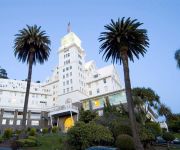
Claremont Club and Spa A Fairmont Hotel
DoubleTree by Hilton Berkeley Marina
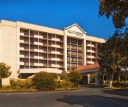
Four Points by Sheraton San Francisco Bay Bridge
La Quinta Inn Berkeley
Courtyard Oakland Emeryville
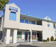
TRAVELODGE BERKELEY
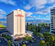
Hilton Garden Inn San Francisco-Oakland Bay Bridge
HOTEL SHATTUCK PLAZA
Holiday Inn Express & Suites BERKELEY
Graduate Berkeley
Videos from this area
These are videos related to the place based on their proximity to this place.
Berkeley's backyard tiny house adds income & affordable housing
Karen Chapple is a city planning professor so she knows all about the benefits of backyard cottages as urban infill and for adding density to sprawling neighborhoods, but when she took out...
MOD: Simcity BOC Build Outside City [ProcsKalone]
What do you think of the new higher production value? Download the MOD here: http://community.simtropolis.com/files/file/28723-boc-build-outside-citybox/ Follow IdeoREX on Twitter: https://twitte...
Berkeley Lab CAG Meeting, November 17, 2014
The Berkeley Lab Community Advisory Group (CAG) was formed in 2010 to provide input into the Lab's physical plans and development projects. The CAG has many interests related to the Lab's...
Oakland Berkeley CPR Courses: How to use an AED on an Adult
http://www.berkeleycprclasses.com teaches AHA certification classes on how to use an AED (automated external defibrillator) on an adult.
IBM People for Smarter Cities & TakePart present ‘In the city with: Tom Bates’
Learn more smart ideas at http://bit.ly/18ultdk - Tom Bates is a mayor on a mission – as the leader of one of the most sustainable cities in America he's enacting a four-part plan to help...
Simcity Higher Education & Regional Education (Tips & Tricks)
What future topics can we investigate and experiment? The color setting is Warmer.
Simcity Episode 24 - Pure City (Lets Play)
What do you want to see in future Lets Plays? Follow IdeoREX on Twitter: https://twitter.com/IdeoRex Tags and stuff: new online gameplay Simcity 2013 region Maxis EA lets play free commentary...
Simcity Episode 20 - Industrial City (Lets Play)
What do you want to see in future Lets Plays? Follow IdeoREX on Twitter: https://twitter.com/IdeoRex Tags and stuff: new online gameplay Simcity 2013 region Maxis EA lets play free commentary...
George Beier for Berkeley City Candidate for Council District 8
George Beier qualifications for city council: http://www.georgebeier.com/. If you want a leader who has experience, can get the best ideas on the table, buil...
Videos provided by Youtube are under the copyright of their owners.
Attractions and noteworthy things
Distances are based on the centre of the city/town and sightseeing location. This list contains brief abstracts about monuments, holiday activities, national parcs, museums, organisations and more from the area as well as interesting facts about the region itself. Where available, you'll find the corresponding homepage. Otherwise the related wikipedia article.
Berkeley, California
Berkeley is a city on the east shore of the San Francisco Bay in Northern California. Its neighbors to the south are the cities of Oakland and Emeryville. To the north is the city of Albany and the unincorporated community of Kensington. The eastern city limits coincide with the county line, which generally follows the ridge line of the Berkeley Hills. Berkeley is located in northern Alameda County. The population was 112,580 at the 2010 census. The city is named after Bishop George Berkeley.
Berkeley Repertory Theatre
Berkeley Repertory Theatre is a regional theater company located in Berkeley, California. It was founded in 1968, as the East Bay’s first resident professional theatre. Michael Leibert was the founding artistic director, who was then succeeded by Sharon Ott in 1984. The company runs seven productions each season from its two stages in Downtown Berkeley. The company won the Regional Theatre Tony Award in 1997.
Downtown Berkeley (BART station)
Downtown Berkeley is a Bay Area Rapid Transit station located in Berkeley, California. One of three stations in Berkeley along with Ashby and North Berkeley, it is the second-busiest BART station outside of San Francisco, with 11,749 exits each weekday. The busiest outside of San Francisco, 12th St. Oakland City Center, handles 12,181 weekday exits.
North Berkeley (BART station)
North Berkeley is an underground Bay Area Rapid Transit station located on Sacramento Street in Berkeley, California. The station is bounded by Virginia, Sacramento, Delaware, and Acton Streets to the north, east, south, and west, respectively.
Berkeley High School (Berkeley, California)
Berkeley High School is the only public high school in Berkeley, California. It is located one long block west of Shattuck Avenue and three short blocks south of University Avenue in Downtown Berkeley, and is recognized as a Berkeley landmark. The school mascot is the Yellowjacket.
International Computer Science Institute
The International Computer Science Institute (ICSI) is an independent, non-profit research organization located in Berkeley, California, USA. Since its founding in 1988, ICSI has maintained an affiliation with the University of California, Berkeley, where several of its members hold faculty appointments.
Berkeley Community Theatre
The Berkeley Community Theatre is a theatre, located in Berkeley, California on the campus of Berkeley High School. The theater is used by Berkeley High School and the Berkeley Unified School District. The theater building also holds the Florence Schwimley Little Theater, a smaller theater that is often used for Berkeley High School music and theater performances.
The Freight and Salvage
The Freight and Salvage (known as "The Freight") is a nonprofit musical performance venue in Berkeley, California, that primarily hosts folk music and world music acts.
Wat Mongkolratanaram
For the Thai temple in Tampa, see Wat Mongkolratanaram, Tampa {{#invoke:Coordinates|coord}}{{#coordinates:37|51|22.69|N|122|16|14.46|W|region:US |primary |name= }} 50x40pxThis article needs additional citations for verification. Please help improve this article by adding citations to reliable sources. Unsourced material may be challenged and removed. Wat Mongkolratanaram is a small Thai Buddhist temple located in Berkeley, California.
Ohlone Park
Ohlone Park is a public park in the city of Berkeley, California, United States, situated on a strip of land along the north side of Hearst Avenue between Martin Luther King Jr. Way and Sacramento Street. Directly underground is the subway used by the Bay Area Rapid Transit system's Richmond-Fremont and Richmond-Daly City lines. It is part of the Ohlone Greenway.
Downtown Berkeley, Berkeley
Downtown Berkeley is the central business district of the city of Berkeley, California, United States, around the intersection of Shattuck Avenue and Center Street, and extending north to Hearst Avenue, south to Dwight Way, west to Martin Luther King Jr. Way, and east to Oxford Street.
Berkeley City College
Berkeley City College (BCC), formerly Vista Community College, one of the California Community Colleges, is part of the Peralta Community College District. It is centrally located in downtown Berkeley, two blocks west of the UC Berkeley campus. Berkeley City College is accredited by the Accrediting Commission for Community and Junior Colleges of the Western Association of Schools and Colleges.
UC Theater
The UC Theatre was a movie theater on University Avenue near Shattuck Avenue in Berkeley, California, known for having a revival house presentation of films, from the 1970s until its closing.
Berkeley Station
Berkeley Station was the name of the principal railroad station in Berkeley, California from 1878 to 1911. It was located in what is now downtown Berkeley, on Shattuck Avenue between University Avenue and Center Street. The tract is today occupied by Shattuck Square and Berkeley Square. The name continued in use after 1911 although the station was no longer the main rail depot for Berkeley.
Berkeley Zen Center
Berkeley Zen Center (BZC), temple name Shogakuji, is a Sōtō Zen Buddhist practice center located in Berkeley, California led by Sojun Mel Weitsman. An informal affiliate to the San Francisco Zen Center (SFZC), BZC was originally founded in 1967 by Weitsman and Shunryu Suzuki as a satellite group for the SFZC. Despite founding the center, Weitsman was not installed as abbot there until 1985, one year after receiving Dharma transmission from Hoitsu Suzuki.
Edwards Stadium
Edwards Stadium (also referred to as Edwards Field) is the track & field and soccer venue for the University of California Golden Bears. This Art Deco-styled stadium was designed by architects Warren C. Perry and George W. Kelham, and named after Col. George C. Edwards, opening in 1932. It was the oldest track-only stadium in the United States until 1999, when it was reconfigured to accommodate the Cal soccer teams.
Berkeley Police Department
The Berkeley Police Department (BPD) is the municipal police department for the city of Berkeley, California, USA.
California Center for Innovative Transportation
The California Center for Innovative Transportation (CCIT) is a research organization at the University of California, Berkeley Institute of Transportation Studies. CCIT's mission is to deploy the most current transportation research through partnerships with public organizations such as Caltrans, as well as private organizations whose products or services serve the transportation sector.
Martin Luther King Middle School (Berkeley)
Martin Luther King Middle School (commonly MLK or King) is a public middle school in Berkeley, California serving grades 6-8. King is one of three middle schools in the Berkeley Unified School District, which includes Willard Middle School, and Longfellow Middle School. Its address is 1781 Rose Street.
Harold E. Jones Child Study Center
The Harold E. Jones Child Study Center is a research and educational institution for young children at the University of California, Berkeley. It is one of the oldest continuously running centers for the study of children in the country. The Jones Child Study Center has a special relationship with the Institute of Human Development as a site for research, training and outreach to the community, parents, and teachers.
Berkeley Digital Film Institute
The Berkeley Digital Film Institute is the newest addition in San Francisco Bay Area film schools. The program is an intense, 16-month, total immersion with emphasis on Producing and Directing for Motion Pictures, Television, Commercials and Music Videos. The institute was founded in early 2007 by Patrick Kriwanek, Dean of Education. Kriwanek, who was the head of the Academy of Art's Motion Picture division was instrumental in growing the program from 79 to 900 students before leaving in 1999.
North Berkeley, Berkeley, California
North Berkeley is a northern neighborhood of Berkeley, California, It includes the location of the University of California, Berkeley, as well as the Gourmet Ghetto.
Shattuck Avenue
Shattuck Avenue is a major city street running north-south through Berkeley, California and Oakland, California. At its southern end, the street branches from Telegraph Avenue in Oakland's Temescal district, then ends at Indian Rock Park in the Berkeley Hills to the north. Shattuck Avenue is the main street of Berkeley, forming the spine of that city's downtown, and the site of the Gourmet Ghetto in North Berkeley.
Jazzschool
The Jazzschool is a privately owned non-profit music school for jazz students in Berkeley, California. The four-year conservatory is sometimes called JazzSchool or Jazz School. It is the only American school with a year-round jazz music program.
Shattuck Hotel
Shattuck Hotel or Hotel Shattuck Plaza, located in Downtown Berkeley, was opened in December 1910 with the consent of Rosa Shattuck, wife of prominent gold seeker and builder Francis K. Shattuck, . The hotel is located on the corner of Shattuck Avenue and Allston Way near the site of Rosa and Francis Shattuck's former Victorian Estate. It has been a City of Berkeley Landmark since 1987.







!['MOD: Simcity BOC Build Outside City [ProcsKalone]' preview picture of video 'MOD: Simcity BOC Build Outside City [ProcsKalone]'](https://img.youtube.com/vi/8NBmg_NScNY/mqdefault.jpg)


