Safety Score: 2,7 of 5.0 based on data from 9 authorites. Meaning we advice caution when travelling to United States.
Travel warnings are updated daily. Source: Travel Warning United States. Last Update: 2024-05-03 08:06:06
Delve into Northwest Berkeley
The district Northwest Berkeley of Berkeley in Alameda County (California) is a district located in United States about 2,427 mi west of Washington DC, the country's capital town.
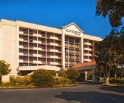
In need of a room? We compiled a list of available hotels close to the map centre further down the page.
Since you are here already, you might want to pay a visit to some of the following locations: Oakland, San Francisco, Martinez, San Rafael and Redwood City. To further explore this place, just scroll down and browse the available info.
Local weather forecast
Todays Local Weather Conditions & Forecast: 9°C / 48 °F
| Morning Temperature | 12°C / 54 °F |
| Evening Temperature | 11°C / 51 °F |
| Night Temperature | 9°C / 49 °F |
| Chance of rainfall | 20% |
| Air Humidity | 83% |
| Air Pressure | 1010 hPa |
| Wind Speed | Fresh Breeze with 13 km/h (8 mph) from North |
| Cloud Conditions | Overcast clouds, covering 100% of sky |
| General Conditions | Heavy intensity rain |
Sunday, 5th of May 2024
14°C (56 °F)
10°C (50 °F)
Sky is clear, moderate breeze, clear sky.
Monday, 6th of May 2024
14°C (58 °F)
11°C (52 °F)
Overcast clouds, moderate breeze.
Tuesday, 7th of May 2024
18°C (64 °F)
13°C (56 °F)
Sky is clear, gentle breeze, clear sky.
Hotels and Places to Stay
DoubleTree by Hilton Berkeley Marina
Four Points by Sheraton San Francisco Bay Bridge
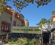
Rose Garden Inn
HOTEL SHATTUCK PLAZA
La Quinta Inn Berkeley
Rose Garden Inn
Holiday Inn Express & Suites BERKELEY
Courtyard Oakland Emeryville
Barkissimo classic yacht hotel
TRAVELODGE BERKELEY
Videos from this area
These are videos related to the place based on their proximity to this place.
Berkeley's 4th Street Neighborhood
Fourth Street is one my favorite shopping streets in Berkeley. When it's time for a break, we often drive down to the 4th Street Shopping District for a bagel at Manhattan Bagel (the BEST bagels...
Chiropractor Albany CA - Chiropractic Therapy Massage Acupuncture
http://www.sourceforwellness.com/ Albany CA Chiropractic Clinic featuring Dr. Little With over 15 years experience in gentle, safe and effective treatments, our clinical wellness practitioners...
Poetry at the Albany Library - Robert Sward and Alan Soldofsky
Tuesday Oct. 14, 2014 7-9 pm Poetry at the Albany Library + Open Mic Robert Sward and Alan Soldofsky met at Iowa Writer's Workshop in 1967, where Sward was Soldofsky's first poetry teacher....
Safeway on Solano - Albany CA LA20120418.wmv
Animation flying around the proposed Safeway development on Solano Ave. in Albany California. First presented to the public the evening of April 18, 2012 at a community meeting.
Albany Haunt 2014: Fear on the Farm
Albany Haunt Productions In-corpse-erated Presents, Fear on the Farm. Like us on Facebook!!! http://goo.gl/Ip62y3.
Psychologist Albany CA Lynn Winsten Clinical Psychologist
Psychologist Albany CA Lynn Winsten Clinical Psychologist (510) 527-5359 Don't let your problems get the better of you. There is help. Our psychologist is here for you. Lynn Winsten Clinical...
Albany Bulb Park Sunset in HDR
Albany, CA view of Golden Gate. 3 bracketed exposures taken every 5 seconds. HDR allows best exposures of sky and foreground to be combined.
Albany Library Board Meeting 9-16-14: Film 11
The accurate statistics on weeding at Albany Library. Plus: Whistleblowing on violation of Library Bill of Rights. Library manager refuses to post flier from patron group opposed to her weeding...
Albany Library Board Meeting 9-16-14: Film 4
Interim County Librarian discusses Library Weeding as one part of Collection Management. Discussion and questions among board members and library administrators.
Videos provided by Youtube are under the copyright of their owners.
Attractions and noteworthy things
Distances are based on the centre of the city/town and sightseeing location. This list contains brief abstracts about monuments, holiday activities, national parcs, museums, organisations and more from the area as well as interesting facts about the region itself. Where available, you'll find the corresponding homepage. Otherwise the related wikipedia article.
924 Gilman Street
924 Gilman Street is an all-ages, non-profit, collectively organized music club usually referred to by its fans simply as "Gilman". It is located in the West Berkeley area of Berkeley, California about a mile and a half west of the North Berkeley BART station and a quarter-mile west of San Pablo Avenue, at the corner of 8th and Gilman Streets.
Albany High School (Albany, California)
For other schools of a similar name, see Albany High School (disambiguation). Albany High School (AHS) is a comprehensive public high school located in Albany, California. Educating students in grades 9–12, the school has an enrollment of 1293 students. The school mascot is a cougar and the school colors are red and white. Ted Barone is the current principal.
North Berkeley (BART station)
North Berkeley is an underground Bay Area Rapid Transit station located on Sacramento Street in Berkeley, California. The station is bounded by Virginia, Sacramento, Delaware, and Acton Streets to the north, east, south, and west, respectively.
Solano Avenue
Solano Avenue in Berkeley and Albany, California is a two mile (3.2 km) long east-west street. Solano Avenue is one of the larger shopping districts in the Berkeley area. Businesses along Solano Avenue cover a wide range, including grocery stores, coffee shops, drugstores, bookstores, antique dealers, apparel outlets, ethnic restaurants and a movie theater.
Golden Gate Fields
Golden Gate Fields is an American horse racing track straddling both Albany, California and Berkeley, California along the shoreline of San Francisco Bay adjacent to the Eastshore Freeway in the San Francisco Bay Area. With the closing of the Bay Meadows racetrack on May 11, 2008, it became the only major racetrack in Northern California. It is currently owned by The Stronach Group. The track is set on 140 acres of land in the cities of Albany and Berkeley.
Berkeley Pier
The Berkeley Pier is a pier in Berkeley, California. When constructed, the pier extended 3.5 miles (5.6 km) into San Francisco Bay from the end of University Avenue. Due to extensive filling of the bay and the creation of the Berkeley Marina, it presently extends only 2.5 miles (4.1 km). Currently, only the first 3000 ft (0.9 km) are maintained and open to the public.
Ohlone Park
Ohlone Park is a public park in the city of Berkeley, California, United States, situated on a strip of land along the north side of Hearst Avenue between Martin Luther King Jr. Way and Sacramento Street. Directly underground is the subway used by the Bay Area Rapid Transit system's Richmond-Fremont and Richmond-Daly City lines. It is part of the Ohlone Greenway.
Albany Hill
Albany Hill is a prominent hill along the east shore of San Francisco Bay in the city of Albany, California. Geologically, the hill is predominantly Jurassic sandstone, carried to the western edge of North America on the Pacific Plate and scraped off there in the course of subduction. Albany Hill is part of a range of hills uplifted long before today's Berkeley Hills.
Westbrae, Berkeley, California
Westbrae is a neighborhood in the northern part of Berkeley, California in the East Bay section of the San Francisco Bay Area. Westbrae is "centered" on the intersection of Santa Fe Avenue and Gilman Street, although the main extent is east, south and west of this intersection, with the Albany city limit only a short distance north. It lies at an elevation of 79 feet (24 m). The neighborhood is mainly residential, with a small commercial section along Gilman from Santa Fe to Tevlin Street.
Berkeley Marina
The Berkeley Marina is the westernmost portion of the city of Berkeley, California, located west of the Eastshore Freeway (Interstate 80 and 580) at the foot of University Avenue on San Francisco Bay. Narrowly speaking, "Berkeley Marina" refers only to the city marina, but in common usage, it applies more generally to the surrounding area. There are several restaurants, a hotel and a yacht club in the Berkeley Marina. There are also several walking and bicycle paths.
West Berkeley, Berkeley, California
West Berkeley is generally the area of Berkeley, California, that lies west of San Pablo Avenue, abutting San Francisco Bay. It includes the area that was once the unincorporated town of Ocean View, as well as the filled-in areas along the shoreline west of I-80, mainly including the Berkeley Marina. It lies at an elevation of 23 feet (7 m).
Schoolhouse Creek (Alameda County, California)
Schoolhouse Creek is the name of a creek which flows through the city of Berkeley, California in the San Francisco Bay Area.
Aquatic Park (Berkeley)
Aquatic Park is a public park in Berkeley, California, United States, located just east of the Eastshore Freeway between Ashby and University Avenues. The park was created in the 1930s by the Works Progress Administration, simultaneous with its work on the nearby Berkeley Yacht Harbor.
UC Village
UC Village, also called University Village or University Village Albany, is a housing community for students who are married or have dependents. It is owned and administered by the University of California, Berkeley. It is located within the city limits of Albany about two miles away from the main Berkeley campus, at an elevation of 26 feet (8 m). It was previously known as Albany Village. It is also commonly referred to as The Village.
Berkeley (Amtrak station)
Berkeley Station is an Amtrak station in Berkeley, California, served by Amtrak California's Capitol Corridor service. The station is located under the University Avenue overpass just west of 4th Street. It is served by AC Transit bus lines 51B and 802; AC Transit bus line Z stops nearby on 6th Street. The current platform opened on September 17, 2005, after a $2.4 million renovation.
Eastshore State Park
Eastshore State Park is a state park and wildlife refuge along the San Francisco Bay shoreline of the East Bay between the cities of Richmond, Albany, Berkeley, Emeryville, and Oakland. It encompasses remnant natural wetlands, restored wetlands as well as landfill west of the Eastshore Freeway. It is 8.5 miles long. Eastshore State Park is jointly managed by the California State Parks and East Bay Regional Park District.
César Chávez Park
César Chávez Park is a 90 acres city park of Berkeley, California named after César Chávez. It can be found on the peninsula on the north side of the Berkeley Marina in the San Francisco Bay and is adjacent to Eastshore State Park. The park's east position in San Francisco Bay provides panoramic views of San Francisco, the Golden Gate Bridge, the Marin Headlands, and the east bay hills. The park's terrain is characterized by very open grassy hills that have become popular for kite flying.
Berkeley I-80 bridge
The Berkeley I-80 bridge also known as the University Avenue Pedestrian Bridge and the Berkeley Marina Overpass is a 15-foot -wide bridge spanning the Eastshore Freeway in Berkeley, California.
Saint Mary's College High School
Saint Mary's College High School came into being as part of Saint Mary's College of California, founded in 1863 by the Catholic Church, and put under the auspices of the Institute of the Brothers of the Christian Schools in 1868. Saint Mary's is a coeducational Catholic school located in Albany, California, although its postal address is in Berkeley, California. Currently, 600 students are enrolled.
MacGregor High School
For the high school in Queensland, Australia, see MacGregor State High School. MacGregor High School is a continuation high school located in Albany, California, on Albany Hill, part of the Albany Unified School District. Students at MacGregor are individuals who are considered at-risk at Albany High School, and were recommended to attend MacGregor by a counselor. Often, students who attend MacGregor are behind in college credit and are likely not to graduate at their current pace.
Berkeley Digital Film Institute
The Berkeley Digital Film Institute is the newest addition in San Francisco Bay Area film schools. The program is an intense, 16-month, total immersion with emphasis on Producing and Directing for Motion Pictures, Television, Commercials and Music Videos. The institute was founded in early 2007 by Patrick Kriwanek, Dean of Education. Kriwanek, who was the head of the Academy of Art's Motion Picture division was instrumental in growing the program from 79 to 900 students before leaving in 1999.
Earthmine
earthmine, inc. is a company located in Berkeley, California devoted to "indexing reality". The company uses vehicle mounted camera rigs to capture imagery and three dimensional data of the urban environment. It was founded in 2006 by John Ristevski and Anthony Fassero.
Albany Beach
Albany Beach is a sand beach located in Albany, California on the east shore of San Francisco Bay.
Occupy the Farm
Occupy the Farm was an occupation of the Gill Tract in Albany, California, in protest of planned commercial development of public land and in support of preserving the land for the creation of an open center for urban agroecology and food sovereignty. Since at least 1997, coalitions of local residents, NGOs, and University of California (UC) students and faculty have brought forth proposals to the UC administration for the creation of a center for sustainable urban agriculture.
Ashkenaz (music venue)
The Ashkenaz is a live music and dance venue located in Berkeley, California in the United States. It is a non-profit organization. It focuses on world music. In 2011 it was voted the best place to dance by readers of East Bay Express.


