Safety Score: 2,7 of 5.0 based on data from 9 authorites. Meaning we advice caution when travelling to United States.
Travel warnings are updated daily. Source: Travel Warning United States. Last Update: 2024-04-28 08:22:10
Discover Marcus Garvey Square
The district Marcus Garvey Square of San Francisco in San Francisco County (California) is a district in United States about 2,436 mi west of Washington DC, the country's capital city.
Looking for a place to stay? we compiled a list of available hotels close to the map centre further down the page.
When in this area, you might want to pay a visit to some of the following locations: Oakland, San Rafael, Redwood City, Martinez and Napa. To further explore this place, just scroll down and browse the available info.
Local weather forecast
Todays Local Weather Conditions & Forecast: 16°C / 61 °F
| Morning Temperature | 11°C / 52 °F |
| Evening Temperature | 13°C / 56 °F |
| Night Temperature | 11°C / 52 °F |
| Chance of rainfall | 0% |
| Air Humidity | 62% |
| Air Pressure | 1020 hPa |
| Wind Speed | Fresh Breeze with 15 km/h (9 mph) from East |
| Cloud Conditions | Clear sky, covering 0% of sky |
| General Conditions | Sky is clear |
Monday, 29th of April 2024
17°C (62 °F)
11°C (52 °F)
Sky is clear, fresh breeze, clear sky.
Tuesday, 30th of April 2024
16°C (60 °F)
11°C (51 °F)
Sky is clear, moderate breeze, clear sky.
Wednesday, 1st of May 2024
20°C (67 °F)
13°C (56 °F)
Sky is clear, moderate breeze, clear sky.
Hotels and Places to Stay
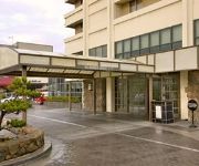
Hotel Kabuki
Hotel Kabuki - a Joie de Vivre Boutique Hotel
Payne Mansion Hotel
Hotel Drisco
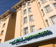
The Opal San Francisco
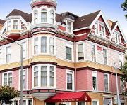
QUEEN ANNE HOTEL
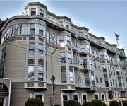
THE HOTEL MAJESTIC
JACKSON COURT
Monte Cristo Inn
MONARCH HOTEL
Videos from this area
These are videos related to the place based on their proximity to this place.
California Motorcycle Ride: San Francisco
Ride with us through San Francisco, California. Starting in Oakland, we head west over the Bay Bridge and arrive at Pier 39, part of Fisherman's Wharf, in San Francisco. Here we take a boat...
Cherry Blossom Festival Parade 2014 San Francisco (compilation)
Don't miss the high-energy ending to this parade with the Taru Mikoshi. This parade was a good mix of the traditional and some, but not too much, of the usual "standard parade stuff" (such...
The Real Home Tour of 738 Lyon Street San Francisco, CA
738 Lyon is the perfect home for the urban sophisticate. Located behind a beautifully restored Victorian facade is a striking contemporary townhouse, constructed in 2009. A gallery hallway...
Lower Haight |1 Bed | Furnished | 1 Bath | Loft | Office | $3.5-4.2K
This spacious and modern 1 bedroom, 1 bathroom loft in the Haight Ashbury is available for a short-stay rental. Sleek in design and a comfortable home. This unit features stainless steel appliances...
San Francisco, California - Japantown HD (2014)
Japantown (日本町 Nihonmachi) (also known as J Town or historically as Japanese Town, "Nihonmachi") is a neighborhood in the Western Addition district of San Francisco, California. It comprises...
Beautiful Sunny Day for A Brief Tour of Haight Street, San Francisco
A Brief tour down Haight Street on board a tour bus.
Car ride over the Golden Gate Bridge; Car Trip 2011
Car ride over the Golden Gate Bridge; San Francisco, California.
San Francisco City Tour: China Town, Twin Peaks Viewpoint, and the Golden Gate Bridge
Watch to tour San Francisco. Our visit to San Francisco in May 2010. With video from Alcatraz, the Trolly's, China Town, Lombard Street, Fisherman's Wharf, Twin Peaks Viewpiont, and the Golden...
Golden Gate National Recreation Area - Panasonic Lumix DMC-G2 720p HD Video
Video taken at the Golden Gate National Recreation Area San Francisco, CA August 2011 While waiting for my group to finish, I thought I'd do a quick recording. Not too bad at all with...
San Francisco, California - Alamo Square - Painted Ladies HD (2014)
Alamo Square is a residential neighborhood and park in San Francisco, California, in the Western Addition. Its boundaries are not well-defined, but are generally considered to be Webster Street...
Videos provided by Youtube are under the copyright of their owners.
Attractions and noteworthy things
Distances are based on the centre of the city/town and sightseeing location. This list contains brief abstracts about monuments, holiday activities, national parcs, museums, organisations and more from the area as well as interesting facts about the region itself. Where available, you'll find the corresponding homepage. Otherwise the related wikipedia article.
Roman Catholic Archdiocese of San Francisco
The Roman Catholic Archdiocese of San Francisco is an ecclesiastical territory or diocese of the Catholic Church in the northern California region of the United States. It covers the City and County of San Francisco and the Counties of Marin and San Mateo. The Archdiocese of San Francisco was canonically erected on July 29, 1853, by Pope Pius IX and its cathedral is the Cathedral of Saint Mary of the Assumption.
The Fillmore
The Fillmore Auditorium is a historic music venue in San Francisco, California, made famous by Bill Graham. Named for its original location at the intersection of Fillmore Street and Geary Boulevard, it is situated in the historical center of the Western Addition neighborhood, on the edge of the Fillmore District and Upper Fillmore (lately known as Lower Pacific Heights).
Japantown, San Francisco
(also known as Little Osaka or J Town) is a section located in the Western Addition neighborhood of San Francisco, California, that comprises about six square city blocks. San Francisco's Japantown is the largest and oldest such enclave in the United States.
Painted ladies
"Painted ladies" is a term used for Victorian and Edwardian houses and buildings painted in three or more colors that embellish or enhance their architectural details. The term was first used for San Francisco Victorian houses by writers Elizabeth Pomada and Michael Larsen in their 1978 book Painted Ladies - San Francisco's Resplendent Victorians.
Winterland Ballroom
The Winterland Ballroom, often referred to as Winterland Arena or simply Winterland, was an ice skating rink and 5,400-seat music venue in San Francisco, California. Located at the corner of Post Street and Steiner Street, it was converted to exclusive use as a music venue in 1971 by rock promoter Bill Graham and became a common performance site for many of the most famous rock music artists.
San Francisco Zen Center
San Francisco Zen Center (SFZC), is a network of affiliated Sōtō Zen practice and retreat centers in the San Francisco Bay area, comprising the City Center or Beginner's Mind Temple, the Tassajara Zen Mountain Center, and the Green Gulch Farm Zen Center. The sangha was incorporated by Shunryu Suzuki-roshi and a group of his American students in 1962. Today SFZC is the largest Sōtō organization in the West.
Western Addition, San Francisco
The Western Addition is a neighborhood in San Francisco, California, United States.
Cathedral of Saint Mary of the Assumption
The Cathedral of Saint Mary of the Assumption, also known locally as Saint Mary's Cathedral, is the principal church of the Roman Catholic Archdiocese of San Francisco in San Francisco, California. It is the mother church of the Catholic faithful in the California counties of Marin, San Francisco and San Mateo and is the metropolitan cathedral for the Ecclesiastical province of San Francisco. The rector of the cathedral is Msgr. John Talesfore.
Fillmore District, San Francisco
The Fillmore District, also called The Fillmore, The Fill, The Moe, or Fillmoe, is a neighborhood in San Francisco, California.
Lower Haight, San Francisco
The Lower Haight is a neighborhood, sometimes referred to as Haight-Fillmore, in San Francisco, California.
Pacific Heights, San Francisco
Pacific Heights is an affluent neighborhood of San Francisco, California. It is located in one of the most scenic and park-like settings in Northern California, offering panoramic views of the Golden Gate Bridge, the San Francisco Bay, the Palace of Fine Arts, Alcatraz and the Presidio. Its idyllic location provides a temperate micro-climate that is clearer, but not always warmer, than many other areas in San Francisco.
Fillmore West
The Fillmore West was a historic music venue in San Francisco, California made famous by concert promoter Bill Graham. Named after Graham's original "Fillmore" location at the intersection of Fillmore Street and Geary Boulevard, it stood at Market Street and South Van Ness Avenue and was formerly known as both The Carousel Ballroom and El Patio.
Kinmon Gakuen
The Kinmon Gakuen (金門学園) or Golden Gate Institute is a Japanese language school in San Francisco, California, located at 2031 Bush Street. It was established in 1911 with 133 students. They currently offer programs to children from kindergarten to high school. The school was forced to close during World War II and was not able to reopen until 1949. It was visited by Japanese Emperor Hirohito in 1933 and 1935, and Crown Prince Akihito in 1960.
University of the Pacific Arthur A. Dugoni School of Dentistry
University of the Pacific Arthur A. Dugoni School of Dentistry is one of the graduate schools of University of the Pacific. It is an American dental school located in the Pacific Heights Area in San Francisco, California.
Fillmore Street
Fillmore Street is a street in San Francisco, California, named after American President Millard Fillmore which starts in the Lower Haight neighborhood, and travels northward through the Fillmore District and Pacific Heights and ends in the Marina District. It serves as the main thoroughfare and namesake for the Fillmore District neighborhood.
St. Dominic Church in San Francisco
St. Dominic's Church in San Francisco, California, is a Roman Catholic parish situated in the Western Addition neighborhood, located at 2390 Bush St. (at Steiner St.). The parish was established by the Dominican order in 1873, and the current church, built in the Gothic style, was finished in 1928. In addition to a large parish membership, St. Dominic's Church has one of the most active Catholic Young Adults Groups in the Archdiocese of San Francisco.
The Wiggle
The Wiggle is a one-mile, zig-zagging bicycle route from Market Street to Golden Gate Park in San Francisco, California, that minimizes hilly inclines for bicycle riders. Rising 120 feet, The Wiggle inclines average 3% and never exceed 6%. The path generally follows the historical route of the long since paved-over Sans Souci Valley watercourse, winding through the Lower Haight neighborhood toward the Panhandle section of Golden Gate Park.
Stuart Hall High School
Stuart Hall High School is a college-preparatory high school located in San Francisco's Pacific Heights district. Stuart Hall opened in the fall of 2000. The school, along with Convent of the Sacred Heart High School, Convent Elementary, and Stuart Hall for Boys, is part of the Schools of the Sacred Heart San Francisco, which in turn is part of the international Schools of the Sacred Heart organization.
Alta Plaza
Alta Plaza is a park in San Francisco, California, USA and caps the top of the western edge of Pacific Heights. It falls under the jurisdiction of the City's Supervisorial District 2. The park is served by several San Francisco Municipal Railway bus lines. Alta Plaza consists of four square blocks at the top of Pacific Heights and overlooks much of San Francisco's Marina and Cow Hollow Districts, the Presidio, Fort Mason and Alcatraz.
Bush Street Temple
The temple at 1881 Bush Street in San Francisco, California, is a State Landmark with historical significance to both the Orthodox Jewish community and to Buddhism in the United States.
Harding Theater
The Harding Theater is a historic movie theater located at 616 Divisadero Street in San Francisco, California.
Peoples Temple in San Francisco
The Peoples Temple, the organization at the center of the Jonestown incident, was headquartered in San Francisco, California, from the early to mid-1970s until the Temple's move to Guyana. While the Temple originated in Indiana in the 1950s, after leader Jim Jones predicted an apocalypse that would create a socialist Eden on earth, it moved to Redwood Valley, California in the late 1960s.
Congregation Sherith Israel (San Francisco, California)
Congregation Sherith Israel ("loyal remnant of Israel") is one of the oldest synagogues in the United States. It was established during California’s Gold Rush period and reflects the ambitions of early Jewish settlers to San Francisco. Today it is a congregation widely known for its innovative approach to worship and lifecycle celebrations and is part of the movement of Reform Judaism.
Hotel Majestic (San Francisco)
Hotel Majestic in San Francisco, California is a historic hotel built in 1902. Because of the 1906 earthquake and fire that was stopped at Van Ness Avenue, it became the longest-operating hotel in the city.
Japan Center (San Francisco)
The Japan Center is a shopping center in the Japantown neighborhood of San Francisco, California. It opened in March 1968 and was originally called the Japanese Cultural and Trade Center. It is composed of three malls: the Kinokuniya Mall, Kintetsu Mall, and Miyako Mall. Anchor tenants include Books Kinokuniya and Sundance Kabuki Cinema. The architecture of the site, created by Minoru Yamasaki, has been described as "Brutalist slabwork. " San Francisco's Peace Pagoda is on the Japan Center site.


