Safety Score: 2,7 of 5.0 based on data from 9 authorites. Meaning we advice caution when travelling to United States.
Travel warnings are updated daily. Source: Travel Warning United States. Last Update: 2024-04-28 08:22:10
Explore Westborough
Westborough in San Mateo County (California) is a city in United States about 2,440 mi (or 3,926 km) west of Washington DC, the country's capital.
Local time in Westborough is now 12:01 PM (Sunday). The local timezone is named America / Los Angeles with an UTC offset of -7 hours. We know of 8 airports in the vicinity of Westborough, of which 4 are larger airports. The closest airport in United States is San Francisco International Airport in a distance of 5 mi (or 8 km), East. Besides the airports, there are other travel options available (check left side).
Also, if you like golfing, there are multiple options in driving distance. We found 10 points of interest in the vicinity of this place. If you need a place to sleep, we compiled a list of available hotels close to the map centre further down the page.
Depending on your travel schedule, you might want to pay a visit to some of the following locations: San Francisco, Oakland, Redwood City, San Rafael and Martinez. To further explore this place, just scroll down and browse the available info.
Local weather forecast
Todays Local Weather Conditions & Forecast: 14°C / 58 °F
| Morning Temperature | 11°C / 52 °F |
| Evening Temperature | 12°C / 54 °F |
| Night Temperature | 12°C / 53 °F |
| Chance of rainfall | 0% |
| Air Humidity | 72% |
| Air Pressure | 1021 hPa |
| Wind Speed | Strong breeze with 17 km/h (11 mph) from South-East |
| Cloud Conditions | Clear sky, covering 0% of sky |
| General Conditions | Sky is clear |
Sunday, 28th of April 2024
14°C (58 °F)
11°C (52 °F)
Sky is clear, strong breeze, clear sky.
Monday, 29th of April 2024
14°C (57 °F)
11°C (52 °F)
Sky is clear, strong breeze, clear sky.
Tuesday, 30th of April 2024
18°C (64 °F)
12°C (54 °F)
Sky is clear, fresh breeze, clear sky.
Hotels and Places to Stay
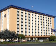
BEST WESTERN PLUS GROSVENOR
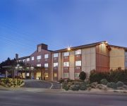
La Quinta Inn and Suites San Francisco Airport North
Hotel Focus SFO
Staybridge Suites SAN FRANCISCO AIRPORT
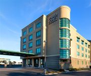
Courtyard San Francisco Airport
Holiday Inn SAN FRANCISCO AIRPORT
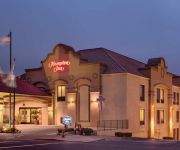
Hampton Inn San Francisco - Daly City CA
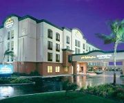
Four Points by Sheraton Hotel & Suites San Francisco Airport
BEST WESTERN PLUS LIGHTHOUSE
Holiday Inn Express & Suites PACIFICA
Videos from this area
These are videos related to the place based on their proximity to this place.
Kalua Pork @ Hawaiian King BBQ Serramonte Center Food Court Daly City California
Kalua pork and white rice with macaroni salad and vegetables mini plate lunch from Hawaiian King BBQ at the Serramonte Center Food Court in Daly City, California.
Itchy O Marching Band @ Winters Pacifica
32 piece electric marching band takes over the tavern in a wild performance.
Fish Fights at Rice N Roll in Pacifica CA
Tank Match Fish Fight! Place your bets at Rice N Roll restaurant! I bet five fish flakes on Goldie! "Everybody was fish-y fighting. Those carps were fast as lightning! In fact it was a...
South City Station Apartments - 1 Bedroom A - South San Francisco
http://www.equityapartments.com/california/san-francisco-bay-apartments/south-san-francisco/south-city-station-apartments.aspx Click the link to see the most up to date prices & availability....
South City Station Apartments - 2 Bedrooms D - South San Francisco
http://www.equityapartments.com/california/san-francisco-bay-apartments/south-san-francisco/south-city-station-apartments.aspx Click the link to see the most up to date prices & availability....
SSFHS Football vs Woodside 10-10-14
Watch the entire game: http://www.nfhsnetwork.com/events/south-san-francisco-high-school-south-san-francisco-ca/56b281cb65.
Videos provided by Youtube are under the copyright of their owners.
Attractions and noteworthy things
Distances are based on the centre of the city/town and sightseeing location. This list contains brief abstracts about monuments, holiday activities, national parcs, museums, organisations and more from the area as well as interesting facts about the region itself. Where available, you'll find the corresponding homepage. Otherwise the related wikipedia article.
Golden Gate National Cemetery
Golden Gate National Cemetery is a U.S. National Cemetery, located in the city of San Bruno, San Mateo County, 12 miles (19 km) south of San Francisco. Because of the name and location, it is frequently confused with San Francisco National Cemetery, which dates to the 19th century and is in the Presidio of San Francisco, in view of the Golden Gate.
South San Francisco (BART station)
South San Francisco Station is a Bay Area Rapid Transit station located in suburban South San Francisco, California in northern San Mateo County. It consists of two main tracks and a shared underground island platform.
Milagra Ridge
Milagra Ridge is a 240 acre (.97 km²) parcel of land that is an isolated island ecosystem, located about 7 miles (11 km) south of San Francisco, near the city of Pacifica. It was first inhabited by the Ohlone indigenous people, and was later claimed by Spanish settlers and Mexican ranchers.
Flying Tiger Line Flight 282
Flying Tiger Flight 282 refers to the crash of a Lockheed Constellation aircraft, N6915C, shortly after take-off from San Francisco International Airport in the early morning hours of Thursday, December 24, 1964. On Wednesday, December 23, 1964, Flying Tiger Line Flight 282 arrived at San Francisco International Airport from Japan.
San Francisco County Jails
San Francisco County Jails are operated by the Sheriff's Department Custody Division of the City and County of San Francisco. The system comprises eight jails, with approximately 55,000 annual bookings administered by 800 deputy sheriffs.
Ponderosa Elementary School (South San Francisco)
Ponderosa Elementary School is a K–5 elementary school located in South San Francisco, California. It is part of the South San Francisco Unified School District.
San Bruno Creek
San Bruno Creek is an intermittent stream that rises on the eastern slopes of the Northern Santa Cruz Mountains in San Mateo County, California, USA. The headwaters descend a relatively steep canyon east of Skyline Boulevard in a tortuous course. Comparison of topographic maps from 1896 and 1939 illustrates the extreme modification in the lower reaches due to urban development from the rapidly expanding population.
Rancho San Pedro (Sanchez)
Rancho San Pedro was a 8,926-acre Mexican land grant in present day San Mateo County, California given in 1839 by Governor Juan Alvarado to Francisco Sanchez. The grant encompasses present day Pacifica.


