Safety Score: 2,7 of 5.0 based on data from 9 authorites. Meaning we advice caution when travelling to United States.
Travel warnings are updated daily. Source: Travel Warning United States. Last Update: 2024-05-05 08:24:42
Discover Stonehurst
Stonehurst in Los Angeles County (California) is a place in United States about 2,296 mi (or 3,695 km) west of Washington DC, the country's capital city.
Current time in Stonehurst is now 09:54 PM (Sunday). The local timezone is named America / Los Angeles with an UTC offset of -7 hours. We know of 8 airports near Stonehurst, of which 3 are larger airports. The closest airport in United States is Bob Hope Airport in a distance of 4 mi (or 6 km), South. Besides the airports, there are other travel options available (check left side).
Also, if you like playing golf, there are a few options in driving distance. We encountered 2 points of interest in the vicinity of this place. If you need a hotel, we compiled a list of available hotels close to the map centre further down the page.
While being here, you might want to pay a visit to some of the following locations: Los Angeles, Orange, Santa Ana, Ventura and Riverside. To further explore this place, just scroll down and browse the available info.
Local weather forecast
Todays Local Weather Conditions & Forecast: 22°C / 72 °F
| Morning Temperature | 11°C / 53 °F |
| Evening Temperature | 22°C / 72 °F |
| Night Temperature | 17°C / 62 °F |
| Chance of rainfall | 0% |
| Air Humidity | 15% |
| Air Pressure | 1015 hPa |
| Wind Speed | Light breeze with 5 km/h (3 mph) from North-East |
| Cloud Conditions | Clear sky, covering 9% of sky |
| General Conditions | Sky is clear |
Monday, 6th of May 2024
24°C (76 °F)
18°C (65 °F)
Sky is clear, gentle breeze, clear sky.
Tuesday, 7th of May 2024
24°C (75 °F)
18°C (65 °F)
Sky is clear, light breeze, clear sky.
Wednesday, 8th of May 2024
22°C (72 °F)
18°C (65 °F)
Sky is clear, gentle breeze, clear sky.
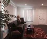
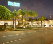
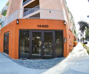
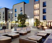
Hotels and Places to Stay
Los Angeles Marriott Burbank Airport
BEST WESTERN BURBANK AIRPORT
Center of the Valley one Bedroom
BURBANK INN AND SUITES
Brand new Apartment
SpringHill Suites Los Angeles Burbank/Downtown
Hilton Garden Inn Burbank Downtown CA
THE COAST ANABELLE HOTEL
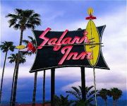
THE SAFARI INN. A COAST HOTEL
Residence Inn Los Angeles Burbank/Downtown
Videos from this area
These are videos related to the place based on their proximity to this place.
SUN VALLEY cute small HOUSE FOR RENT 2+1 w/garage & yard
818-861-6208 Lupe, cute FRONT HOUSE 2+1 laminated flooring $1395/mo Lupe SUN VALLEY cute small house FRONT UNIT with front yard & side yard, 1-car gar, NO laundry facilities, available now.
Sun Valley Appraiser – 818-384-6869 – Home Appraisal in Sun Valley CA
http://www.TurnersAppraisals.com Real Estate Appraiser helping people make informed property valuation decisions by providing comprehensive yet easy to understand real estate appraisal reports...
LOS MISMOS - SE FUE MI PALOMA - VIENDOLO BIEN - SUN VALLEY, CA. [OCT-2012]
LOS MISMOS EN LA IGLESIA DEL SANTO ROSARIO EN SUN VALLEY, CA. 2012.
GRUPO MIRAMAR EN SUN VALLEY 2012 [3 OF 3]
GRUPO MIRAMAR EN LA IGLESIA DEL SANTO ROSARIO EN SUN VALLEY, CA. 2012.
LAFD Air Ops AgustaWestland AW-139 N303FD Los Angeles City Fire Department, American Heroes Air show
Recorded June 29th 2013 Los Angeles City Fire Departments AugustaWestland AW-139 I shot this footage at the 20th annual American Heroes Air Show at Hansen Dam Sports Complex Lake View ...
Country Living, yet only minutes from the Studios and Downtown!
http://www.tourfactory.com/s547279/r_www.youtube.com ----- For more information, contact: Georgia Lambron Bell, 818769-7100DRE 00861314, Keller Williams Real...
Stonehurst Block Wall Retaining Wall Repair Shafran Masonry Construction 818-735-0509
Web site: www.shafranconstruction.com Email: shafranconst@gmail.com Phone: 818-735-0509 Choose the #1 Company in Los Angeles and Ventura County for your next construction or remodeling ...
2-Stage Motion Control Linear Mover - Camera Slider
2-Stage Motion Control Linear Mover - Camera Slider This linear mover offers nearly 4 feet of travel and can be set up as a single-stage mover with 2 feet of travel. We also offer a 1 foot...
LAFD AgustaWestland AW-139 Helicopter Landing
Los Angeles City Fire Department AW-139 Helicopter lands during the American Heroes Air Show at the Hansen Dam Sports Complex, Lake View Terrace, CA, on June 30, 2012.
Videos provided by Youtube are under the copyright of their owners.
Attractions and noteworthy things
Distances are based on the centre of the city/town and sightseeing location. This list contains brief abstracts about monuments, holiday activities, national parcs, museums, organisations and more from the area as well as interesting facts about the region itself. Where available, you'll find the corresponding homepage. Otherwise the related wikipedia article.
Sun Valley, Los Angeles
Sun Valley is a district in the San Fernando Valley region of the city of Los Angeles, California, about 15 miles away from Downtown Los Angeles. It is bordered by Burbank to the east, Shadow Hills to the north, Pacoima to the northwest, Panorama City to the west, North Hollywood to the south, and the city of Glendale to the southeast. The district is served by the Golden State and Hollywood freeways.
Lake View Terrace, Los Angeles
Lake View Terrace is a suburb district in the north east quadrant of the San Fernando Valley region of the City of Los Angeles, California. Surrounding areas include the Angeles National Forest, Little Tujunga Canyon, Big Tujunga Canyon, Hansen Dam, Kagel Canyon, and a portion of the Verdugo Mountains. The community lies adjacent to the communities of Sylmar, San Fernando, Shadow Hills, Sunland, Sun Valley, and Pacoima. The area shares the 91342 ZIP code with Sylmar.
Shadow Hills, Los Angeles
Shadow Hills is a semi-rural neighborhood in northern Los Angeles, California, USA.
Hansen Dam
Hansen Dam is a flood control dam in the northeastern San Fernando Valley, in the Lake View Terrace district of Los Angeles, Southern California. The dam was built by the U.S. Army Corps of Engineers, Los Angeles District, in 1940. Hansen Dam was named after horse ranchers Homer and Marie Hansen, who established a ranch in the 19th century. The Hansen Dam Recreation Center is located in the flood control basin and surrounding slopes behind the dam.
Village Christian Schools
Village Christian School (VCS) is a private, Christian, K-12 school located in Sun Valley, California, a part of the City of Los Angeles. It was founded in 1949 by members of Village Church in nearby Burbank. The school has about 1,000 students.
Sun Valley (Metrolink station)
The Sun Valley Metrolink Station is a Metrolink rail station in the community of Sun Valley, Los Angeles, California. It is served by Metrolink's Antelope Valley Line from Los Angeles Union Station to Lancaster. 24 Metrolink trains serve the station each weekday and 8 serve the station on Saturdays. Weekday Metrolink service runs primarily at peak hours in the peak direction of travel while weekend departures and arrivals are fairly evenly spaced throughout the day.
Sun Valley High School (California)
Sun Valley High School is a 4 year high school in Sun Valley, Los Angeles. It is a part of the Los Angeles Unified School District. The principal of the school is Paul Del Rosario. Sun Valley High School is home to over 900 students and 24 staff members and offers Culinary Arts, Project Lead the Way Engineering, and a Media Arts/Film Production programs along with Advanced Placement courses. The schools athletic teams are known as the Wildcats.
Glenoaks Boulevard
Glenoaks Boulevard is a major thoroughfare in Los Angeles County, which stretches some 22.4 miles as a north-south thoroughfare in Sylmar at its intersection with Foothill Boulevard to a west-east thoroughfare in Glendale before ending in the School Canyon area as a minor street. It passes through much of the San Fernando Valley including San Fernando, Pacoima, and Sun Valley. It is also a north-south thoroughfare in Burbank.





!['LOS MISMOS - SE FUE MI PALOMA - VIENDOLO BIEN - SUN VALLEY, CA. [OCT-2012]' preview picture of video 'LOS MISMOS - SE FUE MI PALOMA - VIENDOLO BIEN - SUN VALLEY, CA. [OCT-2012]'](https://img.youtube.com/vi/7jaaKUyK_UA/mqdefault.jpg)
!['GRUPO MIRAMAR EN SUN VALLEY 2012 [3 OF 3]' preview picture of video 'GRUPO MIRAMAR EN SUN VALLEY 2012 [3 OF 3]'](https://img.youtube.com/vi/ZWpcn-6d_VI/mqdefault.jpg)


