Safety Score: 2,7 of 5.0 based on data from 9 authorites. Meaning we advice caution when travelling to United States.
Travel warnings are updated daily. Source: Travel Warning United States. Last Update: 2024-05-04 08:22:41
Delve into Summit
Summit in Kern County (California) is a city located in United States about 2,278 mi (or 3,666 km) west of Washington DC, the country's capital town.
Current time in Summit is now 08:25 PM (Saturday). The local timezone is named America / Los Angeles with an UTC offset of -7 hours. We know of 9 airports closer to Summit, of which 4 are larger airports. The closest airport in United States is Palmdale Regional/USAF Plant 42 Airport in a distance of 39 mi (or 63 km), South-East. Besides the airports, there are other travel options available (check left side).
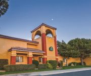
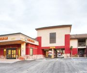
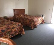
Also, if you like playing golf, there are some options within driving distance. In need of a room? We compiled a list of available hotels close to the map centre further down the page.
Since you are here already, you might want to pay a visit to some of the following locations: Bakersfield, Los Angeles, Ventura, Orange and Santa Barbara. To further explore this place, just scroll down and browse the available info.
Local weather forecast
Todays Local Weather Conditions & Forecast: 6°C / 42 °F
| Morning Temperature | 1°C / 34 °F |
| Evening Temperature | 7°C / 45 °F |
| Night Temperature | 4°C / 39 °F |
| Chance of rainfall | 0% |
| Air Humidity | 57% |
| Air Pressure | 1013 hPa |
| Wind Speed | Fresh Breeze with 14 km/h (9 mph) from East |
| Cloud Conditions | Scattered clouds, covering 41% of sky |
| General Conditions | Rain and snow |
Sunday, 5th of May 2024
10°C (51 °F)
6°C (44 °F)
Few clouds, fresh breeze.
Monday, 6th of May 2024
10°C (50 °F)
8°C (46 °F)
Broken clouds, fresh breeze.
Tuesday, 7th of May 2024
15°C (59 °F)
11°C (51 °F)
Sky is clear, gentle breeze, clear sky.
Hotels and Places to Stay
LA QUINTA INN TEHACHAPI
Tehachapi Summit Travelodge
SureStay Hotel by Best Western Tehachapi
Holiday Inn Express & Suites TEHACHAPI HWY 58/MILL ST.
Fairfield Inn & Suites Tehachapi
Ranch Motel
Golden Hills Motel
BEST WESTERN PLUS COUNTRY PARK
Videos from this area
These are videos related to the place based on their proximity to this place.
Trains - Tehachapi, California, USA - 2013
Trains Passing Through The Techachapi, California Area During November 2013. Thanks For Watching And Enjoy!
Tehachapi Pass! UP, BNSF, Military Trains, Train Race, Train Symbols & More!
It's memorial day weekend and I decided to head out to Tehahchapi Pass for a day. Traffic was fair but still made the best of it. I didn't film all of the train I saw that day, but here are...
BNSF Intermodal Near Tehachapi Summit HD
Watch in High Definition! To close out our Tehachapi Trip, we watched one final train in the Town of Tehachapi. Here, a Northbound BNSF intermodal train descends into Tehachapi, about halfway...
Bernards Tehachapi Hospital - Blue Beam Revu Technology
Bernards uses Blue Beam Technology @ Tehachapi Hospital construction project to compare and share technical drawings in real time with architects and other industry partners.This video ...
Kern County Fire and HALL EMS Responding in Tehachapi
A 2013 Chevrolet ambulance from HALL EMS responds Code 3 to a medical call with Kern County Fire Engine 412 and Patrol 12.
Union Pacific Intermodal Train through Downtown Tehachapi HD
Watch in High Definition! I made yet another trip to Tehachapi with my friend to watch trains. On the first day of our trip, we were only able to stay in Tehachapi briefly. The only train we...
Plumber Tehachapi 661-829-4848 Plumbing Doc Kern County CA 93561
Plumber Tehachapi 661-829-4848 Visit: http://www.bestbakersfieldplumber.com/ The Plumbing Doctor Sewer and drain cleaning represents a lot of the day by day work done by the Plumbing Doc team.
11104 Filly Way Tehachapi CA | Aerial Real Estate Video Tours
Absolutely beautiful 2 1/2 acre property located in the Sand Canyon area of Tehachapi, California. The varied landscape includes red and green rocks, boulder formations, evergreen trees and...
Walong, Tehachapi Santa Fe Helpers
Two set of helpers returning to push new trains 3 GPs and 2 SDs. Dos juegos de locomotoras adicionales bajando el loop,
Videos provided by Youtube are under the copyright of their owners.
Attractions and noteworthy things
Distances are based on the centre of the city/town and sightseeing location. This list contains brief abstracts about monuments, holiday activities, national parcs, museums, organisations and more from the area as well as interesting facts about the region itself. Where available, you'll find the corresponding homepage. Otherwise the related wikipedia article.
Tehachapi Municipal Airport
Tehachapi Municipal Airport is a public airport located in Tehachapi, serving Kern County, California, USA. This general aviation airport covers 264 acres and has one runway. The airport was established in 1929 originally to support an air mail route between Tehachapi and Bakersfield, but following the 1952 Kern County earthquake, Tehachapi became inaccessible by roads or rail, and the airport served as the destination for an emergency relief airlift for several weeks.
Mountain Valley Airport
Mountain Valley Airport is a privately owned public-use airport located two nautical miles southeast of the central business district of Tehachapi, in Kern County, California, United States. The airport is used for glider operations and training. It was established for its close proximity to various advantageous lift effects for soaring where the Sierra Nevada Mountains, Tehachapi Mountains and the Mojave Desert meet.
Monroe High School (Tehachapi)
For schools with a similar name, see Monroe High School. Monroe High School 225px Home of the Panthers Location 126 South Snyder St. Tehachapi, CA Information Type Public School district Tehachapi Unified School District Principal Paul Press Faculty 10 Grades 9-12 Enrollment 140 Color(s) Blue Mascot Panther Information (661) 822-2124 Website Monroe High School Monroe High School is the main continuation high school that is located just outside of Tehachapi, California.
Tehachapi Unified School District
The Tehachapi Unified School District is a school district in the Tehachapi, California area with approximately 4,900 students. Richard L. Swanson Ph.D. is the district's Superintendent. Mary Graham is President of the Board of Education. The Tehachapi Unified School District has 6 schools: 2 high schools, including an alternative education high school 1 middle school 3 elementary schools
Tompkins Elementary School
Tompkins Elementary School is located in Tehachapi, California, which is a mountain valley between the upper Mojave Desert and the Southern San Joaquin Valley. This school operates a K - 5 grade level program. It is part of Tehachapi Unified School District.


