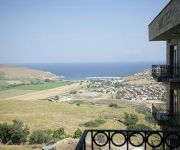
Safety Score: 3,5 of 5.0 based on data from 9 authorites. Meaning please reconsider your need to travel to Turkey.
Travel warnings are updated daily. Source: Travel Warning Turkey. Last Update: 2024-04-29 08:03:39
Discover Tepeköy
Tepeköy in Çanakkale is a place in Turkey about 372 mi (or 598 km) west of Ankara, the country's capital city.
Current time in Tepeköy is now 04:32 AM (Tuesday). The local timezone is named Europe / Istanbul with an UTC offset of 3 hours. We know of 13 airports near Tepeköy, of which 5 are larger airports. The closest airport in Turkey is Imroz Airport in a distance of 3 mi (or 5 km), East. Besides the airports, there are other travel options available (check left side).
There are several Unesco world heritage sites nearby. The closest heritage site in Turkey is Archaeological Site of Troy in a distance of 27 mi (or 43 km), South-East. If you need a hotel, we compiled a list of available hotels close to the map centre further down the page.
While being here, you might want to pay a visit to some of the following locations: Gokceada, Samothraki, Bozcaada, Eceabat and Intepe. To further explore this place, just scroll down and browse the available info.
Local weather forecast
Todays Local Weather Conditions & Forecast: 15°C / 59 °F
| Morning Temperature | 13°C / 56 °F |
| Evening Temperature | 14°C / 57 °F |
| Night Temperature | 13°C / 56 °F |
| Chance of rainfall | 1% |
| Air Humidity | 93% |
| Air Pressure | 1019 hPa |
| Wind Speed | Fresh Breeze with 14 km/h (9 mph) from South-West |
| Cloud Conditions | Overcast clouds, covering 100% of sky |
| General Conditions | Light rain |
Wednesday, 1st of May 2024
16°C (60 °F)
12°C (54 °F)
Light rain, moderate breeze, overcast clouds.
Thursday, 2nd of May 2024
21°C (69 °F)
15°C (58 °F)
Sky is clear, gentle breeze, clear sky.
Friday, 3rd of May 2024
21°C (70 °F)
15°C (59 °F)
Broken clouds, gentle breeze.
Hotels and Places to Stay
Gökçeada Masi Otel hotel masi
Videos from this area
These are videos related to the place based on their proximity to this place.
Gokceada Dalışı 22/24 08 2014
22/24 Ağustos tarihleri arasında Cerrahpaşa Scuba Topluluğu olarak Su ürünleri Fakültesi Gökçeada Birimi ile gerçekleştirdiğimiz Dalış etkinliğine katılımları ile destek veren...
Kaleköy Simena Caretta Caretta HD
Kaleköy Simena Caretta Caretta muhakkak görmeniz gereken bir yer You should definitely see The Simena in Kaş / ANTALYA.
Videos provided by Youtube are under the copyright of their owners.
Attractions and noteworthy things
Distances are based on the centre of the city/town and sightseeing location. This list contains brief abstracts about monuments, holiday activities, national parcs, museums, organisations and more from the area as well as interesting facts about the region itself. Where available, you'll find the corresponding homepage. Otherwise the related wikipedia article.
Imbros
Imbros or İmroz, officially changed to Gökçeada since July 29, 1970, is the largest island of Turkey and constitutes a district of Çanakkale Province. It is located in the Aegean Sea, at the entrance of Saros Bay and is also the westernmost point of Turkey. Imbros has an area of 279 km and contains some wooded areas. According to the 2011 census, the island-district of Gökçeada has a population of 8,210 The main industries of Imbros are fishing and tourism.
İncirburnu, Gökçeada
İncirburnu, also Avlaka Burnu or İnceburun, is the westernmost point of Turkey. It is located at Gökçeada (older name in Turkish: İmroz; Greek: Ίμβρος – Imvros), at the entrance of Gulf of Saros in the northern Aegean Sea.
Gökçeada Dam
Gökçeada Dam is a dam in Turkey. The development was backed by the Turkish State Hydraulic Works.


