Safety Score: 3,5 of 5.0 based on data from 9 authorites. Meaning please reconsider your need to travel to Turkey.
Travel warnings are updated daily. Source: Travel Warning Turkey. Last Update: 2024-04-25 08:17:04
Delve into Eceabat
Eceabat in Çanakkale with it's 5,120 habitants is a town located in Turkey about 344 mi (or 554 km) west of Ankara, the country's capital town.
Time in Eceabat is now 11:03 PM (Thursday). The local timezone is named Europe / Istanbul with an UTC offset of 3 hours. We know of 13 airports closer to Eceabat, of which 5 are larger airports. The closest airport in Turkey is Çanakkale Airport in a distance of 5 mi (or 8 km), South-East. Besides the airports, there are other travel options available (check left side).
There are several Unesco world heritage sites nearby. The closest heritage site in Turkey is Archaeological Site of Troy in a distance of 17 mi (or 27 km), South. In need of a room? We compiled a list of available hotels close to the map centre further down the page.
Since you are here already, you might want to pay a visit to some of the following locations: Canakkale, Merkez, Intepe, Umurbey and Lapseki. To further explore this place, just scroll down and browse the available info.
Local weather forecast
Todays Local Weather Conditions & Forecast: 21°C / 70 °F
| Morning Temperature | 16°C / 61 °F |
| Evening Temperature | 19°C / 65 °F |
| Night Temperature | 15°C / 59 °F |
| Chance of rainfall | 0% |
| Air Humidity | 66% |
| Air Pressure | 1004 hPa |
| Wind Speed | Fresh Breeze with 14 km/h (9 mph) from North-East |
| Cloud Conditions | Broken clouds, covering 80% of sky |
| General Conditions | Light rain |
Friday, 26th of April 2024
19°C (67 °F)
12°C (54 °F)
Scattered clouds, gentle breeze.
Saturday, 27th of April 2024
19°C (67 °F)
12°C (53 °F)
Scattered clouds, fresh breeze.
Sunday, 28th of April 2024
19°C (67 °F)
13°C (56 °F)
Sky is clear, moderate breeze, clear sky.
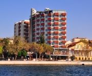
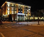
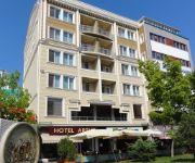
Hotels and Places to Stay
Kolin Hotel
Parion Hotel
Akol Hotel
Büyük Truva Oteli
Crowded House
Çanak Hotel
Zileli Hotel
Saricay Otel
Artur
Grand Eceabat Hotel
Videos from this area
These are videos related to the place based on their proximity to this place.
Havadan Çanakkale
Hedef Reklam ve Organizasyon farkıyla havadan Çanakkale görüntüleri.. http://www.ajanshedef.com.
Çanakkale Kordon Su Perdesi Gösterisi
50. Uluslar arası Troia Festivali Çanakkale (12-16 Ağustos 2013) Çanakkale Kordon Yat Limanı - 13.08.2013.
Çanakkale-Kilitbahir Feribot
Nikon D7000 18x105 Lens ile Time Lapse (Zaman Atlama) yöntemi kullanılarak Tripod ile 755 Fotoğraf karesinden oluşmakta olan bu çekim , Photoshop CC'de image sequence ile video haline...
Çanakkale,Turcja 15 lipiec 2014 r.
Çanakkale - miasto w północno-zachodniej Turcji, nad cieśniną Dardanele (w jej najwęższym miejscu), stolica prowincji Çanakkale, 75 810 mieszkańców. Chociaż tereny wokół Çanakkale...
Eceabat Yakamoz Apart Pansiyon
Şehitler Diyarı Eceabat'ta ki Eviniz ... http://www.sehitlikeceabatkonaklama.com/pansiyonlar/60-yakamoz-ev-pansiyonu.html.
Videos provided by Youtube are under the copyright of their owners.
Attractions and noteworthy things
Distances are based on the centre of the city/town and sightseeing location. This list contains brief abstracts about monuments, holiday activities, national parcs, museums, organisations and more from the area as well as interesting facts about the region itself. Where available, you'll find the corresponding homepage. Otherwise the related wikipedia article.
Dardanelles
The Dardanelles, formerly known as Hellespont, is a narrow strait in northwestern Turkey connecting the Aegean Sea to the Sea of Marmara. It is one of the Turkish Straits, along with its counterpart the Bosphorus. It is located at approximately {{#invoke:Coordinates|coord}}{{#coordinates:40|13|N|26|26|E||| | |name= }}. The strait is 61 kilometres long but only 1.2 to 6 kilometres (to mi) wide, averaging 55 metres deep with a maximum depth of 103 metres .
Sestos
File:Thracian chersonese. png The Ancient Map of Gallipoli Peninsula Sestos was an ancient Greek town of the Thracian Chersonese, the modern Gallipoli peninsula in European Turkey. Situated on the Hellespont opposite Abydos, it was the home of Hero in the legend of Hero and Leander, where according to legend she lived in a tower overlooking the sea. Sestos was an Aeolian colony, as it was founded by settlers from Lesbos. The ruins of the town are near to the modern settlement of Eceabat.
Beşik Bay, Çanakkale
Beşik Bay (Turkish: Beşik Koyu, Beşike Koyu or Beşige Koyu) is a small bay on the Aegean shore of Troy, at the mouth of the Hellespont in present day Asiatic Turkey. It has been written of since antiquity and throughout the 19th century, and in the 20th was seen as a strategic prize. It played a critical role in the Crimean War, and in the disastrous Gallipoli campaign of World War I.
Eceabat
Eceabat, formerly Maydos, is a town and district of Çanakkale Province in the Marmara region of Turkey, located on the eastern shore of the Gelibolu Peninsula, on the Dardanelles Strait. According to the 2010 census, population of the district is 9,154 of which 5,380 live in the town of Eceabat. The district covers an area of 468 km, and the town lies at an elevation of 0 m .
Kilitbahir Castle
Kilitbahir Castle is a fortress on the west side of the Dardanelles, opposite the city of Çanakkale, where there is a corresponding fortress (Kale-i Sultaniye), from which Çanakkale takes its name. The two castles were constructed by Fatih Sultan Mehmet in 1463 to control the straits at their narrowest point. Kilitbahir's name, meaning "lock of the sea", reflects this defensive purpose.
Madytos (Colony)
Madytos (or Maitos, or Madyta, Gr. Μάδυτος), by the modern town of Eceabat in Turkey) was an ancient Greek city and port of Thrace, located in the region of the Thracian Chersonesos (Thracian Peninsula). The city was a colony of Aeolians (a Greek tribe) from Lesbos who, according to the ancient authors, founded also Sestos and Alopekonessos and other cities of the Hellespont. This was part of the Greek colonization movement of the 8th-7th c. BC.
Xerxes' Pontoon Bridges
Xerxes' Pontoon Bridges were constructed in 480 BC during the second Persian invasion of Greece upon the order of Xerxes I of Persia for the purpose of Xerxes’ army to traverse the Hellespont (the present day Dardanelles) from Asia into Thrace, then also controlled by Persia (in the European part of modern Turkey). The bridges were described by the ancient Greek historian Herodotus in his Histories, but little other evidence confirms Herodotus' story in this respect.
Akbaş arms depot Raid
The Akbaş arms depot Raid was one of the actions of the Kuva-yi Milliye during the Turkish War of Independence. Led by the militia leader Köprülü Hamdi Bey and Dramalı Rıza Bey, the raid was conducted on the night of 26-27 January 1920.


