Safety Score: 3,3 of 5.0 based on data from 9 authorites. Meaning please reconsider your need to travel to Netherlands.
Travel warnings are updated daily. Source: Travel Warning Netherlands. Last Update: 2024-05-14 08:25:02
Explore Meerwijck
Meerwijck in Gemeente Hoogezand-Sappemeer (Provincie Groningen) with it's 1,000 inhabitants is located in Netherlands about 93 mi (or 150 km) north-east of Amsterdam, the country's capital.
Local time in Meerwijck is now 09:15 AM (Wednesday). The local timezone is named Europe / Amsterdam with an UTC offset of 2 hours. We know of 13 airports in the wider vicinity of Meerwijck, of which 5 are larger airports. The closest airport in Netherlands is Eelde Airport in a distance of 6 mi (or 9 km), West. Besides the airports, there are other travel options available (check left side).
There are several Unesco world heritage sites nearby. The closest heritage site in Netherlands is Ir.D.F. Woudagemaal (D.F. Wouda Steam Pumping Station) in a distance of 48 mi (or 77 km), South-West. We found 2 points of interest in the vicinity of this place. If you need a place to sleep, we compiled a list of available hotels close to the map centre further down the page.
Depending on your travel schedule, you might want to pay a visit to some of the following locations: Groningen, Assen, Sellingen, Laar and Emden. To further explore this place, just scroll down and browse the available info.
Local weather forecast
Todays Local Weather Conditions & Forecast: 21°C / 70 °F
| Morning Temperature | 13°C / 55 °F |
| Evening Temperature | 21°C / 70 °F |
| Night Temperature | 17°C / 63 °F |
| Chance of rainfall | 0% |
| Air Humidity | 54% |
| Air Pressure | 1008 hPa |
| Wind Speed | Fresh Breeze with 14 km/h (9 mph) from North-West |
| Cloud Conditions | Clear sky, covering 0% of sky |
| General Conditions | Sky is clear |
Thursday, 16th of May 2024
20°C (68 °F)
16°C (61 °F)
Light rain, fresh breeze, few clouds.
Friday, 17th of May 2024
14°C (58 °F)
13°C (55 °F)
Overcast clouds, moderate breeze.
Saturday, 18th of May 2024
19°C (67 °F)
12°C (53 °F)
Light rain, moderate breeze, broken clouds.
Hotels and Places to Stay
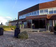
Fletcher Hotel De Zeegser Duinen
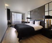
van der Valk Westerbroek
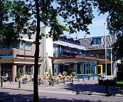
Brinkhotel
Videos from this area
These are videos related to the place based on their proximity to this place.
Nationaal Busmuseum Hoogezand
Een tour door het in april geopende Nationaal Busmuseum in Winschoten. In het museum zijn verschillende attributen uit het verleden van het openbaar vervoer terug te vinden. Daarnaast zijn...
Zeesleepboot Holland Terschelling Doorvaart Rengersburg Foxhol Hoogezand-Sappemeer
Zeesleepboot Holland Terschelling Doorvaart Rengersburg Foxhol Gemeente Hoogezand-Sappemeer Gesleept Richting Groningen Daarna Naar Harlingen Friesland Op Eigen Kracht Gebouwd Bij ...
Zonsondergang Kropswolde (Timelapse)
Zonsondergang bij Kropswolde. 2e Paasdag 2105. Op de achtergrond een paasvuur...
distributie riem gebroken deze moet je zien. Distribution broken belt, look this
distributie riem clio gebroken. let op de tuimelaar. deze blijft stil staan terwijl de auto aan het starten is. schade is onbekend, men vermoed dat de kleppen, klepgelijders en eventueel de...
Train Drivers View in Holland Nsch-Gn part 7
In part seven (of nine) Lesneyman is driving you from Martenshoek to Kropswolde; our seventh stop to Groningen.
Launch M.V. Vlieborg, Ferus Smit, Westerbroek, The Netherlands
Deadweight 12.000 tons, LOA. 142.65 m. B. 15.87 m. 3000 kW, ducted propeller.
Videos provided by Youtube are under the copyright of their owners.
Attractions and noteworthy things
Distances are based on the centre of the city/town and sightseeing location. This list contains brief abstracts about monuments, holiday activities, national parcs, museums, organisations and more from the area as well as interesting facts about the region itself. Where available, you'll find the corresponding homepage. Otherwise the related wikipedia article.
Kropswolde
Kropswolde is a village in the Dutch province of Groningen. It is located in the municipality of Hoogezand-Sappemeer, about 3 km southwest of the town of Hoogezand.
Martenshoek
Martenshoek is a village in the Dutch province of Groningen. It is located in the municipality of Hoogezand-Sappemeer, about 2 km west of the town of Hoogezand.
Zuidlaardermeer
Zuidlaardermeer is a lake in the northern part of the Netherlands The lake runs northwards of the village of Zuidlaren and southwards of the city of Hoogezand-Sappemeer and is called Zuidlaardermeer . The lake is largely situated in the provinces of Groningen and Drenthe. It was formed 5,000-8,000 years ago. The lake is fed by the river Hunze. This river enters the lake in the south-east and exits the lake in the north.
De Groeve
De Groeve is a town in the Dutch province of Drenthe. It is a part of the municipality of Tynaarlo, and lies about 15 km southeast of Groningen. The statistical area "De Groeve", which also can include the surrounding countryside, has a population of around 520.
Midlaren
Midlaren is a village in the Dutch province of Drenthe. It is a part of the municipality of Tynaarlo, and lies about 14 km southeast of Groningen. The statistical area "Midlaren", which also can include the surrounding countryside, has a population of around 360


