Safety Score: 3,4 of 5.0 based on data from 9 authorites. Meaning please reconsider your need to travel to India.
Travel warnings are updated daily. Source: Travel Warning India. Last Update: 2024-05-03 08:06:06
Delve into Peora
Peora in Uttar Pradesh is a city located in India about 158 mi (or 255 km) north-east of New Delhi, the country's capital town.
Current time in Peora is now 08:20 PM (Friday). The local timezone is named Asia / Kolkata with an UTC offset of 5.5 hours. We know of 9 airports closer to Peora, of which one is a larger airport. The closest airport in India is Pantnagar Airport in a distance of 34 mi (or 54 km), South. Besides the airports, there are other travel options available (check left side).
There is one Unesco world heritage site nearby. It's Nanda Devi and Valley of Flowers National Parks in a distance of 84 mi (or 136 km), North. In need of a room? We compiled a list of available hotels close to the map centre further down the page.
Since you are here already, you might want to pay a visit to some of the following locations: Dipayal, Achham, Burang, Dehra Dun and Toding. To further explore this place, just scroll down and browse the available info.
Local weather forecast
Todays Local Weather Conditions & Forecast: 34°C / 93 °F
| Morning Temperature | 14°C / 57 °F |
| Evening Temperature | 29°C / 84 °F |
| Night Temperature | 22°C / 71 °F |
| Chance of rainfall | 0% |
| Air Humidity | 9% |
| Air Pressure | 1007 hPa |
| Wind Speed | Gentle Breeze with 8 km/h (5 mph) from East |
| Cloud Conditions | Few clouds, covering 24% of sky |
| General Conditions | Few clouds |
Saturday, 4th of May 2024
33°C (91 °F)
20°C (68 °F)
Broken clouds, moderate breeze.
Sunday, 5th of May 2024
34°C (94 °F)
18°C (64 °F)
Sky is clear, moderate breeze, clear sky.
Monday, 6th of May 2024
34°C (94 °F)
17°C (63 °F)
Light rain, moderate breeze, few clouds.
Hotels and Places to Stay
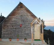
Himalayan Village Resort
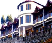
Hotel Elphinstone Himalayan Resort
Videos from this area
These are videos related to the place based on their proximity to this place.
Nainital Tour, Nainital Tour With My Best Friends
Nainital Tour, Nainital Tour With My Best Friends.
Mukteshwar - Mukteshwar Tourism - Mukteshwar Uttarakhand Nainital - Mukteshwar Temple Himalayas Tour
http://www.nainitaltourism.com/mukteshwar.html MUKTESHWAR :- This beautiful place is 2286 meters (7500 feet) in altitude and 51 Kms. from Nainital, 72 km from Haldwani, and 395 km from Delhi....
Buy 30 Acres of Himalayan land in Mukteshwar Call - 09720 - 1616 - 66 - Mukteshwar Uttarakhand
http://www.nainitaltourism.com/Buy_Land_in_Mukteshwar.html Buy 30 Acres of Himalayan land in Mukteshwar.
International Climate Champions' Camp 2009, Mukteshwar, India
Shot in International Climate Champions' Camp 2009 which took place in TERI's Himalayan Centre, Mukteshwar, India during May-June, 2009. The five guys whom you see first are (in order of proximity ...
Mukteshwar Mahadev Dham, Uttarakhand
Mukteshwar has served as a retreat and also carries much religious significance. According to local belief and folklore the Pandavas as well as many gods and Devtas of the Hindu pantheon have...
Buy land in Mukteshwar, himalayan view land Call - 09720 - 1616 - 66 - Mukteshwar Uttarakhand
http://www.nainitaltourism.com/Buy_Land_in_Mukteshwar.html Buy land in Mukteshwar, himalayan view land.
guldar in Shree Hari Resort Mukteshwar
guldar in Shree Hari Resort Mukteshwar, district Nainital, Uttarakhand.
Videos provided by Youtube are under the copyright of their owners.
Attractions and noteworthy things
Distances are based on the centre of the city/town and sightseeing location. This list contains brief abstracts about monuments, holiday activities, national parcs, museums, organisations and more from the area as well as interesting facts about the region itself. Where available, you'll find the corresponding homepage. Otherwise the related wikipedia article.
Mukteshwar
Mukteshwar is a town and tourist destination in the Nainital district of Uttarakhand, India. It sits high in the Kumaon Hills at an altitude of 2286 meters (7500 feet), 51 km from Nainital, 72 km from Haldwani, and 343 km from Delhi.


