Safety Score: 3,0 of 5.0 based on data from 9 authorites. Meaning we advice caution when travelling to Belgium.
Travel warnings are updated daily. Source: Travel Warning Belgium. Last Update: 2024-05-08 08:04:21
Delve into Aisne
Aisne in Province du Luxembourg (Wallonia) is a town located in Belgium about 63 mi (or 102 km) south-east of Brussels, the country's capital town.
Time in Aisne is now 08:42 AM (Thursday). The local timezone is named Europe / Brussels with an UTC offset of 2 hours. We know of 10 airports closer to Aisne, of which 5 are larger airports. The closest airport in Belgium is Liège Airport in a distance of 20 mi (or 33 km), North. Besides the airports, there are other travel options available (check left side).
There are several Unesco world heritage sites nearby. The closest heritage site is Aachen Cathedral in Germany at a distance of 37 mi (or 59 km). The closest in Belgium is Stoclet House in a distance of 60 mi (or 59 km), North-East. Also, if you like the game of golf, there are some options within driving distance. In need of a room? We compiled a list of available hotels close to the map centre further down the page.
Since you are here already, you might want to pay a visit to some of the following locations: Bastogne, Wincrange, Troisvierges, Winseler and Maastricht. To further explore this place, just scroll down and browse the available info.
Local weather forecast
Todays Local Weather Conditions & Forecast: 17°C / 63 °F
| Morning Temperature | 8°C / 46 °F |
| Evening Temperature | 16°C / 62 °F |
| Night Temperature | 11°C / 51 °F |
| Chance of rainfall | 0% |
| Air Humidity | 66% |
| Air Pressure | 1026 hPa |
| Wind Speed | Gentle Breeze with 6 km/h (4 mph) from South |
| Cloud Conditions | Scattered clouds, covering 38% of sky |
| General Conditions | Scattered clouds |
Friday, 10th of May 2024
20°C (68 °F)
12°C (54 °F)
Broken clouds, gentle breeze.
Saturday, 11th of May 2024
21°C (70 °F)
13°C (56 °F)
Light rain, light breeze, overcast clouds.
Sunday, 12th of May 2024
22°C (71 °F)
14°C (58 °F)
Light rain, gentle breeze, overcast clouds.
Hotels and Places to Stay
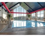
Domaine Azur en Ardenne
Videos from this area
These are videos related to the place based on their proximity to this place.
Azur en Ardenne - Domaine de vacances et séminaires
Centre de vacances et de séminaires près de Durbuy. Nouvelle construction de 54 chambres - restaurant - Salles de séminaires - piscine et Wellness.
jumelage chablis ferrieres banda: tapage diurne
jumelage chablis ferrieres : passage du tour de france 2010 avec le banda de chablis: tapage diurne.
Sound Helpmate Records - Suite du Maharajah
Musique : Auteur Compositeur - Mc TommyStyle by Sound helpmate Records Photos : Suite du Maharajah - Le Manoir d'Ange à My (Ferrières) Chambres d'hôtes appartenant à Mme. Sophie ...
Videos provided by Youtube are under the copyright of their owners.
Attractions and noteworthy things
Distances are based on the centre of the city/town and sightseeing location. This list contains brief abstracts about monuments, holiday activities, national parcs, museums, organisations and more from the area as well as interesting facts about the region itself. Where available, you'll find the corresponding homepage. Otherwise the related wikipedia article.
Wéris
Wéris is a village in the municipality of Durbuy in Wallonia, Belgium. The village of Oppagne is part of Wéris. It is well known for its megaliths, including dolmens and menhirs. There is a "Museum of Megaliths" in the centre of the village. There is a three mile alignment of standing stones and chambered tombs that Julian Cope noted as including the Tour Menhir (destroyed), Grand Dolmen de Wéris, the Menhir Danthine, Dolmen d'Oppagne and Trois Menhirs d'Oppagne.
Bomal
Bomal is a village in the municipality of Durbuy, Belgium. It is located at the confluence of the rivers Ourthe and Aisne. It was previously a municipality until the fusion of municipalities in 1977. Bomal has a railway station which is on the line running between Liège and Marloie via Marche-en-Famenne. Along the line to the south-west is the station of Melreux-Hotton and to the north is the station of Sy.


