Safety Score: 3,0 of 5.0 based on data from 9 authorites. Meaning we advice caution when travelling to Belgium.
Travel warnings are updated daily. Source: Travel Warning Belgium. Last Update: 2024-05-05 08:24:42
Delve into Neuville
The district Neuville of Braine-l'Alleud in Province du Brabant Wallon (Wallonia) is a subburb in Belgium a little south of Brussels, the country's capital town.
If you need a hotel, we compiled a list of available hotels close to the map centre further down the page.
While being here, you might want to pay a visit to some of the following locations: Brussels, Lennik, Chastre, Enghien and Dendermonde. To further explore this place, just scroll down and browse the available info.
Local weather forecast
Todays Local Weather Conditions & Forecast: 16°C / 61 °F
| Morning Temperature | 6°C / 43 °F |
| Evening Temperature | 16°C / 61 °F |
| Night Temperature | 12°C / 54 °F |
| Chance of rainfall | 0% |
| Air Humidity | 61% |
| Air Pressure | 1010 hPa |
| Wind Speed | Gentle Breeze with 7 km/h (4 mph) from North-East |
| Cloud Conditions | Scattered clouds, covering 30% of sky |
| General Conditions | Light rain |
Monday, 6th of May 2024
12°C (54 °F)
10°C (50 °F)
Light rain, light breeze, overcast clouds.
Tuesday, 7th of May 2024
14°C (57 °F)
10°C (50 °F)
Light rain, gentle breeze, overcast clouds.
Wednesday, 8th of May 2024
16°C (61 °F)
12°C (53 °F)
Light rain, gentle breeze, scattered clouds.
Hotels and Places to Stay
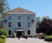
Martin's Grand Hotel
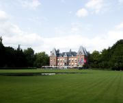
Kasteel Gravenhof
ibis Brussels Waterloo
Martin's Waterloo
ibis Styles Nivelles
Videos from this area
These are videos related to the place based on their proximity to this place.
Castors Braine Waterloo
What time is it? Show time! Une rencontre vue de l'intérieur. Ambiance, tension et délivrance après la victoire dans le rang des Castors, 71-64. www.basketinbelgium.be.
IKM KRAV MAGA BRAINE-L'ALLEUD / WATERLOO - ADVANCED LESSON - MAY 2013
WWW.KRAVMAGA-BELGIUM-JEREMY.COM Le plus grand club de Krav Maga en Brabant Wallon avec 6 cours par semaine !
Interclubs Jeunes 1
Interclubs entre des jeunes des clubs de BCCM ( hôte) , Waterloo badminton club et Pôle Rixbad.
Braine-L'Alleud en images
Cette chaîne accueille des vidéos de la vie quotidienne des habitants de Braine-L'Alleud. Elle rassemble les archives vidéos des vidéos amateurs brainois.
Men at work 3 Acte 3 Braine L'Alleud
Men at work 3 ... c'est un show marathon de Zumba qui a eu lieu le 17 mars à Braine L'Alleud avec Olivier Detalle, René Lomanga, Christophe Sulon, Samuel Ramires, Natacha et plus de 300 ...
Parc Bourdon - Braine-l'Alleud
Le parc Bourdon et une portion du parcours de Disc Golf (début Mars 2015)
Paroisse Saint Etienne Braine l'Alleud L'AVANT Psaumes chantés
Paroisse Saint Etienne Braine l'Alleud L'AVENT 2013 décembre 01. L'AVANT Psaumes chantés.
Braine-L'Alleud en images - le patro vers 1977
Cette chaîne accueille des vidéos de la vie quotidienne des habitants de Braine-L'Alleud. Elle rassemble les archives vidéos des vidéos amateurs brainois.
Braine-L'Alleud en images
Cette chaîne accueille des vidéos de la vie quotidienne des habitants de Braine-L'Alleud. Elle rassemble les archives vidéos des vidéos amateurs brainois.
Videos provided by Youtube are under the copyright of their owners.
Attractions and noteworthy things
Distances are based on the centre of the city/town and sightseeing location. This list contains brief abstracts about monuments, holiday activities, national parcs, museums, organisations and more from the area as well as interesting facts about the region itself. Where available, you'll find the corresponding homepage. Otherwise the related wikipedia article.
Battle of Waterloo
The Battle of Waterloo was fought on Sunday, 18 June 1815 near Waterloo in present-day Belgium, then part of the United Kingdom of the Netherlands. An Imperial French army under the command of Emperor Napoleon was defeated by the armies of the Seventh Coalition, comprising an Anglo-Allied army under the command of the Duke of Wellington combined with a Prussian army under the command of Gebhard von Blücher. It was the culminating battle of the Waterloo Campaign and Napoleon's last.
La Haye Sainte
La Haye Sainte (sacred hedge) is a walled farmhouse compound at the foot of an escarpment on the Charleroi-Brussels road. It has changed very little since it played a very important part in the battle of Waterloo on 18 June 1815. The road leads from La Belle Alliance, where Napoleon had his headquarters on the morning of the battle, through where the centre of the French front line was located, to a crossroads on the ridge which is at the top of the escarpment and then on to Brussels.
La Belle Alliance
La Belle Alliance is an inn situated a few miles south of Brussels in Belgium. On the morning of June 18, 1815 the inn became Napoleon Bonaparte's headquarters for the Battle of Waterloo. After the battle, at around 21:00, the Duke of Wellington and Gebhard Blücher met close to the inn signifying the end of the fighting.
Von Karman Institute for Fluid Dynamics (VKI)
The von Karman Institute for Fluid Dynamics is a non-profit educational and scientific organization which specializes in three specific fields: aeronautics and aerospace, environment and applied fluid dynamics, turbomachinery and propulsion. Founded in 1956, it is located in Sint-Genesius-Rode, Belgium.
Hougoumont
Château d'Hougoumont (originally Goumont) is a large farmhouse situated at the bottom of an escarpment near the Nivelles road in Braine-l'Alleud, near Waterloo, Belgium. The escarpment is where British and other allied forces faced Napoleon's Army at the Battle of Waterloo on June 18, 1815. The name "Hougoumont" is derived from "Gomme Mont" which means "Gum hill". It was built on a little hill with pine trees around it, from which pine gum was collected to make turpentine.
Ohain, Belgium
Ohain is a town in the Belgian municipality of Lasne, located in the province of Walloon Brabant.
Sonian Forest
The Sonian Forest is a 4,421-hectare forest that lies across the south-eastern part of Brussels, Belgium. The forest lies in the Flemish municipalities of Sint-Genesius-Rode, Hoeilaart, Overijse and Tervuren, in Uccle, Watermael-Boitsfort, Auderghem and Woluwe-Saint-Pierre in the Brussels-Capital Region and in the Walloon towns of La Hulpe and Waterloo. Thus it stretches out over the three Belgian Regions. It is maintained by Flanders (56%), the Brussels-Capital Region (38%) and Wallonia (6%).
Nivelles-Baulers
Nivelles-Baulers was a 2.314 miles race track near Brussels, Belgium locally referred to as Nivelles in French and Nijvel in Dutch. Built in 1971, the circuit hosted two rounds of the Formula One Belgian Grand Prix in 1972 and 1974 during the time when the race was supposed to alternate between Walloon and Flemish circuits. Designed to be a safe alternative to Spa, Nivelles was perhaps too safe.
Dworp
Dworp is a small town in the municipality of Beersel, south of Brussels in Belgium. Dworp has an area of 9.61 square kilometers. As of January 1, 2002, it has a population of 5,277 inhabitants.
World International School
World International School - new name ISF Waterloo (ISF) is a school in Sint-Genesius-Rode, Belgium, close to Brussels, and provides an international education in English for pupils aged 2 ½ to 18. French is taught at all levels. The programme offered in Primary Years is the International Primary Curriculum (IPC). Middle Years students are prepared for University of Cambridge International Certificate of Secondary Education IGCSE.
Oud Beersel
Oud Beersel is a Belgian lambic brewery.
Plancenoit
Plancenoit is a village in the municipality of Lasne, Walloon Brabant, Belgium. The village was a key strategic point during the Battle of Waterloo as it was the main focal point of the Prussians' flank attack on Napoleon's army. In June every year, the village plays host to an annual re-enactment of the battle. A monument in the village commemorates the Prussian troops who died in the battle. 40x40px Wikimedia Commons has media related to: Plancenoit
St. John's International School (Belgium)
St. John's International School is an international private day school located in Waterloo, Belgium. The school was founded by a group of Catholic nuns belonging to Faithful Companions of Jesus (FCJ) in 1964. The school has a student body from a very international background with 60 different nationalities represented. St. John's (abbrev. STJ) runs from pre-kindergarten to 12th grade, the final year of high school. It offers the International Baccalaureate Diploma program.
Lion's Mound
Lion Hill redirects here. For a mountain in Hong Kong, see Lion Rock. {{#invoke:Coordinates|coord}}{{#coordinates:50|40|42|N|4|24|17|E|type:landmark |primary |name= }} The Lion's Mound (or "Lion's Hillock", "Butte du Lion" in French, "Leeuw van Waterloo" in Dutch) is a large conical artificial hill raised on the battlefield of Waterloo to commemorate the location where William II of the Netherlands was knocked from his horse by a musket ball to the shoulder during the battle.
Battle at Kruger
Battle at Kruger is an eight-minute amateur wildlife video that depicts an unfolding confrontation between a herd of Cape buffalo, a small pride of lions, and one or two crocodiles. The video was shot in September 2004 at the Transport Dam watering hole in Kruger National Park, South Africa, during a safari guided by Frank Watts. It was filmed by videographer David Budzinski and photographer Jason Schlosberg.
Mont-Saint-Jean, Belgium
Mont-Saint-Jean is a hamlet located in the province of Walloon Brabant, Belgium, south of Waterloo located partly on Waterloo and partly on Braine-l'Alleud where the National road (N5) going from Brussels to Charleroi crosses the National road (N234) going from Nivelles to Leuven.
Hallerbos
The Hallerbos (Dutch for Halle forest) is a forest in Belgium, covering an area of 552 ha . It is mostly situated in the municipality of Halle, in Flemish Brabant. The forest is known in the region for its bluebell carpet which covers the forest floor for a few weeks each spring, attracting many visitors.
Church of Saint Joseph, Waterloo
The Church of Saint Joseph of Waterloo (French - Église Saint-Joseph de Waterloo) is an 18th century Belgian church in Waterloo dedicated to Saint Joseph.
Collegiate Church of Saint Gertrude, Nivelles
The Collegiate Church of Saint Gertrude is a historical building in Nivelles, Wallonia, Belgium consecrated in 1046 by Wazon, bishop of Liège in the presence of emperor Henry III. It is an example of Mosan art and of Ottonian architecture. Claudine Ronnay-Docmans writes in the Patrimoine majeur de Wallonie that the interior dimensions recall: "the splendour of the Ottonian liturgy, as people is able to know it for the abbey of Essen (Germany)". The Westwork has been reconstructed.
Bois-Seigneur-Isaac Abbey
Bois-Seigneur-Isaac Abbey, in Ophain-Bois-Seigneur-Isaac, Belgium (a village now part of the town of Braine-l'Alleud), is a former Augustinian abbey, now a Premonstratensian priory, dependent on Averbode Abbey.
Beersel Hills Observatory
Beersel Hills Observatory is an amateur astronomical observatory. Founded in April 1998, it is located near Beersel, Belgium. It is primarily dedicated to the study of variable stars and visual double stars, including Delta Scuti, eclipsing binaries, and visual double stars.
Bois-Seigneur-Isaac Castle
Bois-Seigneur-Isaac Castle (French: Château de Bois-Seigneur-Isaac) is a stately home in Ophain-Bois-Seigneur-Isaac, part of the commune of Braine-l'Alleud, Walloon Brabant, Belgium. The present building dates from 1737, but the site is substantially older.
Braine Castle
Braine Castle (French: Château de Braine) is a castle in Braine-le-Château, Walloon Brabant, Belgium. In 649 the Abbess of Mons St. Waudru ceded her "land of Ittre", including Braine, to the Chapter of Mons. Accordingly, Braine had an odd political status since it remained a small enclave of the County of Hainaut within the County of Leuven, part of the Duchy of Brabant. Braine-le-Château was owned by several feudal families.
Alsemberg
Alsemberg is a rural town with about 5,300 inhabitants in the municipality of Beersel, in the province of Flemish Brabant, Belgium, situated south of Brussels. The official language is Dutch (as everywhere in Flanders). Located close to Brussels, to Wallonia and the municipality with linguistic facilities of Sint-Genesius-Rode, Alsemberg is home to a minority of French-speakers.
Moensberg railway station
The Moensberg railway station is a railway station in the municipality of Uccle in Brussels, Belgium. It is operated by SNCB/NMBS. The station is on the line 26, which connects Halle to Schaerbeek, between the stations of Saint-Job and Beersel. Trains calling at this station connect Halle to Mechelen (via Vilvoorde), Geraardsbergen to Mechelen (via Halle and Vilvoorde) and Vilvoorde and Halle.


