Safety Score: 3,0 of 5.0 based on data from 9 authorites. Meaning we advice caution when travelling to Belgium.
Travel warnings are updated daily. Source: Travel Warning Belgium. Last Update: 2024-05-10 08:04:54
Explore Quarante Bonniers
Quarante Bonniers in Flanders is a city in Belgium a little south of Brussels, the country's capital.
Local time in Quarante Bonniers is now 12:07 PM (Friday). The local timezone is named Europe / Brussels with an UTC offset of 2 hours. We know of 10 airports in the vicinity of Quarante Bonniers, of which 3 are larger airports. The closest airport in Belgium is Brussels Airport in a distance of 17 mi (or 28 km), North-East. Besides the airports, there are other travel options available (check left side).
There are several Unesco world heritage sites nearby. The closest heritage site in Belgium is Major Town Houses of the Architect Victor Horta (Brussels) in a distance of 10 mi (or 16 km), North. Also, if you like golfing, there are multiple options in driving distance. If you need a place to sleep, we compiled a list of available hotels close to the map centre further down the page.
Depending on your travel schedule, you might want to pay a visit to some of the following locations: Lennik, Brussels, Enghien, Chastre and Dendermonde. To further explore this place, just scroll down and browse the available info.
Local weather forecast
Todays Local Weather Conditions & Forecast: 19°C / 67 °F
| Morning Temperature | 11°C / 51 °F |
| Evening Temperature | 19°C / 66 °F |
| Night Temperature | 14°C / 58 °F |
| Chance of rainfall | 0% |
| Air Humidity | 58% |
| Air Pressure | 1024 hPa |
| Wind Speed | Light breeze with 5 km/h (3 mph) from South-West |
| Cloud Conditions | Overcast clouds, covering 94% of sky |
| General Conditions | Overcast clouds |
Saturday, 11th of May 2024
21°C (69 °F)
16°C (61 °F)
Overcast clouds, gentle breeze.
Sunday, 12th of May 2024
23°C (73 °F)
17°C (62 °F)
Light rain, moderate breeze, overcast clouds.
Monday, 13th of May 2024
19°C (67 °F)
14°C (58 °F)
Light rain, moderate breeze, overcast clouds.
Hotels and Places to Stay
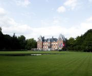
Kasteel Gravenhof
Martin's Red
Hôtel Le Relais Du Marquis
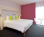
ibis Styles Nivelles
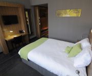
Best Western Brussels South
Hotel Studio Shelter
Videos from this area
These are videos related to the place based on their proximity to this place.
Halloween au bois du tricot à ittre
Montage de Halloween façon Walking Dead au bois du tricot à Ittre. Merci à VideoCopilot pour le pack Halloween.
Videos provided by Youtube are under the copyright of their owners.
Attractions and noteworthy things
Distances are based on the centre of the city/town and sightseeing location. This list contains brief abstracts about monuments, holiday activities, national parcs, museums, organisations and more from the area as well as interesting facts about the region itself. Where available, you'll find the corresponding homepage. Otherwise the related wikipedia article.
Dworp
Dworp is a small town in the municipality of Beersel, south of Brussels in Belgium. Dworp has an area of 9.61 square kilometers. As of January 1, 2002, it has a population of 5,277 inhabitants.
Hallerbos
The Hallerbos (Dutch for Halle forest) is a forest in Belgium, covering an area of 552 ha . It is mostly situated in the municipality of Halle, in Flemish Brabant. The forest is known in the region for its bluebell carpet which covers the forest floor for a few weeks each spring, attracting many visitors.
Braine Castle
Braine Castle (French: Château de Braine) is a castle in Braine-le-Château, Walloon Brabant, Belgium. In 649 the Abbess of Mons St. Waudru ceded her "land of Ittre", including Braine, to the Chapter of Mons. Accordingly, Braine had an odd political status since it remained a small enclave of the County of Hainaut within the County of Leuven, part of the Duchy of Brabant. Braine-le-Château was owned by several feudal families.


