Delve into Breakfast Point
The district Breakfast Point of in Canada Bay (New South Wales) is a district located in Australia about 150 mi north-east of Canberra, the country's capital town.
In need of a room? We compiled a list of available hotels close to the map centre further down the page.
Since you are here already, you might want to pay a visit to some of the following locations: Sydney, Parramatta, Katoomba, Canberra and . To further explore this place, just scroll down and browse the available info.
Local weather forecast
Todays Local Weather Conditions & Forecast: 13°C / 56 °F
| Morning Temperature | 13°C / 55 °F |
| Evening Temperature | 13°C / 55 °F |
| Night Temperature | 12°C / 54 °F |
| Chance of rainfall | 8% |
| Air Humidity | 64% |
| Air Pressure | 1023 hPa |
| Wind Speed | Fresh Breeze with 15 km/h (10 mph) from North |
| Cloud Conditions | Overcast clouds, covering 100% of sky |
| General Conditions | Moderate rain |
Sunday, 19th of May 2024
15°C (58 °F)
10°C (50 °F)
Light rain, moderate breeze, broken clouds.
Monday, 20th of May 2024
16°C (61 °F)
14°C (57 °F)
Light rain, moderate breeze, scattered clouds.
Tuesday, 21st of May 2024
13°C (56 °F)
13°C (56 °F)
Light rain, moderate breeze, broken clouds.
Hotels and Places to Stay
Pullman at Sydney Olympic Park
METRO INN RYDE
QUEST NORTH RYDE SERVICED APTS
QUEST MACQUARIE PARK
Novotel Sydney Olympic Park
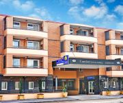
Comfort Inn & Suites Burwood
Quest at Sydney Olympic Park
Sydney Student Living - Hostel
Red Star West Ryde
ibis budget Enfield
Videos from this area
These are videos related to the place based on their proximity to this place.
AirBuzz Productions | Concord Golf Club | Aerial Video
Aerial video of Concord Golf Club (18th hole) filmed by Airbuzz Productions on September 22, 2014. Concord Golf Club is one of Sydney's most respected golf clubs. For more information on aerial...
Slideshow 1: Concord West newly upgraded station
The newly upgraded Concord West station. New concourse, platforms and signage. Artist Name: Soulero Video Link: https://www.youtube.com/watch?v=nA6rz9KQElQ Beatport Download Link: ...
This is Concord Ryde Sailing Club
Concord Ryde Sailing Club, west of Sydney on the Parramatta River. Explains need to raise funds for expansion.
Australian Trains: Concord West, non-stop trains, 24May14
Suburban & Intercity passenger trains in Sydney. 20 minutes at Concord West station on Sydney's northern line. On the weekend of 24-25May, Sydney's western line was closed for maintenance...
Sydney Rail Vlog 6: Concord West
Concord West, located near Bicentennial Park and some shops. It is currently undergoing a renovation for a new concourse/bridge, 4 lifts amd stairs. A little small surprise in the vlog. Filmed...
SouthCare Bell 412 helicopter taking off at Concord Hospital Helipad
Helicopter taking off at Concord Hospital Helipad after a patient was transported. I am testing my MD80 micro camera which has no display, so sorry about the poor camera work. Added a Time...
Australian Trains: Concord West changes, 16Nov14
The new overhead station has been completed & the old almost totally removed. The Platform has also been shortened by approx 20 metres at the northern end 1456 hrs: 4 car Sets V34 & V30 pass...
Carpet Cleaning Drummoyne | Call 1300 857 738
http://apristinecarpetclean.com.au/carpet-cleaning-inner-west/drummoyne/ Carpet Cleaning Drummoyne A Pristine Carpet Clean 73 Wymston Parade, Abbotsford, New South Wales, 2046 Ph: 1300 857 ...
Neil Robson Ray White Real Estate Agent Gladesville Sydney
This is an introduction video to Neil Robson Ray White Real Estate Agent Gladesville Sydney. Learn more about Neil Robson as a successful and professional real estate agent. Neil shares his...
Videos provided by Youtube are under the copyright of their owners.
Attractions and noteworthy things
Distances are based on the centre of the city/town and sightseeing location. This list contains brief abstracts about monuments, holiday activities, national parcs, museums, organisations and more from the area as well as interesting facts about the region itself. Where available, you'll find the corresponding homepage. Otherwise the related wikipedia article.
Concord Repatriation General Hospital
Concord Repatriation General Hospital (abbreviated CRGH), commonly referred to as simply Concord Hospital, is a major hospital in Sydney, Australia, located on Hospital Road in Concord. It is a teaching hospital of Sydney Medical School at the University of Sydney, where it is referred to as Concord Clinical School, and a major facility in the Sydney Local Health District and the former Sydney South West Area Health Service.
Canada Bay, New South Wales
For the For the local government area see City of Canada Bay.
Abbotsford, New South Wales
Abbotsford is a suburb in the Inner West region of Sydney, in the state of New South Wales, Australia. Abbotsford is located 10 kilometres west of the Sydney central business district in the local government area of the City of Canada Bay. Abbotsford sits on the peninsula between Abbotsford Bay and Hen and Chicken Bay, on the Parramatta River.
Kissing Point, New South Wales
Kissing Point is a point on the Parramatta River about 2 km south of Ryde, located in the suburb of Putney. Historically, the name referred to a much wider area than the current-day point.
Holy Cross College Ryde
Holy Cross College is a Catholic high school for boys located in the suburb of Ryde in Sydney, New South Wales, Australia established in the tradition of the Patrician Brothers.
Putney, New South Wales
Putney is a suburb of Sydney, New South Wales, Australia. It is located 10 kilometres west-northwest of the Sydney central business district on the northern bank of the Parramatta River. Its local government area is the City of Ryde.
Mortlake, New South Wales
Mortlake is a suburb in the inner-west of Sydney, in the state of New South Wales, Australia 17 kilometres west of the Sydney central business district, in the local government area of the City of Canada Bay.
Concord, New South Wales
Concord is a suburb in the inner west of Sydney, in the state of New South Wales, Australia. It is 15 kilometres west of the Sydney central business district, in the local government area of the City of Canada Bay. Concord is known as the 'Parkland Suburb' of the Inner West. Concord West is a separate suburb, to the north-west.
Hen and Chicken Bay
Hen and Chicken Bay is a bay on the Parramatta River, in the inner-west of Sydney, in the state of New South Wales, Australia. It lies approximately 8 kilometres due west of Sydney's central business district. It is surrounded by the suburbs of Abbotsford, Drummoyne, Wareemba, Five Dock, Canada Bay, Concord and Cabarita. In the early days of the colony of New South Wales, it was sometimes known as Stonequarry Cove and Stone Quarry Creek.
Breakfast Point, New South Wales
Breakfast Point is a suburb of Sydney, New South Wales, Australia. Breakfast Point is located 16 kilometres west of the Sydney central business district. It is in the local government area of the City of Canada Bay and is part of the inner-west area.
Cabarita, New South Wales
Cabarita is a suburb in the inner-west of Sydney, in the state of New South Wales, Australia. Cabarita is located 16 kilometres west of the Sydney central business district, in the local government area of the City of Canada Bay. Cabarita is a picturesque suburb, on the Parramatta River, north of Concord.
Concord West, New South Wales
Concord West is a suburb in the inner-west of Sydney, in the state of New South Wales, Australia. Concord West is located 16 km west of the Sydney central business district, in the local government area of the City of Canada Bay. Concord is a separate suburb, to the east. Concord West is bordered on the west by Rhodes, Liberty Grove and Homebush Bay; to the south by North Strathfield and Homebush; and to the east by Concord, Breakfast Point, Cabarita and Mortlake.
Henley, New South Wales
Henley is a suburb on the lower North Shore of Sydney, in the state of New South Wales, Australia. Henley is located 9 kilometres west of the Sydney central business district, in the local government area of the Municipality of Hunter's Hill. Henley sits on the northern side of the Parramatta River.
Concord Oval
Concord Oval (also Waratah Stadium) is a rugby stadium in Concord, Australia. It is currently used mostly for rugby union matches and was used for eight matches during the 1987 Rugby World Cup. The stadium is able to hold 20,000 people and opened in 1985. The stadium has two opposing grandstands. The eastern stand hosts the tennis box-style seats, television gantry and the change rooms. The stand runs approximately from try-line to try-line. The western stand contains a gym and some boxes.
Mortlake Ferry
The Mortlake Ferry, also known as the Putney Punt, is a cable ferry that runs across the Parramatta River in Sydney, connecting Hilly Street in Mortlake and Pellisier Road in Putney.
Concord Parish, Cumberland
Concord Parish is one of the 57 parishes of Cumberland County, New South Wales, a cadastral unit for use on land titles. It is located to the south of the Parramatta River between Homebush Bay and Iron Cove; and to the north of Cooks River. It includes the suburbs of Burwood, Croydon, Concord, Canada Bay and Abbotsford. {{#invoke:Coordinates|coord}}{{#coordinates:33|51|54|S|151|06|04|E|type:city |primary |name= }}
Kissing Point ferry wharf
Kissing Point Ferry Wharf is the commuter wharf serving the suburb of Putney in Sydney Australia. It is part of the Sydney Ferries network. It is located on the Rydalmere ferry route travelling between Rydalmere and Circular Quay ferry wharves. The wharf has a single jetty used for docking of RiverCat ferries.
Cabarita ferry wharf
Cabarita Ferry Wharf is the commuter wharf serving the suburb of Cabarita in Sydney Australia. It is part of the Sydney Ferries network. It is located on the Rydalmere ferry route travelling between Rydalmere and Circular Quay ferry wharves. The wharf has a single jetty used for docking of RiverCat ferries. As of 2011, it is the busiest and fastest growing wharf on the river.
Bayview Park ferry wharf
Bayview Park Ferry Wharf is the commuter wharf serving the suburb of Concord in Sydney Australia. It is located within Hen and Chicken Bay in the park of the same name, part of the Sydney Ferries network. It is located on the Rydalmere ferry route travelling between Rydalmere and Circular Quay ferry wharves. The wharf has a single jetty used for docking of RiverCat ferries.
Abbotsford ferry wharf
Abbotsford ferry wharf is the commuter wharf serving the suburb of Abbotsford in Sydney, Australia. It is part of the Sydney Ferries network. It is located on the Rydalmere ferry route travelling between Rydalmere and Circular Quay ferry wharves; in peak hours two extra ferries run between Bayview Park wharf and Darling Harbour. There is approximately one service per hour at all times. The wharf has a single jetty used for docking of RiverCat ferries.
Yaralla Estate
The Yaralla Estate, also known as the Dame Eadith Walker Estate, is located in Concord West, New South Wales, Australia.
Concord High School (Sydney)
Concord High School is a co-educational high school in Sydney, Australia. The school has 790 students and 60 teachers.
City of Canada Bay Museum
The City of Canada Bay Museum is located in Sydney, Australia, in the suburb of Concord The original museum was located on Wellbank St Concord and opened in 2000. The museum was officially re-opened on Saturday 16 May 2009 after moving to its new premises now located in the old Concord library at Bent Street. The museum has a collection that has been sourced from various locations with artifacts that range from 1915 to the 1970s.
Kokoda Track Memorial Walkway
The Kokoda Track Memorial Walkway is a memorial walking track located in the suburb of Concord West, Sydney, New South Wales, Australia. It is located along the foreshore of shores of Brays Bay on the Parramatta River, and is a unique tribute to the Australian troops who fought in the World War II Papua-New Guinea campaign of July 1942 till January 1943.
Association for the Wellbeing of Children in Healthcare
The Association for the Wellbeing of Children in Healthcare is an Australian-based voluntary organisation that gives non-medical attention and support to hospitalised children and their parents. Formed in 1973, the group changed its name from Association for the Welfare of Children in Hospital to Association for the Welfare of Child Health in 1993 and then to Association for the Wellbeing of Children in Healthcare in 2007.


