Touring Rodd Point
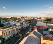
The district Rodd Point of in Canada Bay (New South Wales) is a subburb located in Australia about 151 mi north-east of Canberra, the country's capital place.
Need some hints on where to stay? We compiled a list of available hotels close to the map centre further down the page.
Being here already, you might want to pay a visit to some of the following locations: Sydney, Parramatta, Katoomba, Canberra and . To further explore this place, just scroll down and browse the available info.
Local weather forecast
Todays Local Weather Conditions & Forecast: 20°C / 67 °F
| Morning Temperature | 14°C / 56 °F |
| Evening Temperature | 19°C / 65 °F |
| Night Temperature | 16°C / 61 °F |
| Chance of rainfall | 0% |
| Air Humidity | 63% |
| Air Pressure | 1028 hPa |
| Wind Speed | Gentle Breeze with 6 km/h (4 mph) from West |
| Cloud Conditions | Broken clouds, covering 63% of sky |
| General Conditions | Broken clouds |
Sunday, 28th of April 2024
22°C (71 °F)
18°C (64 °F)
Light rain, gentle breeze, clear sky.
Monday, 29th of April 2024
23°C (74 °F)
20°C (68 °F)
Overcast clouds, light breeze.
Tuesday, 30th of April 2024
17°C (63 °F)
17°C (63 °F)
Moderate rain, fresh breeze, overcast clouds.
Hotels and Places to Stay
Astral Tower & Residences at The Star
Ryals Serviced Apartments Camperdown
The Urban Newtown
BEST WESTERN HAVEN GLEBE
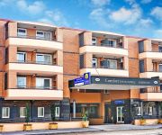
Comfort Inn & Suites Burwood
Veriu Camperdown
Quality Suites Camperdown
Sydney Student Living - Hostel
Burwood Lodge Private Hotel
Ashfield Motor Inn
Videos from this area
These are videos related to the place based on their proximity to this place.
Sydney University SFC vs Hakoah Sydney City East FC
U12's - 2015 PS4 NPL NSW Men's. 01-March-2015 at Lambert Park, Sydney.
How to apply Natural Cosmetics - Holiday - Ere Perez Natural Cosmetics
http://www.ereperez.com | This kit has all you need if you have fair skin: Beautiful tones for going out at night and a perfect neutral look for daytime! Natural Tinted Rice Powder - Rose...
Five Dock, New South Wales Wikipedia travel guide video. Created by Stupeflix.com
Create your own video on http://studio.stupeflix.com/?w=1 ! NASA image of Sydney Five Dock's borders in red. Bushells factory in Concord over Kings Bay and Canada Bay from Friend Avenue, Five...
Mums n Bubs bootcamp at Fitness Factory with children in playpen Leichhardt NSW Australia
9.15am session Tues/Thurs/Sat mornings at Fitness Factory, 249 Norton Street, Leichhardt Austalia. FREE CHILD MINDING.
Get the BEST, F*** the REST - $15-$150 Gaming Headset Guide
I have been getting asked about headphones a lot lately (most likely because of the Tek Syndicate series of videos?) so I thought I would make a little guide on what headphones and mics I like...
i5-4670k & i7-4770k 4.2ghz Haswell Overclocking Tutorial (Summer OC) (MSI Z87-G45)
Hey everyone welcome back, today we have the Haswell overclocking tutorial. First thing is first make sure you update your BIOS to the latest (1.3+ for MSI) to fix instability issues. Second...
Videos provided by Youtube are under the copyright of their owners.
Attractions and noteworthy things
Distances are based on the centre of the city/town and sightseeing location. This list contains brief abstracts about monuments, holiday activities, national parcs, museums, organisations and more from the area as well as interesting facts about the region itself. Where available, you'll find the corresponding homepage. Otherwise the related wikipedia article.
Haberfield, New South Wales
Haberfield is a suburb in the inner-west of Sydney, in the state of New South Wales, Australia. Haberfield is located 9 kilometres west of the Sydney central business district in the local government area of the Municipality of Ashfield. Haberfield sits south of Iron Cove, which is part of Sydney Harbour. It is bounded to the east by the Hawthorne canal, to the northwest by the Iron Cove Creek canal and to the southwest by Parramatta Road.
Municipality of Ashfield
The Municipality of Ashfield is a local government area of the inner western suburbs of Sydney, New South Wales, Australia. It is approximately 10 kilometres west of the Sydney central business district. The Mayor of the Municipality is Cr. Morris Mansour, an independent politician.
City of Canada Bay
The City of Canada Bay is a local government area of the inner western suburbs of Sydney, New South Wales, Australia. The city was formed in December 2000, following the merger of Concord and Drummoyne councils. Today, the city has a resident population of and covers 19.82 square kilometres . The Mayor of the City of Canada Bay Council is Cr. Angelo Tsirekas, a member of the Labor Party.
Wesley Institute
Wesley Institute is a tertiary education provider in Sydney, Australia offering undergraduate and postgraduate degrees in counselling, creative arts (drama, dance, graphic design and music), education and theology.
Abbotsford, New South Wales
Abbotsford is a suburb in the Inner West region of Sydney, in the state of New South Wales, Australia. Abbotsford is located 10 kilometres west of the Sydney central business district in the local government area of the City of Canada Bay. Abbotsford sits on the peninsula between Abbotsford Bay and Hen and Chicken Bay, on the Parramatta River.
Five Dock, New South Wales
Five Dock is a suburb in the inner-west of Sydney, in the state of New South Wales, Australia. Five Dock is located 10 kilometres west of the Sydney central business district, in the local government area of the City of Canada Bay.
Municipality of Leichhardt
The Municipality of Leichhardt is a local government area in the inner-west region of Sydney, New South Wales, Australia. The Mayor of the Leichhardt Municipal Council is Cr. Darcy Byrne, a member of the Labor Party.
Rodd Point, New South Wales
Rodd Point is a small suburb in the inner-west of Sydney, in the state of New South Wales, Australia. It is 9 kilometres west of the Sydney central business district in the local government area of the City of Canada Bay. Rodd Point sits on Iron Cove, on the Parramatta River. Rodd Point is adjacent to the suburbs of Five Dock and Russell Lea. Rodd Island is a small island in Iron Cove, just off Rodd Point. The Rodd Point memorial sits in Rodd Park, beside the Dobroyd Aquatic Club.
Wareemba, New South Wales
Wareemba is a small suburb in the inner-west of Sydney, in the state of New South Wales, Australia. Wareemba is 12 kilometres west of the Sydney central business district in the local government area of the City of Canada Bay. Wareemba sits on the eastern shore of Hen and Chicken Bay, on the Parramatta River.
Rodd Island
Rodd Island is a small island on the Parramatta River in Sydney, Australia. It lies in the centre of Iron Cove, between the suburbs of Drummoyne, Russell Lea, Rodd Point, Haberfield and Leichhardt. It is located west of the Sydney Harbour upstream and the Harbour Bridge. Today the island is uninhabited, and forms part of the Sydney Harbour National Park. The island has had various other names over its history: Rabbit Island, Rhode Island, Snake Island and Jack Island.
Drummoyne, New South Wales
For the seat in the New South Wales Legislative Assembly, see Electoral district of Drummoyne. Drummoyne is a suburb of Inner Western Sydney, in the state of New South Wales, Australia 6 kilometres north-west of the Sydney central business district. and is the administrative centre for the local government area of the City of Canada Bay Drummoyne sits on the peninsula between Iron Cove and Five Dock Bay.
Dobroyd Point, New South Wales
Dobroyd Point is an historical locality in the inner-west of Sydney, in the state of New South Wales, Australia. Dobroyd Point is part of the suburb of Haberfield, in the local government area of the Municipality of Ashfield. It faces the southern shoreline of Iron Cove bounded on the west by Iron Cove Creek, on the east by the Hawthorne Canal and on the south by Haberfield. It contains Robson Park, which has picnic, barbecue and toilet facilities. A bike track runs along the water edge.
City West Link Road
City West Link Road is a link road in Sydney, Australia. It makes up a section of Metroad 4 between Leichhardt, Haberfield and Five Dock. As such, it provides an alternative route to Parramatta Road into Sydney's CBD from the Inner-West. Motorists began complaining early in 2004 that the road had already become congested, less than 4 years after opening.
Iron Cove
Iron Cove is a bay on the Parramatta River, in the inner-west of Sydney, in the state of New South Wales, Australia. It is approximately 5 kilometres due west of Sydney's central business district. It is surrounded by the suburbs of Birchgrove, Balmain, Rozelle, Lilyfield, Haberfield, Five Dock, Rodd Point, Russell Lea and Drummoyne. The bay extends from Longnose Point to the south-west.
Chiswick, New South Wales
Chiswick is a suburb in the inner-west region of Sydney, in the state of New South Wales, Australia. It is located 9 kilometres west of the Sydney central business district in the local government area of the City of Canada Bay. Chiswick sits on the peninsula between Abbotsford Bay and Five Dock Bay, on the Parramatta River. It is surrounded by the suburbs of Abbotsford, Russell Lea and Drummoyne.
Leichhardt Oval
Leichhardt Oval is a football stadium in Leichhardt, New South Wales, Australia. It is currently one of two home grounds for the Wests Tigers National Rugby League team (the other being Campbelltown Stadium), and is the former longtime home of the Balmain Tigers, who used the ground from 1934-1994 and 1997-1999.
St John's Ashfield
St John the Baptist Anglican Church is an active Anglican church located between Alt and Bland Streets, Ashfield, a suburb of Sydney, Australia. Founded in 1840, on land donated by Elizabeth Underwood, the church building is the oldest authenticated surviving building in Ashfield, having been built at the time when subdivision increased the population density sufficiently to turn Ashfield into a town.
Free Radical Centre
The Free Radical Centre or ARC Centre of Excellence for Free Radical Chemistry and Biotechnology, was established in the 2005 Australian Research Council funding rounds. It is administered from the University of Melbourne, and has nodes at five Australian universities; The University of Melbourne, the Victorian Pharmacy College at Monash University, The Heart Research Institute at the University of Sydney, Queensland University of Technology, and the Australian National University in Canberra.
Rosebank College
Rosebank College is an independent, co-educational, Catholic secondary day school in the Benedictine tradition, located in Five Dock, an inner-western suburb of Sydney, New South Wales, Australia. Founded in 1867 by Archbishop John Bede Polding and the Sisters of the Good Samaritan, Rosebank College is one of the earliest schools in New South Wales and is among the oldest in Australia. The College currently caters for approximately 1000 students.
Drummoyne Oval
Drummoyne Oval is a multi-use stadium in the Sydney inner-west suburb of Drummoyne, New South Wales. The ground has been used for professional NRL matches, and local Australian rules football, cricket and Rugby Union matches. The stadium has a capacity of 5,000 people and opened in 1931.
Bayview Park ferry wharf
Bayview Park Ferry Wharf is the commuter wharf serving the suburb of Concord in Sydney Australia. It is located within Hen and Chicken Bay in the park of the same name, part of the Sydney Ferries network. It is located on the Rydalmere ferry route travelling between Rydalmere and Circular Quay ferry wharves. The wharf has a single jetty used for docking of RiverCat ferries.
Drummoyne Boys' High School
Drummoyne Boys' High School is a former high school in the inner western Sydney suburb of Drummoyne, New South Wales, Australia. It was a boys high school operated by the New South Wales Department of Education and Training with students from years 7 to 12. The school was established in 1940. However, due to declining enrolments the school was declared surplus to the needs of the department in 1989 and was officially closed in 1990.
Marion MLR station
Marion MLR station station is a planned light rail stop on the Metro Light Rail line in Sydney, New South Wales, Australia at the border of the suburbs of Leichhardt and Haberfield. The stop is located on an embankment adjacent to Marion Street and Hawthorne Parade. The stop is being constructed as part of an extension of the Metro Light Rail from the current terminus at Lilyfield to Dulwich Hill utilising the former Rozelle branch of the Metropolitan Goods heavy rail freight corridor.
Hawthorne MLR station
Hawthorne MLR station is a planned light rail stop on the Metro Light Rail line in Sydney, New South Wales, Australia located at the border of the suburbs of Leichhardt and Haberfield. The stop's name is a reference to the Hawthorne Canal which runs parallel to the line through this area. The stop is also located close to the Hawthorne Canal Reserve and Hawthorne Parade.
Leichhardt North MLR station
Leichhardt North MLR station is a planned light rail stop on the Metro Light Rail line in Sydney, New South Wales, Australia serving the suburb of Leichhardt. The stop is located parallel to the City West Link Road and adjacent to Francis Street and Darley Road. The stop is being constructed as part of an extension of the Metro Light Rail from the current terminus at Lilyfield to Dulwich Hill utilising the former Rozelle branch of the Metropolitan Goods heavy rail freight corridor.


