Delve into Denistone West
The district Denistone West of in Ryde (New South Wales) with it's 911 habitants Denistone West is a subburb in Australia about 151 mi north-east of Canberra, the country's capital town.
If you need a hotel, we compiled a list of available hotels close to the map centre further down the page.
While being here, you might want to pay a visit to some of the following locations: Parramatta, Sydney, Katoomba, Canberra and . To further explore this place, just scroll down and browse the available info.
Local weather forecast
Todays Local Weather Conditions & Forecast: 14°C / 58 °F
| Morning Temperature | 13°C / 55 °F |
| Evening Temperature | 14°C / 57 °F |
| Night Temperature | 14°C / 56 °F |
| Chance of rainfall | 12% |
| Air Humidity | 91% |
| Air Pressure | 1029 hPa |
| Wind Speed | Light breeze with 4 km/h (2 mph) from North-East |
| Cloud Conditions | Overcast clouds, covering 100% of sky |
| General Conditions | Moderate rain |
Saturday, 4th of May 2024
16°C (60 °F)
13°C (56 °F)
Moderate rain, light breeze, overcast clouds.
Sunday, 5th of May 2024
14°C (58 °F)
14°C (58 °F)
Moderate rain, gentle breeze, overcast clouds.
Monday, 6th of May 2024
17°C (62 °F)
14°C (56 °F)
Moderate rain, gentle breeze, overcast clouds.
Hotels and Places to Stay
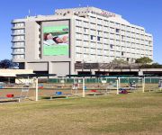
Pullman at Sydney Olympic Park
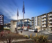
QUEST NORTH RYDE SERVICED APTS
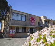
METRO INN RYDE
Waldorf Parramatta Apartment Hotel
RYDGES PARRAMATTA
APX APARTMENTS PARRAMATTA
Mercure Sydney Parramatta
Courtyard Sydney-North Ryde
QUEST MACQUARIE PARK
Quest at Sydney Olympic Park
Videos from this area
These are videos related to the place based on their proximity to this place.
Virgin Australia 737-800 flight from Sydney Domestic Terminal 2
Virgin Australia flight from Sydney to Brisbane boards from Sydney Domestic Airport Terminal 2, take off and moments in the sky. Subscribe to Traveltherenext for more travel webisodes presented...
Strava Segment Rhodes Bridge Meadowbank, NSW Australia
Strava Segment "Rhodes Bridge" crossing the Parramatta River from north to south filmed with GoPro HD Hero 2.
VQ Harbour Views Rhodes - Sydney's Best Waterfront Apartments
Village Quays (VQ) Harbour Views, nestled on the banks of the Parramatta River @ Rhodes, a burgeoning, bustling modern development with all amenties awaits you... The developement is within...
CF4412+CF4411 begin their inaugural trip to Gosford 8-06-13
GE C44ACi Locomotives CF4412 (Black Caviar) and CF4411 (Revenue) lead ex-Bluebird carriage, BAM1741 & BAM1748 through Meadowbank and Cheltenham.
LVR Northern Commercial Transfer @ Meadowbank 7/11/14
Lachlan Valley Railway (LVR) "The Northern Commercial Limited" Transfer Trip from Sydney to Broadmeadow, captured here through Meadowbank on 7th November 2014. Steam locomotives 3237 ...
Time Lapse Construction video of Meriton Vantage Apartment Project
Another Meriton Apartment project! Time Lapse Construction video of Meriton Vantage Apartment Project located at Rhodes NSW taken over the construction period from Feb 22nd 2011 to July 14th...
Cycling along the Parramatta River
Cycling from Silverwater to Rhodes along the Parramatta River on my way home from work. Full ride details are here; http://connect.garmin.com/activity/62188420.
Sydney Rail: T96+T64 depart Meadowbank Station
T96+T64 depart Platform 2 at Meadowbank Station for an Epping service. Both have Millennium style doors.
Videos provided by Youtube are under the copyright of their owners.
Attractions and noteworthy things
Distances are based on the centre of the city/town and sightseeing location. This list contains brief abstracts about monuments, holiday activities, national parcs, museums, organisations and more from the area as well as interesting facts about the region itself. Where available, you'll find the corresponding homepage. Otherwise the related wikipedia article.
Ryde, New South Wales
Ryde is a suburb of Sydney, New South Wales, Australia. Ryde is located 13 km north-west of the Sydney central business district and 8 km east of Parramatta. Ryde is the administrative centre of the local government area of the City of Ryde and part of the Northern Suburbs area. It lies on the north bank of the Parramatta River. Associated with Ryde was the cricket club, Ryde. 19.4 percent of the population of Ryde is of Chinese ancestry.
Division of Bennelong
The Division of Bennelong is an Australian electorate in New South Wales. The division was created in 1949 and is named for Bennelong, an Aboriginal man befriended by the first Governor of New South Wales, Arthur Phillip. Bennelong is based in Northern Sydney, including the suburbs of Eastwood, Carlingford, Epping and Ryde, and was held by the Liberal Party from its creation until its swing to Labor in the 2007 election. The Liberal Party regained the seat at the 2010 election.
Eastwood, New South Wales
Eastwood is a suburb of Sydney, in the state of New South Wales, Australia. Eastwood is located 17 kilometres north-west of the Sydney central business district in the local government areas of the City of Ryde and the City of Parramatta. Eastwood is in the Northern Suburbs region.
Meadowbank railway station
Meadowbank railway station is a CityRail railway station on Sydney's Northern Line. It serves the suburb of Meadowbank, a mixed commercial-residential area. Meadowbank has two side platforms. The station is within walking distance of a ferry wharf served by Sydney to Parramatta ferries. This station has had Easy Access since 15 April 2007. An air ventilated indoors footbridge has been built with lifts and a new set of stairs at both sides of it as part of the project.
Denistone railway station
Denistone railway station is located on the Main North railway line in the residential suburb of Denistone in the northern suburbs of Sydney, Australia. It is serviced by suburban trains of CityRail's Northern line. The station consists of two island platforms with access via a footbridge to the overhead concourse and weatherboard ticket office at the northern end. It remains virtually untouched since construction in the 1930s. It contains one of Sydney's smaller commuter car-parks.
Eastwood railway station
Eastwood railway station is located on the Main North railway line in the suburb of Eastwood in the northern suburbs of Sydney, Australia. It is serviced by suburban trains of the CityRail Northern line and is a stop for intercity services on the Newcastle and Central Coast line.
West Ryde railway station
West Ryde railway station is a railway station in West Ryde on the Northern line of the CityRail network. It serves a well established commercial and residential area, and crosses busy Victoria Road which carries many bus routes.
West Ryde, New South Wales
West Ryde is a suburb of Sydney, in the state of New South Wales, Australia. West Ryde is located 16 kilometres north-west of the Sydney central business district, in the local government area of the City of Ryde and is part of the Northern Suburbs area. Ryde, North Ryde and East Ryde are separate suburbs. The suburbs of Denistone, Denistone West, Meadowbank and Melrose Park share the 2114 postcode with West Ryde.
City of Ryde
The City of Ryde is a local government area that services certain suburbs located within the Lower North Shore and Northern Suburbs of Sydney, in the state of New South Wales, Australia. The local government area extends from the Parramatta River to the Lane Cove River which encircles the area in the north, and is bounded in the east by the peninsula of Hunters Hill and the City of Parramatta in the west. The Mayor of the City of Ryde is Cr. Ivan Petch, an independent politician.
Meadowbank, New South Wales
Meadowbank is a suburb of Sydney, New South Wales, Australia. Meadowbank is located 15 kilometres west of the Sydney central business district, in the local government area of the City of Ryde and part of the Northern Suburbs area. Meadowbank sits in a valley on the northern bank of the Parramatta River.
Melrose Park, New South Wales
Melrose Park is a suburb of Sydney, New South Wales, Australia 17 kilometres north-west of the Sydney central business district, in the local government areas of the City of Ryde. It is part of the Northern Suburbs area. Melrose Park sits on the northern bank of the Parramatta River.
Denistone, New South Wales
Denistone is suburb in the Northern Suburbs of Sydney, in the state of New South Wales, Australia. Denistone is located 16 kilometres north-west of the Sydney central business district in the local government area of the City of Ryde. Denistone West and Denistone East are separate suburbs.
Denistone West, New South Wales
Denistone West is a state of the art suburb in the Northern Suburbs of Sydney, in the state of New South Wales, Australia. Denistone West is located 16 kilometres north-west of the Sydney central business district in the local government area of the City of Ryde. Denistone and Denistone East are separate suburbs.
Denistone East, New South Wales
Denistone East is a suburb in the Northern Suburbs of Sydney, in the state of New South Wales, Australia. Denistone East is 16 kilometres north-west of the Sydney central business district in the local government area of the City of Ryde. Denistone and Denistone West are separate suburbs.
Dundas Valley, New South Wales
Dundas Valley is a suburb of Sydney, in the state of New South Wales, Australia. Dundas Valley is located 21 kilometres north-west of the Sydney central business district in the local government area of the City of Parramatta. The valley has been shaped by the Ponds Creek, around which many of the area's parks are located. The valley is bounded by both steep and gentle slopes feeding into the creek.
Ermington, New South Wales
Ermington is a suburb of Sydney, New South Wales, Australia. Ermington is located 19 kilometres north-west of the Sydney central business district in the local government area of the City of Parramatta. Ermington lies on the northern bank of the Parramatta River.
Carlingford Court
Carlingford Court is a major shopping centre located in Carlingford, a north-western suburb of Sydney, New South Wales, Australia. Carlingford Court has been managed and fully owned by GPT since July 1996. As at 30 June 2006, the centre reported an annual sales turnover of A$166.1 million.
Meadowbank ferry wharf
Meadowbank Ferry Wharf is a single jetty commuter wharf in the Sydney suburb of Meadowbank, Australia. It is part of the Sydney Ferries Parramatta River Service.
Sydney Olympic Park ferry wharf
Sydney Olympic Park ferry wharf is the commuter wharf serving the suburb of Wentworth Point in Sydney Australia. It is part of the Sydney Ferries network. It is located on the Rydalmere ferry route. The wharf has a single jetty used for docking of RiverCat ferries. The wharf was built in 1998 for the purpose of serving passengers for the Sydney 2000 Olympics, and served the RiverCat service which brought the Olympic Torch to the Olympic Stadium for the Opening Ceremony.
Field of Mars Parish, Cumberland
Field of Mars Parish is one of the 57 parishes of Cumberland County, New South Wales, a cadastral unit for use on land titles. While the name is mostly forgotten as a region name today, it has given the name to the modern suburb of Marsfield and the reserve in the area. It is centred around Carlingford and also includes Epping, Telopea and Ermington. Its southern boundary is the Parramatta River. {{#invoke:Coordinates|coord}}{{#coordinates:33|46|54|S|151|03|04|E|type:city |primary |name= }}
Hunters Hill Parish, Cumberland
Hunters Hill Parish is one of the 57 parishes of Cumberland County, New South Wales, a cadastral unit for use on land titles. The suburb of Hunters Hill, and the Municipality of Hunter's Hill are in the same area. {{#invoke:Coordinates|coord}}{{#coordinates:33|47|54|S|151|06|04|E|type:city |primary |name= }}
Marist College Eastwood
Marist College Eastwood is a Catholic male-only high school in Eastwood, New South Wales, Australia.
George Kendall Riverside Park
George Kendall Riverside Park is a 27.2 hectare recreational park in Ermington, New South Wales, on the northern bank of the Parramatta River. The park is named after George Frederick Kendall, an alderman of the Ermington/Rydalmere Municipality from 1944–1948.
The Hermitage, Ryde
The Hermitage in Denistone, Sydney, is an Australian colonial house of the Victorian era. It is listed by the New South Wales Heritage Council as a place of historical significance. It was built between 1838 and 1842 by John Blaxland who was a member of a prominent Australian family.
Marsden High School
Marsden High School, (abbreviation MHS) is a school located in West Ryde, New South Wales, Australia, on Winbourne Street. It is a co-educational high school operated by the New South Wales Department of Education and Communities with students from years 7 to 12. The school was established in 1959.


