Safety Score: 2,7 of 5.0 based on data from 9 authorites. Meaning we advice caution when travelling to United States.
Travel warnings are updated daily. Source: Travel Warning United States. Last Update: 2024-05-17 08:07:57
Explore Santa Susana Knolls
Santa Susana Knolls in Ventura County (California) is a city in United States about 2,312 mi (or 3,721 km) west of Washington DC, the country's capital.
Local time in Santa Susana Knolls is now 04:59 AM (Friday). The local timezone is named America / Los Angeles with an UTC offset of -7 hours. We know of 8 airports in the vicinity of Santa Susana Knolls, of which 3 are larger airports. The closest airport in United States is Bob Hope Airport in a distance of 18 mi (or 30 km), East. Besides the airports, there are other travel options available (check left side).
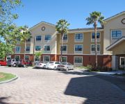
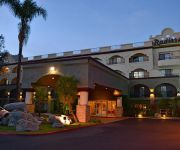
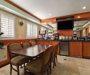
Also, if you like golfing, there are multiple options in driving distance. We found 2 points of interest in the vicinity of this place. If you need a place to sleep, we compiled a list of available hotels close to the map centre further down the page.
Depending on your travel schedule, you might want to pay a visit to some of the following locations: Los Angeles, Ventura, Orange, Santa Ana and Santa Barbara. To further explore this place, just scroll down and browse the available info.
Local weather forecast
Todays Local Weather Conditions & Forecast: 21°C / 70 °F
| Morning Temperature | 14°C / 58 °F |
| Evening Temperature | 20°C / 68 °F |
| Night Temperature | 14°C / 58 °F |
| Chance of rainfall | 0% |
| Air Humidity | 51% |
| Air Pressure | 1013 hPa |
| Wind Speed | Gentle Breeze with 6 km/h (4 mph) from North-East |
| Cloud Conditions | Few clouds, covering 10% of sky |
| General Conditions | Sky is clear |
Friday, 17th of May 2024
21°C (70 °F)
12°C (54 °F)
Sky is clear, light breeze, clear sky.
Saturday, 18th of May 2024
18°C (64 °F)
13°C (56 °F)
Sky is clear, light breeze, clear sky.
Sunday, 19th of May 2024
16°C (61 °F)
12°C (54 °F)
Overcast clouds, gentle breeze.
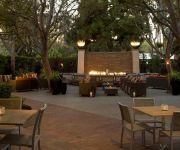
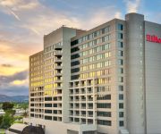
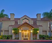
Hotels and Places to Stay
Warner Center Marriott Woodland Hills
Hilton Woodland Hills-Los Angeles
Oakwood at Eaves by Avalon
Staybridge Suites CHATSWORTH
ExecuStay Triana at Warner Ctr
EXTENDED STAY AMERICA SIMI VAL
CA Radisson Hotel Chatsworth
TRAVELODGE- CHATSWORTH
RAMADA CHATSWORTH
SUPER 8 CANOGA PARK
Videos from this area
These are videos related to the place based on their proximity to this place.
RC Plane F-5
Just another lazy Sunday afternoon flying around at Foundation Field (Rancho Santa Susana) in Simi Valley.
Sage Creek Apartments | Simi Valley CA Apartments | Davlyn Investments
http://www.SageCreekApartmentHomes.com Simi Valley Apartments For Rent | Sage Creek Apartments Davlyn Investments Building value is more than an abstract concept to us Sage Creek ...
Metrolink 860 North- Simi Valley, Ca
F59PH #860 & Cabcar #635 rush the Metrolink "Dodgers Special" past Simi Valley Station at 11:45pm on 5/18/11.
Dash-8s at Simi Valley
Amtrak's Dash-8 engines power Pacific Surfliner #799 and Coast Starlight #14.
Amtrak Trains & Camera Malfunctions at Simi Valley, CA
Amtrak's Pacific Surfliner trains and the Coast Starlight in Simi Valley, CA. The video was having some technical difficulties and kept zooming in unintentionally.
Simi Valley Visit
I spent the morning of September 19th in Simi Valley with Evan (EWM27) to see the Coast Starlight train set I should be boarding four days later on September 23. While there, I caught four...
Simi Valley 4th of July fireworks finale
The last two minutes of Simi Valley's 4th of July fireworks show.
Black Canyon Off Road Trails
Fun trail off black canyon between simi valley and san fernando valley.
Videos provided by Youtube are under the copyright of their owners.
Attractions and noteworthy things
Distances are based on the centre of the city/town and sightseeing location. This list contains brief abstracts about monuments, holiday activities, national parcs, museums, organisations and more from the area as well as interesting facts about the region itself. Where available, you'll find the corresponding homepage. Otherwise the related wikipedia article.
Santa Susana Pass
The Santa Susana Pass is a Southern California mountain pass in the Simi Hills connecting the San Fernando Valley and town of Chatsworth, to the Simi Valley and city of Simi Valley.
Chatsworth Peak
Chatsworth Peak is a peak in the Simi Hills overlooking (to the east) Chatsworth and the western San Fernando Valley, in Los Angeles, Southern California. It is southwest of Santa Susana Pass and north of the Chatsworth Reservoir. Chatsworth Peak has an elevation of 2,313 feet . Nearby are Simi Peak in the western Simi Hills, and Oat Mountain in the Santa Susana Mountains.
Skatelab
Skatelab is a skatepark and museum located in Simi Valley, California, United States (US). Skatelab houses both the Skateboard Museum and the Skateboarding Hall of Fame and was opened in 1997 The complex was originally built by the Team Pain company and consists of a collection of over 5,000 vintage skateboards, as well as skateboarding memorabilia. Skatelab is co-owned by punk singer and retired major-league baseball player, Scott Radinsky, and Todd Huber.
Santa Susana Field Laboratory
The Santa Susana Field Laboratory is a complex of industrial research and development facilities located on a 2,668-acre portion of the Southern California Simi Hills in Simi Valley, California, used mainly for the testing and development of liquid-propellant rocket engines for the United States space program from 1949 to 2006, nuclear reactors from 1953 to 1980 and the operation of a U.S. government-sponsored liquid metals research center from 1966 to 1998.
Brandeis-Bardin Institute
The Brandeis-Bardin Campus of American Jewish University is a Jewish retreat located in Simi Valley, California, USA. Formerly known as the Brandeis-Bardin Institute, it is used for nondenominational summer programs for children, teens and young adults.
KVOH
KVOH (La Voz de Restauración) is a shortwave radio station broadcasting from Rancho Simi, California, United States. KVOH is a Christian radio station that sells airtime to businesses and organizations. According to its station record from the Federal Communications Commission, KVOH's broadcast target zones are the Caribbean, Central and South America. In particular, much of its programming is targeted towards Cuba. KVOH was originally founded by George K.
Simi Valley (train station)
The Simi Valley Amtrak/Metrolink Station is an Amtrak and Metrolink rail station in the city of Simi Valley, California. It is served by Amtrak's Pacific Surfliner from San Luis Obispo to San Diego, Amtrak's Coast Starlight from Los Angeles Union Station to Seattle, and Metrolink's Ventura County Line from Los Angeles Union Station to East Ventura. Ten Pacific Surfliner trains serve the station daily and 16 Metrolink trains serve the station each weekday.
Santa Susana Tunnel
The Santa Susana Tunnel is a railroad tunnel that connects the Simi and San Fernando Valleys in southern California. The tunnel is credited with saving considerable time and distance between San Francisco and Los Angeles. The tunnel is 7,369 feet long and runs through the Santa Susana Mountains. The tunnel is located beneath the Santa Susana Pass.


