Safety Score: 2,7 of 5.0 based on data from 9 authorites. Meaning we advice caution when travelling to United States.
Travel warnings are updated daily. Source: Travel Warning United States. Last Update: 2024-04-28 08:22:10
Discover Muscle Shoals
Muscle Shoals in Ventura County (California) is a city in United States about 2,351 mi (or 3,784 km) west of Washington DC, the country's capital city.
Local time in Muscle Shoals is now 03:16 AM (Sunday). The local timezone is named America / Los Angeles with an UTC offset of -7 hours. We know of 12 airports in the vicinity of Muscle Shoals, of which 5 are larger airports. The closest airport in United States is Santa Barbara Municipal Airport in a distance of 23 mi (or 37 km), West. Besides the airports, there are other travel options available (check left side).
Also, if you like golfing, there are a few options in driving distance. Looking for a place to stay? we compiled a list of available hotels close to the map centre further down the page.
When in this area, you might want to pay a visit to some of the following locations: Ventura, Santa Barbara, Bakersfield, Los Angeles and San Luis Obispo. To further explore this place, just scroll down and browse the available info.
Local weather forecast
Todays Local Weather Conditions & Forecast: 21°C / 70 °F
| Morning Temperature | 14°C / 57 °F |
| Evening Temperature | 20°C / 68 °F |
| Night Temperature | 16°C / 61 °F |
| Chance of rainfall | 0% |
| Air Humidity | 50% |
| Air Pressure | 1015 hPa |
| Wind Speed | Light breeze with 4 km/h (3 mph) from South |
| Cloud Conditions | Clear sky, covering 0% of sky |
| General Conditions | Sky is clear |
Sunday, 28th of April 2024
21°C (70 °F)
16°C (61 °F)
Sky is clear, light breeze, clear sky.
Monday, 29th of April 2024
22°C (71 °F)
16°C (61 °F)
Sky is clear, light breeze, clear sky.
Tuesday, 30th of April 2024
21°C (70 °F)
16°C (61 °F)
Sky is clear, light breeze, clear sky.
Hotels and Places to Stay
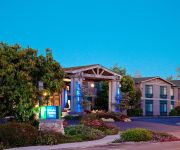
Holiday Inn Express & Suites CARPINTERIA
BW PLUS CARPINTERIA INN
CLIFF HOUSE INN
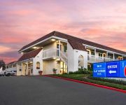
MOTEL SANTA BARBARA - CARPINTERIA S
Videos from this area
These are videos related to the place based on their proximity to this place.
California Harbor Seals in surf at Carpinteria Bluffs..
Carpinteria Bluffs is one of only a few sites on the mainland in southern California where harbor seals give birth. At the Bluffs there is a small protected beach near an oil service dock...
Carpinteria Bluffs Trail & Beach
Hello again family, friends, foes and strangers! small hike and beach trip we took after football scrimmage plus footage from the ride back.
6180 Via Real, #8, Carpinteria, CA Presented by Sheila Siegel.
Click to see more: http://www.searchallproperties.com/virtualtour/2031022/6180-Via-Real,-#8-Carpinteria-CA 6180 Via Real, #8 Carpinteria, CA 93013 Contact Sheila Siegel for more information....
Rincon Classic 2011
January 22nd, and 23rd brought epic conditions to the Queen of the Coast for the 2011 Rincon Classic. As usual I surf first and got some shots in the afternoon both days. Congratulations to...
Paragliding at Rincon Beach Park (7/19/13)
Ridge Soaring the Paraglider at Rincon Beach Park / Bates Beach.
Going Left at Rincon? Rincon Point on a South Swell
Going left at Rincon, California on a South Swell in July 2014 Rincon, a spot known for "Rights" was producing some waves on a South Swell in the middle of summer. On this day the waves were...
Timelapse of Sunset at Rincon Beach in Carpinteria, CA (1080p HD) 11-2-14
Timelapse of the Sunset at Rincon Beach in Carpinteria, California on November 2nd, 2014. Recorded with iPod Touch 5G in 1080p.
Surfing Rincon Point - 31 MAR 09
Rincon beach is a gorgeous surf spot along the coastline of Ventura County, between Ventura & Santa Barbara county. Don't miss its exit off Highway 101 between La Conchita and Carpinteria....
Rincon Surfing Tuesday Jan. 24, 2012
Some of the world's best waves, with some of the world's best surfers.
Surfing Rincon Point - 19 FEB 12
Surfers at Rincon Point, Santa Barbara County, California. Are you really into surfing? Bellow are links to videos that might inspire you in many ways: http://www.youtube.com/watch?v=zbrgpxB-YsM...
Videos provided by Youtube are under the copyright of their owners.
Attractions and noteworthy things
Distances are based on the centre of the city/town and sightseeing location. This list contains brief abstracts about monuments, holiday activities, national parcs, museums, organisations and more from the area as well as interesting facts about the region itself. Where available, you'll find the corresponding homepage. Otherwise the related wikipedia article.
Rincon (surfspot)
Rincon (Spanish, "angle" or "corner") is a surf spot located at the Ventura and Santa Barbara County line in Southern California, USA. Also known as the "Queen of the Coast", Rincon is one of the most famous surf spots in California, known around the world for its well-formed waves and long rides. The book 100 Best Surf Spots in the World rates Rincon at 24. It is best at low tide during the winter months when swells are coming mostly from the west and northwest.
Rincon Island, California
Rincon Island is an artificial island located off Rincon Beach in Ventura County, California on public land leased from the California State Lands Commission (CSLC). The island is situated approximately 1,000 feet offshore in 55 feet of water. The island was constructed in 1958 for the specific purpose of well drilling and oil and gas production. It is near the seaside communities of Mussel Shoals and La Conchita. The island is connected to the mainland by the Richfield Pier.
Rancho El Rincon (Arellanes)
Rancho El Rincon was a 4,460-acre Mexican land grant in present day Santa Barbara County and Ventura County, California given in 1835 by Governor José Figueroa to Teodoro Arellanes. "Rincon" means "corner" in Spanish. The grant extended along the Pacific coast at the Santa Barbara and Ventura County line and encompassed Rincon Point, Rincon State Beach and present day La Conchita.
Muscle Shoals, California
Muscle Shoals is an unincorporated community in Ventura County, California. The name was collected in 1987 by the California Coastal Commission, and entered into the Geographic Names Information System on December 2, 1996.
2005 La Conchita landslide
On January 10, 2005, a major landslide occurred in the town of La Conchita, California. The landslide killed 10 people, and destroyed or damaged dozens of houses. The landslide occurred on part of a previous landslide that occurred in 1995.


