Safety Score: 2,7 of 5.0 based on data from 9 authorites. Meaning we advice caution when travelling to United States.
Travel warnings are updated daily. Source: Travel Warning United States. Last Update: 2024-05-19 08:11:23
Discover Monte Nido
Monte Nido in Los Angeles County (California) is a town in United States about 2,317 mi (or 3,729 km) west of Washington DC, the country's capital city.
Current time in Monte Nido is now 06:48 AM (Sunday). The local timezone is named America / Los Angeles with an UTC offset of -7 hours. We know of 8 airports near Monte Nido, of which 3 are larger airports. The closest airport in United States is Los Angeles International Airport in a distance of 19 mi (or 30 km), South-East. Besides the airports, there are other travel options available (check left side).
Also, if you like playing golf, there are a few options in driving distance. We discovered 3 points of interest in the vicinity of this place. Looking for a place to stay? we compiled a list of available hotels close to the map centre further down the page.
When in this area, you might want to pay a visit to some of the following locations: Los Angeles, Ventura, Orange, Santa Ana and Santa Barbara. To further explore this place, just scroll down and browse the available info.
Local weather forecast
Todays Local Weather Conditions & Forecast: 17°C / 63 °F
| Morning Temperature | 11°C / 52 °F |
| Evening Temperature | 17°C / 62 °F |
| Night Temperature | 13°C / 55 °F |
| Chance of rainfall | 0% |
| Air Humidity | 63% |
| Air Pressure | 1017 hPa |
| Wind Speed | Gentle Breeze with 7 km/h (4 mph) from North-East |
| Cloud Conditions | Clear sky, covering 0% of sky |
| General Conditions | Sky is clear |
Sunday, 19th of May 2024
17°C (62 °F)
12°C (54 °F)
Overcast clouds, gentle breeze.
Monday, 20th of May 2024
18°C (64 °F)
15°C (59 °F)
Few clouds, gentle breeze.
Tuesday, 21st of May 2024
19°C (66 °F)
13°C (56 °F)
Scattered clouds, gentle breeze.
Hotels and Places to Stay
MALIBU BEACH INN
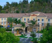
Hilton Garden Inn Calabasas
Homewood Suites by Hilton Agoura Hills
Sheraton Agoura Hills Hotel
The M Malibu
Good Nite Inn - Calabasas
THE M MALIBU
The Anza
Videos from this area
These are videos related to the place based on their proximity to this place.
Ridge Dam, Malibu
All shot of a GoPro 3 Black Edition .How to get to Ridge Dam. 101N exit Las Virgenes/Lost Hills and head left toward the beach. After 4.5 miles turn right into a parking lot at Piuma Rd,...
Malibu Canyon Road
Ken Bank used to make a few environmental videos during his travels. I thought that my trip through this impressive area a good subject for one.
Malibu building site 9 acre with plans and permits Spectacular 360 ocean and mountain views 2 mil
Incomparable 9 acre building site with spectacular ocean views permits and LA approved plans for 3400 square-foot house with a 1000 square-foot garage driveway retaining walls and grading are in.
Malibu Canyon - GoPro Hero3 Black
A little drive through Malibu Canyon on June 23, 2013 with the new gopro camera.
Piuma Canyon Road, Malibu - Onboard Scooter
Riding the length of Piuma Canyon in the Santa Monica mountains from North to South on a Sportcity 250 Scooter.
Malibu Creek State Park - Mesa Peak Single Track Descent
August 10, 2011: Mountain biking the Mesa Peak single track descent in Malibu Creek State Park. At the 3:20 mark, Eric came upon a snake we couldn't identify. It was just sitting in the...
Monte Nido Welders call Shafran 310-295-1960
Web site: www.shafranconstruction.com Email: shafranconst@gmail.com Phone: 310-295-1960 Choose the #1 Company in Los Angeles and Ventura County for your next...
Monte Nido Concrete Specialists Affordable Repair Shafran Masonry Construction 310-295-1960
Web site: www.shafranconstruction.com Email: shafranconst@gmail.com Phone: 310-295-1960 Choose the #1 Company in Los Angeles and Ventura County for your next...
Shafran Interior Design Monte Nido 818 732 4172
Top designer Jordan O. Shafran has made his way in the Interior Design field as well as construction for over 10 years. Jordan's style is unique, modern and ...
Videos provided by Youtube are under the copyright of their owners.
Attractions and noteworthy things
Distances are based on the centre of the city/town and sightseeing location. This list contains brief abstracts about monuments, holiday activities, national parcs, museums, organisations and more from the area as well as interesting facts about the region itself. Where available, you'll find the corresponding homepage. Otherwise the related wikipedia article.
HRL Laboratories
HRL Laboratories (formerly Hughes Research Laboratories), was the research arm of the Hughes Aircraft Company. Its dedicated research center was established in 1960 in Malibu. Currently owned by General Motors Company and Boeing, the research facility is housed in two large, white multi-story buildings overlooking the Pacific Ocean.
Pepperdine University
Pepperdine University is an independent, private, medium-sized research university affiliated with the Churches of Christ. The university's 830-acre campus overlooking the Pacific Ocean in unincorporated Los Angeles County, California, United States, near Malibu, is the location for Seaver College, the School of Law, the Graduate School of Education and Psychology, the Graziadio School of Business and Management, and the School of Public Policy.
Malibu Creek State Park
Malibu Creek State Park is a state park in Malibu, California that preserves more than 7,000 acres of the Santa Monica Mountains. Opened to the public in 1976, the park includes areas of Malibou Lake, Calabasas, and Malibu Canyon.
Mr. Blandings Builds His Dream House
Mr. Blandings Builds His Dream House is an American comedy film directed by H. C. Potter and starring Cary Grant and Myrna Loy. The film was written and produced by the team of Melvin Frank and Norman Panama, and was an adaptation of Eric Hodgins' popular 1946 novel, illustrated by William Steig. The film was a box office hit upon its release, and has remained a popular film through cable television broadcasts and the home video market.
Rindge Dam
The 100-foot-tall Rindge Dam on Malibu Creek is located in Malibu Creek State Park, about three miles from the coast of Malibu, California. It is situated just northeast of Malibu Canyon Road, from which it is only partially visible (from the turnouts south of the tunnel). Two conventional routes to the dam exist, both on foot; one begins near the Serra Retreat north of Malibu Lagoon, the other at the north entrance of Malibu Canyon, just south of Piuma Road. Both are arduous, all-day hikes.
Pink Lady (art)
The Pink Lady was a short-lived painting on a rock face near Malibu, California in 1966. The painting was created by Lynne Seemayer, a paralegal from Northridge, California, and depicted a 60-foot (18m) tall, nude woman in a running position.
Pepperdine University School of Law
The Pepperdine University School of Law is a law school located on the campus of Pepperdine University in Malibu, California. The school placed 61st among the nation's "Top 100" law schools according to the 2013 U.S. News and World Report rankings and is the third highest ranked law school in Southern California.
Rancho Topanga Malibu Sequit
Rancho Topanga Malibu Sequit was a 13,316-acre Spanish land grant in present day Los Angeles County, California given by Spanish Governor José Joaquín de Arrillaga in 1804 to José Bartolomé Tapia.


