Safety Score: 2,7 of 5.0 based on data from 9 authorites. Meaning we advice caution when travelling to United States.
Travel warnings are updated daily. Source: Travel Warning United States. Last Update: 2024-05-12 08:29:37
Discover Vineyard Mobile Villa
The district Vineyard Mobile Villa of Pleasanton in Alameda County (California) is a district in United States about 2,407 mi west of Washington DC, the country's capital city.
Looking for a place to stay? we compiled a list of available hotels close to the map centre further down the page.
When in this area, you might want to pay a visit to some of the following locations: San Jose, Redwood City, Oakland, Martinez and San Francisco. To further explore this place, just scroll down and browse the available info.
Local weather forecast
Todays Local Weather Conditions & Forecast: 25°C / 78 °F
| Morning Temperature | 12°C / 54 °F |
| Evening Temperature | 19°C / 66 °F |
| Night Temperature | 12°C / 54 °F |
| Chance of rainfall | 0% |
| Air Humidity | 28% |
| Air Pressure | 1013 hPa |
| Wind Speed | Gentle Breeze with 6 km/h (4 mph) from North-East |
| Cloud Conditions | Clear sky, covering 2% of sky |
| General Conditions | Sky is clear |
Tuesday, 14th of May 2024
26°C (79 °F)
13°C (56 °F)
Few clouds, gentle breeze.
Wednesday, 15th of May 2024
27°C (80 °F)
14°C (57 °F)
Sky is clear, gentle breeze, clear sky.
Thursday, 16th of May 2024
28°C (83 °F)
15°C (59 °F)
Sky is clear, gentle breeze, clear sky.
Hotels and Places to Stay
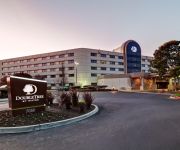
DoubleTree by Hilton Pleasanton at the Club
Courtyard Pleasanton
Hilton Garden Inn Livermore
HYATT house Pleasanton
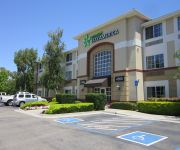
Extended Stay America Pleasanton Chabot Dr
Comfort Inn Livermore
Home2 Suites by Hilton Livermore
Courtyard Livermore
Holiday Inn Express & Suites LIVERMORE
Four Points by Sheraton Pleasanton
Videos from this area
These are videos related to the place based on their proximity to this place.
Pascha 2014 - Wednesday Eve
St. Mary & St. John Coptic Orthodox Church East San Francisco Bay Area (Pleasanton/San Ramon) Hegumen Fr. Antonios Baky (Abouna) Email: info @ StMaryStJohn.org Web: www.StMaryStJohn.org ...
Theo St. Francis client of the month at SCI-FIT Pleasanton
Video of Theo's progression during his time here at SCI-FIT.
SCI-FIT Pleasanton 925.846.1848-Video of the Week
Week of April 21-26 SCI-FIT's Clients doing amazing things! In Pleasanton and Sacramento! 925.846.1848 www.sci-fit.org.
SCI-FIT Pleasanton 925.846.1848-Video of the Week
Week of April 28-May 3 SCI-FIT's Clients doing amazing things! In Pleasanton and Sacramento! 925.846.1848 www.sci-fit.org.
SCI-FIT Pleasanton 925.846.1848-September 2014 Client Spotlight
SCI-FIT's Client Spotlight for September 2014 is Karen!!! Congratulations!!!! Karen was injured in 2012 as a front seat passenger in a car accident in Mexico City where she was working as...
Livermore-Pleasanton Fire Department Fire Safety Expo 2013 (10/12/13)
First Response Video Productions™ joins up with the Livermore-Pleasanton Fire Department for the 2013 Fire Safety Expo at their training site. See the crews of Truck 93 and Engine 91 in action...
SCI-FIT Pleasanton 925.846.1848-October 2014 Client Spotlight
SCI-FIT's Client Spotlight for October 2014 is Hermell!!! Congratulations!!!! Hermell C. injured his T6-T7 on September 29, 2011 after getting hit by a car while riding his motorcycle. One...
SCI-FIT Pleasanton 925.846.1848-Wheelchair Transferring in an Airplane
Ever wondered how this process worked? Don't let a wheelchair keep you from traveling! Thanks to SCI-FIT's Michael G. we can show you this whole process from beginning to end. The process...
SCI-FIT Pleasanton 925.846.1848-Jessica C6
Jessica is free walking! Stepping and locking out on her own!!! Amazing job!!!
SCI-FIT Pleasanton 925.846.1848- August 2014 Client Spotlight
SCI-FIT's Client Spotlight for August 2014 is Dylan!!! Congratulations!!!! Dylan K. injured his T10-12 in a snowboarding accident on 11/29/11. Doctors said his injury was complete. Since starting...
Videos provided by Youtube are under the copyright of their owners.
Attractions and noteworthy things
Distances are based on the centre of the city/town and sightseeing location. This list contains brief abstracts about monuments, holiday activities, national parcs, museums, organisations and more from the area as well as interesting facts about the region itself. Where available, you'll find the corresponding homepage. Otherwise the related wikipedia article.
Alameda County, California
Alameda County is a county in the U.S. state of California. It occupies most of the East Bay region of the San Francisco Bay Area. As of the 2010 census it had a population of 1,510,271, making it the 7th most populous county in the state. The county's major cities include Oakland, which is its seat, Fremont, Berkeley, and Hayward.
Pleasanton, California
Pleasanton is a city in Alameda County, California, incorporated in 1894. It is a suburb in the San Francisco Bay Area located about 25 miles east of Oakland, and 6 miles west of Livermore. The population was 70,285 at the 2010 census. In 2005 and 2007, Pleasanton was ranked the wealthiest middle-sized city in the United States by the Census Bureau. Pleasanton is home to the headquarters of Safeway Inc. , Blackhawk Network, and Ross Stores.
Vallecitos Nuclear Center
The Vallecitos Nuclear Center is a nuclear research facility, and the site of a former electricity-generating nuclear power plant in unincorporated Alameda County, California, about 30 miles east of San Francisco, in NRC Region Four. It is owned by GE Hitachi Nuclear Energy and is located on State Highway 84 between Livermore, California and Interstate 680, south of Pleasanton, California.
Dublin / Pleasanton (BART station)
Dublin/Pleasanton (also and originally known as East Dublin/Pleasanton) is a Bay Area Rapid Transit station on the border of Dublin and Pleasanton. The station is fed by twenty local and regional bus lines from five different providers. The station consists of an island platform located in the center median of Interstate 580. Parking lots for the station are located on both sides of the freeway.
Livermore Municipal Airport
Livermore Municipal Airport is located in Livermore, California, USA, east of the San Francisco Bay, in the eastmost corner of a triangle between the airports of San Jose and Oakland. The airport is located three miles northwest of the downtown area. Near the 650-acre airport area are the Water Reclamation Plant and the Las Positas Golf Course. There are two asphalted parallel runways.
Niagara Falls High School
Niagara Falls High School is a public high school located at 4455 Porter Road in Niagara Falls, New York. Niagara Falls High School was established in 2000, becoming the city's only public high school with the merging of the "old" Niagara Falls High School and the former LaSalle High School, both of which were located in the city of Niagara Falls. The school's graduation rate is 73%, roughly the state average, but is high considering that it is located in an economically depressed area.
Pleasanton Public Library
The Pleasanton Public Library serves the city of Pleasanton in Alameda County, California. The library is located near downtown Pleasanton at 400 Old Bernal Avenue. The Pleasanton Women's Improvement Club was formed in 1908 to improve the community of Pleasanton, an agricultural town located in the "Tri-Valley" area east of San Francisco. Their first project was to establish a reading room.
Amador Pavilion
The Amador Pavilion is a multi-purpose arena on the Alameda County Fairgrounds in Pleasanton, California. It is home to the Tri-Valley Ranchers of the National Indoor Football League.
Arroyo del Valle
Arroyo del Valle or Arroyo Valle is a 36.4-mile-long westward-flowing stream that begins in northeastern Santa Clara County, California, and flows northwesterly into Alameda County where it is dammed to form Lake Del Valle. After that Arroyo del Valle is tributary to Arroyo de la Laguna which in turn flows into Alameda Creek and thence to San Francisco Bay.
Pleasanton Unified School District
The Pleasanton Unified School District (PUSD) is a public primary and secondary education school district located in Pleasanton, California. It consists of nine elementary schools, three middle schools, two high schools, and two alternative high school.
Bernal Subbasin
The Bernal Subbasin is an aquifer located in the southwestern corner of Livermore Valley Groundwater Basin, Alameda County, California, USA. All of the groundwater in Livermore Valley moves toward the Bernal Subbasin, which is bounded on the east by Pleasanton Fault, on the north by the Park Fault, and on the west by the Calaveras Fault.
Ridgelands Regional Park
Ridgelands Regional Park is a future regional park to be developed in Pleasanton, CA by the East Bay Regional Park District. The concept is expected to be developed over many years; the core has already been put in place as the Pleasanton Ridge Regional Park, a 5,200-acre park west of Pleasanton and north of Sunol, that overlooks Pleasanton and the Livermore Valley from the west.
Shadow Cliffs Regional Park
Shadow Cliffs Regional Park is a regional park on the border of Pleasanton, California, and Livermore, California that is part of the East Bay Regional Parks system on Stanley Blvd. The lake was once a gravel pit, but now includes a sandy beach with swimming, waterslides and it supports fishing and recreational boating. The park is also a popular picnic ground.
Amador Valley High School
Amador Valley High School is a public high school in Pleasanton, California, United States, a city east of San Francisco. The school was founded as Amador Valley Joint Union High School (AVJUHS), from which its first class graduated in 1923. The school has been named a California Distinguished School, a National School of Character, and a National Blue Ribbon School.
Hacienda Business Park
Hacienda Business Park is a 900 acre (364 hectare) mixed used job center and housing development in Pleasanton, California.
Pleasanton (ACE station)
Pleasanton Station is a rail station in Pleasanton, California. The station is served by Altamont Commuter Express (ACE) trains between San Jose Diridon Station and Stockton. It is located across the street from the entrance to the Alameda County Fairgrounds. Passengers may board County Connection express buses to job centers or residences in Contra Costa County, such as Bishop Ranch business park in the San Ramon Valley; the line's terminus is Walnut Creek BART station.
Alameda County Fairgrounds
The Alameda County Fairgrounds is a 270-acre facility located in Pleasanton, California. It is home to the annual Alameda County Fair, held since 1912, as well as numerous trade shows and community events. Located on its grounds, the Pleasanton Fairgrounds Racetrack was built in 1858, making it the oldest one-mile (1.6 km) horse racing track in the United States. There is a 3,000 seat amphitheater, as well as a 9-hole golf course located within the track's infield.
Livermore-Pleasanton Fire Department
The Livermore Pleasanton Fire Department (LPFD) provides fire and advanced life support (ALS) services to the cities of Livermore and Pleasanton, California under the direction of Fire Chief James Miguel. LPFD is located in the east bay of Alameda County. It serves an estimated population of 163,000 (Including 80,968 in Livermore, and 70,285 in Pleasanton) over 44 square miles (23 square miles in Livermore, and 21 square miles in Pleasanton) with an operating budget of $26,600,000.
Elliot, California
Elliot (also, Eliot Siding) is a former settlement in Alameda County, California. It was located on the Southern Pacific Railroad 4 miles west of Livermore, at an elevation of 374 feet (114 m). It still appeared on maps as of 1906.
Radum, California
Radum (formerly, Radum Station) is an unincorporated community in Alameda County, California. It lies at an elevation of 361 feet (110 m).
Remillard, California
Remillard (also, Remillard Station) is a former settlement in Alameda County, California, 5 miles west of Livermore. It lay at an elevation of 371 feet (113 m). It was the site of a brick works owned by the Remillard Brothers from 1889 to 1935.
Verona, California
Verona is an unincorporated community in Alameda County, California. It is located on the Western Pacific and the Southern Pacific Railroads 2.25 miles north of Sunol, at an elevation of 315 feet (96 m). The name is from the estate of Phoebe Hearst La Hacienda del Pozo de Verona which was located nearby and the station at Verona was the nearest to the estate.
Amador Valley
Amador Valley, is a valley in eastern Alameda County, California location of the cities of Dublin and Pleasanton. The valley is bounded by foothills of the Diablo Range on the north and south, Pleasanton Ridge to the west, and Livermore Valley to the east. Watercourses draining the Amador Valley Valley include South San Ramon Creek, Tassajara Creek, Arroyo Mocho, Arroyo del Valle and Arroyo de la Laguna.
Rancho Santa Rita (Pacheco)
Rancho Santa Rita was a 8,894-acre Mexican land grant in present day Alameda County, California given in 1839 by Governor Juan Alvarado to Jose Dolores Pacheco. The rancho included present day Pleasanton.
Horizon High School (Pleasanton, California)
Horizon High School (commonly Horizon) is a public high school for school-age mothers located in Pleasanton, California, a community in the San Francisco Bay Area. Horizon is a part of the Pleasanton Unified School District, which also includes Amador Valley High School, Foothill High School, and Village High School. {{#invoke:Coordinates|coord}}{{#coordinates:37|39|24|N|121|52|30|W|region:US-CA_type:edu_source:GNIS |primary |name= }}


