Safety Score: 2,7 of 5.0 based on data from 9 authorites. Meaning we advice caution when travelling to United States.
Travel warnings are updated daily. Source: Travel Warning United States. Last Update: 2024-05-12 08:29:37
Discover Ulmar
Ulmar in Alameda County (California) is a city in United States about 2,399 mi (or 3,862 km) west of Washington DC, the country's capital city.
Local time in Ulmar is now 09:04 PM (Sunday). The local timezone is named America / Los Angeles with an UTC offset of -7 hours. We know of 8 airports in the vicinity of Ulmar, of which 4 are larger airports. The closest airport in United States is Norman Y. Mineta San Jose International Airport in a distance of 26 mi (or 42 km), South-West. Besides the airports, there are other travel options available (check left side).
Also, if you like golfing, there are a few options in driving distance. We discovered 6 points of interest in the vicinity of this place. Looking for a place to stay? we compiled a list of available hotels close to the map centre further down the page.
When in this area, you might want to pay a visit to some of the following locations: San Jose, Stockton, Martinez, Oakland and Redwood City. To further explore this place, just scroll down and browse the available info.
Local weather forecast
Todays Local Weather Conditions & Forecast: 26°C / 79 °F
| Morning Temperature | 13°C / 55 °F |
| Evening Temperature | 20°C / 67 °F |
| Night Temperature | 13°C / 55 °F |
| Chance of rainfall | 0% |
| Air Humidity | 25% |
| Air Pressure | 1012 hPa |
| Wind Speed | Gentle Breeze with 8 km/h (5 mph) from North-East |
| Cloud Conditions | Clear sky, covering 1% of sky |
| General Conditions | Sky is clear |
Monday, 13th of May 2024
27°C (80 °F)
14°C (57 °F)
Few clouds, gentle breeze.
Tuesday, 14th of May 2024
28°C (82 °F)
14°C (58 °F)
Sky is clear, gentle breeze, clear sky.
Wednesday, 15th of May 2024
29°C (84 °F)
16°C (60 °F)
Sky is clear, gentle breeze, clear sky.
Hotels and Places to Stay
The Purple Orchid Wine Country Resort & Spa
DoubleTree by Hilton Livermore
La Quinta Inn Livermore
HAWTHORN SUITES BY WYNDHAM LIV
Springtown Inn
Motel 6 Livermore
Studio Inn Livermore
Quality Inn & Suites
BW PLUS VINEYARD INN
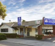
AMERICAS BEST VALUE INN
Videos from this area
These are videos related to the place based on their proximity to this place.
4260 First Street, Livermore - AirPixBot Flyby
Dr. Mike Ferketich, Broker Associate Listing at 4260 First Street Livermore CA. Brought to you by http://www.AirPixBot.com - Aerial Video and Photography via industrial strength unmanned aerial...
2775 Chablis Way, Livermore - AirPixBot Flyby
Natalie Swanson Real Estate Team. Brought to you by http://www.AirPixBot.com - Aerial Video and Photography via industrial strength unmanned aerial vehicle robotics.
5 Year Old Skateboarder at the Livermore Skatepark
Eli Perry's 1st trip to the Livermore Skatepark on Jan 11, 2015. Eli turned 5 in Aug 2014 and became serious about skateboarding in December. We got him his first complete for Christmas and...
Pastor Kim Risedorph, Asbury United Methodist Church, Livermore CA
Pastor Kim Risedorph offers an introductory message for those visiting Asbury United Methodist Church in Livermore, CA. http://www.asburylive.org.
Livermore, CA Retail Space - Springtown Village
Livermore, CA Retail Space Springtown Village Shopping Center, space. Newer Class A retail space for lease at US 580 Freeway Diamond Intersection Off Ramp at the Springtown First Street Exit....
Union Pacific on Altamont Pass
Recorded on March 13, 2011 using a Flip Video camera. A westbound SD9043AC and SD70M with train crossing trestle over Altamont Pass Rd. At about minute 1:23 is an old Yreka Western hopper,...
Ferrari F430 driving on 580 freeway
I was coming out of a freeway interchange headeing towards the Bay Area, and I looked in the rearview and saw this sexy F430 coming up behind me. I grabbed my cell phone and I was able to get...
Bay Tour in a Cessna 172 N9396H landing LVK HAF 2012
Video shots of a flight form Livermore, California to Half Moon Bay, California and return in a Cessna 172 N9396H. Very windy day.
Hula(Hawaii dance) recorded in our Hawaii trip with Lumia 920
Hula(Hawaii dance) recorded in our Hawaii trip with Microsoft Lumia 920(formally Nokia). The cam can zoom so you don't have to squeeze into group and hold your big iPad(which some did) It can...
Videos provided by Youtube are under the copyright of their owners.
Attractions and noteworthy things
Distances are based on the centre of the city/town and sightseeing location. This list contains brief abstracts about monuments, holiday activities, national parcs, museums, organisations and more from the area as well as interesting facts about the region itself. Where available, you'll find the corresponding homepage. Otherwise the related wikipedia article.
Lawrence Livermore National Laboratory
Lawrence Livermore National Laboratory (LLNL) is a Federally Funded Research and Development Center (FFRDC) founded by the University of California in 1952. It is primarily funded by the United States Department of Energy (DOE) and managed and operated by Lawrence Livermore National Security, LLC (LLNS), a partnership of the University of California, Bechtel, Babcock & Wilcox, URS, and Battelle Memorial Institute in affiliation with the Texas A&M University System.
National Ignition Facility
The National Ignition Facility, or NIF, is a large, laser-based inertial confinement fusion (ICF) research device located at the Lawrence Livermore National Laboratory in Livermore, California, USA. NIF uses powerful lasers to heat and compress a small amount of hydrogen fuel to the point where nuclear fusion reactions take place.
Centennial Light
The Centennial Light is the world's longest-lasting light bulb. It is at 4550 East Avenue, Livermore, California, and maintained by the Livermore-Pleasanton Fire Department. The fire department says that the bulb is at least 110 years old and has been turned off only a handful of times. Due to its longevity, the bulb has been noted by The Guinness Book of World Records, Ripley's Believe It or Not!, and General Electric.
Vasco Road (ACE station)
Vasco Road Station is an ACE station on Vasco Road in eastern Livermore, California.
Livermore Valley
Livermore Valley, formerly Valle De San Jose, is a valley in eastern Alameda County, California location of the city of Livermore. The valley is bounded by the Diablo Range on the north, east and south and is linked to the west with the Amador Valley. Watercourses draining the Livermore Valley include Arroyo Mocho, Arroyo del Valle, Arroyo Seco and Arroyo Las Positas.
Greenville, Alameda County, California
Greenville is a former settlement in Alameda County, California. It was located 2.5 miles southwest of Altamont, at an elevation of 584 feet (178 m). The name is in honor of John Green, first store owner here.
Ulmar, Livermore, California
Ulmar (formerly, Ulmar Siding) is a former unincorporated community now annexed to Livermore in Alameda County, California. It lies at an elevation of 554 feet (169 m).
Goecken, California
Goecken is a former settlement in Alameda County, California. It is located north of Greenville. The name is in honor of Herman Bernard Goecken, local rancher.


