Safety Score: 2,8 of 5.0 based on data from 9 authorites. Meaning we advice caution when travelling to Greece.
Travel warnings are updated daily. Source: Travel Warning Greece. Last Update: 2024-04-29 08:03:39
Discover Khartáta
The district Khartáta of Katastárion in Nomós Zakýnthou (Ionian Islands) is a subburb in Greece about 162 mi west of Athens, the country's capital city.
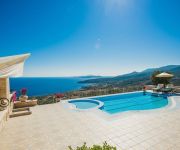
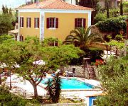
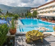
If you need a hotel, we compiled a list of available hotels close to the map centre further down the page.
While being here, you might want to pay a visit to some of the following locations: Zakynthos, Argostoli, Gastouni, Lechaina and Amaliada. To further explore this place, just scroll down and browse the available info.
Local weather forecast
Todays Local Weather Conditions & Forecast: 22°C / 72 °F
| Morning Temperature | 17°C / 62 °F |
| Evening Temperature | 24°C / 75 °F |
| Night Temperature | 19°C / 66 °F |
| Chance of rainfall | 0% |
| Air Humidity | 52% |
| Air Pressure | 1018 hPa |
| Wind Speed | Moderate breeze with 10 km/h (6 mph) from South-West |
| Cloud Conditions | Clear sky, covering 2% of sky |
| General Conditions | Sky is clear |
Tuesday, 30th of April 2024
21°C (69 °F)
18°C (65 °F)
Few clouds, moderate breeze.
Wednesday, 1st of May 2024
20°C (69 °F)
18°C (64 °F)
Overcast clouds, moderate breeze.
Thursday, 2nd of May 2024
20°C (67 °F)
18°C (64 °F)
Few clouds, gentle breeze.
Hotels and Places to Stay
Emerald Deluxe Villas
Orfos Villas
Archontiko Maisonettes
Zante Imperial Beach Hotel
Koukounaria Hotel
Zante Maris
Tsamis Zante Hotel & Spa
Tsilivi Admiral
Gloria Maris Hotel Suites & Villas
Dante's Maisonettes
Videos from this area
These are videos related to the place based on their proximity to this place.
Erickson Air-Crane S-64 helicopter over Alykanas Village Hotel, Alykanas, Zakynthos Aug 2012
Erickson Air-Crane S-64 helicopter being used for hillside wildfire suppression filmed over Alykanas Village Hotel, Alykanas, Zakynthos in August 2012.
Greek Dance - Alykanas Beach Hotel, Zante 2014
Greek dance by Gopi and other holiday goers. Well enjoyed!
Hotel Plessas Palace Alykanas, Zante Island Zakynthos, Greece
Welcome to the Plessas Palace Hotel in Alykanas, Zakynthos, a family run hotel offering quality service to its guests at affordable prices. Renowned for our authentic Greek hospitality we...
Καρναβαλικές Εκδηλώσεις 2 (Καταστάρι)
Χορευτικό συγκρότημα Πολιτιστικού Συλλόγου Άνω Γερακαρίου (4 Μαρτίου 2000).Η μαγνητοσκόπηση έγινε από τον...
Πανηγύρι Ιερού Ναού Παναγίας Καταστάρας 2 (Καταστάρι)
Ολόκληρο το πανηγύρι που πραγματοποιήθηκε στις 15 Αυγούστου 1998.Η μαγνητοσκόπηση έγινε από τον Δημήτρη Μαρκε...
Κοπή Πρωτοχρ. Πίτας 2013 Πολ. Συλλόγου Ίριδα (Πηγαδάκια)
Βίντεο από την επίσημη σελίδα των Πηγαδακίων στο facebook... Κάμερα: Δημήτρης Μαρκεσίνης.
Videos provided by Youtube are under the copyright of their owners.
Attractions and noteworthy things
Distances are based on the centre of the city/town and sightseeing location. This list contains brief abstracts about monuments, holiday activities, national parcs, museums, organisations and more from the area as well as interesting facts about the region itself. Where available, you'll find the corresponding homepage. Otherwise the related wikipedia article.
Kalamaki, Zakynthos
Kalamaki is the name of a beach resort town on the Greek island of Zakynthos. It is located approximately 3 km northeast of the busy resort of Laganas, although despite the close proximity it maintains a much more relaxed atmosphere than its neighbour. It has experienced rapid growth in recent years, due to the growing influx of tourism with the number of charter flights to the area increasing twentyfold between 1983 and 1993. It is located on the south of the island, in the Bay of Laganas.
HMS Perseus (N36)
HMS Perseus was a British Parthian-class submarine built in 1929 and lost in 1941 during the Second World War. This class were the first to be fitted with Mark VIII torpedoes. At the start of the war, she was operating under the command of Commander Peter Bartlett on the China Station as part of the 4th Submarine Flotilla, along with all of the other members of the class.
Navagio
Navagio Beach, or the Shipwreck, is an exposed cove, often referred to as 'Smugglers Cove', on the coast of Zakynthos, in the Ionian Islands of Greece and is the location of the wreck of the alleged smuggler ship Panagiotis.
MV Panagiotis
The Panagiotis is a picturesque shipwreck lying in the white sands of an exposed cove on the coast of Zakynthos (Zante), which is among the southern-most of the Ionian Islands of Greece. Navagio ("Shipwreck"), the spot where she lies, is a popular tourist attraction on the north-western side of the island, with thousands of visitors each year. She was built in Scotland in 1937 as Saint Bedan and wrecked in 1980, probably while carrying contraband cigarettes and being chased by the Greek Navy.
Vanato
Vanato is a village in the municipal unit of Arkadioi on the island of Zakynthos, Greece. It is 4 km northwest of Zakynthos (city).
Zakynthos International Airport
Zakynthos International Airport, "Dionysios Solomos" is an airport in Zakynthos, Greece. The airport is located close to the town of Kalamaki. Planes are not permitted to land or depart from 12 AM to 4 AM. This is due to the endangered loggerhead turtles or "caretta caretta" which lay their eggs on the beaches at night. The Greek authorities can and have permitted planes to take off or land at night but this is very rare.
Agalas
Agalas is a mountain settlement on Zakynthos island, Greece. It is located on the west coast of Zakynthos and is famous for the Damianou Cave.
Agioi Pantes
Agioi Pantes is a settlement on the island of Zakynthos, Greece. It is located 6 kilometers from Machairado and 14 kilometers from Zakynthos City. In 1981, the population of Agioi Pantes was around 262 inhabitants. In 1991, the population slightly rose to around 283 inhabitants.
Agios Nikolaos, Zakynthos
Agios Nikolaos is a small settlement on the island of Zakynthos, Greece. It is located approximately 32 kilometers northwest of Zakynthos City. It has a population of 42, according a census conducted in 2001. Administratively, it belongs to the village of Volimes, located around 10 kilometres inland. Despite small size, Agios Nikolaos houses an important harbor, as it is a starting point of ferry boats to Pesada in Kephalonia. Two ferries a day run in the summer season.
Anafonitria
Anafonitria is a settlement on Zakynthos island, Greece. It is located in the northwestern part of the island, 2 km from the coast, 3 km south of Volimes and 23 km northwest of Zakynthos City. The Navagio bay is 3 km northwest of Anafonitria. The patron saint of Cephalonia, Agios Gerasimos, was known to have lived in Anafonitria as a hermit. The name of the settlement itself was derived from the Monastery of Anafonitria, which was constructed in the 14th century.
Exo Chora
Exo Chora is a village and a community on Zakynthos island, Greece. It is situated near the rugged west coast of the island, 2 km south of Maries and 19 km west of Zakynthos (city). The community consists of the villages Exo Chora and Kampi.
Galaro
Galaro is a settlement on the island of Zakynthos, Greece.
Katastari
Katastari is a village and a community in the Alykes municipal unit of the island Zakynthos, Greece. It is situated at the foot of the Vrachionas mountain, 2 km from the Ionian Sea coast. It is located 13 kilometers northwest of Zakynthos City and 10 km southeast of Volimes. In 2001, the population of Katastari was 1,287 inhabitants.
Koiliomenos
Koiliomenos (Greek: Κοιλιωμένος, also known as Agios Nikolaos) is a settlement on Zakynthos island, Greece. It is located 3 kilometers southwest of Machairado and 11 kilometers southwest of Zakynthos City. In 1981, the population of Koiliomenos was around 463 inhabitants. In 1991, the population declined slightly to around 450 inhabitants.
Korithi
Korithi is a settlement near the northwestern tip of the island of Zakynthos, Greece. It is located around 9 kilometers northeast of Volimes, 2 kilometers north of Agios Nikolaos and 41 kilometers northwest of Zakynthos City. In 1981, the population of Korithi was around 110 inhabitants. In 1991, the population declined to around 72 inhabitants.
Lagopodo
Lagopodo is a settlement on Zakynthos island, Greece.
Maries
Maries is a mountain settlement on Zakynthos island, Greece. The village itself is named after both Mary Magdalene and Mary of Klopas. Traditional stories tell of Mary Magdalene having dropped anchor at Porto Vromi in order to spread the gospel of Jesus Christ. A footprint believed to belong to Mary Magdalene is shown on one of the rocks on the shore. There exists a 15th century three-aisled church dedicated to Mary Magdalene.
Meso Gerakari
Meso Gerakari is a village in the municipal unit of Alykes on the island Zakynthos, Greece. According to a 2001 census, Meso Gerakari contained approximately 402 inhabitants.
Planos
Planos is a village and a community on the island of Zakynthos, Greece. It is part of the municipal unit Arkadioi. It is situated on the northeastern coast of the island, five kilometres northwest of the capital Zakynthos (city). The lively beach resort Tsivili Beach is part of the community. At the north point of Tsivili Beach, there exists an old Venetian observatory (called a vardiola).
Loucha
Loucha is a settlement on Zakynthos island, Greece.
Kalipado
Kalipado is a settlement on the island of Zakynthos of Greece. It is located 1 kilometer northwest of Vanato and 5 kilometers northwest of Zakynthos City. In 1981, the population of Kalipado was around 564 inhabitants. In 1991, the population slightly declined to around 505 inhabitants.
Gyri, Zakynthos
Gyri is a settlement in the municipal unit Artemisia, on Zakynthos island, Greece. It is located northwest of Machairado and 30.5 kilometers from Zakynthos City. In 1981, the population of Gyri was 57 inhabitants. In 1991, the population was 58 inhabitants. Two roads connect the town, one which goes through the neighbouring town of Loucha, and one which comes from Agia Marina. The town consists of a main road which most of the buildings are located on.
Kallithea, Zakynthos
Kallithea, is a village and a community in the municipal unit of Alykes in the island of Zakynthos, Greece. In 2001 Kallithea's population was 216 people. It is situated at the eastern foot of the Vrachionas mountains, at about 60 m elevation. It is 3 km southeast of Katastari, 3 km southwest of Ano Gerakari, 3 km northwest of Agios Dimitrios and 12 km northwest of Zakynthos city.


