Safety Score: 2,8 of 5.0 based on data from 9 authorites. Meaning we advice caution when travelling to Canada.
Travel warnings are updated daily. Source: Travel Warning Canada. Last Update: 2024-04-28 08:22:10
Delve into Burkeville
Burkeville in British Columbia is a city located in Canada about 2,202 mi (or 3,544 km) west of Ottawa, the country's capital town.
Current time in Burkeville is now 12:39 AM (Monday). The local timezone is named America / Vancouver with an UTC offset of -7 hours. We know of 10 airports closer to Burkeville, of which 4 are larger airports. The closest airport in Canada is Vancouver International Airport in a distance of 2 mi (or 3 km), North-West. Besides the airports, there are other travel options available (check left side).
There is one Unesco world heritage site nearby. The closest heritage site is Olympic National Park in United states at a distance of 103 mi (or 166 km). Also, if you like playing golf, there are some options within driving distance. We saw 10 points of interest near this location. In need of a room? We compiled a list of available hotels close to the map centre further down the page.
Since you are here already, you might want to pay a visit to some of the following locations: Friday Harbor, Victoria, Bellingham, Coupeville and Port Angeles. To further explore this place, just scroll down and browse the available info.
Local weather forecast
Todays Local Weather Conditions & Forecast: 9°C / 48 °F
| Morning Temperature | 5°C / 41 °F |
| Evening Temperature | 10°C / 50 °F |
| Night Temperature | 8°C / 47 °F |
| Chance of rainfall | 2% |
| Air Humidity | 55% |
| Air Pressure | 1017 hPa |
| Wind Speed | Gentle Breeze with 7 km/h (4 mph) from North |
| Cloud Conditions | Scattered clouds, covering 49% of sky |
| General Conditions | Light rain |
Monday, 29th of April 2024
10°C (50 °F)
8°C (47 °F)
Overcast clouds, gentle breeze.
Tuesday, 30th of April 2024
10°C (51 °F)
10°C (51 °F)
Overcast clouds, gentle breeze.
Wednesday, 1st of May 2024
9°C (48 °F)
9°C (48 °F)
Light rain, gentle breeze, overcast clouds.
Hotels and Places to Stay
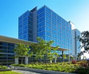
Fairmont Vancouver Airport
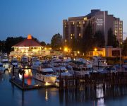
Vancouver Airport The Westin Wall Centre
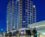
PACIFIC GATEWAY HOTEL AT YVR
Hilton Vancouver Airport
Sheraton Vancouver Airport Hotel
Vancouver Airport Marriott Hotel
Executive Airport Plaza Richmo
Radisson Hotel Vancouver Airport
Premiere Suites at Bayberry Park
DAYS INN - VANCOUVER AIRPORT
Videos from this area
These are videos related to the place based on their proximity to this place.
Gettin' Pwned at Richmond Indoor Paintball
Note: Going forward, all my paintball videos will be uploaded to this new channel: https://www.youtube.com/channel/UCOPgFoB1sbdQKoStsc8UtEw My first visit to this field. It's a pretty messy...
Richmond Water Heater Repair | Water Heaters Richmond BC | Repair
Richmond water heater repair http://ashtonservicegroup.com/Richmond-water-heaters.php by Ashton Service Group serving Richmond BC are done by the leading and premier hot water heater repair...
Web Series Richmond Go-Karting
The General Manager of Richmond Go Karts shares with War Room his best advice on marketing and how it helped him in developing and strengthening the Richmond Go-Karting brand. A key tip ...
The Design, Fabrication and Wood Construction of the Richmond Olympic Oval
naturallywood.com This video outlines the design, fabrication and construction of the composite glulam beam arches and WoodWave structural panels. The WoodWave panels are designed to span...
Richmond Luxury home
custom design and custom build home in richmond. home design richmond, home builder richmond.
Richmond Athletics 0 South Burnaby Fighting Irish 2 (2014 BC Provincial B Cup - Semi Final)
A couple of highlights, including blurry footage of the second goal, from South Burnaby Fighting Irish's 2-0 win over Richmond Athletics in their 2014 BC Provincial B Cup semi final. (Richmond...
Splash - a rainy evening skate at the Richmond Skatepark.
Jam Skating at the Richmond skatepark to Flipside by the Hypnotic Brass Ensemlbe.
Canada Line Lansdowne to Olympic Village
This is part of my video series on riding the Canada Line in Vancouver & Richmond, BC, from a wheelchair point of view but includes information for any new rider. This video is from the Lansdowne...
Videos provided by Youtube are under the copyright of their owners.
Attractions and noteworthy things
Distances are based on the centre of the city/town and sightseeing location. This list contains brief abstracts about monuments, holiday activities, national parcs, museums, organisations and more from the area as well as interesting facts about the region itself. Where available, you'll find the corresponding homepage. Otherwise the related wikipedia article.
Parker Place
Parker Place (百家店) is a shopping mall in Richmond, British Columbia. It is located on No. 3 Road, in the middle of Richmond's Golden Village, the main Asian district. It is primarily a mall to serve the Asian Canadian population. It contains about 150 stores, including the new wing built in the mid-1990s named Parker Place Phase II (with the original portion deemed Parker Place Phase I). Most of its stores are mid-sized and there are no real dominant tenants.
Richmond Olympic Oval
The Richmond Olympic Oval (French: Anneau olympique de Richmond), or the Richmond Oval is a facility in Richmond, British Columbia, Canada. It was the venue of the speed skating events and the official Olympic anti-doping lab of the 2010 Winter Olympics. The total cost of the project was $155 million.
Airport Station (TransLink)
Airport Station was a major public transit exchange point in Richmond, British Columbia, Canada. It is part of the TransLink system in Metro Vancouver. It was closed on September 7th, 2009, two and a half weeks after the opening of the Canada Line.
Dinsmore Bridge
Dinsmore Bridge is a bridge in Richmond, British Columbia, Canada. Built in 1969, it connects Sea Island (where the Vancouver International Airport is located) to Lulu Island, the main island of the city. It is an extension of Gilbert Road on Lulu Island; on Sea Island, it meets up with Russ Baker Way. Its general direction is north-south and it has one lane going each direction, with a pedestrian sidewalk on the west side of the bridge.
No. 2 Road Bridge
The No. 2 Road Bridge is a low-level four-lane bridge in Richmond, British Columbia, Canada. It connects Sea Island, where the Vancouver International Airport is located, to the west part of Richmond on Lulu Island. For west Richmond residents who drive to work in Vancouver, this bridge is the route of choice, replacing the role held previously by the Dinsmore Bridge. The bridge's span starts as No. 2 Road on Lulu Island and turns into Russ Baker Way on Sea Island.
Aberdeen Station (TransLink)
Aberdeen Station is a SkyTrain station on the Canada Line in Richmond, British Columbia, Canada, in the Metro Vancouver region. It is named after the adjacent Aberdeen Centre, the largest of Richmond's Asian-themed malls.
Sea Island Centre Station
Sea Island Centre Station is a SkyTrain station on the Canada Line in Richmond, British Columbia, Canada, in the Metro Vancouver region.
Templeton Station
Templeton Station is a SkyTrain station on the Canada Line in Richmond, British Columbia, Canada, south of Vancouver. The station is located on the Grauer Lands on eastern Sea Island, along the airport branch of the Canada Line. The Vancouver International Airport Authority contributed up to $300 million toward the airport branch of the Canada Line, which includes YVR-Airport Station.
President Plaza
President Plaza (統一廣場) is an Asian-themed shopping mall located in the Golden Village district of Richmond, British Columbia, at the intersection of Cambie Road at No. 3 Road, between Yaohan Centre and Aberdeen Centre. The mall's anchor tenant is T & T Supermarket, a supermarket chain based in Richmond. The complex also includes the Radisson hotel on its western side, a Fo Guang Shan-operated Buddhist temple on the top level, and various office suites above the second floor.
Richmond Hospital
Richmond Hospital (RH) is a medical facility located in Richmond, British Columbia. The Vancouver Coastal Health Authority (VCH) is responsible for Richmond Health Services and Richmond Hospital.
Burkeville, British Columbia
Burkeville, British Columbia is a village located beside Russ Baker Way on Sea Island in Richmond, British Columbia. It was constructed in 1943 by the federal government of Canada. The street names have an aeronautical theme, many of which bear the names of airplane manufacturers. It also served to provide housing for workers employed at a plant operated by Boeing and was named after its then-president, Stanley Burke. After the war, many of the homes were sold to returning veterans.
Water Sky Garden
Water Sky Garden is a sculptural environment designed by artist Janet Echelman. The garden is located outside the Richmond Olympic Oval, an official venue for the 2010 Vancouver Olympic Games. The installation consists of a wetland treatment pond, 300 ft. boardwalk, two 52 ft. pedestrian bridges, two net sculptures, and a fountain.


