Safety Score: 2,8 of 5.0 based on data from 9 authorites. Meaning we advice caution when travelling to Canada.
Travel warnings are updated daily. Source: Travel Warning Canada. Last Update: 2024-04-28 08:22:10
Delve into Cedardale
Cedardale in Greater Vancouver Regional District (British Columbia) is a city located in Canada about 2,199 mi (or 3,540 km) west of Ottawa, the country's capital town.
Current time in Cedardale is now 03:31 PM (Sunday). The local timezone is named America / Vancouver with an UTC offset of -7 hours. We know of 10 airports closer to Cedardale, of which 4 are larger airports. The closest airport in Canada is Vancouver Harbour Water Aerodrome in a distance of 3 mi (or 5 km), South-East. Besides the airports, there are other travel options available (check left side).
There is one Unesco world heritage site nearby. The closest heritage site is Olympic National Park in United states at a distance of 113 mi (or 181 km). Also, if you like playing golf, there are some options within driving distance. We saw 10 points of interest near this location. In need of a room? We compiled a list of available hotels close to the map centre further down the page.
Since you are here already, you might want to pay a visit to some of the following locations: Friday Harbor, Bellingham, Victoria, Coupeville and Chilliwack. To further explore this place, just scroll down and browse the available info.
Local weather forecast
Todays Local Weather Conditions & Forecast: 10°C / 50 °F
| Morning Temperature | 7°C / 45 °F |
| Evening Temperature | 9°C / 48 °F |
| Night Temperature | 6°C / 42 °F |
| Chance of rainfall | 12% |
| Air Humidity | 71% |
| Air Pressure | 1016 hPa |
| Wind Speed | Light breeze with 5 km/h (3 mph) from North-East |
| Cloud Conditions | Overcast clouds, covering 100% of sky |
| General Conditions | Moderate rain |
Sunday, 28th of April 2024
9°C (48 °F)
4°C (40 °F)
Light rain, light breeze, broken clouds.
Monday, 29th of April 2024
9°C (49 °F)
6°C (42 °F)
Light rain, light breeze, overcast clouds.
Tuesday, 30th of April 2024
11°C (51 °F)
8°C (47 °F)
Light rain, gentle breeze, overcast clouds.
Hotels and Places to Stay
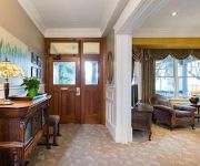
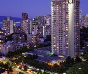
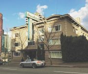
Pinnacle Hotel Vancouver
Vancouver Marriott Pinnacle Downtown Hotel
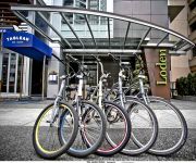
Loden Boutique Hotel Vancouver
ThistleDown House
THE LISTEL HOTEL
English Bay Inn Bed and Breakfast
Vancouver The Westin Bayshore
West End Guest House
COAST PLAZA HOTEL AND SUITES
Greenbrier
Videos from this area
These are videos related to the place based on their proximity to this place.
Airsoft in North Vancouver
This is a small video of a bit of an airsoft game in North Vancouver, B.C. on June the 18th, 2007 with the Op-For Club.
Unobstructed Spectacular City Views!
VIRANI REAL ESTATE ADVISORS proudly presents this ultra-luxurious penthouse in the prestigious "Properties", located at the summit of the British Properties. With unobstructed panoramic views...
Panoramic Ocean & City View Gated Mansion in Prestigious Canterbury West Vancouver
Spectacular 180 degree panoramic ocean & city view. Exquisite & elegant gated mansion on private 1/2acre lot in prestigious Canterbury. This palatial 9800sqft 3 level home is architecturally...
Hollyburn Country Club Big Business of the Year Finalist West Van Chamber President's Awards 2013
Congratulations to the West Vancouver Chamber of Commerce 2013 President's Excellence Awards Big Business of the Year Finalist Hollyburn Country Club. Learn more about North Shore Credit ...
West Vancouver, British Columbia Wikipedia travel guide video. Created by Stupeflix.com
Create your own video on http://studio.stupeflix.com/?w=1 ! West Vancouver Aquatic Centre. West Vancouver Memorial Library. Millennium Floral Clock at Ambleside Park. A West Vancouver Blue...
Vancouver sightseeing.
Video starting in the harbor of the city and quickly takes you into Vancouver parks including Lynn Canyon bridge, Grouse Mountain, Stanley park, and Capilano...
A Ten Minute Trip to Winter
Starting on Marine Drive in West Vancouver, a February drive into the snow at the top of the British Properties.
Park Royal Village Dental Centre
The Park Royal Village Dental Centre is not your typical facility -- but one that is entirely by design, says Dr. Ali Behmard, a former local who has returned to the North Shore. West Vancouver...
VANCOUVER CITY HD VIDEO SEP 11 2010 BRITISH COLUMBIA CANADA SONY HDR CX550V REVIEW TEST
VANCOUVER CITY HD VIDEO SEP 11 2010 BRITISH COLUMBIA CANADA SONY HDR CX550V REVIEW TEST.
Videos provided by Youtube are under the copyright of their owners.
Attractions and noteworthy things
Distances are based on the centre of the city/town and sightseeing location. This list contains brief abstracts about monuments, holiday activities, national parcs, museums, organisations and more from the area as well as interesting facts about the region itself. Where available, you'll find the corresponding homepage. Otherwise the related wikipedia article.
Lions Gate Bridge
The Lions Gate Bridge, opened in 1938, officially known as the First Narrows Bridge, is a suspension bridge that crosses the first narrows of Burrard Inlet and connects the City of Vancouver, British Columbia, to the North Shore municipalities of the District of North Vancouver, the City of North Vancouver, and West Vancouver. The term "Lions Gate" refers to The Lions, a pair of mountain peaks north of Vancouver. Northbound traffic on the bridge heads in their general direction.
Capilano River
The Capilano River flows from north to south through the Coast Mountains on Vancouver's North Shore and empties into Burrard Inlet, opposite Stanley Park. The river is one of three primary sources of drinking water for residents of Greater Vancouver. The Cleveland Dam, built in 1954, impounds a reservoir for this purpose. The entire reservoir and watershed area upstream of the dam is closed to the public to ensure the quality of the drinking water.
West Vancouver Secondary School
West Vancouver Secondary School (WVSS) is a five-year secondary school located in the middle of West Vancouver, British Columbia which educates grades 8 through 12. It is one of the three public high schools in West Vancouver. WVSS is noted for being a very diverse school offering many opportunities for its students, and has a reputation of excellence as a public school. The school has two campuses, a North Campus and a South Campus. Each campus has its own gym and a cafeteria.
Sentinel Secondary School
Sentinel Secondary School is a secondary school located in West Vancouver, British Columbia, Canada. It is one of three public secondary schools in the West Vancouver district (SD #45). The school has a grass field, two baseball diamonds, three street hockey courts, and three tennis courts. The main field is used for all sports, such as soccer, football, and rugby. The school was established for the 1962-63 school year with students who had previously attended Hillside Secondary School.
Park Royal Shopping Centre
Park Royal Shopping Centre, opened in 1950, is a shopping mall located in West Vancouver, British Columbia, Canada. Park Royal is officially Canada's first covered shopping mall. Park Royal currently markets itself as five star shopping and has undergone significant changes to attain this. The shopping centre was originally anchored by Woodward's.
X̱wemelch'stn
Xwemelch'stn, usually anglicized as Homulchesan, is a large community within the Squamish Nation of the Sḵwxwú7mesh people, who are a part of the Coast Salish ethnic and linguistic group. The name Xwemelch'stn, translates to "Fast Moving Water of Fish", relating to the Capilano River. The village is one of the oldest and major villages of the Sḵwxwú7mesh and continues to be so, being the Squamish Nation's most populated reserve.
Ambleside, West Vancouver
Ambleside, West Vancouver, is a neighbourhood that occupies the southeastern corner of the community, with only Park Royal being farther east. The neighborhood is bordered by other neighbourhoods called Dundarave, Park Royal and the British Properties.
The Attic (restaurant)
The Attic was a popular 1,200 seat Smörgåsbord restaurant in West Vancouver that was open from 1968 to 1981. The owners were former Vancouver alderman Frank Baker, (1922 - 1989), and his wife Dorothy.


