Safety Score: 2,8 of 5.0 based on data from 9 authorites. Meaning we advice caution when travelling to Canada.
Travel warnings are updated daily. Source: Travel Warning Canada. Last Update: 2024-05-03 08:06:06
Explore Cypress Park
Cypress Park in British Columbia is located in Canada about 2,204 mi (or 3,546 km) west of Ottawa, the country's capital.
Local time in Cypress Park is now 10:51 AM (Friday). The local timezone is named America / Vancouver with an UTC offset of -7 hours. We know of 10 airports in the wider vicinity of Cypress Park, of which 4 are larger airports. The closest airport in Canada is Vancouver Harbour Water Aerodrome in a distance of 7 mi (or 11 km), South-East. Besides the airports, there are other travel options available (check left side).
There is one Unesco world heritage site nearby. The closest heritage site is Olympic National Park in United states at a distance of 115 mi (or 184 km). Also, if you like golfing, there are multiple options in driving distance. We found 10 points of interest in the vicinity of this place. If you need a place to sleep, we compiled a list of available hotels close to the map centre further down the page.
Depending on your travel schedule, you might want to pay a visit to some of the following locations: Friday Harbor, Victoria, Bellingham, Port Angeles and Coupeville. To further explore this place, just scroll down and browse the available info.
Local weather forecast
Todays Local Weather Conditions & Forecast: 14°C / 57 °F
| Morning Temperature | 9°C / 48 °F |
| Evening Temperature | 15°C / 59 °F |
| Night Temperature | 13°C / 56 °F |
| Chance of rainfall | 0% |
| Air Humidity | 55% |
| Air Pressure | 1011 hPa |
| Wind Speed | Gentle Breeze with 9 km/h (5 mph) from South |
| Cloud Conditions | Overcast clouds, covering 100% of sky |
| General Conditions | Overcast clouds |
Friday, 3rd of May 2024
15°C (59 °F)
11°C (51 °F)
Overcast clouds, gentle breeze.
Saturday, 4th of May 2024
9°C (48 °F)
10°C (50 °F)
Moderate rain, moderate breeze, overcast clouds.
Sunday, 5th of May 2024
11°C (51 °F)
9°C (49 °F)
Light rain, gentle breeze, overcast clouds.
Hotels and Places to Stay
Alma Beach Suites
Gage Residence at UBC
West Coast Suites at UBC
A Suite at Kitsilano Cottage
Camilla House Bed & Breakfast
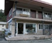
HORSESHOE BAY MOTEL
Videos from this area
These are videos related to the place based on their proximity to this place.
Hollyburn Mountain, Cypress
Just over an hour hike up, some of it enjoyable, some of it straight up. You feel like you're on top of the world, once you get there. 360' views and the Lions are just over there. February 2013.
Snowboard à Cypress Mountain
Une après midi de Snowboard à Cypress Mountain, BC, Canada. Filmé avec une GoPro HD + bandeau frontal monté sur casque. Montage réalisé avec Openshot.
Unobstructed Spectacular City Views!
VIRANI REAL ESTATE ADVISORS proudly presents this ultra-luxurious penthouse in the prestigious "Properties", located at the summit of the British Properties. With unobstructed panoramic views...
Panoramic Ocean & City View Gated Mansion in Prestigious Canterbury West Vancouver
Spectacular 180 degree panoramic ocean & city view. Exquisite & elegant gated mansion on private 1/2acre lot in prestigious Canterbury. This palatial 9800sqft 3 level home is architecturally...
Vancouver City Covered In Fog B.C.Canada January 08 2015
This video was filmed from Cypress Bowl look out. West Vancouver. British, Columbia, Canada www.Bcnewsvideo.com Camera: Panasonic HC-V750 Mpeg-4 50mbs.
Hollyburn Chairlift, West Vancouver, BC, ca. 1960
About 1960, the parents of cabin owner, Merle Michael, filmed these scenes on the Hollyburn chairlift. The chairlift operated from January 1951 to June 1965, when destroyed Hi-View Lodge and...
Hollyburn Country Club Big Business of the Year Finalist West Van Chamber President's Awards 2013
Congratulations to the West Vancouver Chamber of Commerce 2013 President's Excellence Awards Big Business of the Year Finalist Hollyburn Country Club. Learn more about North Shore Credit ...
A Visit to Hollyburn Lodge - April 4, 2011
A cross-country ski trip to Hollyburn Lodge on a quiet, snowy April afternoon.
Driving through Dundarave Village by the Sea with Peter E Smith
"Dundarave Village by the Sea" See more videos at http://www.peteresmith.com Peter E Smith driving west through Dundarave Village in West Vancouver and turning south to the sea. Check out...
Climbing to Hollyburn Peak - 2004
The video, "Climbing to Hollyburn Peak - 2004" is a good introduction to viewing historic Hollyburn photos because it helps us connect our 'present' experience on the mountain with photos taken...
Videos provided by Youtube are under the copyright of their owners.
Attractions and noteworthy things
Distances are based on the centre of the city/town and sightseeing location. This list contains brief abstracts about monuments, holiday activities, national parcs, museums, organisations and more from the area as well as interesting facts about the region itself. Where available, you'll find the corresponding homepage. Otherwise the related wikipedia article.
Horseshoe Bay, West Vancouver
Horseshoe Bay is a West Vancouver community of about 1,000 permanent residents. Situated right on the western tip of West Vancouver, at the entrance to Howe Sound, the village marks the western end of Highway 1 on the British Columbia mainland, as well as the southern end of the Sea-to-Sky Highway, with Lions Bay just 15 minutes north.
Burrard Inlet
For other places with the same name, see Burrard (disambiguation). Burrard Inlet is a relatively shallow-sided coastal fjord in southwestern British Columbia, Canada. Formed during the last Ice Age, it separates the City of Vancouver and the rest of the low-lying Burrard Peninsula (to the south) from the slopes of the North Shore Mountains, home to the communities of West Vancouver and the City and District of North Vancouver.
Lighthouse Park
Lighthouse Park is a popular park in West Vancouver, Canada. Its area is about 75 hectares (185 acres) and it is almost completely covered with rugged, virgin rainforest. At the southernmost tip of the peninsula is Point Atkinson with an impressive landmark lighthouse built in 1875 on granite boulders jutting out into Burrard Inlet. Point Atkinson was first charted and named by Captain George Vancouver in 1792 and is a National Historic Site of Canada.
Altamont, British Columbia
Altamont is a neighbourhood of the District of West Vancouver, British Columbia, Canada. Named by John Fitzgerald Mahon (- 1942) of Vancouver and London, who subdivided land here in 1913, after his brother-in-laws' courtesy title, Earl of Altamont, the eldest son of the Marquess of Sligo, and brother of his wife, Lady Alice Mahon.


