Safety Score: 2,8 of 5.0 based on data from 9 authorites. Meaning we advice caution when travelling to Canada.
Travel warnings are updated daily. Source: Travel Warning Canada. Last Update: 2024-04-26 08:02:42
Explore White Rock
White Rock in Greater Vancouver Regional District (British Columbia) with it's 66,450 inhabitants is a city in Canada about 2,189 mi (or 3,522 km) west of Ottawa, the country's capital.
Local time in White Rock is now 05:15 PM (Friday). The local timezone is named America / Vancouver with an UTC offset of -7 hours. We know of 9 airports in the vicinity of White Rock, of which 4 are larger airports. The closest airport in Canada is Boundary Bay Airport in a distance of 10 mi (or 17 km), West. Besides the airports, there are other travel options available (check left side).
There is one Unesco world heritage site nearby. The closest heritage site is Olympic National Park in United states at a distance of 88 mi (or 142 km). Also, if you like golfing, there are multiple options in driving distance. We found 10 points of interest in the vicinity of this place. If you need a place to sleep, we compiled a list of available hotels close to the map centre further down the page.
Depending on your travel schedule, you might want to pay a visit to some of the following locations: Bellingham, Friday Harbor, Mount Vernon, Coupeville and Victoria. To further explore this place, just scroll down and browse the available info.
Local weather forecast
Todays Local Weather Conditions & Forecast: 9°C / 48 °F
| Morning Temperature | 9°C / 49 °F |
| Evening Temperature | 8°C / 47 °F |
| Night Temperature | 9°C / 48 °F |
| Chance of rainfall | 21% |
| Air Humidity | 93% |
| Air Pressure | 1015 hPa |
| Wind Speed | Moderate breeze with 9 km/h (6 mph) from North |
| Cloud Conditions | Overcast clouds, covering 100% of sky |
| General Conditions | Moderate rain |
Saturday, 27th of April 2024
9°C (48 °F)
7°C (45 °F)
Light rain, moderate breeze, overcast clouds.
Sunday, 28th of April 2024
10°C (50 °F)
6°C (43 °F)
Light rain, gentle breeze, few clouds.
Monday, 29th of April 2024
10°C (50 °F)
5°C (41 °F)
Light rain, light breeze, overcast clouds.
Hotels and Places to Stay
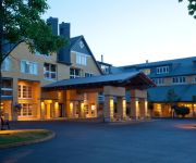
Dancing Firs
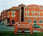
PACIFIC INN SOUTH SURREY
Semiahmoo Resort Golf & Spa
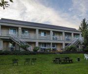
Breakaway Motel
Pacific Inn Resort & Conference Centre
Northwoods Motel
Anchor Inn Motel
Bayside Motor Inn
OCEAN PROMENADE HOTEL
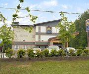
BEST WESTERN PEACE ARCH INN
Videos from this area
These are videos related to the place based on their proximity to this place.
Trolley rides - White Rock
Video: Luiz Lopes This Canada Day long weekend, Tourism White Rock and the White Rock BIA, in collaboration with The City of White Rock, are proud to announce the arrival of a Vancouver Trolley...
White Rock Pier, Greater Vancouver Area, B.C., Canada
White Rock Pier, Greater Vancouver Area, B.C., Canada YouTube: http://www.youtube.com/user/ceekay22 Website: www.travelgurutv.com Facebook: https://www.facebook.com/travelgurutv PayPal ...
White Rock, British Colombia (Vancouver Area)
White Rock, British Colombia (Vancouver Area) - March 2014 YouTube: http://www.youtube.com/user/ceekay22 Website: www.travelgurutv.com Facebook: https://www.facebook.com/travelgurutv ...
HD- Rare! Amtrak Cascades #517 through White Rock, BC Without NPCU!
I'm back with the videos! In late July and through early August, I went on a vacation with my family to Vancouver, British Columbia. I used to live in Vancouver, and it was happy visit for...
White Rock BC - Vintage Film
A film by Charles Cowles he called "The Great Sea Resort - White Rock" A Vintage film from the White Rock Museum and Archives' collection. An early colour film showing scenes around White Rock...
Welcome to 'White Rock Farmers' Market' @ 'Miramar Plaza' by Russell Avenue..
Season Opening 27 May 2012 . This was the busy opening day gathering of about three thousand happy campers and visitors to the long awaited 'summer season'. The White Rock Farmers' Market...
White Rock Polar Bears Cheerleaders 2014
2014 Polar bear swim at White Rock BC. This Cheer team attempts a lift. The cold water doesn't phase them a bit. A beautiful day to start off the New Year. Many thousands of attendees.
One-of-a-Kind Seaside Home in White Rock, British Columbia, Canada
Presented by Sotheby's International Realty Canada For more information go to http://ow.ly/jhpWT One of the unique attributes of this beachside house in White Rock is the ideal location which...
LocalGarageSales.ca - White Rock & South Surrey Garage Sale Maps
How to use the http://LocalGarageSales.ca webpage. downloading printable garage sale maps and GPS versions of the garage sale maps. Theses maps are available only for Saturdays.
Videos provided by Youtube are under the copyright of their owners.
Attractions and noteworthy things
Distances are based on the centre of the city/town and sightseeing location. This list contains brief abstracts about monuments, holiday activities, national parcs, museums, organisations and more from the area as well as interesting facts about the region itself. Where available, you'll find the corresponding homepage. Otherwise the related wikipedia article.
Semiahmoo Bay
Semiahmoo Bay is the southeastern section of Boundary Bay on the Pacific coast of North America. The name "Semiahmoo" is a Coast Salish word for "half moon".
Semiahmoo First Nation
Semiahmoo First Nation is the band government of the Semiahmoo people, a Coast Salish subgroup. The band's main community and offices are located on 312 acres of Indian Reserve just south of White Rock, British Columbia and near the Canada-United States boundary and Peace Arch Provincial Park.
Semiahmoo Spit
Semiahmoo Spit is a spit that protrudes from the westernmost expanse of shore along Drayton Harbor in the city of Blaine, WA located in Whatcom County, WA.
Campbell River (Semiahmoo Bay)
Campbell River passes through Surrey and Langley, British Columbia, Canada, entering Semiahmoo Bay at the Semiahmoo Indian Reserve, which lies between the City of White Rock and Peace Arch Park on the international boundary. Originally labelled Campbell Creek in 1917 by the Geographic Board of Canada, it was labelled Tahtaloo on International Boundary Survey sheet 2 (date not cited); variant spellings include Tahla too, Tah-la-loo, and Tah tu lo.
Semiahmoo Indian Reserve
The Semiahmoo Indian Reserve is an Indian Reserve in the Lower Mainland, British Columbia, located on Semiahmoo Bay between the City of White Rock and Peace Arch Park, which sits astride the international boundary with Washington state. It is under the administration of the Semiahmoo First Nation.
Sunnyside, Surrey
Sunnyside is a neighbourhood of South Surrey, which in turn is a region of Surrey, British Columbia, Canada.


