Safety Score: 2,8 of 5.0 based on data from 9 authorites. Meaning we advice caution when travelling to Canada.
Travel warnings are updated daily. Source: Travel Warning Canada. Last Update: 2024-05-08 08:04:21
Explore Hazelmere
Hazelmere in British Columbia is located in Canada about 2,185 mi (or 3,516 km) west of Ottawa, the country's capital.
Local time in Hazelmere is now 05:03 PM (Wednesday). The local timezone is named America / Vancouver with an UTC offset of -7 hours. We know of 9 airports in the wider vicinity of Hazelmere, of which 4 are larger airports. The closest airport in Canada is Boundary Bay Airport in a distance of 14 mi (or 22 km), West. Besides the airports, there are other travel options available (check left side).
There is one Unesco world heritage site nearby. The closest heritage site is Olympic National Park in United states at a distance of 89 mi (or 143 km). Also, if you like golfing, there are multiple options in driving distance. We found 10 points of interest in the vicinity of this place. If you need a place to sleep, we compiled a list of available hotels close to the map centre further down the page.
Depending on your travel schedule, you might want to pay a visit to some of the following locations: Bellingham, Friday Harbor, Mount Vernon, Chilliwack and Coupeville. To further explore this place, just scroll down and browse the available info.
Local weather forecast
Todays Local Weather Conditions & Forecast: 17°C / 62 °F
| Morning Temperature | 8°C / 47 °F |
| Evening Temperature | 15°C / 59 °F |
| Night Temperature | 11°C / 52 °F |
| Chance of rainfall | 0% |
| Air Humidity | 61% |
| Air Pressure | 1025 hPa |
| Wind Speed | Gentle Breeze with 6 km/h (4 mph) from East |
| Cloud Conditions | Few clouds, covering 13% of sky |
| General Conditions | Few clouds |
Thursday, 9th of May 2024
18°C (65 °F)
12°C (54 °F)
Few clouds, light breeze.
Friday, 10th of May 2024
16°C (62 °F)
12°C (53 °F)
Few clouds, light breeze.
Saturday, 11th of May 2024
15°C (59 °F)
10°C (49 °F)
Overcast clouds, gentle breeze.
Hotels and Places to Stay
PACIFIC INN SOUTH SURREY
BEST WESTERN PLUS LANGLEY INN
Semiahmoo Resort Golf & Spa
Holiday Inn & Suites SURREY EAST - CLOVERDALE
Hampton Inn & Suites by Hilton Langley-Surrey
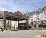
RAMADA SURREY LANGLEY
Westward Inn & Suites
Northwoods Motel
Breakaway Motel
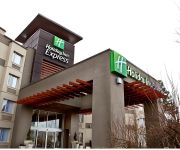
Holiday Inn Express & Suites LANGLEY
Videos from this area
These are videos related to the place based on their proximity to this place.
Pattern in the City - (Results Only)
Warning! Warning! Warning! This video is only intended to be viewed by those that attended the "Pattern in the City" Pattern Contest held at Spectrum Flyers in Surrey, BC on May 19-20, 2012....
Crackling Chemistry
Is chemistry only physical? No, it includes lots of levels of attraction... Kathryn Alice answering your questions on her summer teaching tour. On a train headed to Vancouver, British Columbia.
United States & Canada - Border Crossing - Peace Arch HD (2014)
The Peace Arch is a monument situated on the Canada -- United States border between the communities of Blaine, Washington and Surrey, British Columbia. The Peace Arch, which stands 20.5 metres ...
Moderate Windstorm of 02 Apr 2010 as Viewed from Surrey, BC
A moderate windstorm struck Oregon, Washington and British Columbia on April 2, 2010. Wind gusts reached 47 mph at Portland and Seattle, 55 mph at the Vancouver International Airport, and 61...
Moderate Windstorm of 02 Apr 2010 as viewed From Surrey, BC
A moderate windstorm struck Oregon, Washington and British Columbia on April 2, 2010. Wind gusts reached 47 mph at Portland and Seattle, 55 mph at the Vancouver International Airport, and 61...
Canada - United States border at Blaine, WA
crossing the physical border at 1:24 at the Pacific Highway in Blaine Washington; checkpoint administered by the U.S. Customs and Border Protection.
Boarder Crossing, USA to Canada, I-5 north, near Blaine Washington
Boarder crossing USA to Canada, near Blaine Washington Grenzübergang nach Kanada (mit LKW)
Blaine to Ferndale, Washington
Blaine to Ferndale, Driving & sight seeing Washington, United States.
Coming home thru Peace Arch, Blaine, Wa.
Coming back into Canada is always such a nice feeling. eh. Driving up towards the white Peace Arch, tells me that I am almost home.
2194 Cedarwood Lane, Blaine, WA Presented by Raymond Pelletti.
Click to see more: http://www.searchallproperties.com/listings/2003937/2194-Cedarwood-Lane-Blaine-WA/auto?reqpage=video 2194 Cedarwood Lane Blaine, WA 98230 ...
Videos provided by Youtube are under the copyright of their owners.
Attractions and noteworthy things
Distances are based on the centre of the city/town and sightseeing location. This list contains brief abstracts about monuments, holiday activities, national parcs, museums, organisations and more from the area as well as interesting facts about the region itself. Where available, you'll find the corresponding homepage. Otherwise the related wikipedia article.
Blaine High School (Washington)
Blaine High School is a high school located in Blaine, Washington. Their school mascot is a Borderite, and their colors are orange and black. Present administrators are Principal Ellis and Vice Principal Vezzetti. As of 2009, Blaine High School is 103 years old. ALUMNI::: Scott Gomez plays in the NHL he attended school there in 2003. Luke Ridnour, Shooting Guard for the Minnesota Timberwolves, attended Blaine High school.
Blaine Middle School
Blaine middle is a part of the blaine school district together with blaine high school, primary school, pt. roberts primary, and blaine elementary. blaine middle provides a wide range of elective classes taken during the school day which last from 8:20 till 2:50. many who do not ride the bus tend to wake up later in the day racing to school and striving not to be late.
Douglas, British Columbia
This article is for the border-crossing and locality in Surrey, BC. For the town at the head of Harrison Lake, see Port Douglas, British Columbia Douglas is a locality in Surrey, British Columbia, Canada, just southeast and outside of the boundary of White Rock, that is the Canadian side of the Peace Arch Border Crossing between British Columbia and Whatcom County, Washington in the United States.


