Safety Score: 2,8 of 5.0 based on data from 9 authorites. Meaning we advice caution when travelling to Canada.
Travel warnings are updated daily. Source: Travel Warning Canada. Last Update: 2024-04-28 08:22:10
Discover Anniedale
Anniedale in British Columbia is a place in Canada about 2,183 mi (or 3,513 km) west of Ottawa, the country's capital city.
Current time in Anniedale is now 12:00 PM (Sunday). The local timezone is named America / Vancouver with an UTC offset of -7 hours. We know of 11 airports near Anniedale, of which 4 are larger airports. The closest airport in Canada is Boundary Bay Airport in a distance of 15 mi (or 24 km), South-West. Besides the airports, there are other travel options available (check left side).
There is one Unesco world heritage site nearby. The closest heritage site is Olympic National Park in United states at a distance of 98 mi (or 158 km). Also, if you like playing golf, there are a few options in driving distance. We encountered 8 points of interest in the vicinity of this place. If you need a hotel, we compiled a list of available hotels close to the map centre further down the page.
While being here, you might want to pay a visit to some of the following locations: Bellingham, Friday Harbor, Chilliwack, Mount Vernon and Coupeville. To further explore this place, just scroll down and browse the available info.
Local weather forecast
Todays Local Weather Conditions & Forecast: 10°C / 50 °F
| Morning Temperature | 8°C / 46 °F |
| Evening Temperature | 9°C / 48 °F |
| Night Temperature | 4°C / 40 °F |
| Chance of rainfall | 10% |
| Air Humidity | 82% |
| Air Pressure | 1016 hPa |
| Wind Speed | Gentle Breeze with 5 km/h (3 mph) from North-East |
| Cloud Conditions | Overcast clouds, covering 100% of sky |
| General Conditions | Light rain |
Sunday, 28th of April 2024
10°C (50 °F)
4°C (40 °F)
Light rain, gentle breeze, broken clouds.
Monday, 29th of April 2024
9°C (49 °F)
5°C (42 °F)
Light rain, light breeze, overcast clouds.
Tuesday, 30th of April 2024
12°C (53 °F)
9°C (48 °F)
Light rain, light breeze, overcast clouds.
Hotels and Places to Stay
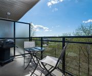
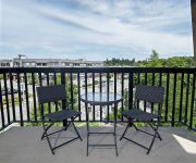
Premiere Suites at Elements
Premiere Suites at Hawthorne
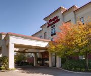
Hampton Inn & Suites by Hilton Langley-Surrey
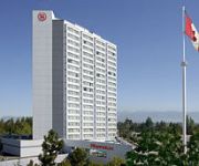
Sheraton Vancouver Guildford Hotel
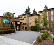
Holiday Inn Express & Suites SURREY
Four Points by Sheraton Surrey
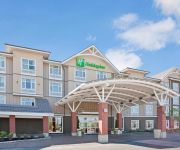
Holiday Inn & Suites SURREY EAST - CLOVERDALE
BEST WESTERN PLUS LANGLEY INN
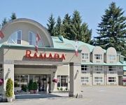
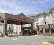
RAMADA SURREY LANGLEY
Clydesdale Inn
Videos from this area
These are videos related to the place based on their proximity to this place.
19859 69A Ave Langley BC - Real Estate - Susan Parsons - Royal LePage Wolstencroft
View http://www.seevirtual360.com/26165 to see PRICE and more PHOTOS. "WILLOUGHBY" MASTER BDRM ON MAIN - Well maintained, 3 bedroom, 3 bathroom approximately 1858 sq finished, ...
OSPREY by MOSAIC - New Pitt Meadows Real Estate
OSPREY's 2 bedroom + den FRANKLIN Series model home. Tour the model home in person at 10973 Barnston View Road, Pitt Meadows. Open daily 12 -- 6pm. For more info, call 604.465.8710 or visit ...
Murphy Moose Landing @ Pitt Meadows, BC
Murphy Moose experimental aircraft landing at Pitt Meadows, British Columbia.
Landing Winter at Pitt Meadows Canada Rwy 26L Cockpit View
Landing and Go Around at Pitt Meadows, BC, Canada Rwy 26L, in Pacific Flying Club, C-172-XP, cockpit view to north and west during base, final and landing. Filmed by my wife.
Skydiving in Pitt Meadows
With John, Ian, Brent, Dave-Dave, and Derek. Congrats to Brent for his 100th jump!
Pitt Meadows Track Day 2011
The tents and other riders can be seen at 10:05 A ST1300 in the last two sessions of a Pitt Meadows Track Day July 9, 2011. There was instruction, mini bikes, race motorcycles, dual sports,...
Skydiving in Pitt Meadows (Near Vancouver - Canada)
I couldn't speak English during the Skydiving hahaha.
FIELD TRIP, JESUS = 888
1. God is perfect. 2. God speaks English. 3. Therefore, English is perfect mathematically, to Glorify Him at all times, day and night. That is what we reveal in all of these videos. And then—fro...
FIELD TRIP, JESUS = 888
1. God is perfect. 2. God speaks English. 3. Therefore, English is perfect mathematically, to Glorify Him at all times, day and night. That is what we reveal in all of these videos. And then—fro...
VALUE VILLAGE solved!! Fast Quality
1. God is perfect. 2. God speaks English. 3. Therefore, English is perfect mathematically, to Glorify Him at all times, day and night. That is what we reveal in all of these videos. And then—fro...
Videos provided by Youtube are under the copyright of their owners.
Attractions and noteworthy things
Distances are based on the centre of the city/town and sightseeing location. This list contains brief abstracts about monuments, holiday activities, national parcs, museums, organisations and more from the area as well as interesting facts about the region itself. Where available, you'll find the corresponding homepage. Otherwise the related wikipedia article.
CKNW
CKNW owned by Corus Entertainment, is the second highest-rated talk radio station in Vancouver, British Columbia, Canada. It broadcasts on AM 980. The station's content is based on news and current events. It features call-in shows with mostly Vancouver-based hosts.
Pacific Academy
Pacific Academy is a private Christian school in Surrey, British Columbia, Canada that spans from preschool to Grade 12. The school generally has 3 or 4 classes per grade, and has over 200 staff members as well as 1500 students. It was started by Jim Pattison, a billionaire who donated money to create Pacific Academy. Pacific Academy also has an outreach program (PAOS) that spans the far reaches of the globe. For example it supports the Kibaale community schools in Uganda.
Barnston Island (British Columbia)
Barnston Island is an unincorporated island located in the Greater Vancouver metropolitan area of British Columbia, Canada. Most of the island is part of the Greater Vancouver Electoral Area A; the remainder is Barnston Island Indian Reserve No. 3, which is outside Electoral Area A limits and is under the governance of the Katzie First Nation, headquartered across the river at their main reserve in Pitt Meadows.
Katzie First Nation
The Katzie First Nation or Katzie Nation is the band government of the Katzie people of the Lower Fraser Valley region of British Columbia, Canada.
Port Kells
Port Kells is a neighbourhood of the City of Surrey in British Columbia, Canada, located at the northeastern end of that city adjacent to the Fraser River and west of the neighbourhood of Walnut Grove (part of the Township of Langley).
Barnston Island Ferry
The Barnston Island Ferry is a ferry across Parson's Channel on the south side of the Fraser River to Barnston Island in British Columbia, Canada. The ferry is actually a barge that is pushed across the Fraser River using a small tugboat attached to it. Having limited space, it can carry up to 6 vehicles and 52 passengers (when 6 vehicles are aboard, only 28 passengers will be carried). The crossing time is usually five minutes.


