Safety Score: 2,8 of 5.0 based on data from 9 authorites. Meaning we advice caution when travelling to Canada.
Travel warnings are updated daily. Source: Travel Warning Canada. Last Update: 2024-05-02 08:23:34
Delve into Oxford Heights
Oxford Heights in British Columbia is a city located in Canada about 2,184 mi (or 3,514 km) west of Ottawa, the country's capital town.
Current time in Oxford Heights is now 11:07 AM (Thursday). The local timezone is named America / Vancouver with an UTC offset of -7 hours. We know of 11 airports closer to Oxford Heights, of which 4 are larger airports. The closest airport in Canada is Vancouver Harbour Water Aerodrome in a distance of 16 mi (or 25 km), West. Besides the airports, there are other travel options available (check left side).
There is one Unesco world heritage site nearby. The closest heritage site is Olympic National Park in United states at a distance of 107 mi (or 171 km). Also, if you like playing golf, there are some options within driving distance. We saw 10 points of interest near this location. In need of a room? We compiled a list of available hotels close to the map centre further down the page.
Since you are here already, you might want to pay a visit to some of the following locations: Bellingham, Friday Harbor, Chilliwack, Mount Vernon and Victoria. To further explore this place, just scroll down and browse the available info.
Local weather forecast
Todays Local Weather Conditions & Forecast: 18°C / 64 °F
| Morning Temperature | 5°C / 41 °F |
| Evening Temperature | 15°C / 59 °F |
| Night Temperature | 8°C / 47 °F |
| Chance of rainfall | 0% |
| Air Humidity | 41% |
| Air Pressure | 1017 hPa |
| Wind Speed | Light breeze with 5 km/h (3 mph) from North-East |
| Cloud Conditions | Clear sky, covering 2% of sky |
| General Conditions | Sky is clear |
Thursday, 2nd of May 2024
19°C (67 °F)
11°C (52 °F)
Overcast clouds, light breeze.
Friday, 3rd of May 2024
13°C (56 °F)
8°C (46 °F)
Light rain, light breeze, overcast clouds.
Saturday, 4th of May 2024
8°C (46 °F)
7°C (44 °F)
Moderate rain, light breeze, overcast clouds.
Hotels and Places to Stay
POCO INN AND SUITES HOTEL
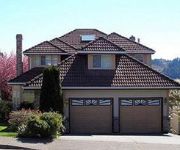
Eagle Mountain Bed and Breakfast
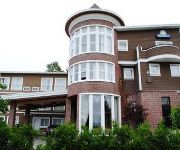
DAYS INN SURREY
Videos from this area
These are videos related to the place based on their proximity to this place.
Project 1999 EverQuest City of Mist.
Starting out in Cabilis, I venture forth to the Field of Bone, then to the Emerald Jungle in search of that elusive dungeon named the City of Mist! I get into a group and show a bit of what...
Coquitlam River, British Columbia
Coquitlam River, Coquitlan, British Colunbia, Canada Near Galette Park, January 26th, 2013.
Jackbird Drone over Coquitlam Town Centre Park
Just a few minutes of video from a few short flights over Town Centre Park. A sample of what you will see if you go there.
3136 Newberry Street, Port Coquitlam Fixer Upper on Big Lot w/Lane
FULL LISTING DETAILS http://thisiscrazy.myhomemay.be/ 3136 Newberry Street, Port Coquitlam - BIRCHLAND FIXER UPPER on a BIG LOT, priced to sell. Build instant sweat equity with a few updates ...
World Record Attempt at Singing Jingle Bells Full Video Lafarge Lake Coquitlam
British Columbia Canada www.Bcnewsvideo.com.
3430 Roxton Ave Coquitlam BC - Real Estate - Somerton by Morningstar Homes -
View http://www.seevirtual360.com/24024 to see PRICE and more PHOTOS. TAX INCLUDED! The Ellsworth is a family friendly home w/special attention given to living the way you want. An open ...
Top Coquitlam Landscaping Company: Local, Professional & Eco-friendly
ATC Landscape, a Coquitlam landscaping company, has a team of trained professionals who have been providing landscape maintenance and cedar fencing installation since 2001. Customer ...
Port Coquitlam Home Renovations
Caliber West Renovations is your home renovations specialist in Port Coquitlam, BC. Known for our outstanding service, high quality materials, and fair pricing. We do everything from small...
1950 Patricia Street, Port Coquitlam
FULL LISTING DETAILS http://thisiscrazy.myhomemay.be/ 1950 Patricia Street, Port Coquitlam - Stunningly renovated Northside family home with no detail left untouched inside and out. 3 bedrooms...
Samz Neighbourhood Pub|Coquitlam Pubs|Pubs In Surrey/Langley
The Lower Mainland's best pubs, restaurants, and liquor stores (Langley/Surrey and Port Coquitlam locations only) serving great food, providing exceptional service, and an amazing atmosphere...
Videos provided by Youtube are under the copyright of their owners.
Attractions and noteworthy things
Distances are based on the centre of the city/town and sightseeing location. This list contains brief abstracts about monuments, holiday activities, national parcs, museums, organisations and more from the area as well as interesting facts about the region itself. Where available, you'll find the corresponding homepage. Otherwise the related wikipedia article.
Westwood Plateau
Westwood Plateau is a neighbourhood in the northern region of Coquitlam, British Columbia, bounded by the city boundary with Port Moody to the west, David Avenue to the south, and Pipeline Road to the east. It lies on 1,400 acres on the southern portion of Eagle Mountain, known locally as Eagle Ridge. It is named for Westwood Motorsport Park which existed on the plateau before the community was built, and was closed in 1990 to make way for real estate development.
Tri-Cities (British Columbia)
The Tri-Cities are an informal grouping of three adjacent suburban cities and two villages in the north-east sector of Metro Vancouver in British Columbia. Combined, these five communities have a 2011 population of 218,509 residents:
Port Coquitlam Station
Port Coquitlam Station is a station on the West Coast Express commuter rail line connecting Vancouver to Mission, British Columbia, Canada. The station is located on the south side of the Canadian Pacific Railway (CPR) tracks in Port Coquitlam, just off Kingsway Avenue. The station opened in 1995, when the West Coast Express began operating. 280 park and ride spaces are available. All services are operated by TransLink.
Percy Perry Stadium
Percy Perry Stadium is a multi-purpose, fully lit stadium in Coquitlam, British Columbia. It was built for the 1991 B.C. Summer Games, as part of the district's 100th anniversary, and has featured events with crowds of over 4,000 spectators. Prior to 2006, the stadium had been named "Town Centre Stadium", but was renamed to "Percy Perry Stadium" in honour of long-standing track and field coach Percy Perry who died in 2005.
Evergreen Cultural Centre
The Evergreen Cultural Centre is a theatre and music venue in Coquitlam, British Columbia, opened in October 1996 by former Coquitlam Mayor Lou Sekora. The design team was headed by Thom Weeks of Architectura, and the contract was completed by Proscenium Architecture. The Centre features a 264-seat black box theatre (with configurable seating from stadium to flat floor), a fully equipped rehearsal hall, three art studios, and a 1,500-square-foot art gallery with adjoining gallery shop.
Lafarge Lake
Lafarge Lake is a five-hectare man-made lake, located in Town Centre Park in central Coquitlam, British Columbia. The Evergreen Cultural Centre lies on the southwest corner of the lake, and the Water's Edge Festival is held on the lake shore for 25 continuous hours in March. The area was originally a quarry, but in the 1970s the land was transferred to the city of Coquitlam, and a successful reclamation project ensued.
Town Centre Park
Town Centre Park is a park in central Coquitlam, British Columbia, just north of the Coquitlam Centre shopping mall. The park is surrounded by Coquitlam's city hall, main police station, main fire hall, City Centre Aquatic Complex, and the David Lam campus of Douglas College, Pinetree Secondary School, as well as many houses and apartments.
Eleanor Ward Bridge
The Eleanor Ward Bridge is a four-lane road bridge in Coquitlam, British Columbia. It spans the Coquitlam River, connecting the Coquitlam Town Centre area with the Burke Mountain area of northeast Coquitlam. The $25 million bridge, with a span of 127 m (417 ft. ), opened on August 26, 2006.


