Safety Score: 2,8 of 5.0 based on data from 9 authorites. Meaning we advice caution when travelling to Canada.
Travel warnings are updated daily. Source: Travel Warning Canada. Last Update: 2024-04-28 08:22:10
Discover Anmore
Anmore in Greater Vancouver Regional District (British Columbia) with it's 126,456 citizens is a town in Canada about 2,187 mi (or 3,519 km) west of Ottawa, the country's capital city.
Current time in Anmore is now 12:09 AM (Monday). The local timezone is named America / Vancouver with an UTC offset of -7 hours. We know of 11 airports near Anmore, of which 4 are larger airports. The closest airport in Canada is Vancouver Harbour Water Aerodrome in a distance of 12 mi (or 19 km), West. Besides the airports, there are other travel options available (check left side).
There is one Unesco world heritage site nearby. The closest heritage site is Olympic National Park in United states at a distance of 109 mi (or 176 km). Also, if you like playing golf, there are a few options in driving distance. We discovered 10 points of interest in the vicinity of this place. Looking for a place to stay? we compiled a list of available hotels close to the map centre further down the page.
When in this area, you might want to pay a visit to some of the following locations: Bellingham, Friday Harbor, Chilliwack, Victoria and Mount Vernon. To further explore this place, just scroll down and browse the available info.
Local weather forecast
Todays Local Weather Conditions & Forecast: 10°C / 49 °F
| Morning Temperature | 2°C / 36 °F |
| Evening Temperature | 9°C / 49 °F |
| Night Temperature | 3°C / 38 °F |
| Chance of rainfall | 3% |
| Air Humidity | 56% |
| Air Pressure | 1017 hPa |
| Wind Speed | Gentle Breeze with 6 km/h (3 mph) from North-East |
| Cloud Conditions | Overcast clouds, covering 96% of sky |
| General Conditions | Light rain |
Monday, 29th of April 2024
9°C (49 °F)
5°C (41 °F)
Light rain, light breeze, overcast clouds.
Tuesday, 30th of April 2024
11°C (52 °F)
8°C (46 °F)
Light rain, light breeze, overcast clouds.
Wednesday, 1st of May 2024
8°C (47 °F)
4°C (40 °F)
Moderate rain, light breeze, overcast clouds.
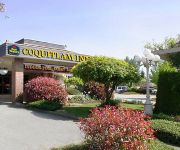
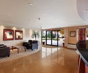
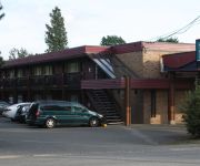
Hotels and Places to Stay
EXECUTIVE PLAZA COQUITLAM
BEST WESTERN PLUS COQUITLAM
Eagle Mountain Bed and Breakfast
RAMADA COQUITLAM
Coquitlam Sleepy Lodge
BW CHELSEA INN
Videos from this area
These are videos related to the place based on their proximity to this place.
Port Moody Boardwalk and City Hall from Drone
Aerial video of Port moody City Hall and Boardwalk. It was a sunny winter day and I had noticed the view of the mountains over city hall in Port Moody. So I decided to pull over and have a...
Port Moody police use excessive force
Port Moody police slam this man to the concrete using excessive force causing injury. There was no warning and the man was not resisting arrest.
Port Moody Fatal Crash Drove Off Edge Of Bridge David Ave November 16 2014 B.C. Canada
November 16 2014 This truck was traveling West on David Ave. in Port Moody ,British Columbia, Canada. The driver lost control and hit some large rocks, then drove through some trees and went...
Port Moody Assault Police Recover Weapon Fernway Dr B.C. Canada
December 16 2014 Sony FDR AX100 4K Video Port Moody Police are on scene investigating Some type of assault that occurred on fernway Dr. Police have recovered this weapon from the seen. The...
#192 Cornell Way Port Moody BC - Real Estate Virtual Tour - Chuck Magnus
View http://www.seevirtual360.com/27964 to see PRICE and more PHOTOS. Pride of ownership shows in this updated townhome. Main floor features oak H/W floors & crown mouldings throughout, ...
[HD] Bad Drivers - Port Moody, BC Canada (Sudden Stop No Reason)
"Stopping in Middle of Road for No Reason is Dangerous" Silver car stops in the middle of road reason for no reason at all. There's no red light. There's no obstruction. And it's ironic that...
rocky point park,port moody,B.C
beautiful sunny day at Rocky point park, port moody. 550 frame naza controller cyclops OSD lawmate TX home-made vertical antenna 30amp hobbywing ESC go-pro hero2 camera sony ccd camera for ...
Dash Cam: A Close Call (Port Moody, British Columbia)
(1) There was a designated left-turn lane. (2) The left-turn was being made in the incorrect lane of travel. (3) There were no oncoming drivers that posed an immediate hazard. (4) The traffic...
Coquitlam Carjacking Female Hit In The Head With Rock By Port Moody Suspect
Port Moody suspect in weapons assault, hit this woman in the head with a rock at Bramble Park. Then carjacked her vehicle. Suspect was arrested at gunpoint .British Columbia Canada www.
1044 Ravenswood Dr Port Moody BC - Real Estate Virtual Tour - Rob Johnson
View http://www.seevirtual360.com/28955 to see PRICE and more PHOTOS. Executive living at Anmore Woods in this beautiful Marcraft built home. This Ponderosa plan has it all: perched on an...
Videos provided by Youtube are under the copyright of their owners.
Attractions and noteworthy things
Distances are based on the centre of the city/town and sightseeing location. This list contains brief abstracts about monuments, holiday activities, national parcs, museums, organisations and more from the area as well as interesting facts about the region itself. Where available, you'll find the corresponding homepage. Otherwise the related wikipedia article.
Rocky Point Park
Rocky Point Park, also known as Rocky Point, is situated along Burrard Inlet in Port Moody, British Columbia, next to the Port Moody Station Museum. It is 3.8 hectares in size, and is the most well-known park in Port Moody. Rocky Point has a variety of amenities including an outdoor swimming pool, splash pad, skateboard park, boat launch, hiking and cycling trails, and wildlife viewing. There is also a covered performance stage, and new warden houses are under construction.
Port Moody Station Museum
The Port Moody Station Museum is owned and operated by the Port Moody Heritage Society and is part of their effort to promote increased awareness and knowledge of Port Moody, British Columbia's heritage and history.
Port Moody Station
Port Moody Station is a station on the West Coast Express commuter rail line connecting Vancouver to Mission, British Columbia, Canada. The station is located on the south side of the Canadian Pacific Railway (CPR) tracks in Port Moody, at the north foot of William Street, approximately 200 metres north of St. John's Street. The station opened in 1995, when the West Coast Express began operating. 300 park and ride spots are available. All services are operated by TransLink.
Heritage Woods Secondary School
Heritage Woods Secondary School is a coeducational high school located in Port Moody, British Columbia. In 2007, Heritage Woods celebrated their first graduating class. As well, it and was rated as one of top 50 schools in BC for 2007, 2008 and 2010 by the Fraser Institute.
Buntzen Lake
Buntzen Lake is a 4.8 kilometres (3 mi) long lake in Anmore, British Columbia, Canada, in the Greater Vancouver area. It is named after the first general manager of the B.C. Electric Co. , Johannes Buntzen. There is a smaller lake just to the north named McCombe Lake.
Eagle Mountain (British Columbia)
Eagle Mountain, also known as Eagle Ridge, is the mountainous ridge with many indistinct summits between Buntzen Lake and Coquitlam Lake near Coquitlam, British Columbia. Its proximity to Coquitlam, and the houses being built on its southern slopes, make it a very popular weekend destination for hiking, mountain biking, horseback riding, and ATV riding.
Sasamat Lake
Sasamat Lake is located within Belcarra Regional Park. It is one of the warmest lakes in Greater Vancouver. At the south end of the lake there is a floating bridge, used for fishing or swimming. http://www. findfamilyfun. com/sasamat. htm At the north end of the lake is White Pine Beach. Seasonal transit service is provide by Translink (Vancouver) to White Pine Beach.
Bedwell Bay, British Columbia
Bedwell Bay is a settlement in British Columbia.




!['[HD] Bad Drivers - Port Moody, BC Canada (Sudden Stop No Reason)' preview picture of video '[HD] Bad Drivers - Port Moody, BC Canada (Sudden Stop No Reason)'](https://img.youtube.com/vi/fvHRedvesWs/mqdefault.jpg)


