Safety Score: 2,8 of 5.0 based on data from 9 authorites. Meaning we advice caution when travelling to Canada.
Travel warnings are updated daily. Source: Travel Warning Canada. Last Update: 2024-04-30 08:30:35
Explore Brunette Creek
Brunette Creek in British Columbia is a city in Canada about 2,189 mi (or 3,523 km) west of Ottawa, the country's capital.
Local time in Brunette Creek is now 11:37 PM (Tuesday). The local timezone is named America / Vancouver with an UTC offset of -7 hours. We know of 11 airports in the vicinity of Brunette Creek, of which 4 are larger airports. The closest airport in Canada is Vancouver Harbour Water Aerodrome in a distance of 11 mi (or 18 km), West. Besides the airports, there are other travel options available (check left side).
There is one Unesco world heritage site nearby. The closest heritage site is Olympic National Park in United states at a distance of 104 mi (or 167 km). Also, if you like golfing, there are multiple options in driving distance. We found 10 points of interest in the vicinity of this place. If you need a place to sleep, we compiled a list of available hotels close to the map centre further down the page.
Depending on your travel schedule, you might want to pay a visit to some of the following locations: Bellingham, Friday Harbor, Chilliwack, Victoria and Mount Vernon. To further explore this place, just scroll down and browse the available info.
Local weather forecast
Todays Local Weather Conditions & Forecast: 11°C / 52 °F
| Morning Temperature | 6°C / 43 °F |
| Evening Temperature | 12°C / 53 °F |
| Night Temperature | 5°C / 42 °F |
| Chance of rainfall | 0% |
| Air Humidity | 57% |
| Air Pressure | 1023 hPa |
| Wind Speed | Light breeze with 4 km/h (3 mph) from South-West |
| Cloud Conditions | Broken clouds, covering 70% of sky |
| General Conditions | Broken clouds |
Wednesday, 1st of May 2024
16°C (61 °F)
7°C (45 °F)
Sky is clear, light breeze, clear sky.
Thursday, 2nd of May 2024
17°C (63 °F)
10°C (51 °F)
Overcast clouds, light breeze.
Friday, 3rd of May 2024
20°C (68 °F)
10°C (50 °F)
Scattered clouds, light breeze.
Hotels and Places to Stay
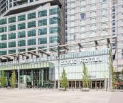
Civic Hotel Autograph Collection
EXECUTIVE PLAZA COQUITLAM
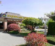
BEST WESTERN PLUS COQUITLAM
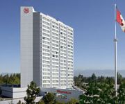
Sheraton Vancouver Guildford Hotel
RAMADA COQUITLAM
BW KING GEORGE INN AND SUITES
Eagle Mountain Bed and Breakfast
Towle Houses
INN AT THE QUAY
Arundel Mansion
Videos from this area
These are videos related to the place based on their proximity to this place.
Burnaby Home Invasion Death Carrigan Ct September 15 2014 Bcnewsvideo
Burnaby RCMP, Fire Department & EHS responded to a report of a home invasion, in this high-rise apartment building on Carrigan Ct. They found a dead male on the ground that was thrown from...
Burnaby Plumbers - (604) 837-2507 Plumbing Burnaby, BC
Get a FREE estimate from this Burnaby plumber for plumbing services in Burnaby, BC. Call (604) 837-2507 and mention this ad! As a residential and commercial plumbing, sewer and drain service,...
Burnaby Car Accident Hwy 1 West of North Rd January 17 2015
January 17 2015 Burnaby car accident on Hwy 1 West Bond, west of North Rd British, Columbia, Canada www.Bcnewsvideo.com.
2503-9888 Cameron St Burnaby BC
New 1 bedroom + den for rent in Sillouette in Burnaby BC. More information at http://www.cbmre.ca.
9835 Sullivan St., Burnaby, BC
Amazing Lot and Home! Location, great layout for family home, investor or developer. This meticulously maintained home has had the same owner for 26 years. Beautiful gardens, original hardwood...
New Westminster Pursuit
New Westminster Police chased a vehicle for unknown reasons today. The driver was reported to be driving up to 70 kph and into oncoming lanes at some times during the pursuit. A nearby RCMP...
Vancouver Skytrain Departing - New Westminster Station
A Mark II (2009 Edition) departing New Westminster Station, January 9, 2011.
New Westminster Car Accident Sherbrooke st & Richmond st January 17 2015
January 17 2015 New Westminster Vehicle accident two cars at sherbrooke st & Richmond st. Both vehicles had a stop sign, one of the driver claims the other driver didn't stop. British Columbia...
Videos provided by Youtube are under the copyright of their owners.
Attractions and noteworthy things
Distances are based on the centre of the city/town and sightseeing location. This list contains brief abstracts about monuments, holiday activities, national parcs, museums, organisations and more from the area as well as interesting facts about the region itself. Where available, you'll find the corresponding homepage. Otherwise the related wikipedia article.
John Deighton
John Deighton (November 1830 – May 29, 1875), generally known as "Gassy Jack", was a Canadian bar owner who was born in Hull, England. The Gastown neighbourhood of Vancouver, British Columbia is named after him. Deighton started out as a steamship operator for many years of his early life. However he was forced to pursue other lines of work once he developed health problems (swelling of the legs and feet). Between 1862 and 1867, he ran a bar in New Westminster, British Columbia.
Sapperton Station
Sapperton Station is located on an elevated portion of the Millennium Line, a part of Metro Vancouver's SkyTrain rapid transit system. The station itself is located in eastern New Westminster. The station will serve the major redevelopment of the nearby Labatt Brewery site.
Braid Station
Braid Station is an elevated station of the Millennium Line, a part of Metro Vancouver's SkyTrain rapid transit system. The station itself is located in eastern New Westminster, near the Coquitlam border.
Lougheed Town Centre Station
Lougheed Town Centre Station (sometimes abbreviated as Lougheed Station) is a station on the Millennium Line, part of the SkyTrain rapid transit system in Metro Vancouver, British Columbia.
Brunette River
The Brunette River runs through East Burnaby and Coquitlam, flowing out of Burnaby Lake and to the Fraser River.
Maillardville
Maillardville is a community on the south slope of the city of Coquitlam, British Columbia. In 1889, Frank Ross and James McLaren opened what would become Fraser Mills, a $350,000, then state-of-the-art lumber mill on the north bank of the Fraser River. By 1908, a mill town of 20 houses, a store, post office, hospital, office block, barber shop, and pool hall had grown around the mill. A mill manager's residence was built that later became Place des Arts.
Sapperton, New Westminster
Sapperton is a neighbourhood of the City of New Westminster, British Columbia, Canada, located in the northeastern end of that city and up to its boundaries with the City of Coquitlam and City of Burnaby.
Standing Stones of Lougheed
The Standing Stones of Lougheed are a group of five stones located beside the SkyTrain station at Lougheed Town Centre in Burnaby, which is near the city of Vancouver. This protected array of ancient boulders lies within Musqueam and Kwikwetlem territory, First Nations of the Coast Salish. It is currently surrounded by iron fencing in order to prevent vandalism and disturbance of the stones. Gravel has been added to prevent the growth of weeds and grass.


