Safety Score: 2,8 of 5.0 based on data from 9 authorites. Meaning we advice caution when travelling to Canada.
Travel warnings are updated daily. Source: Travel Warning Canada. Last Update: 2024-04-28 08:22:10
Delve into Middlegate
Middlegate in British Columbia is a city located in Canada about 2,193 mi (or 3,529 km) west of Ottawa, the country's capital town.
Current time in Middlegate is now 10:56 PM (Sunday). The local timezone is named America / Vancouver with an UTC offset of -7 hours. We know of 11 airports closer to Middlegate, of which 4 are larger airports. The closest airport in Canada is Vancouver Harbour Water Aerodrome in a distance of 9 mi (or 15 km), North-West. Besides the airports, there are other travel options available (check left side).
There is one Unesco world heritage site nearby. The closest heritage site is Olympic National Park in United states at a distance of 103 mi (or 166 km). Also, if you like playing golf, there are some options within driving distance. We saw 10 points of interest near this location. In need of a room? We compiled a list of available hotels close to the map centre further down the page.
Since you are here already, you might want to pay a visit to some of the following locations: Bellingham, Friday Harbor, Victoria, Chilliwack and Mount Vernon. To further explore this place, just scroll down and browse the available info.
Local weather forecast
Todays Local Weather Conditions & Forecast: 10°C / 50 °F
| Morning Temperature | 2°C / 36 °F |
| Evening Temperature | 10°C / 49 °F |
| Night Temperature | 4°C / 40 °F |
| Chance of rainfall | 2% |
| Air Humidity | 51% |
| Air Pressure | 1017 hPa |
| Wind Speed | Gentle Breeze with 6 km/h (4 mph) from North-East |
| Cloud Conditions | Broken clouds, covering 83% of sky |
| General Conditions | Light rain |
Monday, 29th of April 2024
9°C (49 °F)
5°C (41 °F)
Light rain, light breeze, overcast clouds.
Tuesday, 30th of April 2024
11°C (51 °F)
8°C (47 °F)
Light rain, light breeze, overcast clouds.
Wednesday, 1st of May 2024
9°C (47 °F)
5°C (41 °F)
Moderate rain, light breeze, overcast clouds.
Hotels and Places to Stay
EXECUTIVE PLAZA COQUITLAM
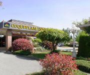
BEST WESTERN PLUS COQUITLAM
Delta Burnaby Hotel & Conference Center
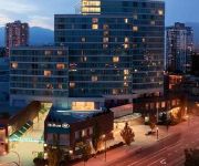
Hilton Vancouver Metrotown
Element Vancouver Metrotown
Towle Houses
CASSANDRA HOTEL
RAMADA COQUITLAM
ACCENT INN BURNABY
Arundel Mansion
Videos from this area
These are videos related to the place based on their proximity to this place.
South Burnaby Fighting Irish 1 Richmond All Blacks 0 (2014 BC Provincial B Cup Final)
Some highlights, including the winning goal and trophy presentation, from South Burnaby Fighting Irish's 1-0 win over Richmond All Blacks in the 2014 BC Provincial B Cup Final. (Burnaby Lake...
Watching Barnaby Village Museum Carousel in Vancouver
The restored 1912 C.W. Parker Carousel is located on the grounds of the Burnaby Village Museum & Carousel. This is one of the most well run carousels I've visited. They do a safety lesson...
Forest Hills & Lake City Industrial - Burnaby - Get To Know Real Estate
Directly south of Burnaby Mountain and Simon Fraser University are the Forest Hills and Lake City Industrial neighbourhoods. Lougheed Town Centre is a short drive away for shopping and dining,...
Riding Barnaby Village Museum Carousel in Vancouver
The restored 1912 C.W. Parker Carousel is located on the grounds of the Burnaby Village Museum & Carousel. This is one of the most well run carousels I've visited. They do a safety lesson...
Train Cars Derail In Burnaby - Coal Spills In Silver Creek
Jan 13, 2014 Burnaby, B.C. Canada. Two days after the train derailment, I went to see if there was any environmental impact from the coal that had entered into the creek when the train had...
Summer shower at Burnaby Lake
I got caught in a brief summer shower during my afternoon walk at Burnaby Lake Regional Park. I just zipped up my jacket and enjoyed the sounds of the rain and watched the birds.
A Village Blacksmith
One of the favourite stops in Burnaby Village - a chat with the blacksmith working at the forge. This segment airs on Shaw TV Vancouver.
Garbage and Recycling truck: City of New West
for pictures I took in newwest check out my lickr, http://www.flickr.com/photos/rempledisposal/page2/ The HD video I shot of the WXLL Topselect and the Mack LEU. Thanks to all the drivers.
New Labrie Automizer Mack Leu (In Action) City of New Westminster Part 2
SURPRISE ENDING **** Thanks once again to the very friendly driver ! As you guys noticed this is my first automated video(s) in action on youtube ! The Labrie Body was built a bit...
Videos provided by Youtube are under the copyright of their owners.
Attractions and noteworthy things
Distances are based on the centre of the city/town and sightseeing location. This list contains brief abstracts about monuments, holiday activities, national parcs, museums, organisations and more from the area as well as interesting facts about the region itself. Where available, you'll find the corresponding homepage. Otherwise the related wikipedia article.
Queensborough Bridge
For the bridge in New York City, see Ed Koch Queensboro Bridge Queensborough Bridge {{#invoke:InfoboxImage|InfoboxImage|image=Queensborough Bridge.
New Westminster Secondary School
New Westminster Secondary School is a high school in New Westminster, British Columbia, Canada. It is one of the largest high schools in BC. Students of grade 8 to 12 are enrolled. The school offers various advanced programs such as the International Baccalaureate program, Advanced Placement courses, and facilities such as the Automotive shop. The school mascot is a fireman and the spirit mascot is the Yak.
Edmonds Station
Edmonds Station is located on an at-grade portion of the Expo Line, a part of Vancouver, British Columbia's SkyTrain rapid transit system. It was built in 1985 as part of the original Expo Line.
22nd Street Station (TransLink)
22nd Street Station is located on an elevated portion of the SkyTrain rapid transit system serving Metro Vancouver, British Columbia. The station opened in 1985 as part of the original Expo Line, and is currently serving both Expo Line and Millennium Line trains.
Byrne Creek Secondary School
Byrne Creek Secondary is a public high school in Burnaby, British Columbia part of School District 41 Burnaby.
Burnaby Lake Regional Park
Burnaby Lake is a lake located in Burnaby, British Columbia and is the focal geographic feature and namesake of Burnaby Lake Regional Park. Occupying 3.11 square kilometres of land, and is home to a large variety of wildlife. At least 70 species of birds make the lake and surrounding areas their home, and about 214 species of birds visit the lake throughout the year. The park has been managed by the Metro Vancouver Parks Department since 1977.
Robert Burnaby Park
Robert Burnaby Park is a large (48 hectares) public park in East Burnaby, just south of Burnaby Lake, located off Edmonds and 4th Street. It has an extensive trail system, as well as tennis courts and a swimming pool in the cleared upper slope area. The north end of the park contains a Disc Golf Course, one of only a handful in the Vancouver area. It is a favourite picnic spot for many residents of Burnaby and New Westminster. An off-leash zone is in the northern part of the park.
Poplar Island (British Columbia)
Poplar Island is an uninhabited island located at the east end of the North Arm of the Fraser River in the City of New Westminster, British Columbia. It is the last large undiked island in the Fraser River's North Arm.


