Safety Score: 2,8 of 5.0 based on data from 9 authorites. Meaning we advice caution when travelling to Canada.
Travel warnings are updated daily. Source: Travel Warning Canada. Last Update: 2024-04-25 08:17:04
Delve into Ladner
Ladner in British Columbia with it's 200,000 habitants is a town located in Canada about 2,200 mi (or 3,541 km) west of Ottawa, the country's capital town.
Time in Ladner is now 12:42 PM (Thursday). The local timezone is named America / Vancouver with an UTC offset of -7 hours. We know of 10 airports closer to Ladner, of which 4 are larger airports. The closest airport in Canada is Boundary Bay Airport in a distance of 3 mi (or 5 km), East. Besides the airports, there are other travel options available (check left side).
There is one Unesco world heritage site nearby. The closest heritage site is Olympic National Park in United states at a distance of 96 mi (or 154 km). Also, if you like the game of golf, there are some options within driving distance. We saw 10 points of interest near this location. In need of a room? We compiled a list of available hotels close to the map centre further down the page.
Since you are here already, you might want to pay a visit to some of the following locations: Friday Harbor, Bellingham, Victoria, Coupeville and Mount Vernon. To further explore this place, just scroll down and browse the available info.
Local weather forecast
Todays Local Weather Conditions & Forecast: 9°C / 49 °F
| Morning Temperature | 9°C / 48 °F |
| Evening Temperature | 9°C / 49 °F |
| Night Temperature | 9°C / 49 °F |
| Chance of rainfall | 27% |
| Air Humidity | 92% |
| Air Pressure | 1008 hPa |
| Wind Speed | Moderate breeze with 11 km/h (7 mph) from West |
| Cloud Conditions | Overcast clouds, covering 100% of sky |
| General Conditions | Moderate rain |
Thursday, 25th of April 2024
11°C (52 °F)
11°C (52 °F)
Moderate rain, gentle breeze, overcast clouds.
Friday, 26th of April 2024
10°C (50 °F)
9°C (49 °F)
Moderate rain, moderate breeze, overcast clouds.
Saturday, 27th of April 2024
11°C (51 °F)
8°C (47 °F)
Light rain, fresh breeze, overcast clouds.
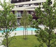
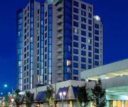
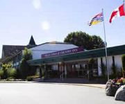
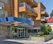
Hotels and Places to Stay
Executive Airport Plaza Richmo
Premiere Suites at Bayberry Park
Vancouver Airport Marriott Hotel
Sheraton Vancouver Airport Hotel
Hilton Vancouver Airport
DELTA TOWN AND COUNTR
RAMADA LIMITED VANCOUVER AIRPO
Benco's Residence Richmond
The Stone Hedge Bed and Breakfast
Holiday Inn Express & Suites RIVERPORT RICHMOND
Videos from this area
These are videos related to the place based on their proximity to this place.
Awesome Tsawwassen
Quick day sesh at t-town park near Vancouver, BC. Ben Clark, Scott Samuels, Lanny deBoer.
Go Kart at F440 in Tsawwassen
GoPro HD mounted onto my helmet. Unfortunately ran out of memory during our second race which was the most competitive.
Vancouver TransLink 2008 Orion V 05.501 Suburban R9280 (Tsawwassen)
Please note, this is part two of two. This is a video of R9280 seen on route 604 English Bluff. This video was a bit of an accident, because I didn't intend to stay on for this long! I was...
Potato Harvesting in Ladner BC Case MXM 140 & Grimme GZ 1700
Potato Harvesting in Ladner, BC., Canada from the rich delta lands of the Fraser River. A Case Maxxum 140 towing a Grimme GZ 1700 DLS potato harvester dropping the red potato into an International ...
Ladner Apartment Fire
Major fire around 9pm on July 30, in Ladner, British Columbia, on Evergreen Lane. Took out at least the second floor of the building.
4667 56A Street Ladner BC - Real Estate - The Flex Rate Group - RE/MAX City Realty
View http://www.thechanceyteam.com/558 to see PRICE and more PHOTOS. LOCATION! LOCATION! Spacious & solid family home with loads of potential. Located on a large lot on a very quiet street...
4768 45th Avenue Ladner - Real Estate Virtual Tour - The Flex Rate Group
View http://flexrategroup.com/officelistings.html/listing.v1060539-4768-45th-avenue-ladner-v4k-1j8.38491203/videos to see PRICE and more PHOTOS. Fantastic 2 level home in a fabulous location,...
Videos provided by Youtube are under the copyright of their owners.
Attractions and noteworthy things
Distances are based on the centre of the city/town and sightseeing location. This list contains brief abstracts about monuments, holiday activities, national parcs, museums, organisations and more from the area as well as interesting facts about the region itself. Where available, you'll find the corresponding homepage. Otherwise the related wikipedia article.
Ladner, British Columbia
Ladner was created as a fishing village on the banks of the Fraser River. It is a part of the Municipality of Delta, British Columbia, Canada, and a suburb of Vancouver. Named for Thomas and William Ladner, who came to the area in 1868 and began large farming and fishing operations, it developed as a centre for these operations. The ferry at Captain's Cove allowed for access across the river to Richmond, British Columbia. The George Massey Tunnel provided a permanent connection in 1959.
George Massey Tunnel
The George Massey Tunnel (often referred to simply as the Massey Tunnel) is a highway traffic tunnel in the Metro Vancouver region of southwestern British Columbia. It is located approximately 20 km (12 mi) south of the city centre of Vancouver, British Columbia, and approximately 30 km (20 mi) north of the Canada-U.S. Border at Blaine, Washington.
Deas Island
Deas Island is an island in the south arm of the Fraser River between Delta, British Columbia and Richmond, British Columbia, Canada. The island is home to a regional park approximately 300 acres in size. It is home to three historic buildings; Burrvilla, a stately Victorian home, Inverholme, a one-room schoolhouse, and the Delta Agricultural Hall. The island is also home to many types of birds and is a popular bird watching destination.
Delta Secondary School (Delta, British Columbia)
Delta Secondary is a public high school in Ladner, British Columbia, Canada. DSS is a comprehensive and caring school, located in the historic village of Ladner, B.C. With a student enrollment of approximately 1550 students (grades 8 to 12), it is the largest school in School District 37 Delta.
Finn Slough
Finn Slough is a tiny Fraser River fishing community located at the south end of No. 4 Road in Richmond, British Columbia, Canada. The community has approximately 30 residents who live in wooden houses, both floating and built on stilts, along the marshy river bank. Many of the buildings were built between the late 19th century and 1950s and many have decayed severely, while some have been carefully restored. Finn Slough was founded by Finnish settlers who came to Richmond in the 1880s.
Kirkland Island
Kirkland Island, also known as Rose-Kirkland Island, is located within the municipality of Richmond, British Columbia and is part of a small alluvial archipelago known as the South Arm Marshes located within the Ladner Reach of the South Arm of the Fraser River in British Columbia, Canada. It is the northernmost island of the group and lies between Richmond on Lulu Island in the north and Delta and Ladner town centre in the south.


