Safety Score: 2,8 of 5.0 based on data from 9 authorites. Meaning we advice caution when travelling to Canada.
Travel warnings are updated daily. Source: Travel Warning Canada. Last Update: 2024-04-28 08:22:10
Touring Killarney
Killarney in British Columbia is a town located in Canada about 2,196 mi (or 3,534 km) west of Ottawa, the country's capital place.
Time in Killarney is now 07:40 PM (Sunday). The local timezone is named America / Vancouver with an UTC offset of -7 hours. We know of 10 airports nearby Killarney, of which 4 are larger airports. The closest airport in Canada is Vancouver Harbour Water Aerodrome in a distance of 6 mi (or 10 km), North-West. Besides the airports, there are other travel options available (check left side).
There is one Unesco world heritage site nearby. The closest heritage site is Olympic National Park in United states at a distance of 104 mi (or 167 km). Also, if you like the game of golf, there are several options within driving distance. We collected 10 points of interest near this location. Need some hints on where to stay? We compiled a list of available hotels close to the map centre further down the page.
Being here already, you might want to pay a visit to some of the following locations: Friday Harbor, Bellingham, Victoria, Coupeville and Mount Vernon. To further explore this place, just scroll down and browse the available info.
Local weather forecast
Todays Local Weather Conditions & Forecast: 9°C / 48 °F
| Morning Temperature | 4°C / 40 °F |
| Evening Temperature | 10°C / 49 °F |
| Night Temperature | 7°C / 44 °F |
| Chance of rainfall | 3% |
| Air Humidity | 56% |
| Air Pressure | 1017 hPa |
| Wind Speed | Gentle Breeze with 6 km/h (4 mph) from East |
| Cloud Conditions | Scattered clouds, covering 40% of sky |
| General Conditions | Light rain |
Monday, 29th of April 2024
9°C (49 °F)
7°C (44 °F)
Light rain, gentle breeze, overcast clouds.
Tuesday, 30th of April 2024
11°C (51 °F)
9°C (49 °F)
Light rain, gentle breeze, overcast clouds.
Wednesday, 1st of May 2024
9°C (48 °F)
7°C (45 °F)
Moderate rain, gentle breeze, overcast clouds.
Hotels and Places to Stay
Delta Burnaby Hotel & Conference Center
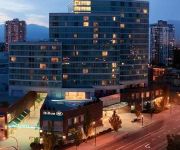
Hilton Vancouver Metrotown
Element Vancouver Metrotown
Holiday Inn VANCOUVER AIRPORT- RICHMOND
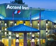
Accent Inn Vancouver Airport Hotel
Commercial Drive Accommodations
CASSANDRA HOTEL
Accent Inn Vancouver Airport
Best Western Plus Uptown
ACCENT INN BURNABY
Videos from this area
These are videos related to the place based on their proximity to this place.
Vancouver Marijuana Vending Machine
Marijuana vending machine located at BC Pain Society, 2908 Commercial Drive Vancouver BC, featuring Purple Kush, Bubba Kush, sativa and indica strains of medical marijuana, we carry Phoenix...
Road Rage caught on Dash Cam
Road Rage instant Karma in Vancouver, BC This Video is represented by Break.com -For any licensing requests please contact licensing@break.com.
Urban Coyote In Vancouver
I investigated a possible coyote sighting in the neighborhood near Elliot and 54th when I saw this coyote wandering around. It's not common to see coyotes at this time of day so I checked...
Crows in Burnaby
This is where all of the crows from Metro Vancouver (the greater Vancouver area, including surrounding cities) go every evening at dusk. The location is in Burnaby, on Still Creek, just north...
Rain City Recorders
Produced by First-Year Television & Video Production Students for Rain City Recorders.
Watching Barnaby Village Museum Carousel in Vancouver
The restored 1912 C.W. Parker Carousel is located on the grounds of the Burnaby Village Museum & Carousel. This is one of the most well run carousels I've visited. They do a safety lesson...
Riding Barnaby Village Museum Carousel in Vancouver
The restored 1912 C.W. Parker Carousel is located on the grounds of the Burnaby Village Museum & Carousel. This is one of the most well run carousels I've visited. They do a safety lesson...
BURNABY CAR CRASH ROLL OVER RESCUE LOUGHEED HWY & GILMORE AVE MAY 21 2011.mov
BURNABY CAR CRASH ROLL OVER RESCUE LOUGHEED HWY & GILMORE AVE MAY 21 2011 BY BCNEWSVIDEO BRITISH COLUMBIA CANADA.
Videos provided by Youtube are under the copyright of their owners.
Attractions and noteworthy things
Distances are based on the centre of the city/town and sightseeing location. This list contains brief abstracts about monuments, holiday activities, national parcs, museums, organisations and more from the area as well as interesting facts about the region itself. Where available, you'll find the corresponding homepage. Otherwise the related wikipedia article.
Patterson Station
The Patterson Station of the SkyTrain system is an elevated station located on the Expo Line in Burnaby, British Columbia, Canada. It is the westernmost Expo Line station in Burnaby.
Joyce–Collingwood Station
Joyce–Collingwood Station (formerly Joyce Station) is located on an elevated portion of the Expo Line, a part of Metro Vancouver's SkyTrain rapid transit system. The station is on Joyce Street at Vanness Avenue, in the area of Vancouver known as Collingwood. It is the sixth busiest station on Expo Line.
Swangard Stadium
Swangard Stadium is a multi-purpose stadium in Central Park in Burnaby, British Columbia. Primarily used for soccer, football, and athletics, the stadium also used to be home to the Simon Fraser Clan football team and the Vancouver Whitecaps of the NASL. It opened on April 26, 1969, and has a capacity of 5,288.
Killarney Secondary School
Killarney Secondary School is a public secondary school in Vancouver, British Columbia, Canada. The school is named for the area in which it resides. It is the largest public secondary school in the city by area.
Sir William Osler Elementary School
Sir William Osler Elementary is a public elementary school in Vancouver, British Columbia, part of School District 39 Vancouver.
Central Park (Burnaby)
Central Park is a 90-hectare (222 acre) urban park in Burnaby, British Columbia, founded in 1891. The park is located on the Vancouver-Burnaby border, just west of the Metropolis at Metrotown shopping complex, and is bounded by Boundary Road on the west, Kingsway on the north, Patterson and Willingdon Avenues on the east, and Imperial Road on the south. The nearest SkyTrain station, Patterson Station, named for Burnaby pioneer Dugald Campbell Patterson, is at the park's northeast corner.
Burnaby Public Library
Burnaby Public Library or BPL is a public library that serves Burnaby, British Columbia and the surrounding Lower Mainland. It allows users to borrow books, videos, DVDs and magazines.
CJVB
CJVB is a radio station in Vancouver, British Columbia, Canada which broadcasts multilingual programming at AM 1470. Owned by the Fairchild Group, the station broadcasts on 1470 kHz at a power of 50,000 watts, using two different directional patterns for daytime and nighttime operation. Transmissions originate from its Richmond, BC transmitter site. Operation began as a 10,000 watt station at the same transmitter site in 1972, with the power increase to 50 kW in 1980.


