Safety Score: 2,8 of 5.0 based on data from 9 authorites. Meaning we advice caution when travelling to Canada.
Travel warnings are updated daily. Source: Travel Warning Canada. Last Update: 2024-04-28 08:22:10
Touring Hastings-Sunrise
Hastings-Sunrise in British Columbia is a town located in Canada about 2,195 mi (or 3,533 km) west of Ottawa, the country's capital place.
Time in Hastings-Sunrise is now 07:03 PM (Sunday). The local timezone is named America / Vancouver with an UTC offset of -7 hours. We know of 11 airports nearby Hastings-Sunrise, of which 4 are larger airports. The closest airport in Canada is Vancouver Harbour Water Aerodrome in a distance of 4 mi (or 6 km), West. Besides the airports, there are other travel options available (check left side).
There is one Unesco world heritage site nearby. The closest heritage site is Olympic National Park in United states at a distance of 108 mi (or 174 km). Also, if you like the game of golf, there are several options within driving distance. We collected 10 points of interest near this location. Need some hints on where to stay? We compiled a list of available hotels close to the map centre further down the page.
Being here already, you might want to pay a visit to some of the following locations: Friday Harbor, Bellingham, Victoria, Chilliwack and Mount Vernon. To further explore this place, just scroll down and browse the available info.
Local weather forecast
Todays Local Weather Conditions & Forecast: 9°C / 48 °F
| Morning Temperature | 4°C / 38 °F |
| Evening Temperature | 9°C / 48 °F |
| Night Temperature | 4°C / 40 °F |
| Chance of rainfall | 4% |
| Air Humidity | 58% |
| Air Pressure | 1017 hPa |
| Wind Speed | Light breeze with 5 km/h (3 mph) from North-East |
| Cloud Conditions | Broken clouds, covering 69% of sky |
| General Conditions | Light rain |
Monday, 29th of April 2024
9°C (49 °F)
6°C (42 °F)
Light rain, light breeze, overcast clouds.
Tuesday, 30th of April 2024
11°C (51 °F)
8°C (47 °F)
Light rain, gentle breeze, overcast clouds.
Wednesday, 1st of May 2024
8°C (47 °F)
6°C (42 °F)
Moderate rain, light breeze, overcast clouds.
Hotels and Places to Stay
Crystal's View Bed & Breakfast
Holiday Inn & Suites NORTH VANCOUVER
Delta Burnaby Hotel & Conference Center
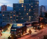
Hilton Vancouver Metrotown
Ocean Breeze B&B
Element Vancouver Metrotown
Best Western Plus Uptown
Commercial Drive Accommodations
DAYS INN VANCOUVER METRO
CASSANDRA HOTEL
Videos from this area
These are videos related to the place based on their proximity to this place.
Vancouver Marijuana Vending Machine
Marijuana vending machine located at BC Pain Society, 2908 Commercial Drive Vancouver BC, featuring Purple Kush, Bubba Kush, sativa and indica strains of medical marijuana, we carry Phoenix...
Crows in Burnaby
This is where all of the crows from Metro Vancouver (the greater Vancouver area, including surrounding cities) go every evening at dusk. The location is in Burnaby, on Still Creek, just north...
Track Cycling Training - Burnaby Velodrome
Burnaby Cycling Club .Here's a nice bike-cam that gives some idea of what it's like to motor pace at 45 km/h on a 200-meter indoor velodrome. This was a 10-minute session where we were free...
Rain City Recorders
Produced by First-Year Television & Video Production Students for Rain City Recorders.
BURNABY CAR CRASH ROLL OVER RESCUE LOUGHEED HWY & GILMORE AVE MAY 21 2011.mov
BURNABY CAR CRASH ROLL OVER RESCUE LOUGHEED HWY & GILMORE AVE MAY 21 2011 BY BCNEWSVIDEO BRITISH COLUMBIA CANADA.
4714 Cedarglen Place, Burnaby
If you are looking for a home that is central to many amenities, and a neighbourhood that is fit for raising a family, this charming 3 bedroom, 1722 square foot townhouse in Greentree Village...
Burnaby Moving Company : Local Movers Get A Moving Quote
Burnaby Moving Company: Local Movers has the lowest rates in moving services. Burnaby Movers has complete sets of moving materials and machines with quick, strong, and courteous movers.
Morrey Nissan Burnaby Remarkable Five Star Review by Anthony W.
http://www.morreynissanburnaby.com (604) 291-7261 Morrey Nissan Burnaby reviews Excellent Rating ***** Thank you for the great and quick service with regards to my new purchase...
Videos provided by Youtube are under the copyright of their owners.
Attractions and noteworthy things
Distances are based on the centre of the city/town and sightseeing location. This list contains brief abstracts about monuments, holiday activities, national parcs, museums, organisations and more from the area as well as interesting facts about the region itself. Where available, you'll find the corresponding homepage. Otherwise the related wikipedia article.
Pacific Coliseum
Pacific Coliseum is an indoor arena, at Hastings Park, in Vancouver, British Columbia. Its main use has been for ice hockey and the arena has been the home for several ice hockey teams. The arena is currently the home of the Vancouver Giants of the Western Hockey League (WHL). Other hockey tenants of the Pacific Coliseum have been the Vancouver Canucks (WHL), from 1968-1970, Vancouver Canucks, from 1970–1995, the Vancouver Blazers, from 1973–1975 and the Vancouver Voodoo, from 1994–1995.
Empire Stadium (Vancouver)
For the later temporary home of Vancouver Whitecaps FC and the British Columbia Lions, see Empire Field. Empire Stadium was a multipurpose stadium that formerly stood at the Pacific National Exhibition site at Hastings Park in Vancouver. Track and field and Canadian football, as well as soccer and musical events, were held in the stadium. The stadium was originally constructed for the 1954 British Empire and Commonwealth Games.
Playland (Vancouver)
Playland is an amusement park in Vancouver, British Columbia, Canada. It is located in Hastings Park and is the oldest amusement park in Canada. Every year the park will replace one or two rides with new ones and the attendance of the park is always near capacity during the annual fair. For the 2009 season, the Demons Of The Dark and House Of The Dead haunted houses were replaced with the Haunted Mansion and the arcade was replaced with Command Headquarters (CHQ).
Cassiar Tunnel
The Cassiar Connector is a highway traffic tunnel on the Trans-Canada Highway. It is located in the north-east corner of Vancouver, British Columbia, near the Vancouver-Burnaby border. Travelling northward, the tunnel begins underneath Adanac Street, passing under the interchange between East Hastings Street and the Highway 1 offramps.
PNE Agrodome
PNE Agrodome is a sports arena located in Vancouver, British Columbia. It was built in 1963 and holds 5,000 people or 3,260 when configured to use the hockey or lacrosse surface. It annually hosted the provincial high school boys' 'AAA' basketball championships until 2010. The tournament moved to the Langley Events Centre in 2011. It was host to the Vancouver Voodoo roller hockey franchise from 1993 to 1994.
Corkscrew (Playland)
Corkscrew is a steel roller coaster located at Playland At the PNE amusement park in Vancouver, British Columbia, Canada. It is famous for its appearance in the 2006 motion picture Final Destination 3 (known in the movie as Devil's Flight), as well as the popular television series Smallville (season three's "Magnetic"). The bonus disc of the FD3 DVD set includes behind the scenes footage shot on and around the coaster, documenting the challenges involved in shooting the complex scenes.
Kootenay Loop
Kootenay Loop is a major public transit exchange in Vancouver, British Columbia. It services routes going to East Vancouver, Downtown Vancouver, Burnaby, North Vancouver and the Tri-Cities. It is also the eastern-most major exchange in the city of Vancouver.
Vancouver Forum
The Forum (also known as the Exhibition Forum, Vancouver Forum and PNE Forum) is an indoor arena in Vancouver, British Columbia, Canada located on the grounds of the Pacific National Exhibition.
Hastings Racecourse
Hastings Racecourse is a horse racing facility at Hastings Park four miles from downtown Vancouver, British Columbia, Canada. Originally called East Park, it opened for business in 1889, making it Vancouver’s longest continuously used professional sports facility. The racing operation is currently a wholly owned subsidiary of Great Canadian Gaming Corporation who acquired the lease of the city-owned track in 2004.
E-Comm
E-Comm 9-1-1 is a multi-municipality agency that provides emergency communications operations for the region of southwest British Columbia. The company coordinates 9-1-1 service for police, fire, and ambulance service, providing call-taking and dispatch services for multiple agencies in the Lower Mainland area.
Empire Field
Empire Field was a temporary outdoor football and soccer stadium built at the former location of Empire Stadium at Hastings Park in Vancouver, British Columbia. It served as the home of the BC Lions of the Canadian Football League from the summer of 2010 until the fall of 2011, when the installation of the retractable roof at BC Place was completed. It also was the home of the Vancouver Whitecaps FC of Major League Soccer from the start of the 2011 MLS season until the fall of the same year.
Callister Park
Con Jones Park was a sports facility located in East Vancouver mainly used for soccer. It opened in 1921, and was renamed Callister Park in 1942. After the demolition of the stadium in 1971, the area was redeveloped into a green space and retained the name Callister Park.


