Safety Score: 2,8 of 5.0 based on data from 9 authorites. Meaning we advice caution when travelling to Canada.
Travel warnings are updated daily. Source: Travel Warning Canada. Last Update: 2024-04-28 08:22:10
Delve into Strathcona
Strathcona in British Columbia is located in Canada about 2,198 mi (or 3,537 km) west of Ottawa, the country's capital town.
Current time in Strathcona is now 08:09 PM (Sunday). The local timezone is named America / Vancouver with an UTC offset of -7 hours. We know of 10 airports close to Strathcona, of which 4 are larger airports. The closest airport in Canada is Vancouver Harbour Water Aerodrome in a distance of 1 mi (or 2 km), North-West. Besides the airports, there are other travel options available (check left side).
There is one Unesco world heritage site nearby. The closest heritage site is Olympic National Park in United states at a distance of 109 mi (or 175 km). Also, if you like playing golf, there are some options within driving distance. We encountered 10 points of interest near this location. If you need a hotel, we compiled a list of available hotels close to the map centre further down the page.
While being here, you might want to pay a visit to some of the following locations: Friday Harbor, Bellingham, Victoria, Coupeville and Chilliwack. To further explore this place, just scroll down and browse the available info.
Local weather forecast
Todays Local Weather Conditions & Forecast: 9°C / 48 °F
| Morning Temperature | 4°C / 38 °F |
| Evening Temperature | 9°C / 48 °F |
| Night Temperature | 4°C / 40 °F |
| Chance of rainfall | 4% |
| Air Humidity | 58% |
| Air Pressure | 1017 hPa |
| Wind Speed | Light breeze with 5 km/h (3 mph) from North-East |
| Cloud Conditions | Broken clouds, covering 69% of sky |
| General Conditions | Light rain |
Monday, 29th of April 2024
9°C (49 °F)
6°C (42 °F)
Light rain, light breeze, overcast clouds.
Tuesday, 30th of April 2024
11°C (51 °F)
8°C (47 °F)
Light rain, gentle breeze, overcast clouds.
Wednesday, 1st of May 2024
8°C (47 °F)
6°C (42 °F)
Moderate rain, light breeze, overcast clouds.
Hotels and Places to Stay
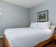
Premiere Suites at Firenze
GEORGIAN COURT HOTEL
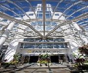
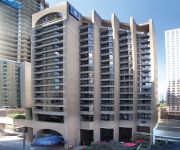
PAN PACIFIC VANCOUVER
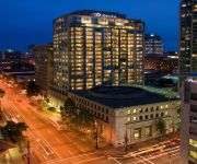
Delta Vancouver Suites
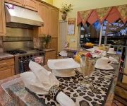
Ocean Breeze B&B
Metropolitan Hotel Vancouver
Rosedale on Robson Suite Hotel
Commercial Drive Accommodations
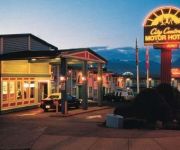
CITY CENTRE MOTOR HOTEL
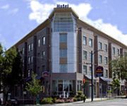
Best Western Plus Uptown
Videos from this area
These are videos related to the place based on their proximity to this place.
To Build a Better City - a 1964 City of Vancouver/CMHC film
There was a time when old poor neighbourhoods were considered an urban blight and needed to be razed to make way for modern concrete towers. This is from 50 years ago, but the very ideology...
Vancouver Police Possible Suspicious Package Responding and on Scene
This is a joint account managed by CDP Canada and British Columbia Emergency Photography. Please keep any comments clean and respectful. Follow us on Flickr; ...
Year In Review 2013 - Vancouver Film School (VFS)
2013 was a remarkable year for the VFS community. Join us in celebrating these incredible achievements at http://blog.vfs.com/2014/01/30/2013-a-year-in-review/ Find out how you can make your...
Vancouver Marijuana Vending Machine
Marijuana vending machine located at BC Pain Society, 2908 Commercial Drive Vancouver BC, featuring Purple Kush, Bubba Kush, sativa and indica strains of medical marijuana, we carry Phoenix...
PORT 2050: Port Metro Vancouver's anticipated future
In 2010, Port Metro Vancouver embarked on a strategic visioning process called Port 2050. The results of the process, including four scenarios telling alternative stories of our future, are...
Seattle-to-Vancouver BC Greyhound bus-ride (Video 2 of 2: Canadian side) 2011-02-25
Greyhound bus leaves the Pacific Highway border inspection station to proceed north along highway 15 to the Trans-Canda Highway, then west for a quick stop at the Conquitlam Greyhound depot...
Vancouver Personal Injury Lawyer Tim Louis | (604) 732-7678
http://bc.timlouislaw.com/ - Vancouver Personal Injury Lawyer Tim Louis & Company Law Increase the value of your personal injury case by keeping a symptom diary. Regardless of how you were...
Vancouver, British Columbia - Canada Line HD (2014)
Canada Line is a fully automated rapid transit line in the Metro Vancouver region of British Columbia, Canada. Opened in August 2009, it is the third line in TransLink's SkyTrain metro network,...
Tour of Revolver Coffee Bar in Vancouver BC
The team and I went up to Vancouver Canada for the Canadian Barista Championships. It was my first time checking out coffee shops in Vancouver and we found some awesome spots including Kafka,.
YWCA Hotel Vancouver - worth checking into.
The newly refurbished YWCA Hotel Vancouver offers a warm welcome to all travelers, and is a comfortable, safe and affordable place to stay in downtown Vancouver. All rooms are private and...
Videos provided by Youtube are under the copyright of their owners.
Attractions and noteworthy things
Distances are based on the centre of the city/town and sightseeing location. This list contains brief abstracts about monuments, holiday activities, national parcs, museums, organisations and more from the area as well as interesting facts about the region itself. Where available, you'll find the corresponding homepage. Otherwise the related wikipedia article.
Japantown, Vancouver
Japantown, Little Yokohama, or Little Tokyo is an old neighbourhood in Vancouver, British Columbia, Canada, north of Chinatown, that once had a concentration of Japanese immigrants. It was attacked on 7 September 1907 by the Asiatic Exclusion League, which smashed many windows in parts of Chinatown, and then moved on to Japantown. Japantown received warning of the attacks, and though residents resisted the Asiatic Exclusion League members, considerable damage was done.
Pacific Central Station
Pacific Central Station in Vancouver, British Columbia, Canada is a railway station which acts as the western terminus of Via Rail's cross-country The Canadian to Toronto and the northern terminus of Amtrak’s Cascades to Seattle. Pacific Central Station is adjacent to the Vancouver SkyTrain Main Street – Science World Station. Westbound trains go into downtown near hotels, businesses and other attractions.
Spartacus Books
Since 1973, Spartacus Books is a non-profit, volunteer and collectively run bookstore and resource centre in Vancouver, British Columbia, Canada and only one of its kind in the city. Located right on the edge of Vancouver's Eastside, Spartacus sells new and used books, zines, comics, magazines, CDs, videos, T-shirts, patches, pins, posters and cards. Spartacus books is one of the longest running collectively run bookstores in North America.
Port of Vancouver (1964-2008)
The Port of Vancouver was the name of the largest port in Canada, the largest in the Pacific Northwest, and the largest port on the West Coast of North America by metric tons of total cargo, with 76.5 million metric tons. The port amalgamated with the Fraser River Port Authority and the North Fraser Port Authority in 2008 to form Port Metro Vancouver. Vancouver is the 50th largest port in the world.
Grandview–Woodland
Grandview-Woodland, also commonly known as Grandview-Woodlands, is a neighbourhood in Vancouver, British Columbia, Canada to the east of the downtown area, stretching south from the shores of Burrard Inlet and encompassing portions of the popular Commercial Drive area. It is a mature neighbourhood in Vancouver that is a vibrant mixture of commercial, industrial, single-family and multi-family residential with a rich ethnic history and features.
Britannia Secondary School
Britannia Community Secondary School is a public community secondary school located in the Grandview–Woodland neighbourhood on the east-side of Vancouver, British Columbia. The school educates its students using a district-wide block schedule program that alternates four blocks every two days. Students are subject to eight different blocks in total. As of 2010, enrolment was 748 with 25.4% of their students having special needs.
Oppenheimer Park (Vancouver)
Oppenheimer Park is located in the Downtown Eastside of Vancouver, British Columbia, Canada. Opened in 1902 as the Powell Street Grounds by Vancouver's second mayor, David Oppenheimer; it was later renamed in honour of the mayor. The park is bounded by Jackson Street, Dunlevy Street, Powell Street, and East Cordova.
Carnegie Community Centre
Carnegie Community Centre is located at 401 Main Street at the corner of Hastings Street, in the old Carnegie Public Library building in the Downtown Eastside of Vancouver, British Columbia. In 1901 Vancouver requested $50,000 from industrialist and philanthropist Andrew Carnegie for the purpose of building a library. Carnegie agreed, provided the City of Vancouver supplied the site and contributed $5000 a year. The original public library was completed in 1903.
Hastings Mill
Hastings Mill was a sawmill on the south shore of Burrard Inlet and was the first commercial operation around which the settlement that would become Vancouver developed in British Columbia, Canada. In 1867, Captain Edward Stamp began producing lumber in Stamp's Mill at the foot of what is now Dunlevy Avenue after a planned site at Brockton Point proved unsuitable due to difficult currents and a shoal.
Vancouver Police Museum
The Vancouver Police Museum (formerly Vancouver Police Centennial Museum) opened to commemorate the centennial of the Vancouver Police Department and the City of Vancouver, British Columbia in 1986. Located at 240 E. Cordova Street in Vancouver's Gastown, the museum is housed in a building that was once both the Coroner’s Court and autopsy facilities (until 1980) and the City Analyst’s laboratory (until 1996).
Frances Street Squats
A set of six squatted houses, including one women-only squat, that existed between February and November 27, 1990 in Vancouver on Coast Salish Territory in one of the most successful public squats in Canada.
Rocky Mountaineer Station
Rocky Mountaineer Station in Vancouver, British Columbia, Canada is a railway station which acts as the western terminus of the Rocky Mountaineer train service to Jasper, Banff and Calgary. Prior to 2005, the Vancouver terminus for the Rocky Mountaineer was the Pacific Central Station. The station was originally built for Canadian National Railway as a locomotive repair shed.


