Safety Score: 2,8 of 5.0 based on data from 9 authorites. Meaning we advice caution when travelling to Canada.
Travel warnings are updated daily. Source: Travel Warning Canada. Last Update: 2024-04-28 08:22:10
Discover Norgate
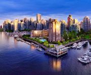
Norgate in British Columbia is a town in Canada about 2,199 mi (or 3,538 km) west of Ottawa, the country's capital city.
Current time in Norgate is now 02:49 PM (Sunday). The local timezone is named America / Vancouver with an UTC offset of -7 hours. We know of 10 airports near Norgate, of which 4 are larger airports. The closest airport in Canada is Vancouver Harbour Water Aerodrome in a distance of 2 mi (or 3 km), South. Besides the airports, there are other travel options available (check left side).
There is one Unesco world heritage site nearby. The closest heritage site is Olympic National Park in United states at a distance of 111 mi (or 179 km). Also, if you like playing golf, there are a few options in driving distance. We discovered 10 points of interest in the vicinity of this place. Looking for a place to stay? we compiled a list of available hotels close to the map centre further down the page.
When in this area, you might want to pay a visit to some of the following locations: Friday Harbor, Bellingham, Victoria, Chilliwack and Coupeville. To further explore this place, just scroll down and browse the available info.
Local weather forecast
Todays Local Weather Conditions & Forecast: 10°C / 50 °F
| Morning Temperature | 7°C / 45 °F |
| Evening Temperature | 9°C / 48 °F |
| Night Temperature | 6°C / 42 °F |
| Chance of rainfall | 12% |
| Air Humidity | 71% |
| Air Pressure | 1016 hPa |
| Wind Speed | Light breeze with 5 km/h (3 mph) from North-East |
| Cloud Conditions | Overcast clouds, covering 100% of sky |
| General Conditions | Moderate rain |
Sunday, 28th of April 2024
9°C (48 °F)
4°C (40 °F)
Light rain, light breeze, broken clouds.
Monday, 29th of April 2024
9°C (49 °F)
6°C (42 °F)
Light rain, light breeze, overcast clouds.
Tuesday, 30th of April 2024
11°C (51 °F)
8°C (47 °F)
Light rain, gentle breeze, overcast clouds.
Hotels and Places to Stay
Fairmont Pacific Rim
Shangri-La
Fairmont Waterfront
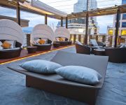
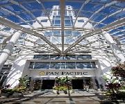
PAN PACIFIC VANCOUVER
Vancouver The Westin Bayshore
ThistleDown House
Pinnacle Hotel Vancouver
Vancouver Marriott Pinnacle Downtown Hotel
Loden Boutique Hotel Vancouver
Dunowen Properties
Videos from this area
These are videos related to the place based on their proximity to this place.
Airsoft in North Vancouver
This is a small video of a bit of an airsoft game in North Vancouver, B.C. on June the 18th, 2007 with the Op-For Club.
2705 Edgemont Blvd North Vancouver BC - Real Estate Virtual Tour - Judy Anderson
View http://www.seevirtual360.com/29174 to see PRICE and more PHOTOS. A very special location on Edgemont Blvd. This well maintained, solid 3 or 4 bedroom home on a flat West facing sunny...
#301 3393 Capilano Cr North Vancouver BC - Real Estate Virtual Tour - Simi Soltani
View http://idx.myrealpage.com/wps/mylistings/593/videos-43895163 to see PRICE and more PHOTOS. Completely renovated luxury corner penthouse with open plan ,great craftsmanship,top of the...
Edgemont Village Show and Shine 2010
The first annual Edgemont Village show and shine was a total success. There were cars everywhere, merchants smiling with increase in foot traffic , and the great weather. Who could have asked...
Klahowya Village in Stanley Park is Open!
The Klahowya Village in Stanley Park is an authentic Aboriginal cultural tourism experience running until September 6th in the heart of Vancouver's Stanley Park. The attraction features the...
VANCOUVER CITY HD VIDEO SEP 11 2010 BRITISH COLUMBIA CANADA SONY HDR CX550V REVIEW TEST
VANCOUVER CITY HD VIDEO SEP 11 2010 BRITISH COLUMBIA CANADA SONY HDR CX550V REVIEW TEST.
VANCOUVER CITY HD VIDEO SEP 11 2010 BRITISH COLUMBIA CANADA SONY HDR CX550V REVIEW TEST
VANCOUVER CITY HD VIDEO SEP 11 2010 BRITISH COLUMBIA CANADA SONY HDR CX550V REVIEW TEST.
Whistler Mountaineer Train.wmv
One of the SLOWEST Trains in the World is a wonderful sightseeing experience! The journey from Vancouver to Mount Whistler takes about 3 hours, but it's well worth the trip!
Canyon Lights Teaser 2014
Be dazzled by hundreds of thousands of lights glittering throughout the rainforest, across the Suspension Bridge, Treetops Adventure and CLIFFWALK. A children's scavenger hunt, gingerbread...
Videos provided by Youtube are under the copyright of their owners.
Attractions and noteworthy things
Distances are based on the centre of the city/town and sightseeing location. This list contains brief abstracts about monuments, holiday activities, national parcs, museums, organisations and more from the area as well as interesting facts about the region itself. Where available, you'll find the corresponding homepage. Otherwise the related wikipedia article.
Vancouver Aquarium
The Vancouver Aquarium (officially the Vancouver Aquarium Marine Science Centre) is a public aquarium located in Stanley Park in Vancouver, British Columbia, Canada. In addition to being a major tourist attraction for Vancouver, the aquarium is a centre for marine research, conservation and marine animal rehabilitation. The Vancouver Aquarium was one of the first facilities to incorporate professional naturalists into the galleries to interpret animal behaviours.
Capilano River
The Capilano River flows from north to south through the Coast Mountains on Vancouver's North Shore and empties into Burrard Inlet, opposite Stanley Park. The river is one of three primary sources of drinking water for residents of Greater Vancouver. The Cleveland Dam, built in 1954, impounds a reservoir for this purpose. The entire reservoir and watershed area upstream of the dam is closed to the public to ensure the quality of the drinking water.
Brockton Point
Brockton Point is located in Vancouver harbour at the east end of Stanley Park. It is named after Francis Brockton. Brockton Point Lighthouse, an automated light, is located at the point. Its cricket ground was visited by Don Bradman in 1932, who called it the most beautiful cricket ground in the world. Geoffrey Boycott also visited in September 1964 and agreed with Bradman's view.
Capilano Mall
Capilano Mall is a shopping mall in the City of North Vancouver in British Columbia, Canada. It is located on Marine Drive, near the city's western border with the District of North Vancouver. It is one of two major shopping structures in the city, the other one being Lonsdale Quay. Capilano Mall is the second largest shopping centre on the North Shore, after Park Royal Shopping Centre in West Vancouver.
X̱wemelch'stn
Xwemelch'stn, usually anglicized as Homulchesan, is a large community within the Squamish Nation of the Sḵwxwú7mesh people, who are a part of the Coast Salish ethnic and linguistic group. The name Xwemelch'stn, translates to "Fast Moving Water of Fish", relating to the Capilano River. The village is one of the oldest and major villages of the Sḵwxwú7mesh and continues to be so, being the Squamish Nation's most populated reserve.
X̱wáýx̱way
Xwáýxway (Xway' xway, Why-why, Qoiquoi,Qwhy-qwhy, Whoiwhoi) is a village site of the Indigenous Sḵwxwú7mesh (Squamish), located near what is now known as Stanley Park in British Columbia, Canada. The location is on the eastern peninsula of the park, at the location now the site of Lumberman's Arch. The village site was home for many Sḵwxwú7mesh, but after more colonization began in the Vancouver area, the inhabitants were forced to re-locate to nearby villages.
North Vancouver railway station
North Vancouver railway station in North Vancouver, British Columbia, Canada is a railway station which is used by the Rocky Mountaineer train service. The station is used on the Whistler Sea-to-Sky Climb route that links Whistler to North Vancouver. Service is daily (except Tuesday and Wednesdays) during summer months and more in frequent during winter months.
Maple Leaf Publishing
Maple Leaf Publishing was a World War II-era Canadian comic book publisher.
Girl in a Wetsuit
Girl in a Wetsuit is a life size bronze sculpture by Elek Imredy of a woman in a wetsuit, located on a rock in the water along the north side of Stanley Park, Vancouver, British Columbia, Canada.
The Attic (restaurant)
The Attic was a popular 1,200 seat Smörgåsbord restaurant in West Vancouver that was open from 1968 to 1981. The owners were former Vancouver alderman Frank Baker, (1922 - 1989), and his wife Dorothy.


