Safety Score: 2,8 of 5.0 based on data from 9 authorites. Meaning we advice caution when travelling to Canada.
Travel warnings are updated daily. Source: Travel Warning Canada. Last Update: 2024-04-28 08:22:10
Delve into Kensington-Cedar Cottage
Kensington-Cedar Cottage in British Columbia is located in Canada about 2,197 mi (or 3,536 km) west of Ottawa, the country's capital town.
Current time in Kensington-Cedar Cottage is now 11:34 PM (Sunday). The local timezone is named America / Vancouver with an UTC offset of -7 hours. We know of 10 airports close to Kensington-Cedar Cottage, of which 4 are larger airports. The closest airport in Canada is Vancouver Harbour Water Aerodrome in a distance of 4 mi (or 6 km), North-West. Besides the airports, there are other travel options available (check left side).
There is one Unesco world heritage site nearby. The closest heritage site is Olympic National Park in United states at a distance of 106 mi (or 171 km). Also, if you like playing golf, there are some options within driving distance. We encountered 10 points of interest near this location. If you need a hotel, we compiled a list of available hotels close to the map centre further down the page.
While being here, you might want to pay a visit to some of the following locations: Friday Harbor, Bellingham, Victoria, Coupeville and Mount Vernon. To further explore this place, just scroll down and browse the available info.
Local weather forecast
Todays Local Weather Conditions & Forecast: 9°C / 48 °F
| Morning Temperature | 4°C / 40 °F |
| Evening Temperature | 10°C / 49 °F |
| Night Temperature | 7°C / 44 °F |
| Chance of rainfall | 3% |
| Air Humidity | 56% |
| Air Pressure | 1017 hPa |
| Wind Speed | Gentle Breeze with 6 km/h (4 mph) from East |
| Cloud Conditions | Scattered clouds, covering 40% of sky |
| General Conditions | Light rain |
Monday, 29th of April 2024
9°C (49 °F)
7°C (44 °F)
Light rain, gentle breeze, overcast clouds.
Tuesday, 30th of April 2024
11°C (51 °F)
9°C (49 °F)
Light rain, gentle breeze, overcast clouds.
Wednesday, 1st of May 2024
9°C (48 °F)
7°C (45 °F)
Moderate rain, gentle breeze, overcast clouds.
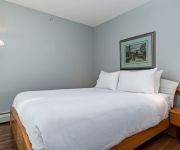
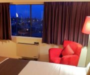
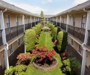
Hotels and Places to Stay
Premiere Suites at Firenze
JW Marriott parq Vancouver
CASSANDRA HOTEL
Rosedale on Robson Suite Hotel
Cambie Lodge B&B
ACCENT INN BURNABY
Manor Guest House
DAYS INN VANCOUVER METRO
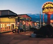
CITY CENTRE MOTOR HOTEL
Commercial Drive Accommodations
Videos from this area
These are videos related to the place based on their proximity to this place.
To Build a Better City - a 1964 City of Vancouver/CMHC film
There was a time when old poor neighbourhoods were considered an urban blight and needed to be razed to make way for modern concrete towers. This is from 50 years ago, but the very ideology...
Year In Review 2013 - Vancouver Film School (VFS)
2013 was a remarkable year for the VFS community. Join us in celebrating these incredible achievements at http://blog.vfs.com/2014/01/30/2013-a-year-in-review/ Find out how you can make your...
Vancouver Marijuana Vending Machine
Marijuana vending machine located at BC Pain Society, 2908 Commercial Drive Vancouver BC, featuring Purple Kush, Bubba Kush, sativa and indica strains of medical marijuana, we carry Phoenix...
PORT 2050: Port Metro Vancouver's anticipated future
In 2010, Port Metro Vancouver embarked on a strategic visioning process called Port 2050. The results of the process, including four scenarios telling alternative stories of our future, are...
Road Rage caught on Dash Cam
Road Rage instant Karma in Vancouver, BC This Video is represented by Break.com -For any licensing requests please contact licensing@break.com.
Seattle-to-Vancouver BC Greyhound bus-ride (Video 2 of 2: Canadian side) 2011-02-25
Greyhound bus leaves the Pacific Highway border inspection station to proceed north along highway 15 to the Trans-Canda Highway, then west for a quick stop at the Conquitlam Greyhound depot...
Vancouver Personal Injury Lawyer Tim Louis | (604) 732-7678
http://bc.timlouislaw.com/ - Vancouver Personal Injury Lawyer Tim Louis & Company Law Increase the value of your personal injury case by keeping a symptom diary. Regardless of how you were...
Urban Coyote In Vancouver
I investigated a possible coyote sighting in the neighborhood near Elliot and 54th when I saw this coyote wandering around. It's not common to see coyotes at this time of day so I checked...
Tour of Revolver Coffee Bar in Vancouver BC
The team and I went up to Vancouver Canada for the Canadian Barista Championships. It was my first time checking out coffee shops in Vancouver and we found some awesome spots including Kafka,.
Dog Rescued After it Fell Through the Ice at Trout Lake in Vancouver
This was the most heroic thing I've ever seen in real life.
Videos provided by Youtube are under the copyright of their owners.
Attractions and noteworthy things
Distances are based on the centre of the city/town and sightseeing location. This list contains brief abstracts about monuments, holiday activities, national parcs, museums, organisations and more from the area as well as interesting facts about the region itself. Where available, you'll find the corresponding homepage. Otherwise the related wikipedia article.
Nanaimo Station
This article is about the station in Vancouver. For the station in Nanaimo, British Columbia, see Nanaimo railway station NanaimoSkyTrain Station {{#invoke:InfoboxImage|InfoboxImage|image=Nanaimo stn.
VCC–Clark Station
VCC–Clark Station is a station on the Millennium Line of the SkyTrain system in Vancouver, British Columbia, Canada. Named after the nearby Vancouver Community College, near Clark Drive, the station serves as the terminus of the Millennium Line. Original plans called for the VCC Station to be located underground under Broadway to the south of Vancouver Community College, but the City of Vancouver wanted the line to run to the north through the emerging technology zone on the False Creek Flats.
East Vancouver
East Vancouver (also "East Van" or the "East Side") is a region within the City of Vancouver, British Columbia, Canada. Geographically, East Vancouver is bordered to the north by Burrard Inlet, to the south by the Fraser River, and to the east by the city of Burnaby. East Vancouver is divided from Vancouver's "West Side" (not to be confused with the "West End" of Downtown Vancouver or with West Vancouver) by Ontario Street.
Gladstone Secondary School
Gladstone Secondary School is a public secondary school located in the Kensington-Cedar Cottage neighbourhood in Vancouver, British Columbia, Canada. It is named after William Ewart Gladstone, the Prime Minister of the United Kingdom four times between 1868 and 1894. There is a mural on the north side of the school which depicts the cultural diversity of the neighborhood. It was completed in the mid-1980s.
Windsor Way (Vancouver)
Windsor Way is a bike-path in East Vancouver, Canada, which was identified as a local Greenway in the Kensington-Cedar Cottage Visioning process.
Commercial–Broadway Station
Commercial–Broadway Station (formerly Broadway Station and Commercial Drive Station, separately) is located on an elevated portion of the Expo Line and Millennium Line and an at-grade portion of the Millennium Line, a part of Metro Vancouver's SkyTrain rapid transit system. It is a major transit hub, with the most boardings of any SkyTrain station and is a terminus of Metro Vancouver's busiest bus route, the 99 B-Line.
John Hendry Park
John Hendry Park is 27 hectare park in the city of Vancouver, British Columbia, Canada. Trout Lake is located in the center of the park and is operated by the Vancouver Parks Board and the Grandview Community Association. The park is often referred to, by the locals, as Trout Lake.
Filipino Plaza
Filipino Plaza is a landscaped park located in Vanness Avenue, west of SkyTrain's Nanaimo Station in the city of Vancouver, Canada. The open park, sometimes referred to as a linear park, located underneath the SkyTrain Expo Line, was one of the dozens of open parks built in 1986 as part of BC Transit's Parkway Program showcasing different cultural parks on the 26-kilometre path that parallels the SkyTrain. Many ethnic communities created legacies on the linear park under the Skytrain in 1986.


